Yodellers Range - 5 - 8 October 2005
All images © David Noble. No image can be used for any purpose
without permission.
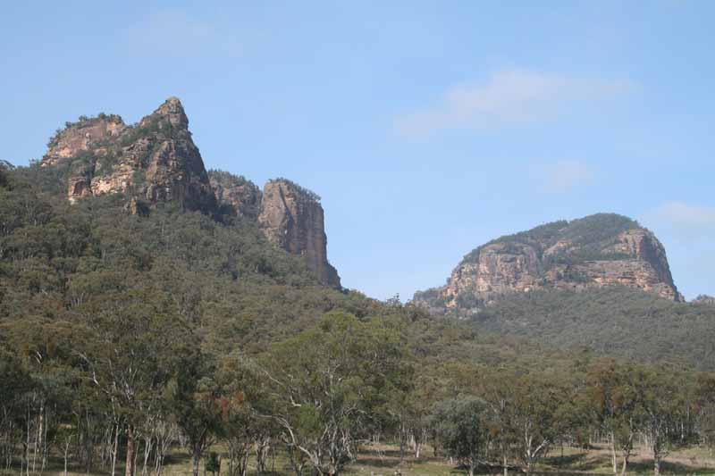
Above - The three summits of Wedding Cake Mountain on the left (it is
incorrectly marked on the Widden 1:25,000 map) and Watts Mountain on
the right from Myrtle Creek front gate. The cone like peak of Wedding
Cake Mountain is called Mt Tindale.
Rik Deveridge organised this trip to go to the Yodellers Range in the
Widden Valley (Far Northern Blue Mts). He had never been there before.
Neither had Lisa and Brian who also came along. I had first been to the
Yodellers in 1976 when a group of us in SUBW did a beaut series of
trips traversing the whole range and many of the other peaks in the
valley. I had returned a few times over the intervening years, and it
was very good to go there again and see the range still much as it was
in earlier times.
Day 1 - October 5 - Stage 4 (and part of
stage 3) - Cats Ears, Christmas Pudding, Pile of Poop
Day 2 - October 6 - Walk up Myrtle Trail and
return (too hot for ridge)
Day 3 - October 7 - Stage 2 - Auguille
du Schooner, Un-named peak, Blue Yodeller, Octave Gap
Day 4 - October 8 - Drive around to Emu Ck
and a close look at Mt Morgan (The Geryon)
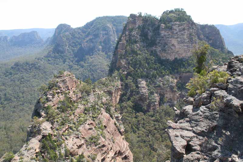
Looking along the Yodellers Range from the Christmas Pudding. Wedding
Cake Mountain is on the middle right, the Un-named peak is on the far
left. Watts Mountain lies behind Wedding Cake Mountain. The closest
peak is the Pile of Poop.
For more information and photos of the range and the Widden area go to
my Widden
Valley web page
Return to david-noble.net