Tasmania - Traverse of the King William Range, Spires and Prince of
Wales Range - Jan - Feb 1977
All images © David Noble. No image can be used for any
purpose without permission.
Section 4 - Prince of Wales Range - Southern Section
We were now on our 15th day. We had started from the Lyell Highway and
traversed the King William Range and
then traversed the Spires.
After that we traversed the northern
peaks of the Prince of Wales Range and were now on our way to Mt
Humbolt.
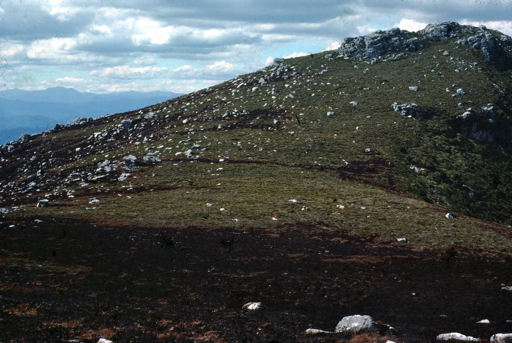
Above - In the late afternoon - we reached our airdrop - in a saddle
not far before Mt Humbolt. We had been very lucky. The bushfire we had
seen earlier that week - had indeed burnt very close to our airdop. The
burnt area is in the foreground - the closest of the three bags is only
2 metres from the fire. Place your
cursor inside the image to see the location of the 3 airdrop bags
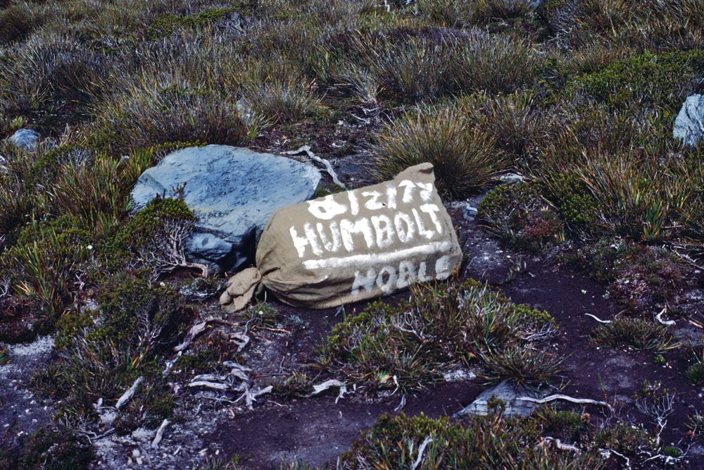
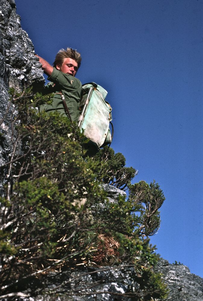
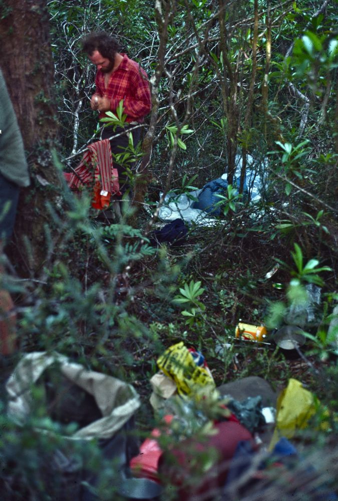
Above - One of the airdrop bags. Food and gas cylinders were tightly
packed in strong plastic fertilliser bags. These were in turn packed in
hessian sacks and padded with balls of newspaper. The drops themselves
had been placed by Jim England - who was very experienced at flying
over the south west. These bags had been thrown out of the plane when
it was about 20m above the saddle. After extracting the food and fuel -
we built a large fire to burn all the packaging.

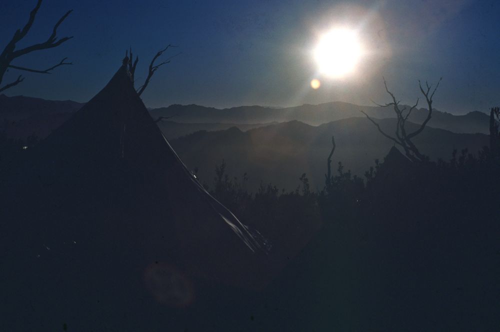
Above - Ian looking west at dusk
Above - Looking down to our campsite from the next peak south. Our two
tents are visible just before the black, burnt section. In the far
distance it is possible to see the spire of Diamond Peak.
Above - Ian looking ahead to Mt Humbolt - this section involved the
most challenging route finding of the trip.

Above - Looking north along the Prince of Wales Range from the summit
of Mt Humbolt.
Soon after - we were surprised to meet anothre party of walkers - from
the ACT. They had come by boat along part of the Gordon impoundment and
then crossed the Denison and climbed onto the range nearby. They then
intended to traverse the range north and exit via the Spires and
Denison Range.
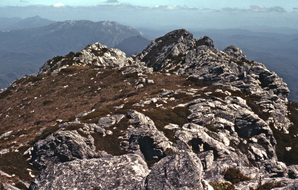
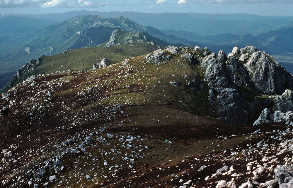
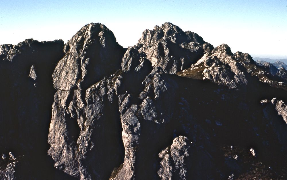
Above - Looking to Southern Bluff

Above - Pinnacles
Above - Bluffs
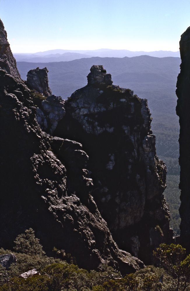
Above - From Southern Bluff - Looking to Mt Humbolt
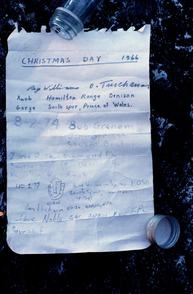
Above - We added an entry to a page found in spirit bottle on Southern
Bluff.
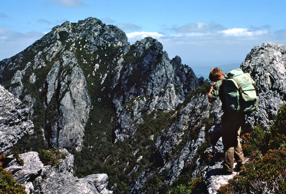
Above - Ian descending off Southern Bluff. This was the most difficult
scrambling and routefinding of the trip.
The southern 5 miles of the range had been called "Yop Yop" by Reg
Williams after hearing Olegas Truchanus continually uttering
these Lithuanian swear words whilst in the scrub.

Above - Our first campsite - in buttongrass - not far below Southern
Bluff - and just before the serious scrub started
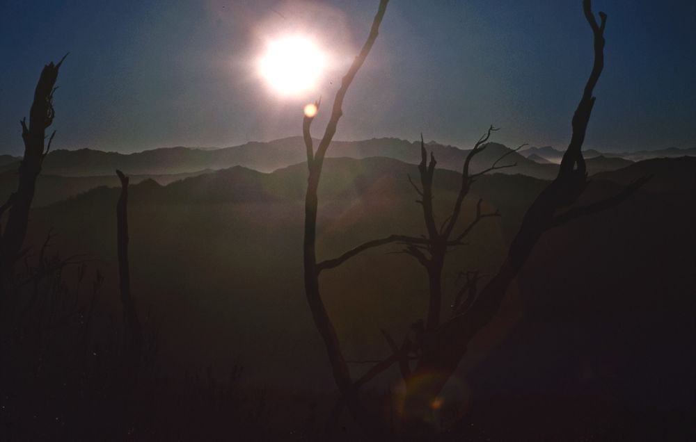
Above - Dusk
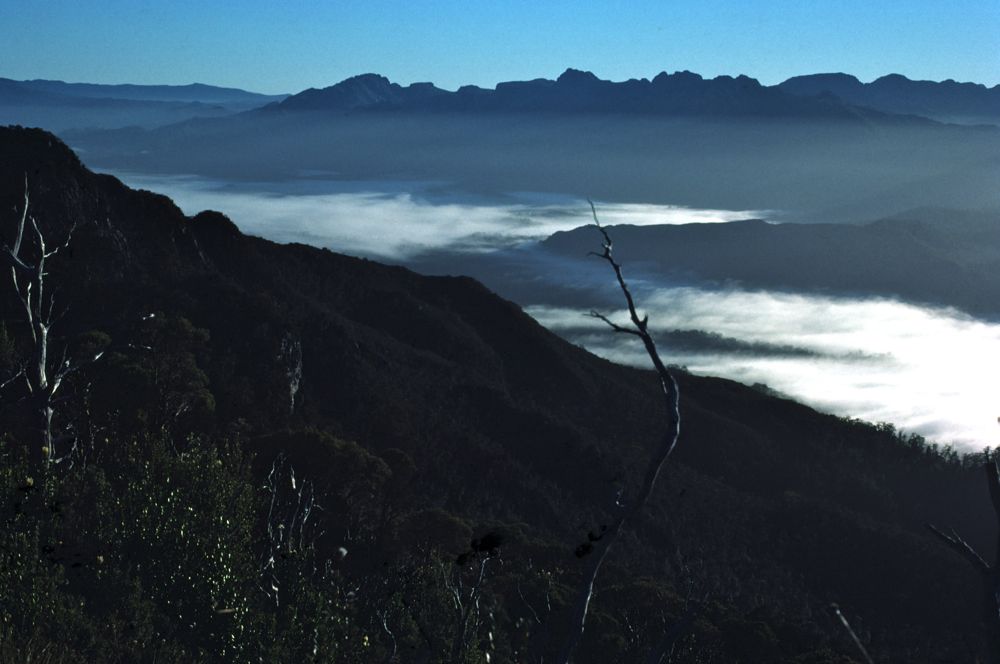
Above - Morning mist - in the Denison Valley. Beyond are the peaks of
the Spires.

Above - Looking to the South - towards the Arthur and Frankland Ranges
Above - One of our campsites on the Yop Yop section. We camped twice in
the scrub.
We were lucky to be able to camp in short sections of ridgetop
horizontal rainforest. Most of the way was a continual struggle in
thick baura and tea tree. Some of the worst bits, the baura was
entwined around dead logs and cutting grass. We had a rigid system of
alternate leads - at first swapping leads every 30 minutes and later
every 15 minutes - and having a 15 minute rest after we each had a
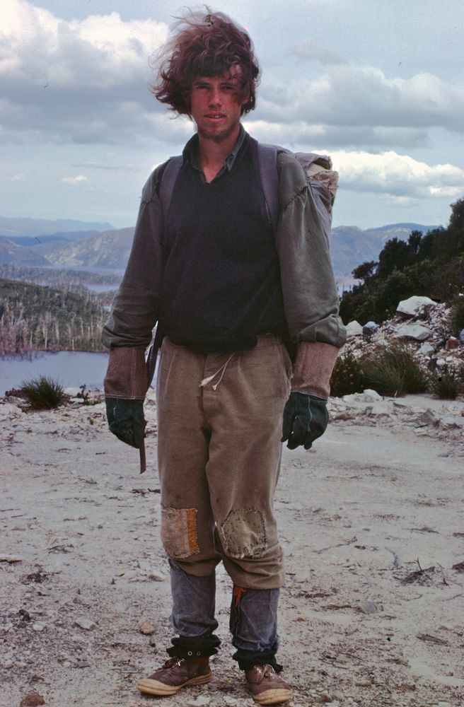
lead. This way - we could at least make some forward progress. We wore
long pants, long sleeve shirts, gaiters and leather gloves or
gauntlets.
As well as the scrub - we had problems with heat and lack of water. We
tried squeezing moss - but most was dry. Later we did find some moss
that contained liquid - but it was horid. We could not filter it
through cloth or toilet paper (it could not be squeezed through!) - so
we drank it as it was - a dark black, thick liquid. At one stage Peter
resorted to squeezing the abdomen of the March Flies - a drop of goo
would come out - and it tasted sweet - but did not really quench the
thirst. Each evening - we managed to find some small soaks off the side
of the range. Lack of water caused us to abandon our final objective -
Mt Yop Yop (the end of the 5 mile section - now called Mt Olegas) -
about 1.5 miles short - and head off the range to the Denison River.
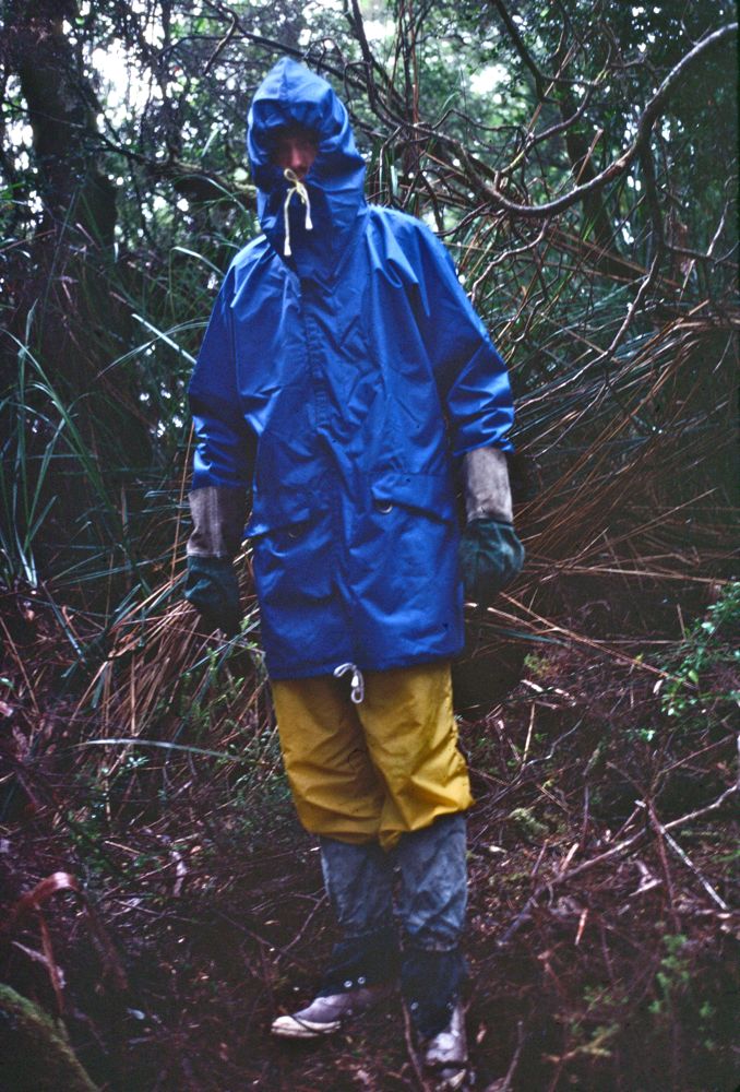
Above - Dave wearing parka and ovrepants - ready for the descent
through horizontal scrub to the Denison River.
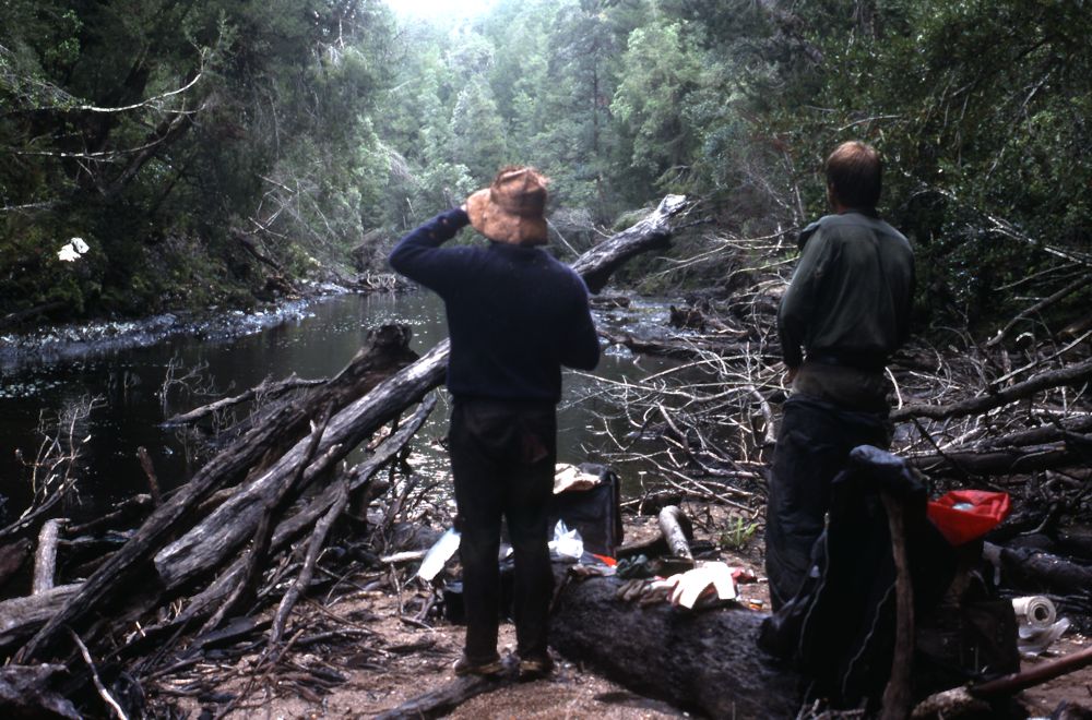
Above - Peter and Ian at the Denison River
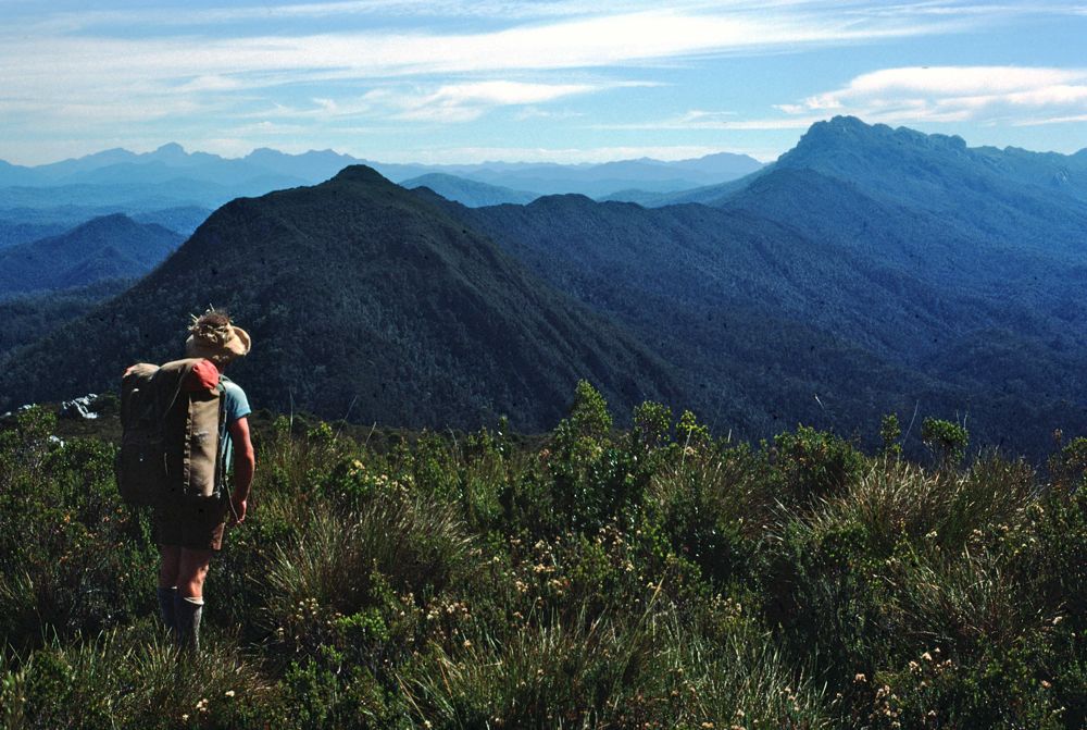
Above - Peter looking back at Yop Yop from the Hamilton Range. This was
on our 20th day.
We then dropped down to the Gordon Dam and walked to Strathgordon.
Above - Dave at the Gordon Dam

Above - The gorge below the dam
Ian and myself accompanied by Tom Williams and Bob Sault returned to
the Prince of Wales Range in January 1981 - and traversed all the range.
Return to menu
Return to david-noble.net