
This was a pleasant day in the bush with Bob yesterday wandering around some seldom used passes at the end of the ridge that branches out from Hat Hill at Blackheath.

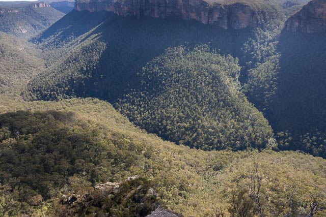
Grose Valley from Bald Head
This ridge, called the bald head Ridge, terminates at Bald Head, and on the way it passes a spot mark on the map as Bennett Lookout. On trips down the Grose Valley I had noticed two rock peninsulas sticking out into the Grose Valley near Bald Head. I had long wanted to visit them as I thought they may be good vantage points and be a nice places for a high camp. You can also see these rock peninsulas from Anvil Rock. On a recent trip to Blue Gum Forest via Pierces Pass, I and also noticed what looked like a possible pass along a ledge just under the higher of these two peninsulas. I had taken a photo of the possible passes and emailed it to Bob, and we and put this spot into our list for a future daywalk. Meanwhile we had both done a little research and found that the pass was probably the same as mentioned in “The Upper Grose Valley” by Brian Fox and Michael Keats (p 464). It was referred to as “Brownes Path” and apparently used by former NPWS ranger Kevin Browne.
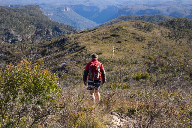
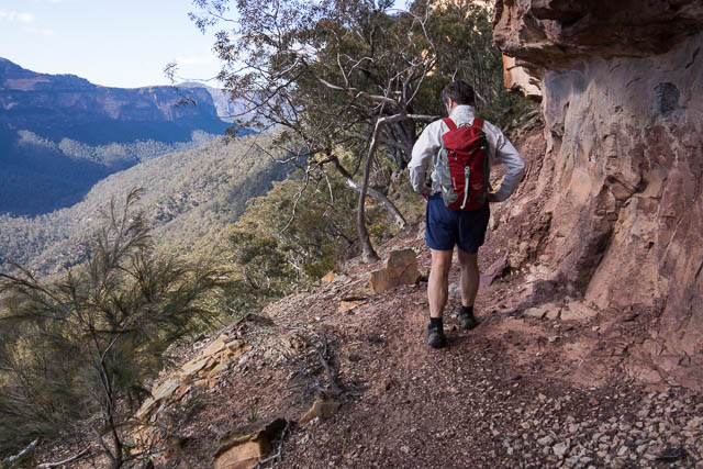
So we set out from Hat Hill following the track towards Bald Head. There was no obvious turn-off to Bennett Lookout. We stopped at a rock platform just above the last saddle before Bald Hill. Here, we left the track and wandered through the bush towards the upper of the rock peninsulas. This was easy to locate and required a short scramble to get to. From it, there were good views, but no better than other places. We found a few rock cairns and an old faggot placed in a cave.
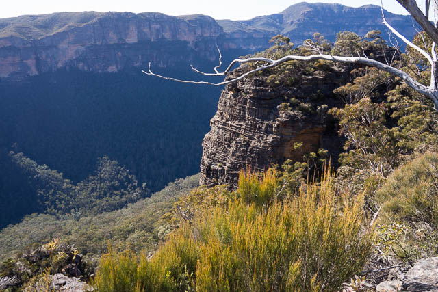
It was easy to scramble down to the bottom of the peninsula and then we went through a cave and onto the ledge of Brownes Path. We found no human footprints, but there were plant of signs that the pass was used by animals. It was easy to traverse along the ledge to easy slopes leading down to the Grose River.
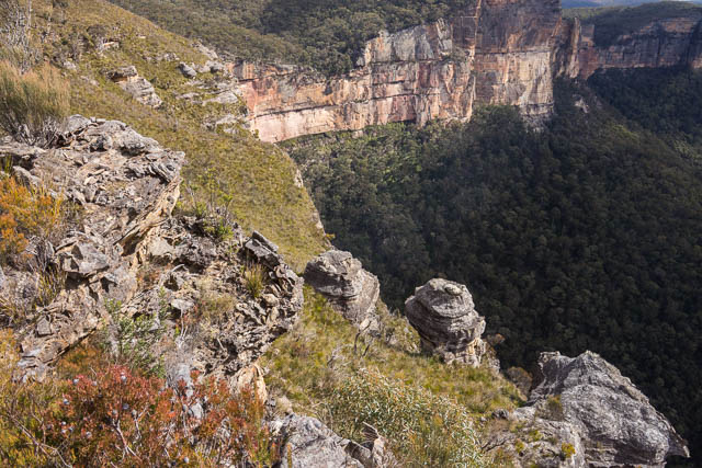
Bob on Brownes Path
Our intention was, after descending the pass, to try and climb back up via a nearby gull between us and Bald Head. We followed the base of the cliffs at first until the talus slope was too steep and unstable, so descended to a lower level and then traversed some more towards the gully. This was not easy! Then we climbed up the gully, but found our way blocked by a dry waterfall. We bypassed this by a steep scramble on the east side. This was not pleasant and on very unstable terrain. Things improved when we regained the gully and we could follow it up from that point to the saddle near Bald Head. There we found the track and followed it to Bald Head for lunch.
At Bald Head, there were very good views of the Upper Grose Valley. This would be a great place for a sunset photoshoot.

After luck we headed back to Hat Hill. On the way, we detoured off the track to see if we could find Bennett Lookout. We didn’t find any really great vantage points.
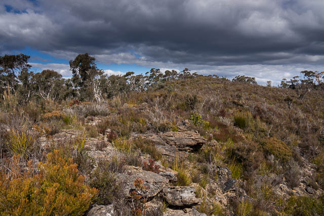
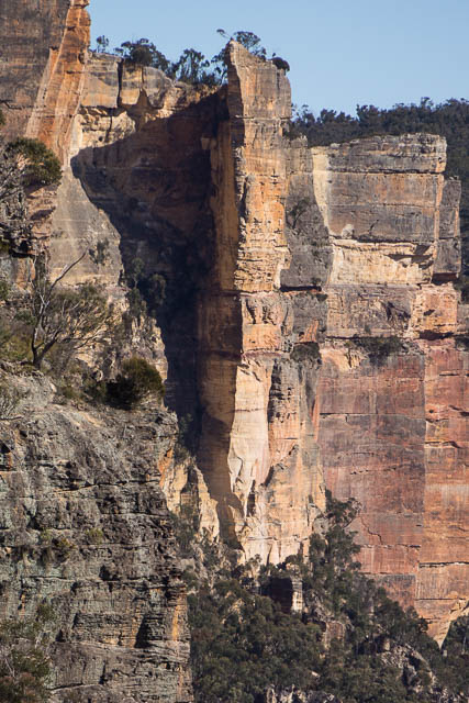
Heath on Bald Head
More photos from the walk are online here.
Congratulations. This is the first new (to me) Grose Valley pass I’ve heard about in 20 years. I gave the Grose a good going over between ‘86 and ’97 and thought I had them all!
Did a walk from Anvil L/O down into Bennet Gully (there was a cairn there but it didn’t go), along the cliff edge to the high point, then west across to the Bald Head saddle. I suppose if we’d continued following the cliff edge down to the north west instead we would have found the pass. Later on I actually put a question mark on the map in that area, but only because it showed the talus slope contours at 830m theoretically being higher than the top of the cliff in the gully at 800m. Then promptly forgot about it.
We then followed the gully from the saddle down to the Grose. Don’t remember it being that difficult at the time (22/6/91), taking about 90 minutes from the saddle. My only notation was, “Couple of falls to bypass on right”.
I did this walk last sunday (12 Nov 2017) – very nice and no one around.
One thing I’m 100% sure: the “rocky peninsula” on the third photo (probably taken from the top of another peninsula closer to Band Head Saddle) is what is named “Bennett Lookout” on the topo map.
Bennett Lookout’s been found. After I realised the path veered left to the saddle, I backed up and navigated N to the top of it. Nice easy scramble (one move really) to its top. The Brownes Path circumventing it is really nice, though short. Then, below the cliff, the path started traversing back to NW, along the easiest gradient. But I didn’t feel like walking unstable talus slopes to get to Bald Head, the next objective. So I went back Brownes Path but did not climb back all the way to Bennett Lookout, which would be a waste of my potential energy. Instead, I decided to continue traversing at Brownes Path level (~I estimate 830m altitude) W under the cliffs flanking true right side of your gully. And it went very easy, almost like a marked path. My route can be considered the extension of Brownes Path to the W and it eventually joined your route up the gully before climbing the vegetated slope to the saddle.
I think Bennett Lookout lost its popularity when people discovered Bald Head has better view (because it’s open in all directions) and started walking there trampling the path through the saddle. And the path to Bennett Lookout (if existed) was forgotten. Only very few enthusiast scramblers walk there but very infrequently (and the cairns on top also look old & very weathered) not enough to maintain visible path.