
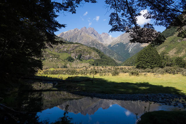
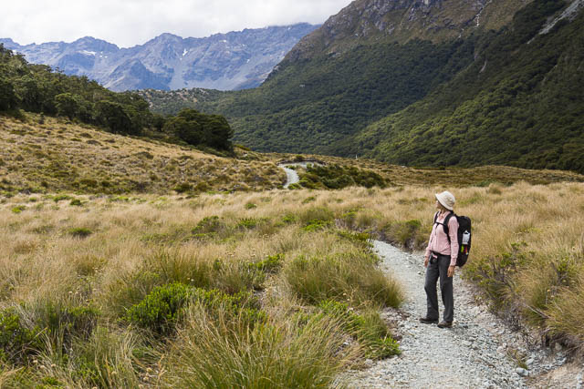
From Te Anau, Wendy and myself had headed to The Divide and from there set off along the start of the Routeburn Track around Key Summit heading towards the Greenstone Valley.
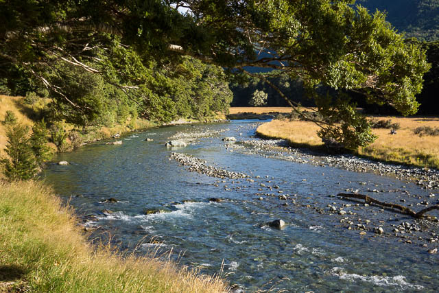
I was familiar with the Caples – Greenstone area, having walked the loop – up the Caples and then down the Greenstone back in 2009 (see photos here) and on a much earlier trip up along the Routeburn Track from the eastern side and then back via the Upper Caples and Kay Creek. On both those trips I was really impressed by the wild beauty of the Upper Caples Valley. Particularly the river and the overhanging beech trees. On both those previous trips, the weather for that section had been quite bad – constant rain, which had made photography very difficult. This was a major reason I was keen to return – so I could see the river again.

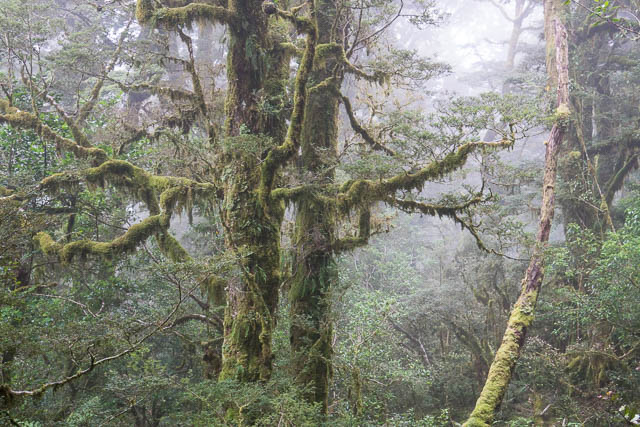
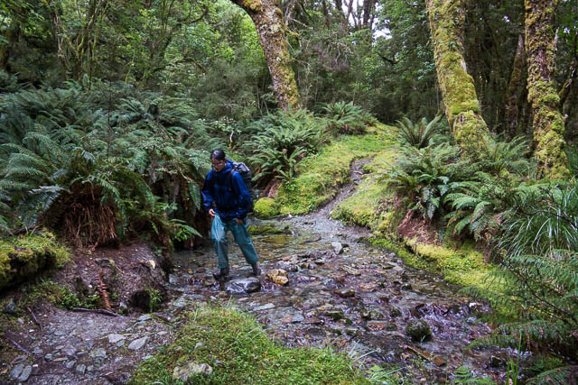
We set off from The Divide around midday. The weather was not real good – cold and rainy. However the forecast was for it to improve and the next few days should be fine. This turned out to be correct. The bad weather of the start of our walk made the forest along this section particularly attractive. The beech tress are covered with a mat of moss and in mist and drizzle they took on an eerie beauty.
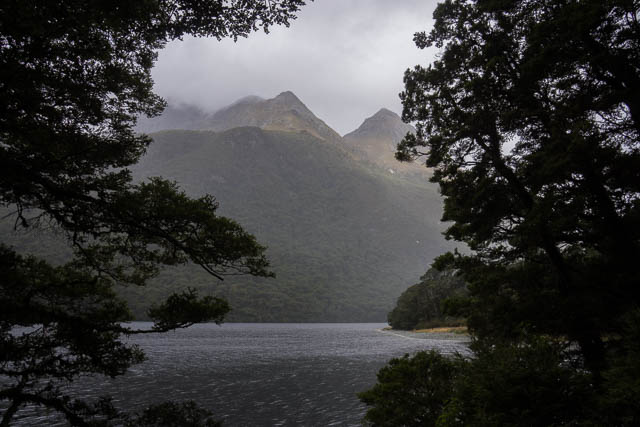
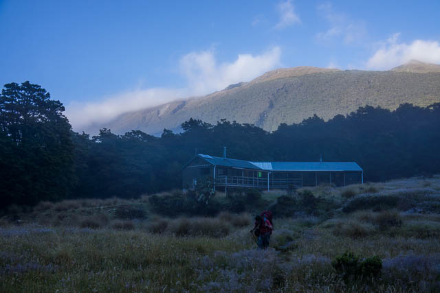
We arrived at Howden Hut and found the place crowded out with trampers. Most of them seemed to be doing the Routeburn Track. We sheltered under an awning of a nearby hut and had a quick lunch. We then left the hustle and bustle of the Routeburn for the relative quiet of the Greenstone. The track wanders through more attractive beech forest past Lake Howden and then over a saddle into the head of the Greenstone Valley. We passed the Caples turnoff – we would later come back that way, and walked around Lake McKellar and found ourselves at McKellar Hut.
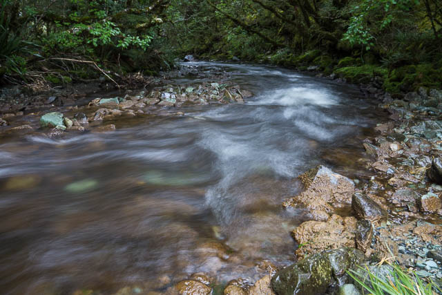
This comfortable hut seems to have expanded since my previous visit in 2009. It has doubled in size. In the late afternoon, I wandered around in the forest outside the hut. There is plenty to see. Lots of beautiful beech forest, but there is one bad thing. The rocks of the Greenstone River are covered with “rock snot” – or Didymo, a nasty type of invading algae probably brought in accidentally by fishermen not cleaning their gear. The Greenstone is badly affected, the Caples is still free of it.
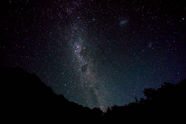
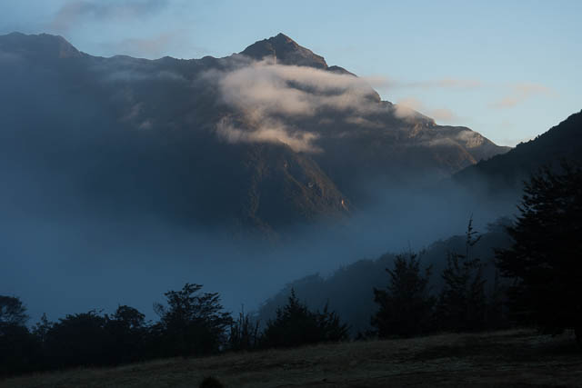
It did fine up around dusk. The clouds vanished leaving a clear night.
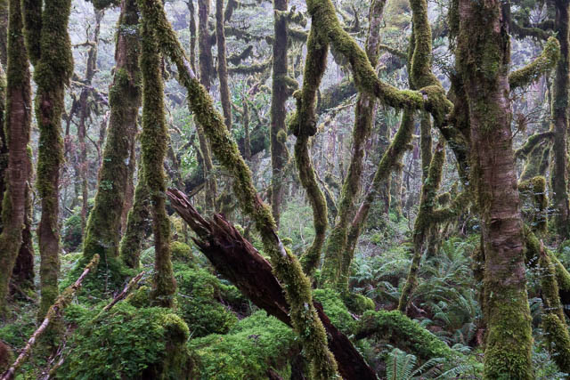
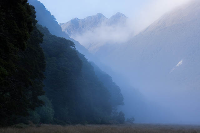
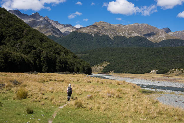
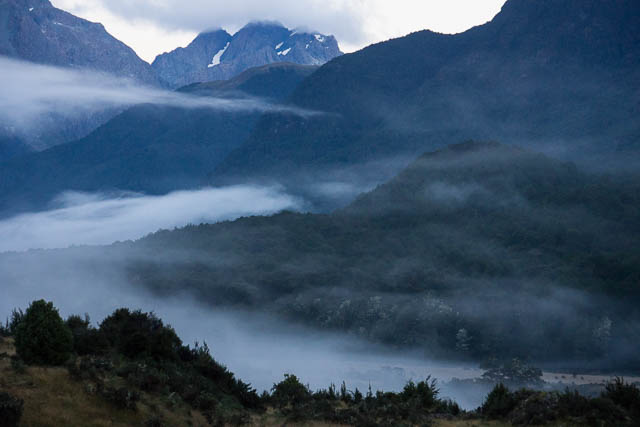
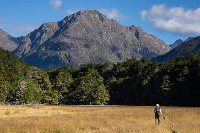
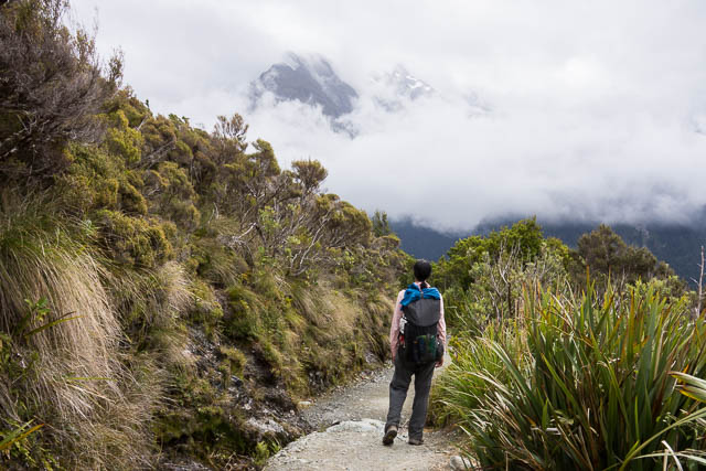
The next morning, we awoke to find a light mist had settled in the valley. The first few kilometres of our walk down the valley were magnificent. The mist turned the beech forest into an enchanted place full of mystery and atmosphere. Nice! Then more mist spreading along the open valley. This valley walking reminded me of walking in Switzerland. Lower down the valley there were even cows. Much of the Caples and Greenstone valleys is Maori land and cattle are run on it by a pastoral company. The cattle have little impact on the passing walkers. As the sun got higher the mist dispersed.

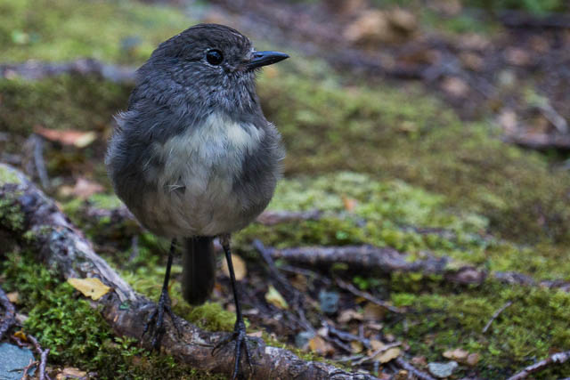
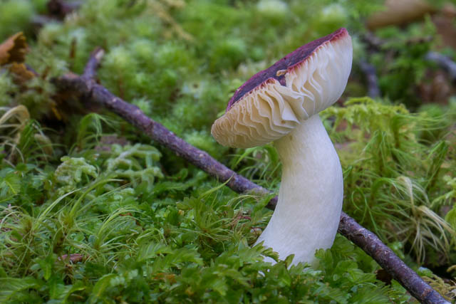
Being valley walking, there are no hills, and it is easy fast walking down the valley to our next hut – the Greenstone Hut. This is another fairly new and comfortable hut that replaces the old Slyburn Hut. It is also used by walkers on the Te Araroa Trail (which passes up the lower Greenstone and then along the Mavora Walkway, which heads off to the south from Greenstone Hut). The walk down the Greenstone Valley to the hut alternates between open river flats, a few shingle slips and long sections of beech forest. There is much to see and appreciate along the way – flowers and ferns, lichens and fungi, and some quite friendly birds.
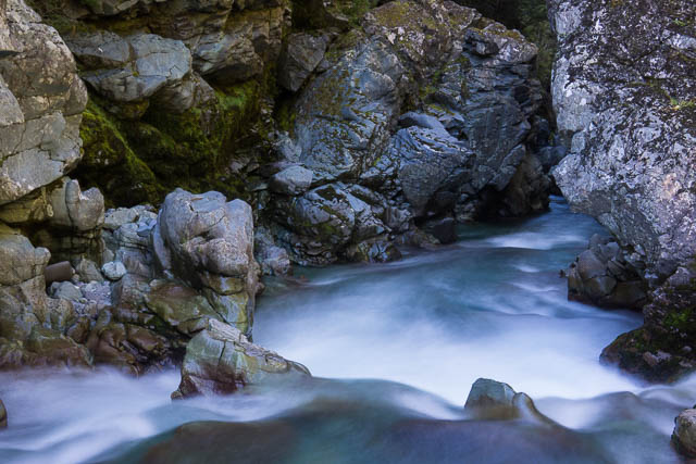
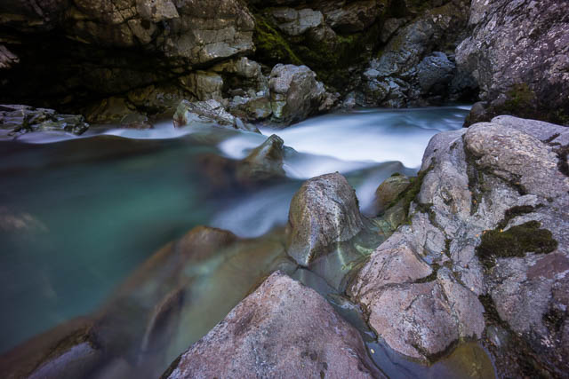
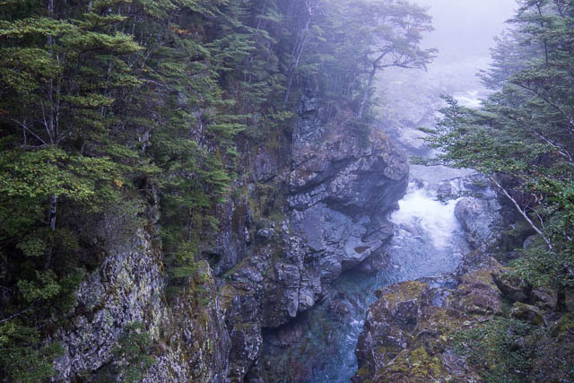
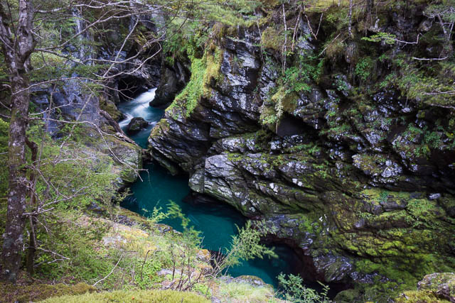
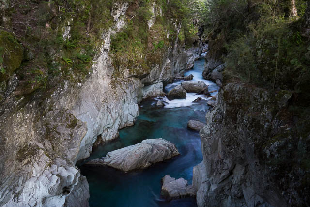
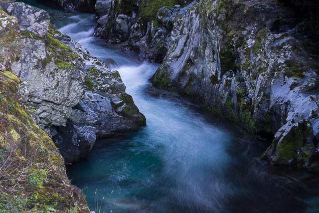
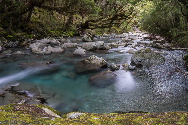
To get to the Greenstone Hut there is a branch track that crosses the Greenstone River at an impressive gorge. I spent the late afternoon climbing down into the gorge trying to get some photos.
The next day was another glorious fine day. We set off from Greenstone Hut, again in valley mist, crossed the gorge again and back onto the main track and down it, through forest and meadows to reach the large flats near the Greenstone – Caples junction.

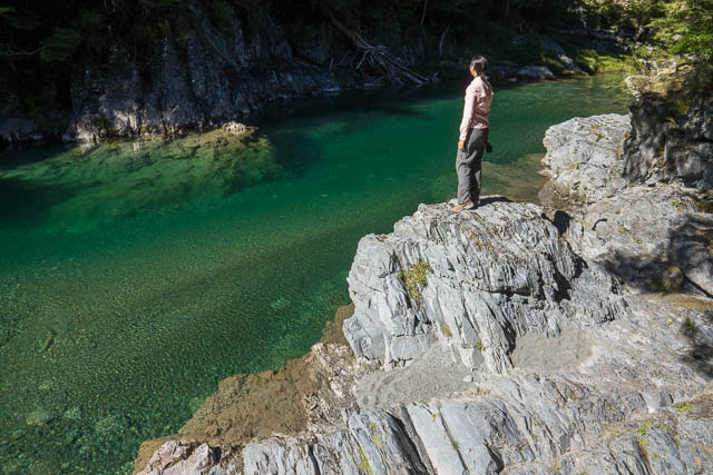
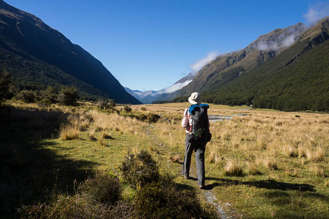
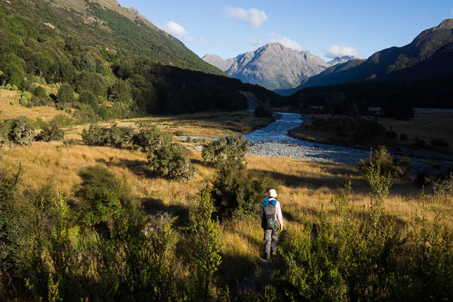
Then it was more pleasant valley walking up the Caples Valley. The Caples River is similar to the Greenstone, but if anything it is more beautiful. And no rock snot!
On previous trips, I have stayed in the very nice Upper Caples Hut. This hut has now been sold by DOC to deer stalkers, and walkers now stay in the newly rebuilt Mid Caples Hut lower down the valley. Like the Greenstone Hut – this hut also has a gorge nearby and was a good place to visit and photograph. Quite a few other trampers were staying in the hut.
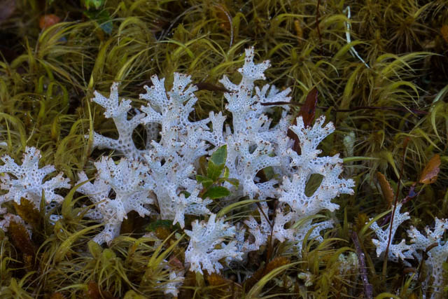
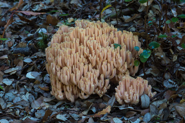
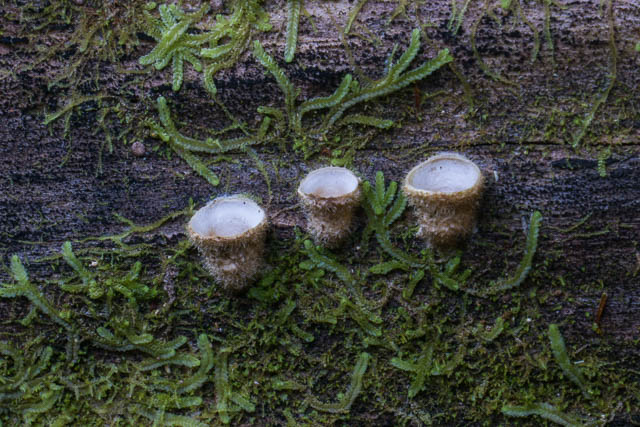
On our last day of the walk, we set off to walk up the upper section of the Caples. Not far from the hut, about 1 km from the hut, we dumped our packs and checked out another river gorge a short distance away. It was here that Wendy spotted an interesting birds nest type fungi growing on an old log.
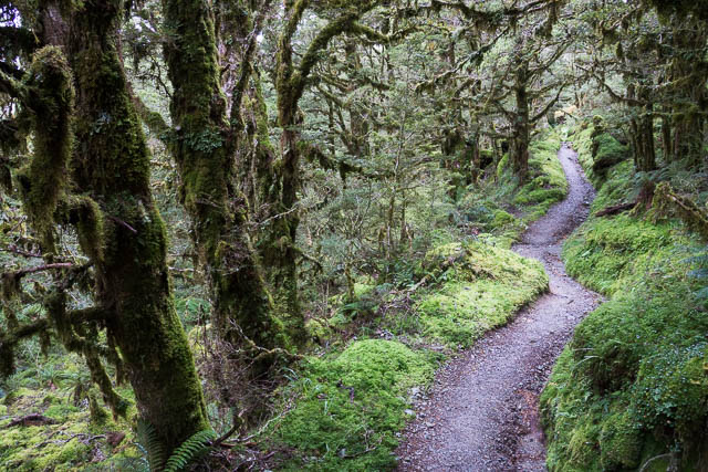
The walking again alternates between river flats and beech forest and is fast and pleasant. Particularly so in the early morning sun.
The hut warden at Mid Caples Hut and told us of some new track work in the upper Caples, and he referred to is as a “superhighway”. He was not wrong. The new track deviates from where the old track went to the old Upper Caples Hut and carves a new way out through the forest. And it really does “carve” a new way. It looks like the new track was constructed by a small bulldozer type machine. Lots of huge rocks have been moved out of the way. The new track deviates a long way from where the old track passed close to the river – the beautiful section of river and forest that I had been looking forward to seeing again. I felt this was a real shame. I guess the old track is still there somewhere and you could probably follow it – but so many visitors will miss seeing this amazingly beautiful forest and river. Compare some of my old photos with the new ones!

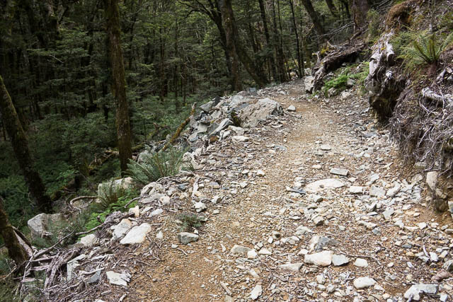
All that can be said for the new track is that it is easy and fast. But I had walked in to see the river and its forest and now had missed out on that. Further up, where the new track passed close to the river – things had also changed for the worse. The debris from the new track – boulders and cut logs had been pushed very close to the river – spoiling its beauty!
The new track climbs up to a high saddle in the Ailsa Mountains, crosses it and descends down into the Greenstone Valley near Lake McKellar. The descent track is all new and again looses the character of the old track.
The last part of the walk was back along to Howden Hut, and this time it was a good refuge for lunch as the weather pendulum swung back to bad. Then another hour or so around Key Summit back to The Divide.
This was a very pleasant walk, even with the reservations above about the new track missing the best features of the Upper Caples. More photos of the trip can be viewed online spread over three pages – Page 1, Page 2 and Page 3.