
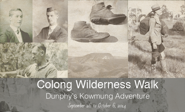
One hundred years ago, in 1914, a classic bushwalk took place. Myles Dunphy and Herbert “Bert” Gallop set off from Katoomba for an adventure along the Kowmung River. This walk, in many ways marked the beginning of both the sport of bushwalking and also the conservation of wild places in Australia.
In the 1960’s, Myles’ son, Milo Dunphy was one of the founders of the Colong Committee and became its first Director. They battled to save Colong Caves, one of the areas visited by Myles and Herb on their pioneering walk, from limestone mining. Their battle was successful, and so was a later battle to prevent the nearby Boyd Plateau from becoming a pine plantation. The Colong Committee is now the Colong Foundation for Wilderness.
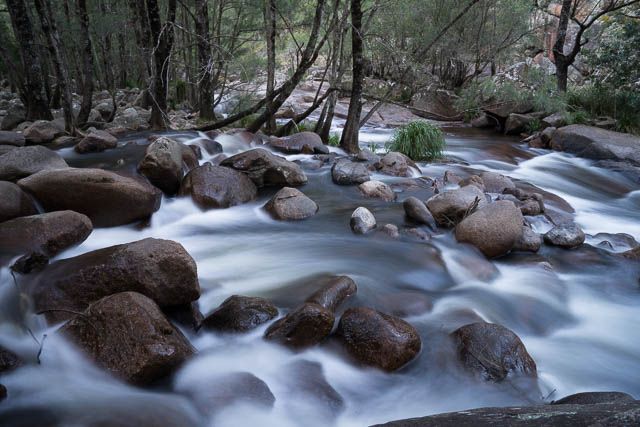
Myles and Bert were out for about 22 days. A long time in what was mostly wilderness. The walk tested them both mentally and physically. They carried swags, but also carried a newly designed and home made japara tent. They needed a good tent. They had to endure a lot of rain and flooded rivers. The country they travelled through was very rugged and then only carried a few parish maps to aid their navigation. It was a real adventure. Myles was a master mapmaker. All the areas they travelled through – he mapped in extraordinary detail. He later produced large scale maps that benefitted many later generations of bushwalkers. Many of these maps are still available and are treasured by bushwalkers. They seem to show the bush so well. Many of the names given to features by Myles and Bert have made there way to current official maps.
One hundred years after their epic adventure, young bushwalker Alex Allchin was inspired reading about their walk that he thought about re-enacting it. He approached the Colong Foundation. Keith Muir, the current Director, was very enthusiastic and a committee was formed to organise the walk. A lot of hard work took place by all those involved. I was privilege to go on virtually the whole re-enactment – from Katoomba to Wooglemai Environmental Education Centre near Picton (Alex and some of the other walkers walk right to Picton Railway Staion).
Alex Allchin
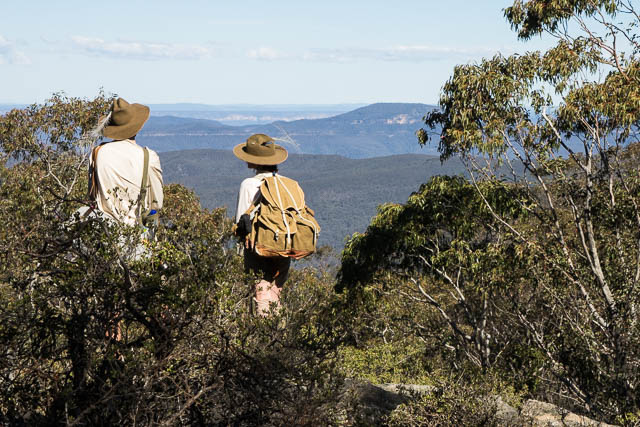
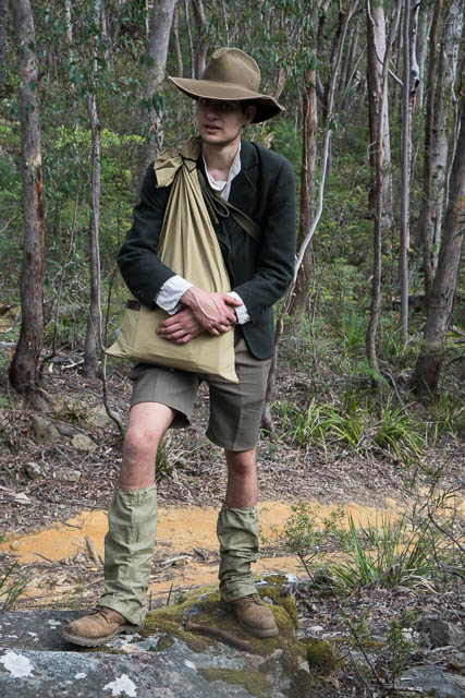
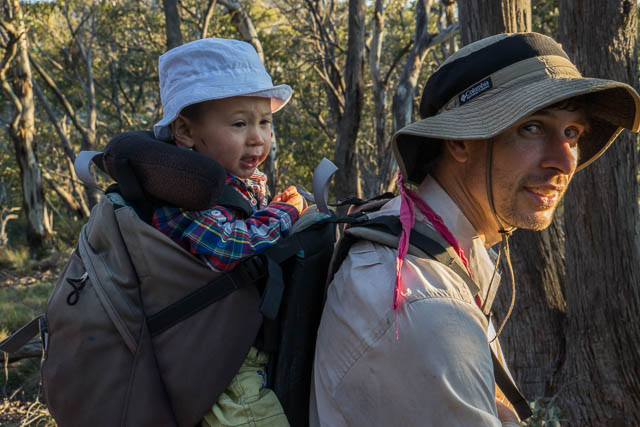
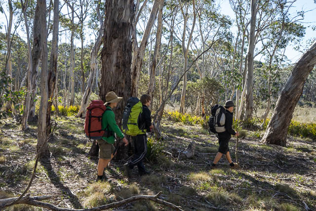
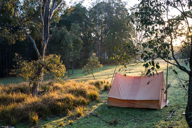
With modern maps and lightweight gear, together with vehicles meeting us every few days bringing in extra food, we did not have all the challenges that Myles and Bert had. However, to fit in with school holidays, we were doing the walk in less than half the time – with many long days. Also – Alex and Sierra Classen, another of the key organisers, walked all the way in period costume and used old bushwalking gear – including tweed jackets, swags and gunny sacks. For shelter they used an old japara tent.
As well as maps, Myles documented his walks in great detail with sketches and photographs. He incorporated these in a series of journals which are now housed in the Mitchell Library. Another one of the walk organisers, Wyn Jones had incorporated Myles’ notes and photos from his Kowmung Journal into a series of small booklets that he gave to the walkers on each stage of the re-enactment. The walk was designed so that walkers could compete one or more of five short stages.
Here is my account of the walk. As well as this account, I also have a gallery of photos that you can each from this menu page. A lot more information including the route map is on the Colong Foundation for Wilderness website here.
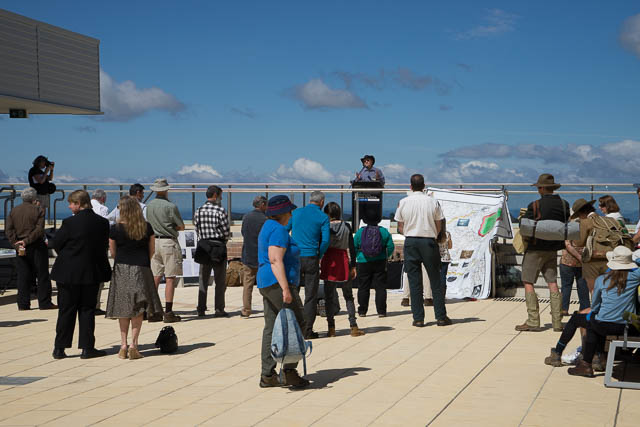
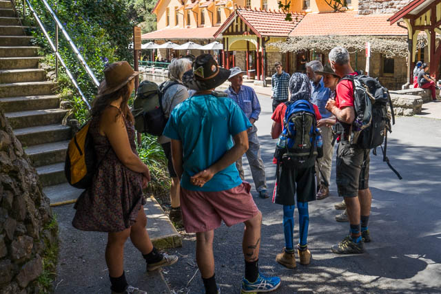
The Launch – at the Cultural Centre, Katoomba.
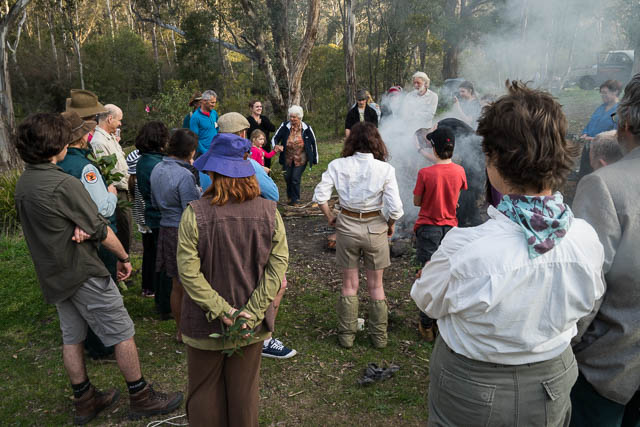
Chaired by Tara Cameron from the Blue Mountains Conservation Society. We were welcomed to the country by Gundungura Aboriginal elder Aunty Sharyn Halls. Aunty Sharyn later performed a smoking ceremony at our first campsite at the Old Ford Reserve in Megalong Valley. Speakers included the Local member, Roza Sage, The mayor Mark Greenhill, The NPWS Regional Director, Keith Muir from the Colong Foundation and Professor Dextor Dunphy, Myles’ son and brother to Milo Dunphy. As well, both Alex Allchin and Sierra Classen spoke. Then, after morning tea, we could set off.
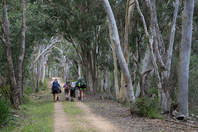
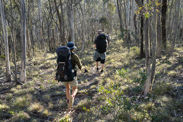
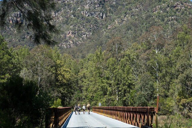
Stage 1 – Katoomba to Jenolan Caves
We left through the back streets of Katoomba and then alone ga track to take us to the top of Nellies Glen. From here we could follow the SixFoot Track, to our first campsite at the Old Ford Reserve in Megalong Valley and then continue along the track all the way to Jenolan Caves. On the way we camped the second night at the designated campground at the top of Black Range near the Jenolan Caves Road.
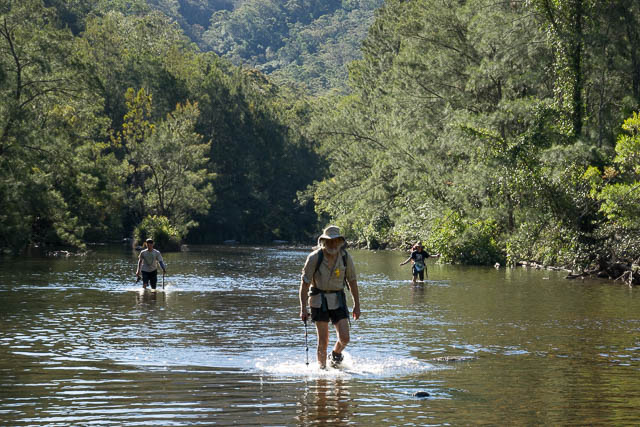
At the Old Ford Reserve, Aunty Sharyn performed a smoking ceremony and explained its purpose and significance. We then enjoyed a great BBQ organised by the Blue Mountains Conservation Society. A large number of walkers took part in the walk dan from Katoomba. Most were only staying for the afternoon and a bus took them back out. Some of the campers wee continuing on to the caves. For other groups – they could walk down to the Coxs River, camp a night there and return to Katoomba the next day. Quite a few did this.
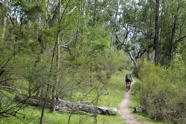
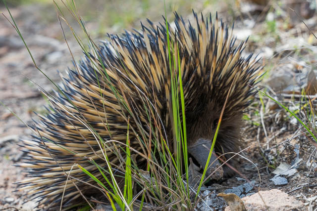
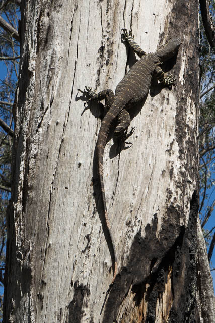
I was in the party walking that day to the top of the Black Range. We set off early as we had a long walk in front of us. On the way down to the river we encountered many wild animals including a swamp wallaby, snakes and an echidna.
Once across the Coxs River we were accosted by Willi, the owner of the Six Foot Track Eco-Lodge. She invited us in for a very welcome cup of tea. She also explained the interesting aboriginal history of the area.
We then began a big climb up onto the Black Range. We broke the climb up by stopping for lunch at Alum Creek – a nice grassy and shady campsite about half way up. Not too far from our next campsite, we were greeted by another group of walkers, camping in the wild near the fire road. They had been expecting us to pass by having heard about the walk on the radio that morning.
We had a comfortable camp that night on the Black Range, and set off next morning for Jenolan Caves. This was an easy descent and we arrived at the Caves by 11 am.
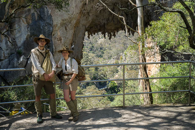
Alex and Sierra at the Carlotta Arch
At the Caves, like Myles and Bert we passed by the Carlotta Arch and arrived at the Caves House. There, like Myles and Bert we were greeted by the Chief Guide. This position is now occupied by Grant Commons, and he also showed us the start of the route to take to climb out from the Caves (like what happened to Myles and Bert 100 years earlier).
This was the end of stage 1 and we farewelled Michael, Cameron, Wyn, Jarrah and Megan from the party.
Stage 2 – Jenolan Caves to Dingo Dell
For this stage we took on extra walkers – John, Chuin Nee and young Jasper, Warwick, a second John and a second Alex. They joined Alex Allchin, Sierra and myself.
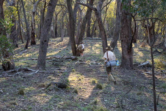
The stage began with a steep climb up a spur behind Caves House to the top near the Kanangra Walls Road. We then walked along the road and along a fire road to Mt Bunthingeroo. From their we followed an easy open ridge down to the junction of Budthingeroo Creek and the Hollanders River. This was one part of the walk were had to deviate slightly from Myles’ original path because of private land.
Jasper and John
Descending to the River
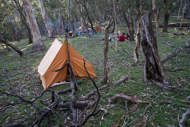
Camp near the Hollanders River
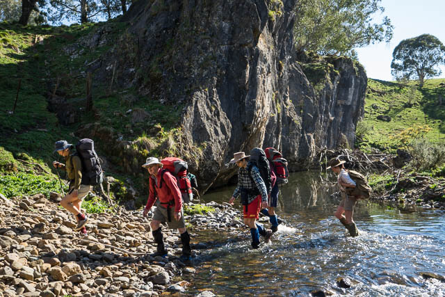
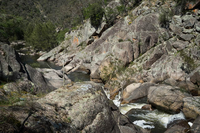
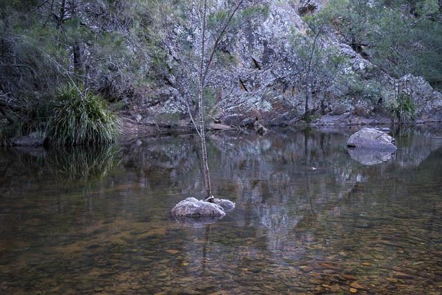
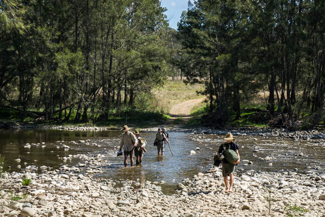
The next day, we walked down the delightful Hollanders River. It was mostly easy going on open flats. Like Myles and Bert, we had to cross the river numerous times. And like then we encountered many interesting limestone bluffs along the way.
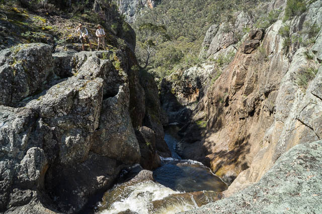
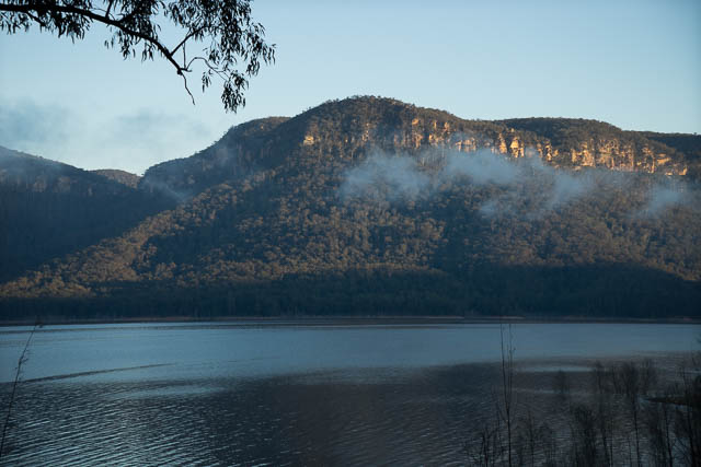
We soon approached the mighty walls of an impressive amphitheatre above Chardon Canyon. Here, we climbed out of the gorge and sidled to Tuglow Falls. It is just below these falls where the Tuglow River joins the Hollanders that the Kowmung River starts.
Above Tuglow Falls
That afternoon we continued on to Tuglow Caves and then then along a fire road to Dingo Dell, our next campsite.
Stage 3 – Dingo Dell to the top of the Uni Rover Trail, Boyd Plateau.
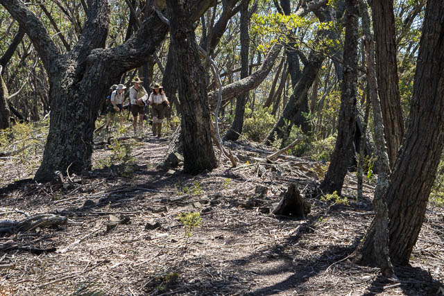
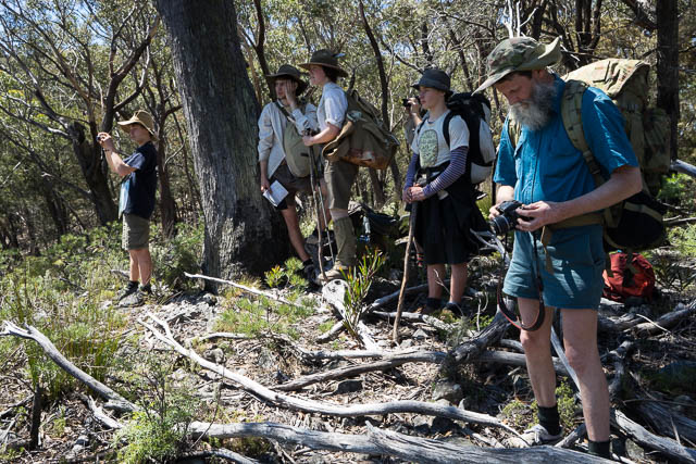
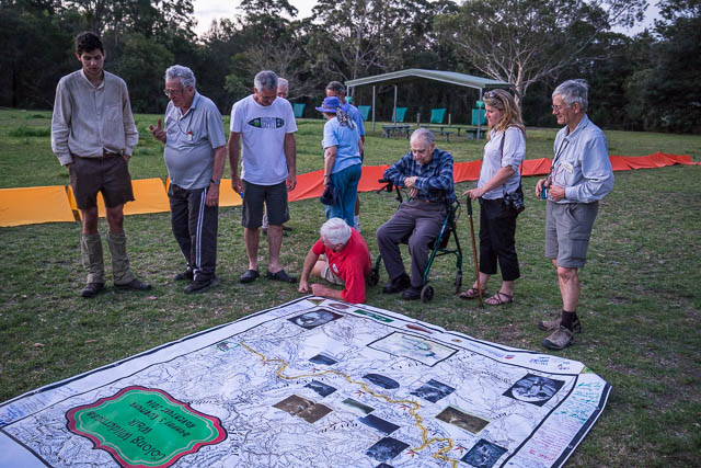
Walkers on this stage were – Alex, Sierra, Dave, Keith, Warwick, Peter, Milo, Kalang and Tallai
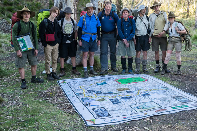
The party for stage 3 – with the big map
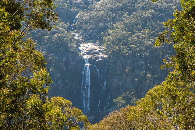
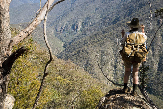
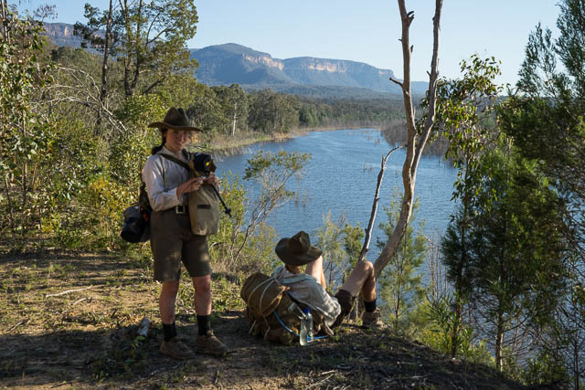
We left Dingo Dell via the Banshee fire road. Soon we arrived at a lookout that provided good views of Morong Falls. Similar to those Myles and Bert had?
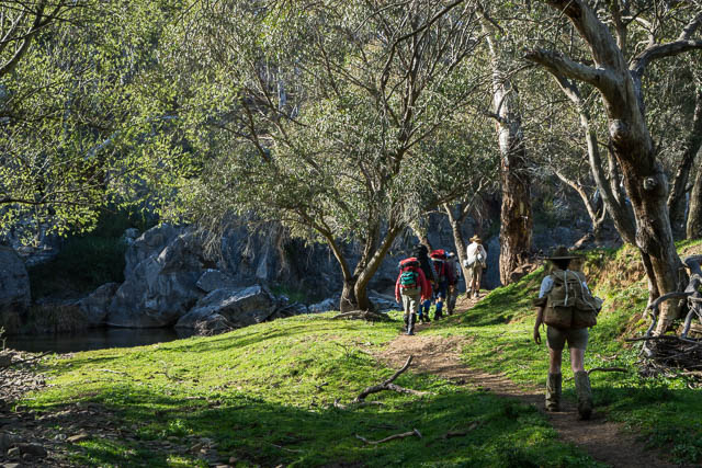
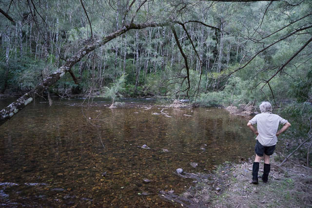
We continued along the road and then branched off through open forest and then descended to the Kowmung River near where Peatfields Creek enters. After a break, we crossed the river and found our way downstream blocked by a gorge. So we climbed up the ridge (a little early) to have lunch on top and then traversed to Megalith Ridge.
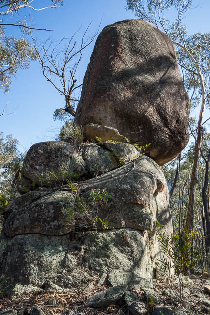
We followed down, passing a series of granite tors on the way to again reach the Kowmung River.
Campsites are scarce in this section of the river. We crossed over to the other side and Keith soon found a good site a short distance upstream.
Next morning, we crossed the river again and continued downstream for a kilometre or so, to arrive at the base of Misery Ridge. It was nice open going up the ridge and we were soon on top. Then a little more climbing to reach Mt Goondel and the Uni Rover Trail. After crossing a swamp we reached a nice lunch spot. Here we could relax as we didn’t have too far to go to our campsite.
After our break, we continued along the trail to Lost Rock. On the original journey, Myles and Bert had set up their tent near here and then wan deed off to explore the area. They had difficulty finding their tent – and so named one of the local features “Lost Rock”. We enjoyed the views from their and from there it was pleasant going along the trail through the forest of the Boyd Plateau to reach our campsite. This was the end of the stage.
Stage 4 – Uni Rover Trail to Yerranderie
Here we farewelled Keith, Peter and Tallai and picked up Wyn and Guy. Guy was Guy Dunphy, grandson of Myles.
The day began with us retracing our steps back to Lost Rock and we continued down the Uni Rover Trail to Mt Savage. Easy fast walking.
From here, we followed the original route down Dicksonia Spur to reach the Kowmung River again – this time at Cache Bend. Here Myles and Bert had found a cache of food left probably by stockmen.
We followed the river downstream to reach its junction with Lannigans Creek. Here we camped.
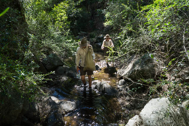
Next morning we crossed over to Lannigans Creek and followed the creek upstream to where Carkeneller joins it. Most of the creek was easy walking – but the banks were covered in prickly vines.
The original route, followed by Myles and Bert went further up the creek to Colong Caves and then they followed a very complex route to Colong Gap (it seems they made a few navigational mistakes here). We followed a ridge system to the base of Mt Colong and then picked up an old track to the Gap. We then descended down the other side of the gap and joined the road that eventually we followed via Tonalli Gap to Yerranderie. This was a long day and we arrived in Yerranderie after dark.
Stage 5 – Yerranderie to Wooglemai
At Yerranderie, we had our only rain on the walk – and then only a few spots. A marked contrast to conditions of 100 years earlier! But when Myles and Bert passed through Yerranderie, the town was still a going concern. Bert hd even purchased a new pair of boots at the general store. Nowdays Yerranderie is a ghost town.
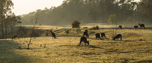
Yerranderie is a great place to observe nature, in particular wallabies and kangaroos.
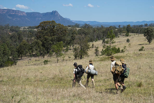
Our last stage of the walk was to be entirely on roads. And it was close to 50 km. Walkers on this stage were Alex, Sierra, Dave, Milo and Kalang.
We left Yerranderie just as a large convoy of 4WD’s was arriving. They were being escorted by rangers from the Sydney Catchment Authority. We had a chat to the rangers. They were expecting us – as we had special permission to walk around the Wollondilly Arm of Lake Burragorang – a section normally restricted from all visitors. We felt quite privileged to be able to walk through an exclusion zone of the Catchment Area.
We followed the normal bushwalkers corridor to the Wollondilly River. Here we crossed over and cooled off. It was a hot day.
The afternoon was spent with more road bashing – but through beautiful country around the side of the Lake. We camped that night close to the road.
Not long after we set off the next morning, we were again met by Catchment Authority Rangers. They presented with two large bags of fruit – apples and bananas. Very welcome indeed! We sat on a huge boulder near the road eating fruit and admiring the view.
It was not too far to the Nattai crossing and then all uphill to Wooglemai. On the way up the hill – we met up with NPWS rangers. They escorted us through a dangerous section of the road before heading off to attend to a fire alert nearby.
Further along the road – was our welcome party. They escorted us to Wooglemai. This is an Environmental Education Centre and also used as a retreat by members of the Catholic Bushwalking Club. There were quite a few Catholic Bushwalkers at Wooglemai and they made us very welcome. Here the Picton Rotary Club put on a fantastic BBQ. Many thanks!
Wyn had set up on the lawn a huge leaf – made from small tents. After the BBQ , all the walkers and helpers assembled in the leaf for a photo.
Next morning, Alex, Sierra, Milo and Kalang walked the rest of the way to Picton. I left with friends.
Links
My gallery of photos from the walk
An impressive movie of the start and end of the walk filmed from drones is on YouTube.
The Colong Foundation Website for the walk – lots of information and history.
Epic trip re enactment and a great pictorial record.
The only ‘criticism’ I have is that I didn’t see anyone carrying a billy in the hand, which they all did in those days.
Alex did carry his billy in his hand from time to time.
Dave
Yes, must admit I wasn’t attentive enough. Such attention to detail, impressive.
Great recount of the Dunphy Kowmong Adventure re-enactment David.
It has been good to trace the steps of the people conducting the re-enactment,
through visualising photos taken during their sojourn.
Thank You for joining in on the journey and capturing it on film for us all to enjoy.
Recording events is very important to pass on to future generations.
It gives appreciation of what we have and hopefully will inspire participation in protecting and enjoying our natural world.
Thanks for this account and the wonderful photos, David. I’ve just spent an interesting few hours reading up on the reenactment walk. It sounds like it was amazing!