
This is a post about a landform feature that seems to me to be fairly common in sub alpine areas – but I have never been able to find a “proper” name for them (searching online for this geomorphological feature)
In Corsica, they are known as “pozzines” – and are a well known feature close to a certain part of the GR20 walking route. In http://fr.wikipedia.org/wiki/Pozzine a “pozzine” is defined as –
Une pozzine est un trou d’eau observé dans les montagnes corses. Elles sont reliées par des canaux naturels creusés par l’écoulement des neiges fondues et se trouvent dans de vastes prairies.
And translating gives –
A pozzine is a water hole observed in the mountains of Corsica. They are connected by carved by flowing natural channels snow melted and are in wide meadows
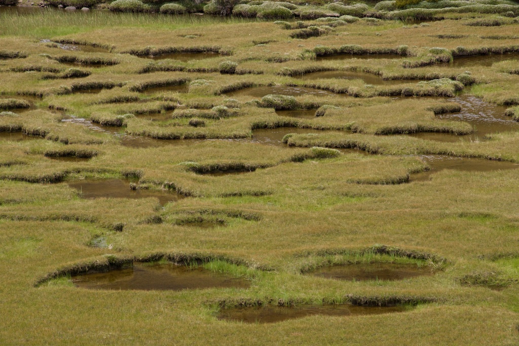
Here is a photograph of the Corsican pozzines –
Pozzines near Lake Nino in Corsica
Given their description and how they appear – these types of small lakes or waterholes seem quite common. I have seen very similar waterholes in New Zealand and Tasmania.
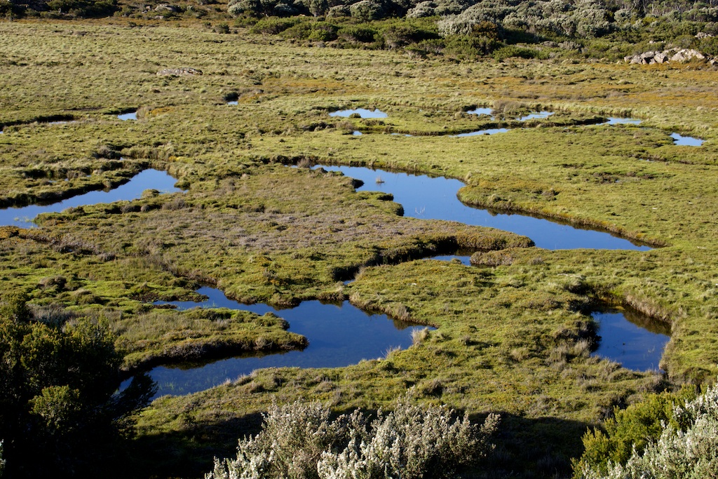
Here are some from New Zealand –
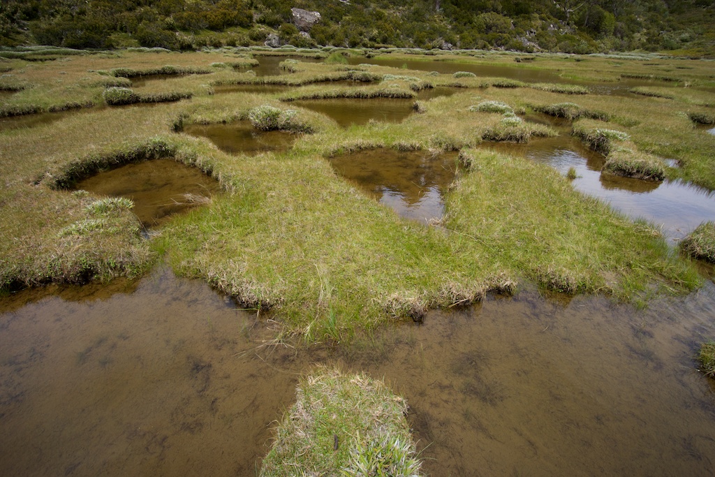
On the Rees-Dart Saddle, South Island of New Zealand
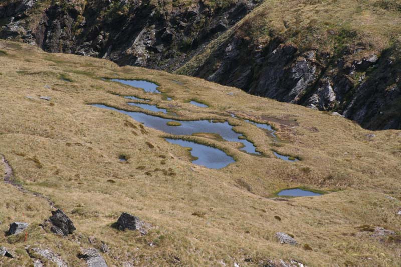
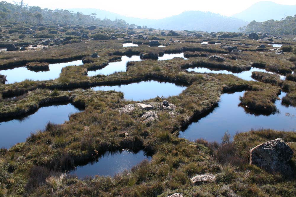
Tasmania seems to have plenty of examples. I have myself seen pozzines in three places, all on the Central Plateau. One place is where Higgs Track crests the Plateau – and close to Lady Lake Hut.
Pozzines near Lady Lake – Central Plateau of Tasmania
Another is at the Walls of Jerusalem – near the Zion Gate –
Pozzines near the Zion Gate
Pozzines near the Zion Gate
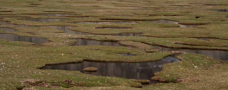
The third example I know of in Tasmania is on the Chinamans Plains – close to Lake Ball.
Pozzines on the Chinamans Plains – Tasmania
I think these landform features should have a name. Perhaps “pozzine”? Or do they already have a name that I have not been able to find? I expect them to be common features in other alpine and sub-alpine parts of the World.
I remember reading about these while doing research on alpine peat formation. I think they already have an English name.
Mt Field National Park has these in the alpine area. Are they “flark ponds” (from “Dynamics of a Tasmanian bolster heath string fen” at http://link.springer.com/article/10.1007/BF00044930) ?
Thanks for the comments. “Flarks” may be the term I was after. It seems “flark” means “small pond” – so it may refer to any small pond in a peat bog or fen? Here we have a set of ponds that are close together and connected, which the term “pozzine” seems to refer to. Google image does throw up some connected pools referred to as “strangs and flarks”. I could not find any reference to “strangs” as a landform feature. Perhaps they are the thin bits of land that separate the flarks?
More online research – it looks like the feature should be called “patterned peat bogs” or “patterned fens” and the patterns can be “irregular” or “reticulated”. The pools are called “flarks” and the bits of land between then called “strings” (in most references) or “strangs” in some references.