
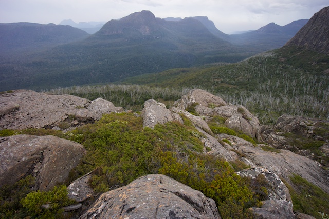
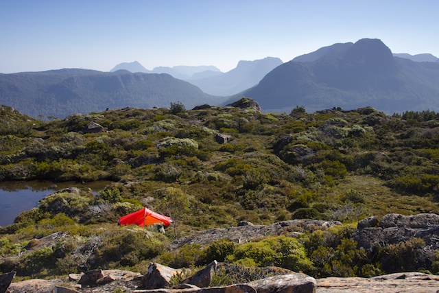
I left the Walls of Jerusalem area via Dixons Kingdom and Lake Ball. I had been down to Lake Ball many times – but the more recent visits had been around the eastern end and then out to the Chinamans Plains. On other trips where I had headed down to Lake Adelaide from the Walls, I had gone via Lake Salome, Wild Dog Creek and then cut cross country as a shortcut to the Lake Adelaide Track. This shortcut is both easy and very scenic – with several beautiful tarns and some amazing cushion plants. But it had been a while since I walked around Lake Ball and so that was where I headed this walk.
The track down to Lake Ball is faint in spots, but the route is easy. Along the Lake there is a good track. Growing around the lake was the first fagus (deciduous beech) of the walk.

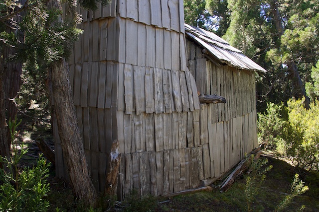
Part way round you pass an old shingle hut – the Boy Miles Hut. Its worth looking inside and reading about its history.
At the west end of the lake is an interesting section of pineapple grass clumps. This was well worth a wander out to with my camera. I saw some other walkers here, day trippers, and they flew past as though they were in a hurry without noticing this very singular feature.

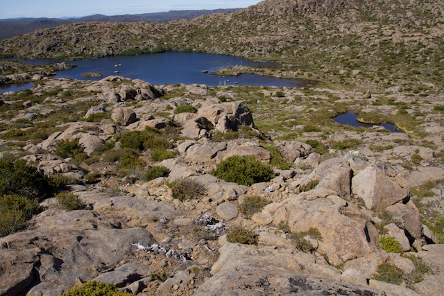
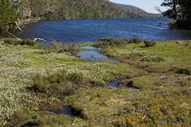
Then it is an easy walk down to Lake Adelaide. By the time I got to the lake, it was getting quite hot. As it turns out – this hot weather would last to almost the end of my walk. I stopped for lunch at the southern end of Lake Adelaide. It was warm enough to have a swim in the lake and to wash my clothes. They quickly dried while I had lunch in a shady spot.
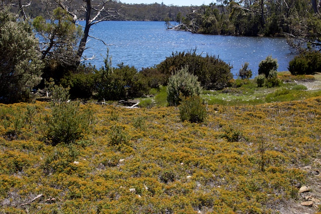
Lake Adelaide
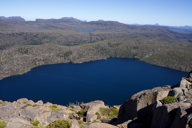
Then off to the next lake – Lake Meston.
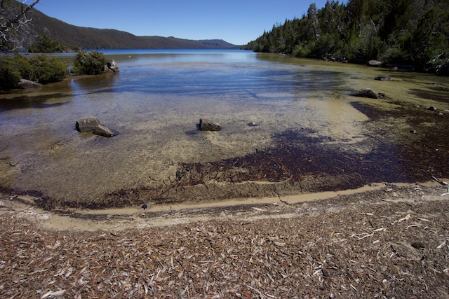
Lake Meston
I was quite disappointed when I arrived. At the campsite was a very recent fireplace – a ring of stones and a large pile of firewood. This is in a fuel stove only zone! I spent a fair bit of time scattering the wood and trying to “restore” the fireplace to as natural a condition as I could. The fireplace was near the main campsite here, but nearby are other campsites in some more sheltered and shady spots – but it appeared they had been used as toilets! Shallow holes had been dug, right at the campsites. Later animals had come along and dug up the holes. The result – a hole with toilet paper scattered around. Nasty! I would like to think that people coming to places like this had been “toilet trained” for the bush. It seems not. I was to find the same toilet habits near Lake Meston Hut.
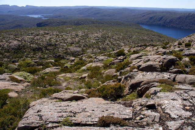
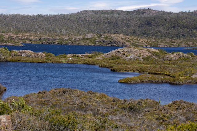
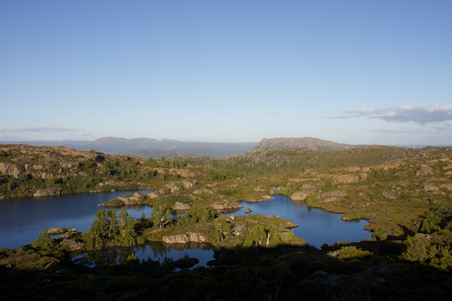
Lake on Rogoona Plateau
I was keen to do a side trip to Mt Rogoona, a mountain I had never climbed. However, when I arrived at the Lake Meston Hut, where the turnoff to Mt Ragoona is, I thought it too hot to lug my pack up the mountain and look for a high camp. Instead I went down to the lake for another swim. I camped outside the hut.
Next morning I left my tent up and headed out early for Mt Rogoona. I followed the Lake Bill Track for a short way till I picked up a route marked with ducks that seemed to head in the Mt Rogoona direction. At first this was easy to follow, but the ducks became further apart as I climbed. Eventually they seemed very hard to spot – but it didn’t matter at this stage as I was climbing up an open dolerite ridge. Then across a small dip that went down to a lake and from there it was a short way to the top. It was a clear, fine day and so I had extensive views in all directions. Particularly impressive were the peaks to the west stretching from Mt Olympus to Cradle Mountain – nearly all the peaks of the Reserve! See my panorama here.
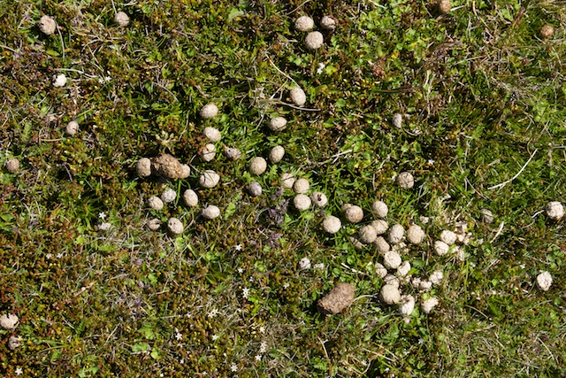
What are the small scats? the larger ones are wallaby.
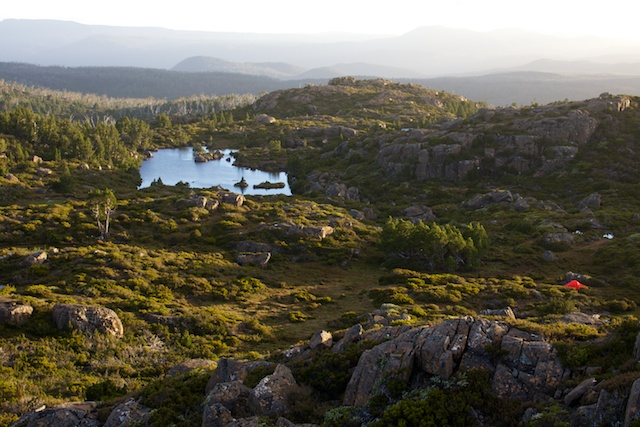
Then back down to Lake Meston and back to my gear. As it was hot, I had lunch in the cool interior of the hut. This was a mistake, as I found out that night when I realised I had left my head torch on a shelf in the hut. After lunch, I packed my gear, and walked down to Junction Lake. There are campsites near the hut, but the best ones are around the lake a few hundred metres. So I walked around there and met two other walkers that had already set up camp. Will and Phil were very friendly – and as they were walking out the next day, they were able to give me a spare battery for my tiny radio – so I could pick up weather reports once more. Thanks!
Junction Lake Campsite
When I realised my folly in leaving my head torch back at Lake Meston I decided it would be best to run back and get it the next morning. This I did. The round trip took me a bit over two hours – thankfully the track was very dry.
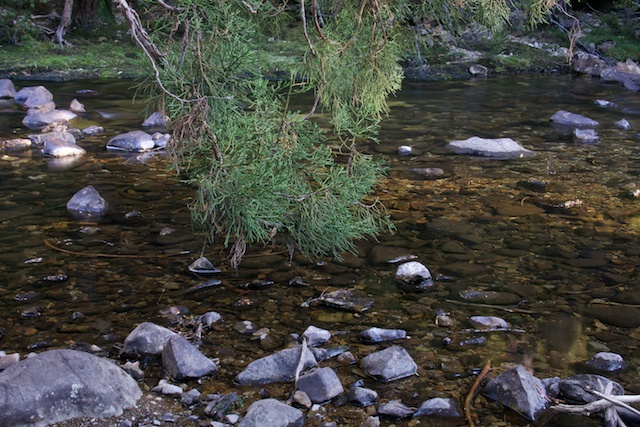
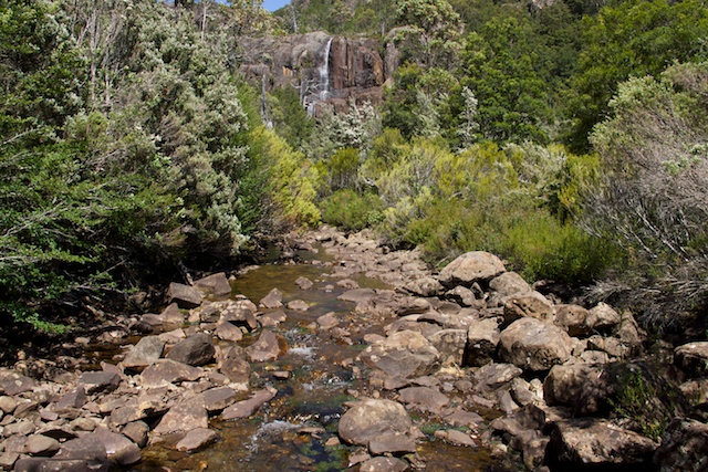
Mersey River near Junction Lake
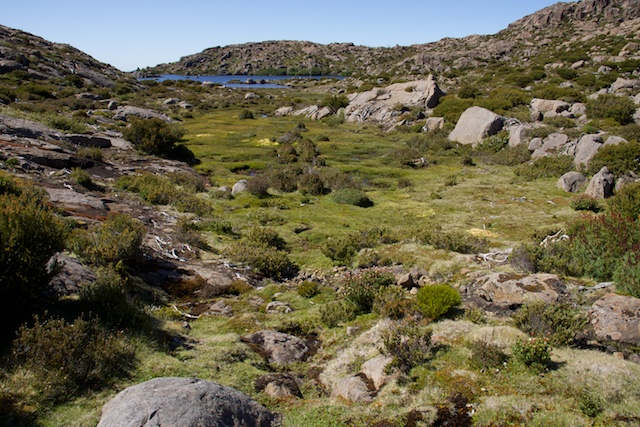
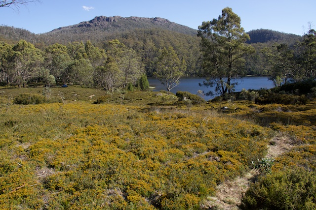
Then I packed up and headed up the track towards Cloister Lagoon.
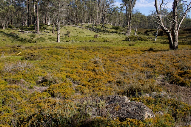
Open moors on the way to Cloister Lagoon
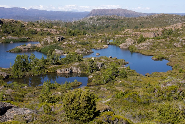
There are three standard routes from Junction Lake to the Overland Track. Many walkers, probably most go via the “Never Never” – and easy walk down the Mersey River. This joins up with the Overland Track near Hartnett Falls. A far better route, although harder and slower, is over the Traveller Range. This is the way I had gone before many times. A track from the far side of the river to Junction Lake Hut goes up to Lake Artemis and then to Lake Eros, and with care it can be followed to close to Lake Merope. Then after a short bit of scrub, you are on the fairly open tops of the Traveller Range. This is a walkers paradise! Fantastic scenery and great views all the way to Du Cane Gap where you descend to the Overland Track.
Cloister Lagoon
This time I chose to reach the Overland Track via Cathedral Mountain. I had been over the mountain twice before but never spent much time on the Cathedral Mountain Plateau. This was back in 1991 and 2002. It was time to visit the mountain again. On my previous trips I and gone up onto the plateau via a route that starts at the north end of Cloister Lagoon. Then around the south end of Chalice Lake and eventually up to the rim. This time I followed the same track to Cloister Lagoon, but kept on it till Chapter Lake where I picked up a route near Grail Falls to Chalice Lake and Tent Tarn.
Grail Falls – the route goes up to the left of the falls as viewed here.
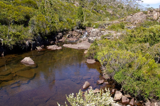
Creek below Chalice Lake
Chalice Lake
The route was marked by ducks all the way to Tent Tarn, and then I picked up more ducks heading up towards the Twin Spires. I followed the ducks till I left most of the scrub and climbed out onto dolerite boulders. Then I traversed south to the rim and walked along to the near the lowest point to set up camp.
It was now late afternoon, and a storm was approaching – so I chose a sheltered spot low down from the rim. Rain hit as I was taking photos from the rim – so I made a quick retreat back to the tent. I had plenty of days left on my trip – and I had already decided to spend a rest day on the plateau.

Next morning I decided to pack up my stuff and move my tent a few hundred metres to a more scenic position. The front had passed over and more hot fine weather was coming.

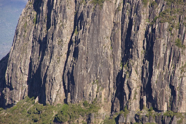
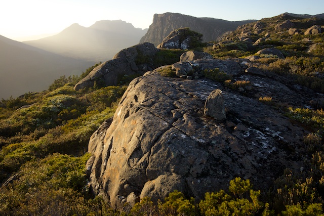
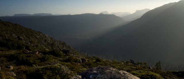
The rim of Cathedral Mountain is certainly a first class place to camp. Its great in particular for sunsets and sunrises. Close by are the massive peaks of the Du Cane Range – from my new campsite I could see The Acropolis, Mt Massif and Falling Mountain. To the right of these are Mt Ossa and the gigantic headwall of Cathedral Mountain. A impressive panorama! See here. On the other side of the campsite – I could see Mt Ragoona and the more distant peaks of the Walls of Jerusalem, but as a foreground to them lay a most beautiful set of lakes flanked by pencil pines. See this panorama.
That evening the sun set below the peaks of the Du Cane Range.
From my campsite, the next morning it only took me a little over an hour to reach the Mersey River near Fergusson Falls. It was easy going through open rainforest.
See this page for more photos and panoramas.
i enjoyed reading your walk over cathedral mt.have u walked from east lake ball to lake st clair via chinamans plains,mts of jupiter,then traveller range to travellers rest lagoon and out to derwen bridge or lake st clair,i would be interested in your comments.rgds james young
Hello James. I have walked from Lake Ball to the Mts of Jupiter quite a few times, and on this trips have joined the Overland Track at Du Cane Gap. I have also walked, on part of a longer walk, from Du Cane Gap, onto the Traveller Range and then down to Rim Lake and Mt Ida, then to Travellers Rest Lagoon and then logging roads to Derwent Bridge. See the main section of my website for photos of those trips. Its great country!!
I walked across the traveller Range and the Lakes of Orion on new years day 1970 with a Coast & Mountain Bushwalking Club group led by Dennis Brown. We suffered heavy rain and cloud with no views for the 3 days or so we were there. These stunning pics have shown me the views we would have experienced. Thanks. Must go back there soon—in good weather !
Thanks for putting your walks out there for us to enjoy.
Many fond memories rekindled.
That Cathedral rim has a special place in my mind.
An awesome vista well worth spending time at, especially camping.
Those “open moors” too were special, as was coming across Mr Miles and his horse at Junction Lake.
Much appreciated.
Best edit that please.
That would have been Dick Reed.
Loved it, must come back for more.
Great write up David. We’re heading to do something similar for the New Year. I was wondering…you mentioned you were camped on the rim then head down to Fergusson Falls -in an hourish -which route did you take off the Plateau? We’re planning to head down to Lee’s Paddock via the creek *track* between Bishop and Curate. Love a good bush bash but from all accounts I have read, it’s a good couple of hours down. If there’s a more direct and easier route…I’d be keen.
I descended a few times from the plateau (North East of the falls) – from close to the lowest point in the plateau in that area. No cliffs. Except for the first bit (a bit of scoparia etc), it is quite easy to descend. It is forest most father way down and becomes more open as you drop down, and I have tended to follow a compass bearing to the falls. But then you have to get down from Fergusson Falls (perhaps walk to Kia Ora, and then take the track down to Lees Paddock).
Love your articles David and concur with you about the camp toilet paper desecration. Thanks.
Brian Cameron,
Burnie, Tasmania
Hi Dave,
Hope you are well.
Our DuCane Range traverse (We discussed in a separate post), in March this year, did not go that well as some particularly cold, windy, nasty weather came in to rain on our parade. We spent two nights up at the Labyrinth and did a couple of day trips from there before hightailing it back down to Pine Hut to escape the 100km/h winds! My little Nemo tent doesn’t really handle the wind that well!
Next January, we’re heading up to the Cathedral Plateau for two nights and then down to Junction Lake and a day trip to Mountains of Jupiter, before heading back to the car via Meston Hut, (Rogoona), Myrtle Lake and Jackson Creek track back to the car/.
After climbing up via Grail Falls, my plan is to camp in a similar location to yours near Twin Spires. (Looks amazing) and then follow the cliffs and wander south eastish toward Convent Hill and instead of descending at Grail Falls, heading south east from Convent Hill down to meet up with the Cloisters -Junction Lake track. Have you ever climbed or descended this hill? Just wondering how thick the scrub is. Thanlks,
I have climbed up onto the plateau, near a small creek, just north of Cloister Lagoon. Not too far from Chalice Lake. On top the going is reasonable, but not fast. I think trying to descend further south would be tricky. There are cliffs in places. I think the Grail Falls route is the quickest and easiest route.