
I had never walked from Loftus to Bundeena before. It seemed a very logical route to walk. At each end there are good public transport connections. There seemed to be tracks going most of the way, and those tracks would visit a few places that I was unfamiliar with. The only downside was a bit of road walking in the middle and an indifferent weather forecast.
I started out from Loftus Station, and exited through the Tramyards towards the highway. After carefully crossing this very busy road, I left it at my first opportunity – fortunately very close – via a mountain bike single track that took me to the railway line to National Park Station. I followed the tracks, past the station to the visitor centre. From there I followed the Honeymoon Track which leaves from the back of the Education Centre, and descends to Audley.
Then another 100 m of road, across the causeway and up the hip a short way to the track to Winifred Falls. This follows an old sewerage pipe that must come from Maianbar or Bundeena.
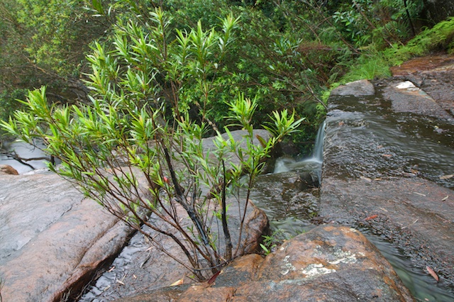
All the time it was raining. Lightly at first then heavier as I headed towards Winfred Falls. I was hoping that the rain may mean the falls would have a decent flow. Unfortunately not! I found a nice cave to shelter from the rain – and ventured out with camera, tripod and umbrella to try and capture some images. Not too good in low water however – but a nice place, despite the scar of the sewer pipe as it crossed the stream-bed.
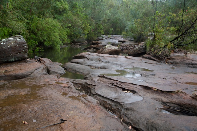
Then it was a nice track to Anice Falls. It was too wet to stop for photos and again – not very spectacular in a very low flow.
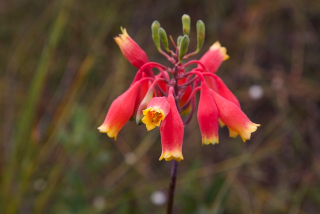
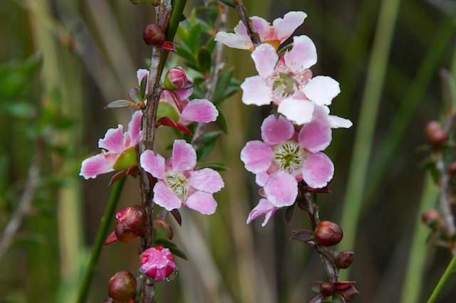
The track then continued through attractive heath, with lots of wild flowers. Too wet to stop for photos however.
The rain did not stop until I reached the road. And then it was fairly dry until the walk ended. The Anice Falls Track took me to the Maianbar Road, then I walked along it to the Bundeena Road and then to the track to the Deer Pool. Perhaps 25 minutes of road walking – unpleasant with cars whizzing past. But perhaps the worst part of walking along a busy road that is in the bush is noticing all the rubbish strewn along the verge.
It was good to escape down the Deer Pool Track. More easy walking – and this time I could take photos of the flowers.
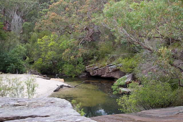
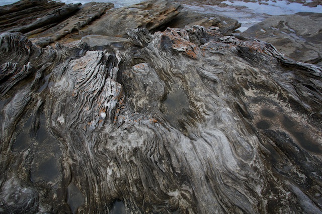
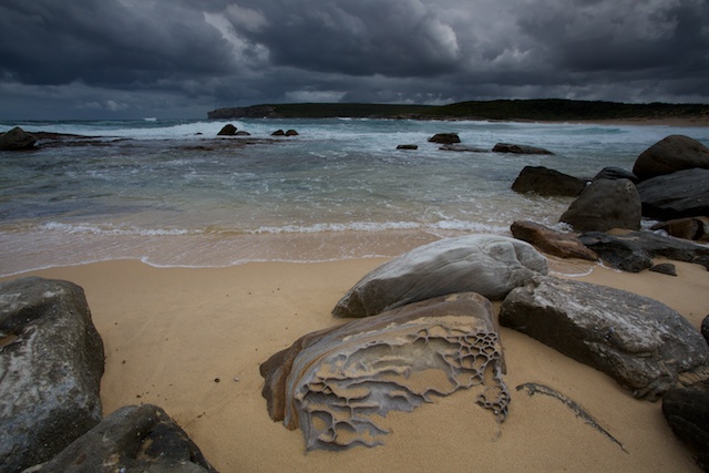
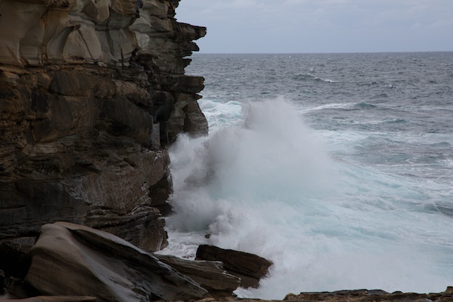
I went past the Deer Pool to Marley Beach. It joins the Coastal Track fairly close to Little Marley Beach. Between Marley and Little Marley are some very unusual rocks on the platform just above the surf. Always a good place to stop for photos.
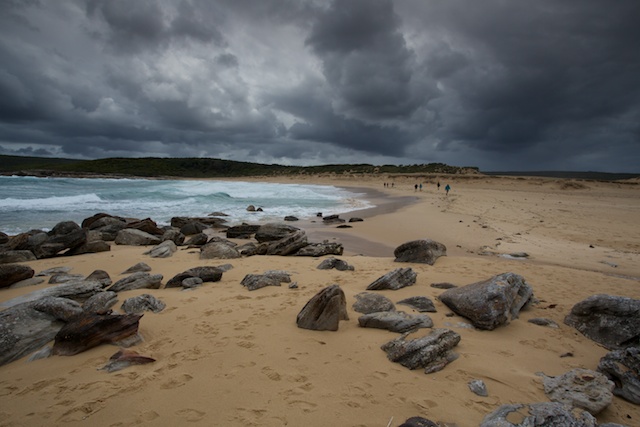
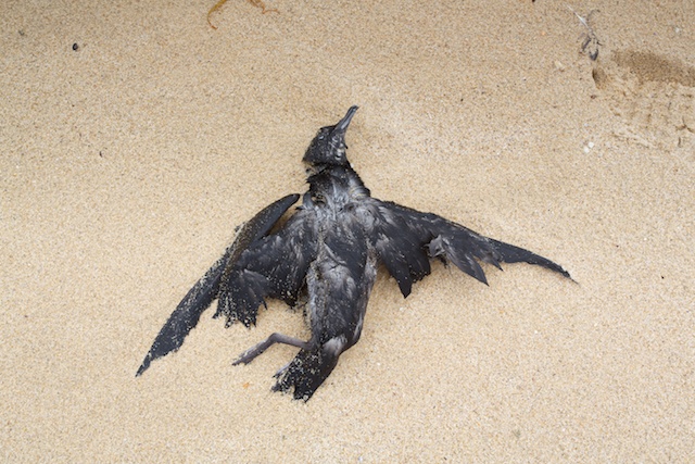
Marley Beach – the big beach, has a justly bad reputation for danger with its series of rips. It is a place where bushwalkers have drowned when stopping for a swim. It is much safer to swim in the more sheltered Little Marley. On this visit – Big Marley was a scene of death! Washed up on the beach were hundreds of dead Shearwaters (Muttonbirds). These were ones that had not made it on their long migration south to breed. It is not uncommon for some of them to starve and run out of energy. But is it uncommon for them to die in such large numbers? Perhaps their usual food (fish) has been fished out? Or perhaps it was a big storm? (and see this link)
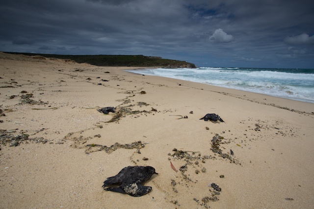
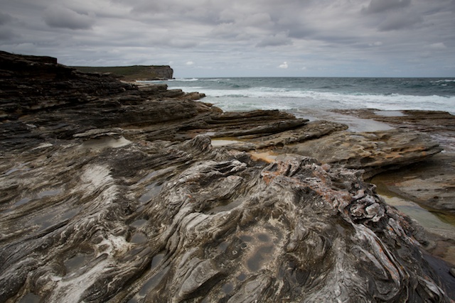
Marley was also made dramatic with the storm clouds above being at their peak. Impressive and awesome.
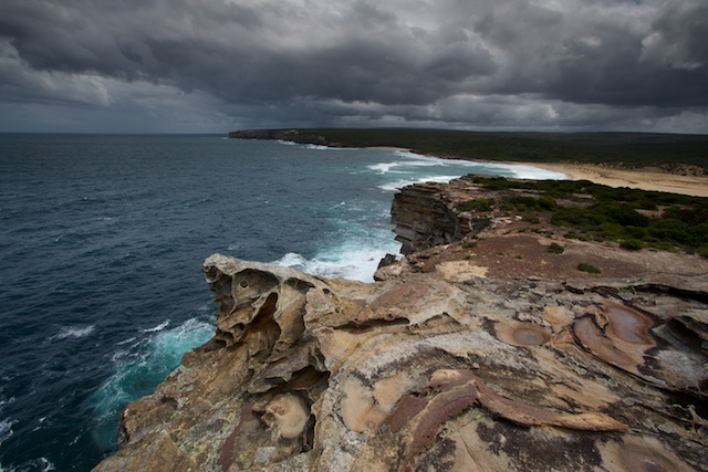
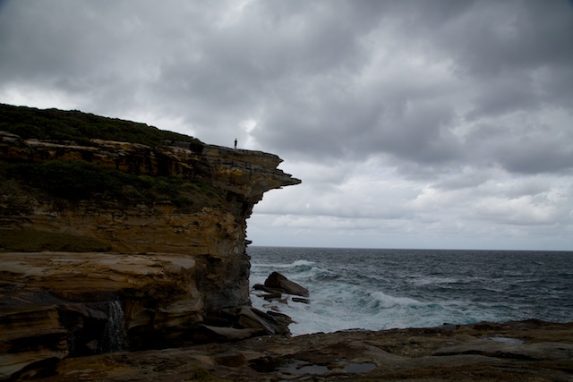
The last part of the walk was north along the Coastal Track to Bundeena. This is a great section of coastal walking – on top of the sea cliffs.
More photos on my website here
Did this walk a few years ago, and similarly didn’t like the section along Bundeena road. It would be nice if the national parks constructed a bush track to join the two walks.
Yes, such track would be a convinient path for a East – West crossing of RNP.
Yes that would be good. And it would be a nice 4 day walk – from Loftus to Bundeena on the first day, then two days down the Coastal Track, then another day along the Illawarra Escarpment track.
If not intending to head down the coast cut straight across the Mainabar road for a good off track route to Bonnie Vale and Bundeena, that will first bring you down at the back of The Basin; from there wade along the mangrove lined eastern side, the most extensive mangrove forest in the park, and the off track effort will be well worth it.
I was recently mapping all the tracks at Maianbar and I was surprised you did not mention the track that starts 200m prior to the Maianbar Rd off the Anice Falls track. You are now able to walk all the way to Bonnievale on track except to cross over Maianbar Rd at the Brick bus shelter where another track leads down and around the edge of the Cabbage Tree Basin. These tracks are in good condition and are being maintained, probably by locals.
Yes – I think I have been down that track, many years ago by mountain bike. It was then very overgrown. Good to hear that it is now in good condition. On this walk, I wanted to go to the Deer Pool and Marley – a nice diversion. I want to return to those waterfalls again sometime for some decent photos. But this requires high water levels – and then the Audley Causeway may be closed. Thanks for this information.