
Erskine Creek is a beautiful wild creek in the Blue Labyrinth Section of Blue Mountains National Park. It starts off as Bedford Creek and has a source close to Wentworth Falls and Kings Tableland. Downstream, the name changes to “Erskine Creek” – and the creek is a lot more remote.
It lies in an area explored by the Warrigal Club and in particular, two great bushwalkers, Harry Whaite and Jack Gibson, in a period between World War 1 and 2.
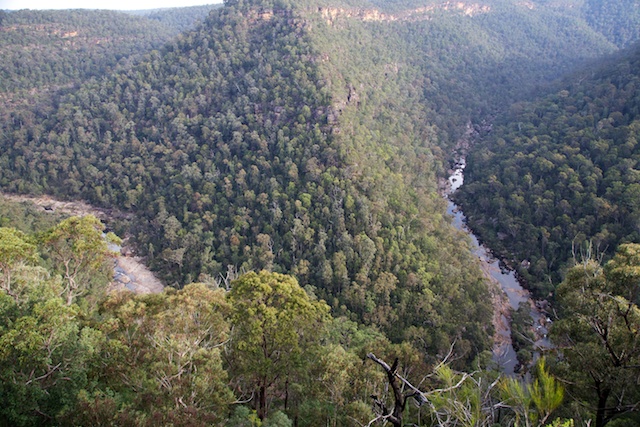
The most popular part of the creek for bushwalkers to visit in recent times is the more accessible lower few kilometres. The creek can be reached from the Glenbrook entrance to the park via the Oaks Firetrail and then via another firetrail that goes to the Nepean Lookout. On this last firetrail are two tracks that lead down to the Creek. The relatively easy Jack Evans Track and the much more rugged Tierny Track that leads off from Pisgah Rock.
My recent visit was with John, Chuin Nee and their baby Jasper. We chose the Tierney Track despite its more difficult nature, because it takes you to a delightful campsite at the junction of Erskine Creek with Lincoln Creek.
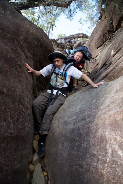
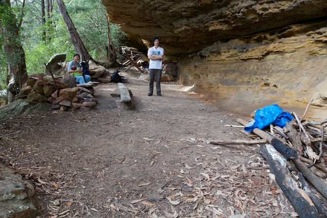
After visiting Pisgah Rock we headed off along a track and soon found ourselves in the Attic Cave. This was an interesting camp cave high up in the cliff line. We hadn’t meant to go that way – but had followed the wrong track! It was not far back to Pisgah Rock and its magnificent views of Erskine Creek and we soon found the correct track. This track which steeply descends through clifflines to Monkey Ropes Creek is known as the “Tierney Track” after another pioneering bushwalker Fr Frank Tierney.
The track is a steep scramble in places. In fact most of the way down. Interesting for John with baby Jasper on his back. I had brought a handline which we found useful in places. For most of the descent, Jasper was sound asleep.
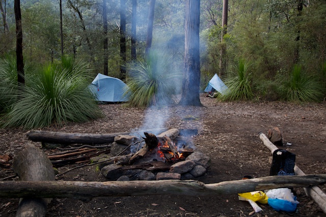
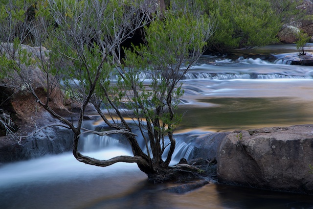
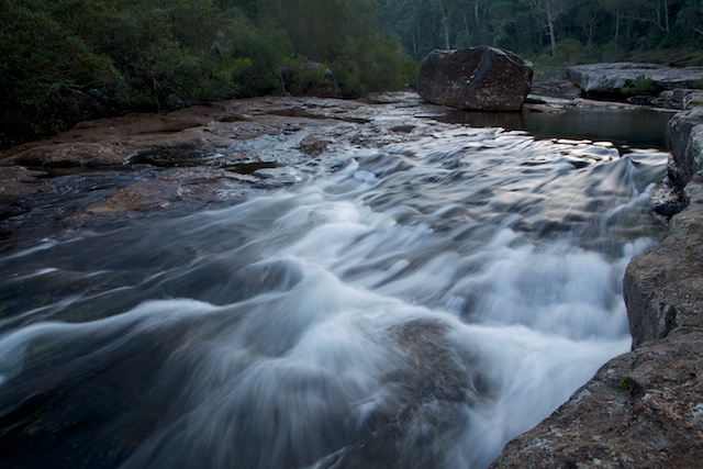
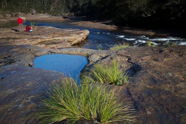
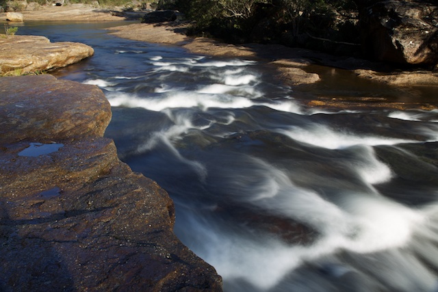
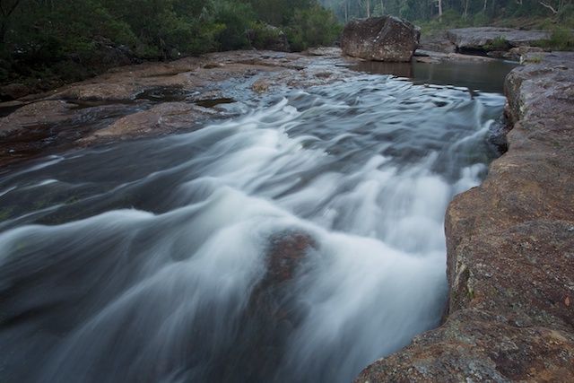
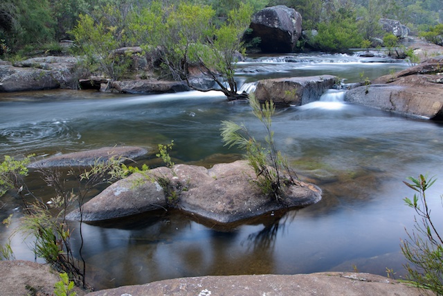
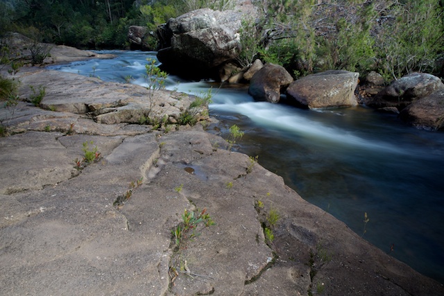
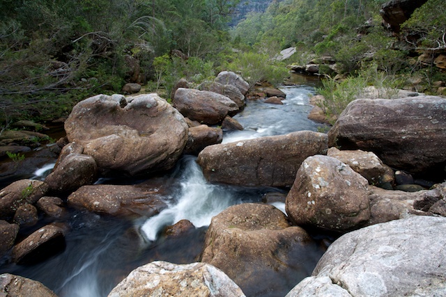
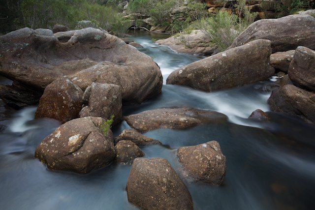
We arrived at the campsite in time for lunch and then set up camp. Then we headed downstream to a large area of rock slabs with some delightful rapids. This is just downstream from a huge deep pool – a great place to swim in summer. It was nice sitting in the sun admiring the creek, the slabs and the towering sandstone bluffs above.
As the sun was lowering, we headed back to camp. Another party had arrived and set up their tents and so the site was a bit more crowded. But there was plenty of room to sit around a roaring fire as we talked into the evening.
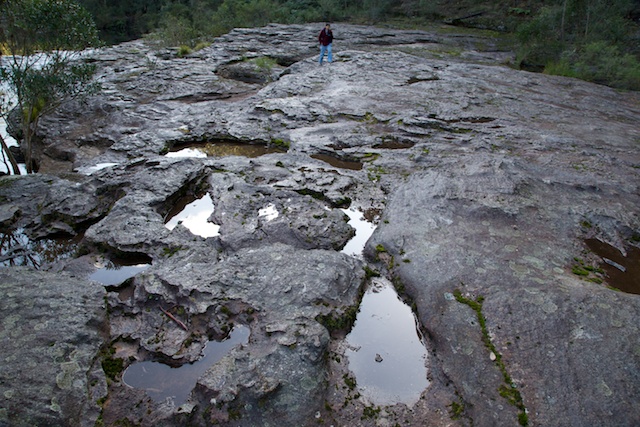
At the Lincoln Creek junction, the main campsite is on a dry higher terrace. There is probably room for about 10 tents. On a lower sandy site nearer to Erskine Creek there would be room for about 3 or 4 tents. There is another nice place that you could camp between the first and second rock slabs a short way up Lincoln Creek.
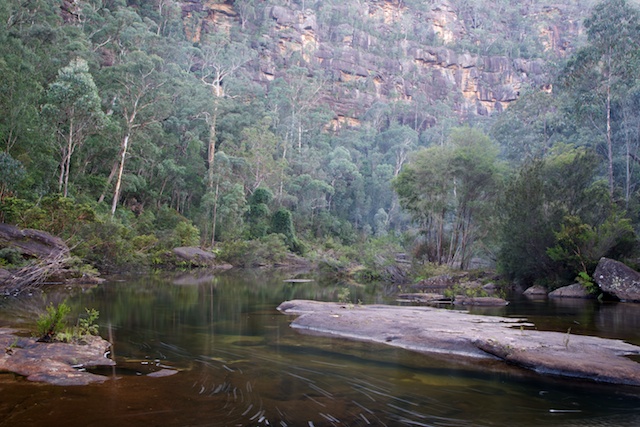
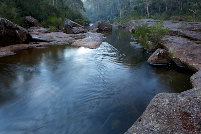
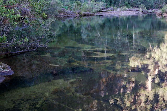
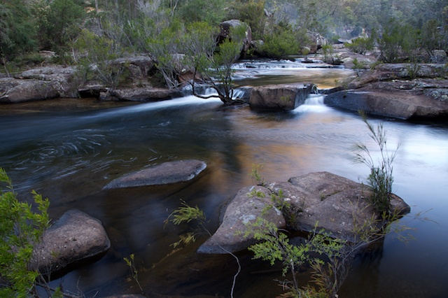
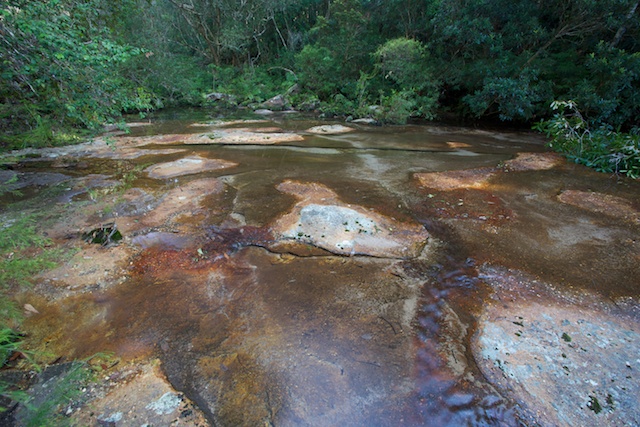
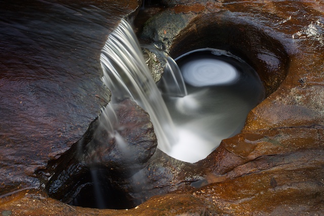
I spent a bit of time on Sunday morning taking photographs of the rock slabs, rapids and pools of Erskine Creek and of an interesting little cascade in Lincoln Creek. This creek is named after one of the Halls brothers – Lincoln, Duncan and Machin Hall. Bushwalking pioneers from around 1900 who regularly visited the area. There are other features named after them in the Blue Labyrinth. I think famous Australian mountaineer, the late Lincoln Hall is a descendent of this family.
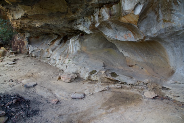
One of the Hall brothers favourite places is a cave a little way up Erskine Creek – the Dadder Cave (from Death Adder – these snakes are found in the area) Its about an hour’s walk to the cave. You head upstream on the true left bank, crossing to an area of rock slabs when you can (usually by jumping across on boulders), then easier going on the open slabs and a faint track in places, past a few small overhangs until the cave is reached. The Cave is interesting but is a bit dusty and dirty. It would be a good refuge in bad weather, but you would have to make sure you were not cut off by rising water (if so – you could walk out via Warragamba Dam, which is not that far away). The other people we had camped with, had told us that when they asked about the cave at the park entrance, they were told that you are not allowed to camp there any more. I’m not sure if this is correct.
Dadder Cave
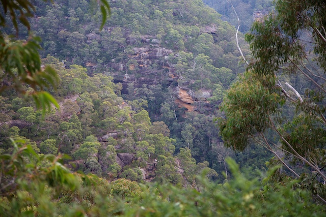
We returned for lunch back at the campsite and then climbed out up the Tierney Track. At the Pisgah Rock Lookout, it looked to me that there would be a better view of Erskine Creek from other rock ledges a little further along in the downstream direction. The view was better – but there was a bit of scrub to negotiate on the way.
We finished off by visiting the Nepean Lookout, not far away at the end of the road.
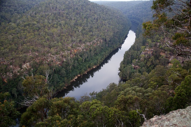
Nepean River
More photos are on my website starting here.
The historical information above comes from an excellent book – A History of the Blue Labyrinth (1992) by Bruce Cameron, a local bushwalker and climber. It has long been out of print. But I have heard recently that Bruce is thinking of revising the book and reprinting it. Good news!
Erskine Creek looks a lot cleaner than when I was last there (about 6 years ago) when it still hadn’t recovered from bush fires. There is also a route up over Little Crater Ridge that I did 6 years ago but it involves some off track walking and so is only for experienced walkers. From where Jack Evans Track reaches the big pool on Erskine Creek you head WSW up a long spur onto the ridge, then work around to the point where the dry (probably) creek reaches the cliff top overlooking Erskine Creek downstream of Dadder Cave. There is (or was) a cairned route off the cliff and down the slope to the creek.
Hi Dave
I’ve been thinking about a solo trip Id like to do for a few years now for my 50th birthday that might interest you.I’m planning to walk the length of Bedford creek and Erskine Creek from the end of my street in Bullaburra to the Nepean River. Around April seems like a good time, water and weather not to cold not to hot and hopefully snakes a bit quieter.To my knowledge I don’t know of anyone who has tried this walk but it should be a good challenge mentally and physically.I’m an experienced camper ,hiker, and crayoner and I expect to be wet more than dry as the vegetation especially in the upper section is very thick.
I’ve followed a lot of your trips and enjoyed them very much over the years.
I don’t know of anyone that has walked the whole way down Bedford Ck/Erskine Ck on the one long trip. I do know a party that set off from Lawson and went down Bedford Creek as far as they could go on a weekend. I would also expect a lot of the gorge has been walked by parties. It is rough country in spots.
Did you end up doing this walk? I do know of another who has done it with his dad when he was younger. I’ve thought of doing a similar trip
Not yet
From Bullaburra to the crossing of Bedford creek at Anderson’s fire trail took 3 days to do approximately 6 kilometres. So thick I spent most of the time in the creek as it was impossible to push through the vines etc on the banks. So after some reassessment I be been breaking the walk down in sections over the last few years. Spectacular creeks especially Erskine. The floods in the last year have certainly made it easier to travel as they have cleaned the banks of a lot of the underground for at least 4 to 5 meters up each bank. Truly awesome power of a big flood. I wish there were more access points because there is still a lot I haven’t got to. Cheers.
Hi Dave. My son and I are hoping to do Kings Tableland to Nepean River via Erskine Creek over 3 days next weekend starting Friday. If it goes ahead I will let you know how it went. My son is a budding photographer as well. Should be good. Let’s see how far we get
I am curious to know if Rod Titovs and his son did complete the walk from Kings Tableland to the Nepean River and if they consider it safe to do on your own.
I’m not expecting these plans to realize.
There was a SUBW trip into the headwaters of Bedford few years back. Those guys have been really set on their “press on regardless” motto but hey had to bail out: they did not accomplish their goal of linking couple of firetrails with the creek, because the vegetation was too thick.
Now, compare this report to the goal of walking the whole length of Bedford which is 20km+, then Erskine another 10km+, and the goal looks simply insane. In such terrain, the only realistic trip would be to link high ridges hoping that the linking descnts to the creeks won’t be too thick. But walking strictly along the creeks is unfeasible, unless you hire a group of jungle warriors who would clear the way for you in turns with machetes. The last option is neither reasonable nor legal.