
Martin had organised this walk for UTS Outdoor Adventure Club and had invited me to join him. Andres was also on the walk. He had planned to go for three days along the divide between the Wolgan and Capertee Valleys.
We parked at the Donkey Mountain car park on the Newnes Road. Instead of using the style to cross and fence and head up to Donkey Mountain, we went the other way. Crossing a small creek and climbing up onto the top to the north.
Both Martin and myself had used this pass on a previous trip. Its steep but quite easy for the most part. On the tops – we walked towards Collet Gap. The section between these tops and Collet Gap – only a kilometer or so, was the only section of the whole divide that I had not traversed on earlier trips. It was very easy.
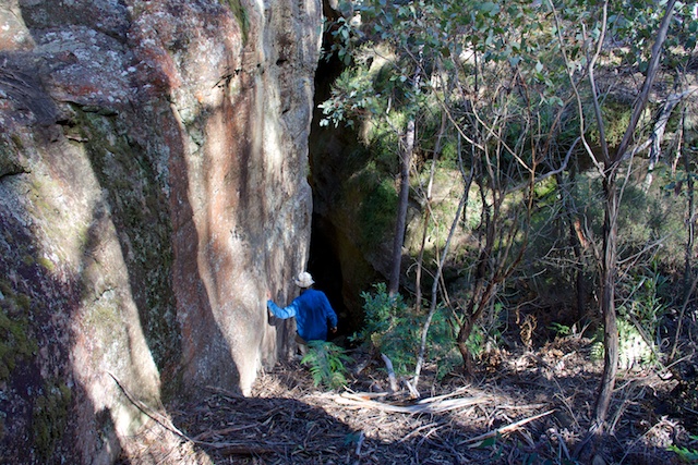
We crossed Collet Gap without difficulty. Woolpack Gap was another matter. On a previous trip, back in 1975, with Keith Maxwell and Chris Cosgrove, we had walked from McLeans Gap to Collet Gap and at Woolpack Gap, we had forced a pass up the eastern side very close to the skyline. On the present trip , we spent a fair bit of time looking for that pass. We probably found the route we used – a very steep gully going down a face. We scrambled down without packs and almost reached the bottom. We were stopped by a short overhang – only 3 or 4 m above a large ledge. Perhaps on the 1975 trip – we had jammed a log in place and climbed up? We retreated up the gully, back onto the tops and then explored to the north.
We first checked out some promising looking canyons – and at one point, we could climb down a fair way – but would have needed to do a few abseils to go all the way through.
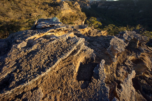
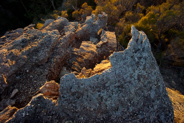
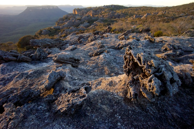
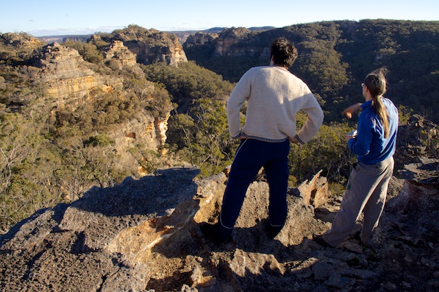
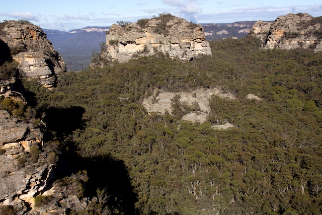
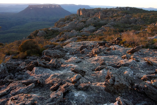
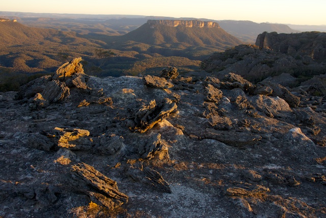
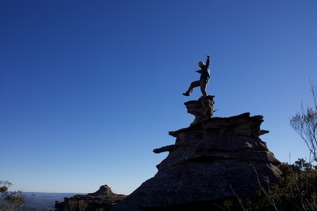
It was now getting a late, so we ended up camping on the tops near some pagodas that offered nice views. The pagodas also provided interesting subjects for evening and dawn photos.
The next day, we continued our exploration to the north and ended up going down an easy ramp to the bottom. This took us down close to the junction between Red Rock Creek and small tributary. We could use this creek to refill our water containers. The ridge between these creeks provided a fast and open passage up towards Woolpack Rock. On the way we passed a few campsites.
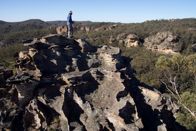
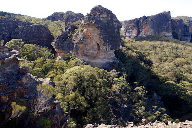
Woolpack Rock
We had hoped to find a way up Woolpack Rock. This looked futile. There seems to be no scrambling route to the top.
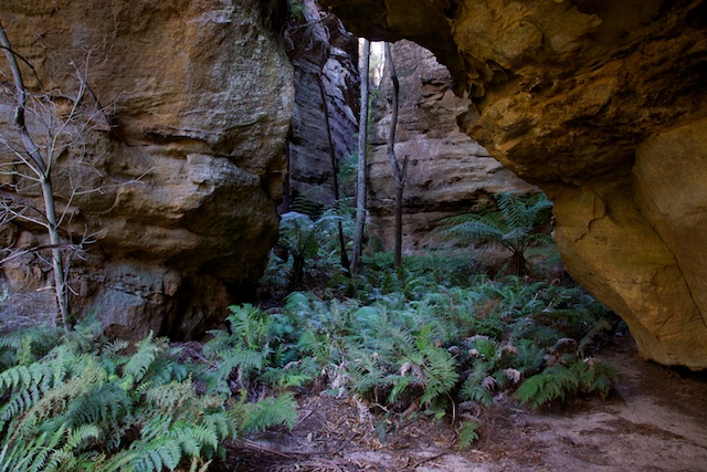
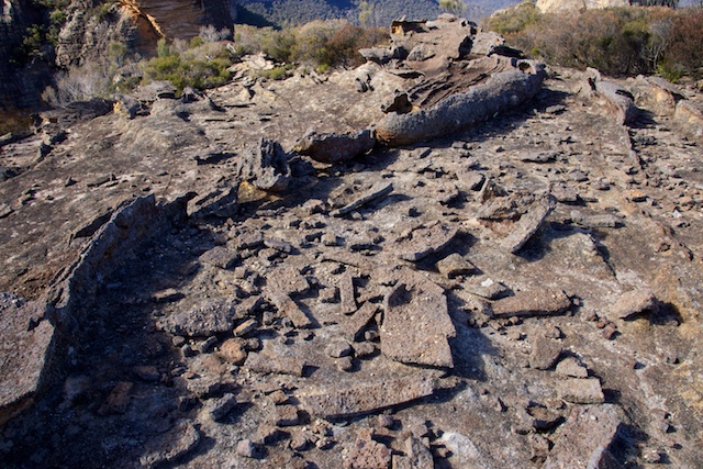
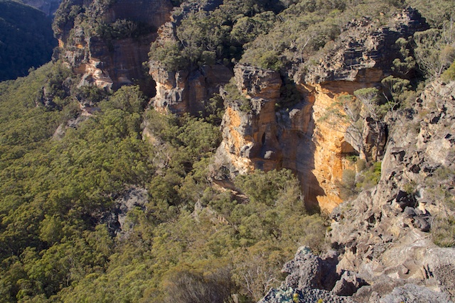
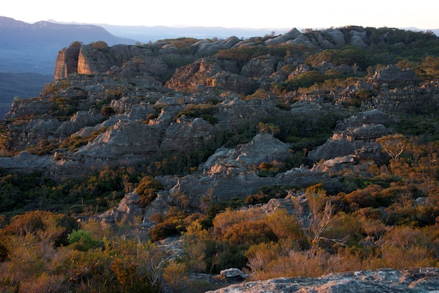
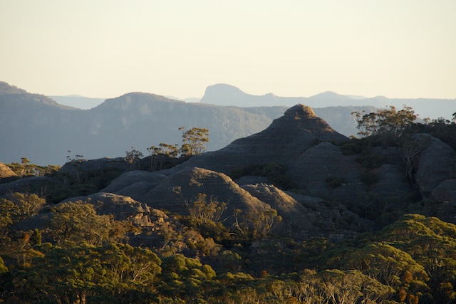
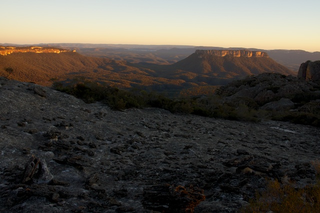
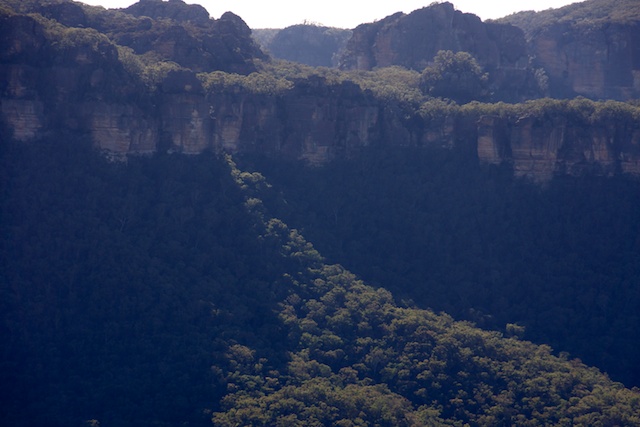
Instead we explored the tops to the south west of Woolpack Gap. These tops are rent by many chasms and canyons and have some very interesting pagodas. Views are outstanding. But – between the pagodas there is a lot of tough scrub! It is not easy going.
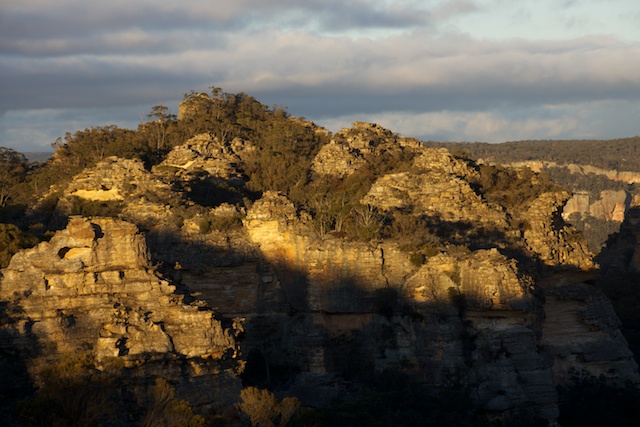
Next, we walked towards Hughes Defile. The route west from here was well known to both Martin and myself from recent trips and we made very fast time crossing Hughes Defile and Blue Rock Gap to arrive at a campsite we had used on the last June Long weekend near the Exploded Pagoda.
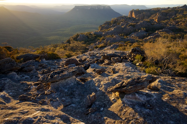
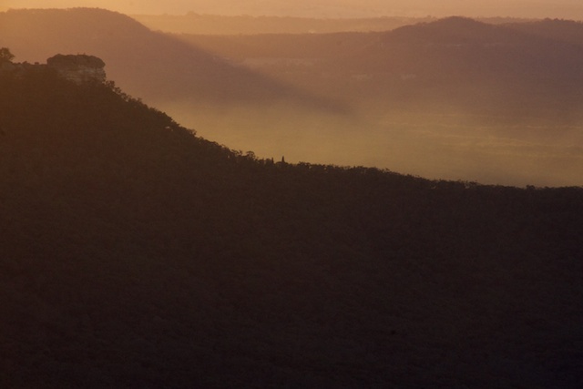
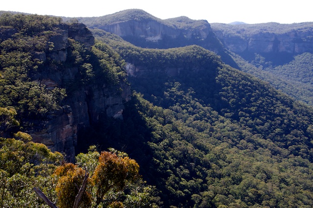
This is a great area for late afternoon and early morning photography. Standout features are the scattered fragments of the Exploded Pagoda, a maze of pagodas to the north known as “The Lost City”, an area of domes near Point Cameron and then the more distant features – Baal Bone Point and the mesa of Pantoneys Crown.
Day three of the trip started with a brisk walk to McLeans Gap and then to the fire road to the south west.
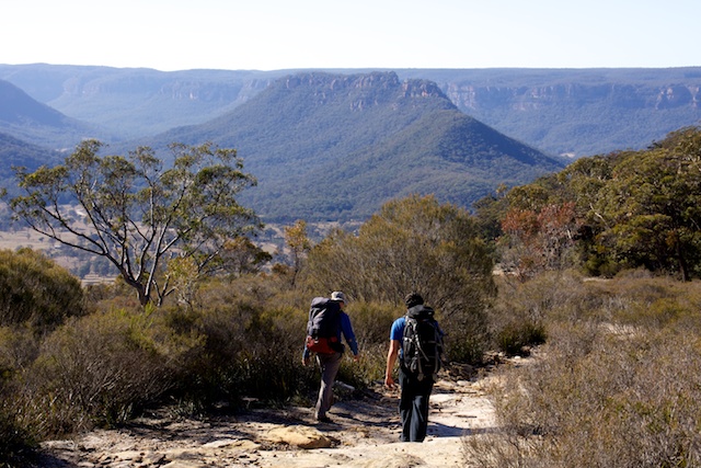
Once on the road, we walked to the end of it – to a viewpoint overlooking Cape Horn. None of us had descended off the Cape, but thanks to an email from Tom Brennan, we had grid references for passes through the cliffs. The first one was about 250m north of the road end, down a steep ramp/corner. Then a traverse under the upper cliffline back to the point and out past a large dome and then towards Cape Horn. Shortly before the end, we descended an easy gully to the south and then sidled under the cliffs and down a nice spur to the Newnes Road. A 5km road bash took us back to the car.
Every day on the walk we had fine, sunny but quite cold weather.

More photos are on my website starting from this page.
Hi Dave,
It might be of interest to you, that in the last two years, the guys from Bush Explorers, lead by Brian Fox/Michael Keats, have done more exploration of the area west of Woolpack Rock. They provide few very detailed track notes from their trips, e.g.
https://www.bushexplorers.com.au/media/reports/1143944_2_BCSNW-Woolpack%20Gap-Alcatraz-Red-Rocks-Creek-and-more-270516-Track-Notes.pdf
https://www.bushexplorers.com.au/media/reports/1244402_2_The%20Wonders%20of%20Alcatraz-081217-Track%20Notes.pdf
You will recognize pictures therein. I could find at least two-three of their pictures taken in identical locations as yours above. They named a prominent rock just W of Woolpack Gap “Alcatraz” and the canyon (likely the same you’ve been exploring above) “Liberty Gully”. What’s interesting, they used easy passes on both gaps around Woolpack Rock as a shortcut access so their trips could be completed in a day from Wolgan Valley. They also found another pass through the cliffs directly S. How many more passes the area can offer? Well, too many and unnecessary IMO, because it is completely surrounded by private farms. They say they obtained access permission, but I imagine farmers won’t be happy if many more bushwalkers try to follow, given the freely available information I cited. Your pass further to E is a longer approach so involves an overnight trip but at least appears not to involve any private land crossing nor any fence jumping, am I correct?
Too far to go for day walks, and high camps are always worth while.