
Pete Harvey was a very well respected and admired walker in SUBW. He had served the club in many roles including a term as president. His sudden death shocked his friends from the club. On the weekend after his funeral service, Tom Murtagh of SUBW organised a memorial walk in the Baal Bone – Blue Rocks part of Gardens of Stone National Park. This was an area that Pete loved to walk in.

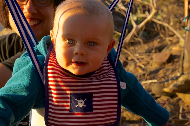
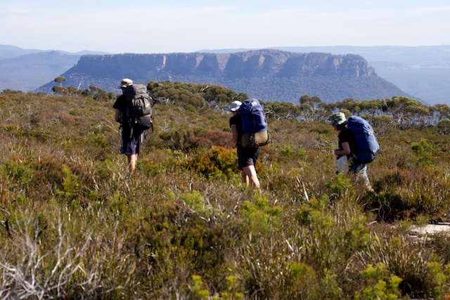
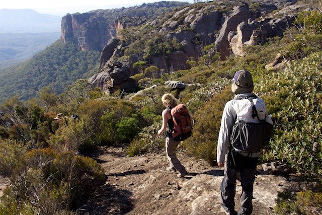
We had a large contingent of walkers, including Dave and Nicole’s little baby Oli (6 months old) on his first overnight walk.
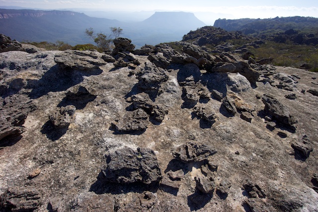
Being a memorial for Pete Harvey, our original intention was to get to Mt Harvey near the Red Rocks. An ambitious plan! We almost made it. We camped about a kilometre south of the mountain and reached a high pagoda overlooking it on the Sunday morning.
Our route was from ridge out to McLeans Gap and then along the Wolgan/Capertee Divide out to Blue Rock Gap and Hughes Defile and then north along the plateau and ridge to Mt Harvey.
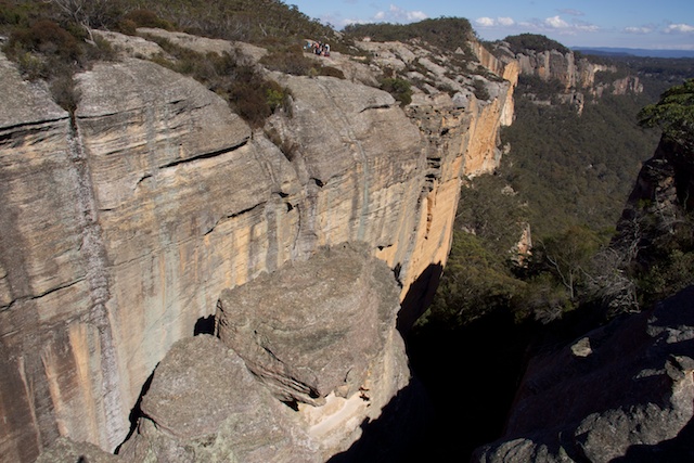
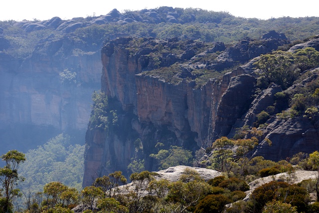
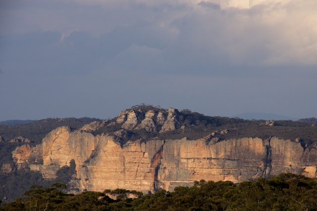
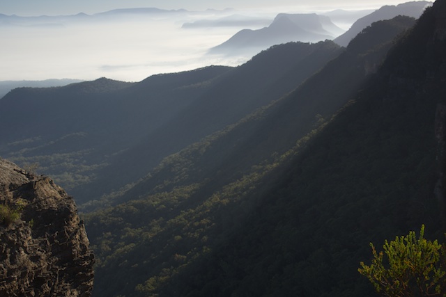
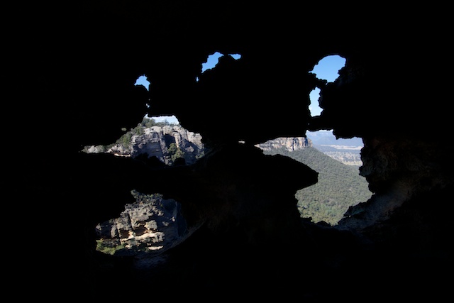
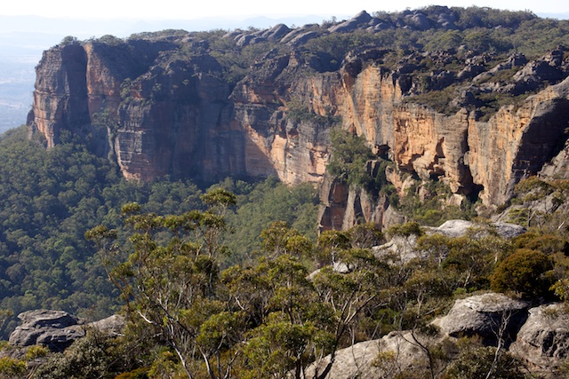
This is very scenic country. It is great country for bushwalking, with breathtaking views of both the Wolgan and Capertee clifflines.

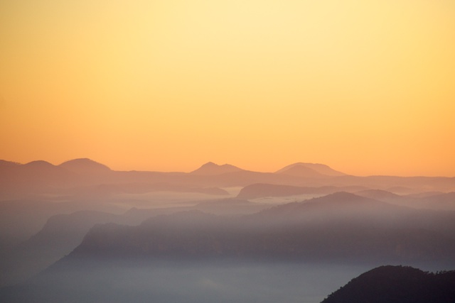
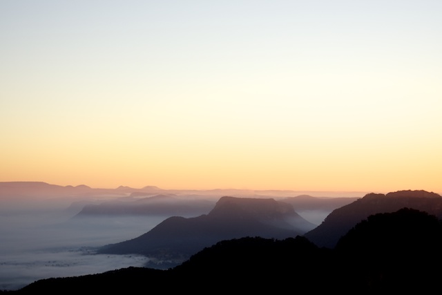
We set out in a few separate parties and met up at a campsite on the cliffs a kilometre or so short of Mt Harvey. This campsite had outstanding views overlooking the Capertee Valley – from Baal Bone Point, Pantoneys Crown, Tayan Pic and right around to the Red Rocks.


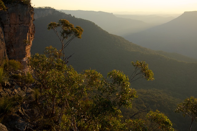
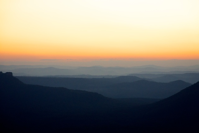
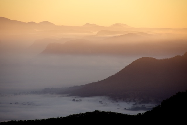
On Sunday morning, some of us got up early to photograph the sunrise. A small amount of mist was in the valley adding to the atmosphere.

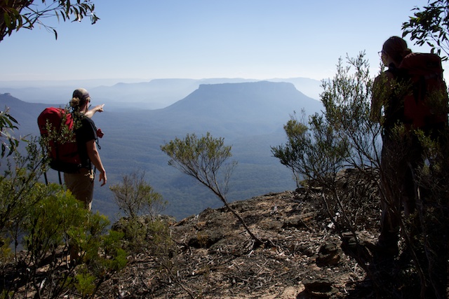
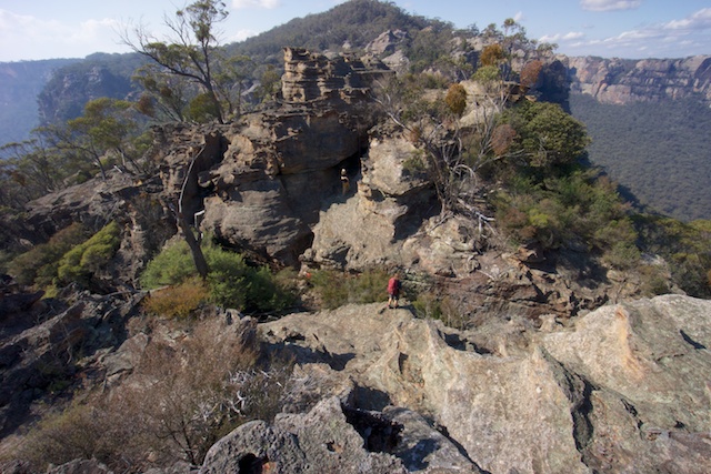
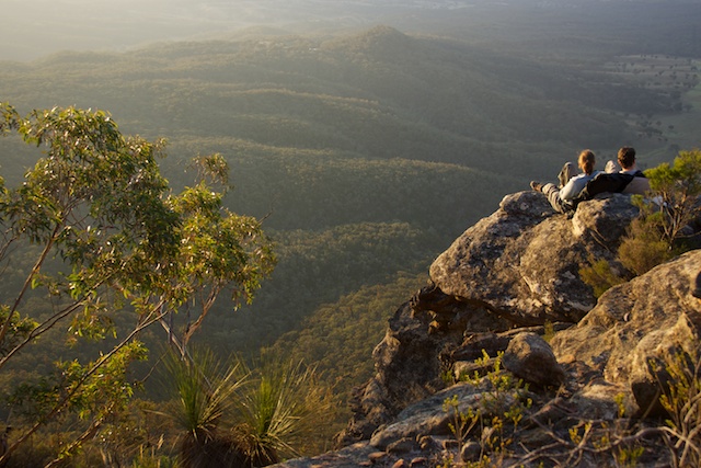
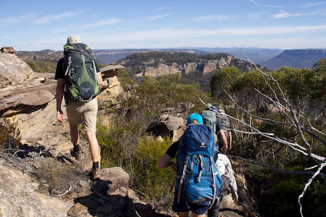
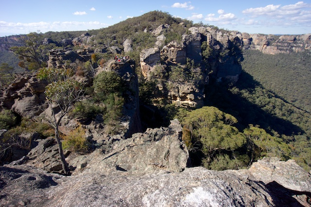
After breakfast, we headed further along the ridge to Mt Harvey and stopped on a high pagoda a short way from the peak. This pagoda had very commanding views but was not easy to get off. We had left the rope back with our packs near the campsite. So we decided to stop there, although Chris later found an easy bypass route.


At the pagoda, we all spent some time reflecting on the good times and trips we had been on with Pete. It was an emotional time. A sad time….
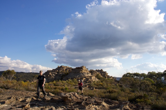
We then had to reluctantly head back. Our route was to retrace our path of the day before. Again – more fantastic views and nice walking.
Pete’s passing has been a sad time for many in SUBW, but it was good to be out in the bush with friends to celebrate his life and his love for the wild places.
More photos of the trip are on my website here.
Hi David… Firstly, thank you for putting the time & effort in to sharing your passion for the amazing wilderness areas we are blessed to have surrounding us here in Sydney – I often look at your site when I’m looking for inspiration in finding a new area to walk in.
I wonder if you might be able to help me with something?
This coming weekend, I’d really love to take some friends on this Pete Harvey memorial walk or the Blue Rocks walk you also posted. Do you know of anywhere I might be able to find some basic track notes, or would the track be marked on the topo map for the area?
Thanks again!
I don’t think there are any walks notes available. To get to our start – we turned off the Newnes Rd not far past the Angus Place Colliery, and followed the fire trail up a gentle valley onto the tops – and stopped just before the big hill down to Baal Bone Gap. There a road turns off to the north east. You follow that road for a while and then follow a faint track out to McLeans Gap and beyond – the track gets fainter as you go. But its not too hard to get to Blue Rock Gap – which requires some route finding to get across. Hughes Defile was quite easy to cross. Its an area that its best to explore rather than rely on notes.
Thanks for the quick reply Dave! I’ve been doing as much research as possible today, but theres still not a lot of info to be found! I think if I could get myself to McLeans pass then navigating my way out across the plateau towards Hughes Defile & back would be pretty simple as long as I kept my eye on the topo map. I’ve been out to Mt Dawson Caves & I assume its a similar kind of plateau landscape.
My main issue at the moment stems from not having the Cullen Bullen topo & so it’s difficult to determine how to get to McLeans Gap. On the Ben Bullen topo a number of trails seem to converge at a locked gate on the bicentennial trail. I won’t get a chance to get the missing topo map till Thursday, but my main issue now I think is whether the fire trail will be passable in my Subaru Forester after the heavy rain we’ve just had.
Anyways, just to clarify, when you say the “Newnes Rd.” I’m assuming you mean the Wolgan Valley Rd. that ends at Newnes? I should be able to find it once I’ve got the Cullen Bullen topo. Do you think a Subaru Forester would make it up from the Wolgan Rd?
Ps…. I think your photos are amazing, especially those from this Blue Rocks post. I’m a professional photographer, so take that as a compliment!
I think I’ve found that fire trail you mentioned. It heads off the left hand side of the Newnes rd. a little way past the coliery as your heading to Newnes. Ill give someone at the park office a call tomorrow to find out if the roads passable. I hope it is… The area looks stunningly beautiful. I’ve seen it from the Mt. Dawson plateau and also from that look out on the Castlereagh Hwy. Can’t wait to get out there!
Thanks again Dave.
We drove out in a Yaris. But the road can change after rain. A Forester should have no trouble. Just make sure you don’t drive down the hill to Baal Bone Gap – its far too steep to drive back up.
A Yaris!? Thats pretty impressive! All I can say is, whatever you do, do not attempt the Baal Bone Gap Rd. after the kind of rain we had a few weeks ago!! The track has been churned into cake mix by all the 4WD hoons. I (stupidly!) attempted to get through a muddy puddle & got my Subaru Forrester so bogged that it sunk into the mud & flooded the inside of my car. There’s a photo here if you’re interested:
https://www.dropbox.com/s/v540i5w07gr356h/photo.jpeg
Luckily it happened at the start of the track & I was able to flag down a 4WD with a winch & was pulled out after only 45 minutes of submersion. Still…. it did something like $1000 worth of damage. It was a total rookie mistake, & I’m sure the guys who pulled me out had a good laugh about it on the way home! I will get to the top of that damn plateau one day, even if I have to walk from the bottom!
Hi David…. finally made it out to this spectacularly complex & fractured landscape after having drowned my car in the attempt last year. Turns out that back then I headed out on the northern branch of the Baal Bone Gap Road which begins in a swamp that is still impassable in anything other than a jacked up 4WD. Not being familiar with the area it took us a whole day to navigate our way to McLeans Gap after a few wrong turns. It’s certainly not suitable for anyone without some navigational skills. We mistakenly took what is probably a trail bike track south from McLeans & before realising some kilometres later that we were back on the Wolgan Cliff Line, next to a fire trail which intersects the Bicentennial Trail. We were expecting that track to eventually hook back up on to the plateau opposite McLeans Gap, but I’m sure theres an easier way. Having studied Google Earth images it looks like there might be a ramp up from McLeans Gap from very close to the Capertee ridge line. Would this be correct? Would it also be correct that you stay as close to the Capertee cliff line as possible for most of the way towards what you call the “Lost City”? Anyway, I’ll be back ASAP to continue piecing together the wonderful jigsaw puzzle this area is. Such a spectacular & humbling landscape! Thanks for sharing it with us.
Having re-read your reply from last year, it seems as though you may have originally suggested we start from that same fire trail we stumbled across heading south from McLeans Gap. Interesting! Instead, we started from the water pressure reducing station at Baal Bone Gap & followed a gully up to a pass on the eastern edge of the plateau. I think your suggestion would definitely have been quicker! Still, the Bicentennial trail down that corridor of beautiful pagodas to Baal Bone Gap is pretty stunning, despite being a 4WD track!
You may want to check out the gps plot from this trip from 2008. Look for the dark blue line. There is a rough track that goes out from the fire trail to McLeans Pass – and further along to what I call “The Exploded Pagoda”. Then it fades away.
http://www.david-noble.net/bushwalking/BlueRocksJun08/BaalBoneMap.html
and
http://www.david-noble.net/bushwalking/BlueRocksJun08/BaalBoneGooglepics.html
Hope these are useful. On that trip we came up Mt Stewart from Pantoneys Crown.
Dave
You are a legend! Thanks very much! That’ll definitely help next time.