
I was back from Tasmania and Bob was keen on a mid-week bushwalk. The weather forecast was not looking too good – showers. So we decided not to go up the mountains, and instead chose to visit a place neither of us had been before – Popran National Park. We intended to do circuit walk in the park and visit the Emerald Pool.
Bob drove up the northern motorway and turned off and headed for Mangrove Mountain. We were soon on Ironbark Road. I had also wanted to visit Ironbark Falls, which don’t seem to be marked on any map, but not far along the road, we noticed a sign for Ironbark Falls Reserve. We would investigate the falls on the way back if we had time.
Where Ironbark Road entered Popran National Park, there is a very steep hill – too rough for Bob’s car, so we parked at the bottom, and walked a kilometre or so to a picnic area established in the park. Here there is an information board, a picnic table and toilet. It was raining lightly – and the rain continued for most fo the day.

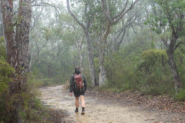
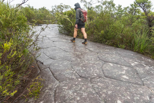
We then crossed a barrier and soon reached a junction of fire trails. We intended to do the loop walk in an anticlockwise direction, so turned off along the 248 Trail which led off on the right. It was easy walking through pleasant country.
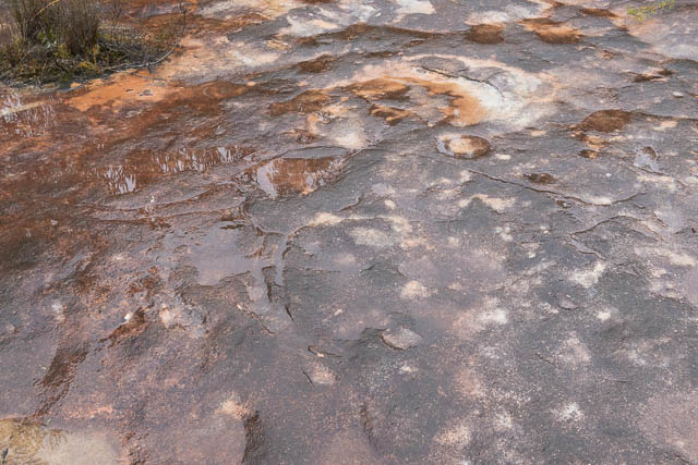
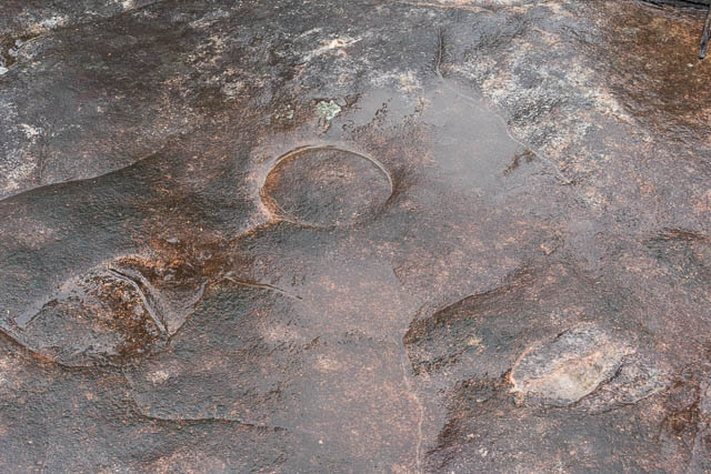
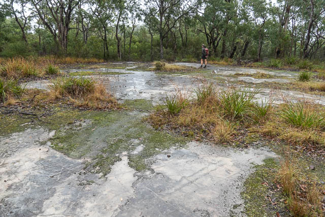
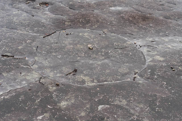
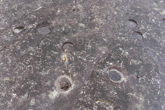
Along the way, in several spots, we noticed side tracks leading off to rock platforms. We explored these and indeed found signs of Aboriginal habitation. We found engravings of animals and also a lot of circular shapes or different sizes. They were too shallow to be wells. We also saw a few axe sharpening grooves.

One nice part of the walk was walking through the Donovans Forest, an attractive forest on the ridge.

Not far past the forest, we did ashore side trip out to a lookout. In the bad weather we dint get any views, but we did find a nice Aboriginal engraving site.


Then we had the descent to Hominy Creek. The part is a track rather than a fire road. At the creek, we went downstream a short way to the Emerald Pool. It was a nice spot, but offered no shelter for a lunch spot, so we didn’t stay long.

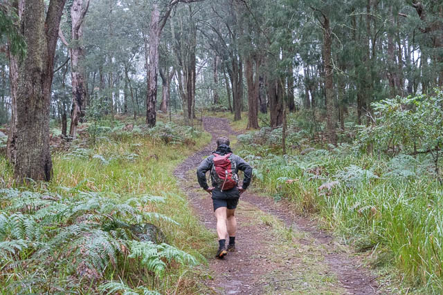
We continued around the loop, climbing up on the eastern side and soon reached another fire road – The Mt Olive Trail. We followed it back, again exploring any side tracks we found for Aboriginal art.
A longer side trip was to climb Mt Olive. Again the views were obscured by mist and as the rain had started again we didn’t stay for long.
We ended up having our lunch, back at the picnic area. not using the picnic table, but instead sitting on the concrete slab of the display board- which was under a bit of shelter.
From there it was not far back to Bob’s car. We stopped further along Ironbark Road and next explored the small Ironbark Falls Reserve. This was very worthwhile. We followed a trail along a fence-line to reach an infraction board about the reserve. We then followed a rather overgrown track for a few minutes to the falls. The falls are quite impressive – but probably so only after rain.

The track also features Aboriginal food and cultural signs. This is an interesting, if somewhat neglected reserve. The sign indicated it is a Gosford Council Reserve, but it does not appear in the list of reserves on their website.
More photos of the walk are online here on my website.
Where do you access the walk from Peats Ridge road or Wisemans Ferry road?
Thanks
You need to go along Ironbark Road – which turns off from the road from Mangrove Mountain to Spencer.
Hi David. beautiful posting, I’m going to be down on mangrove creek and am wondering if there might be a trail up from the bottom of Hominy creek to emerald pools. If you’re not sure that’s ok. Cheers Aidan
No track that I am aware of. There are tracks closer to Mt Olive – that go east and west.
Just below Emerald Pool, Hominy creek runs over a beautiful series of rock slabs covered in grinding grooves. After about 200m the creek drops over a 30m waterfall into a near vertical-sided valley filled with rainforest. From the top it appears that it would be very difficult to bypass the fall from below unless you started from well downstream and climbed a very steep ridge. If the creek is like others in this area e.g. Ironbark creek its lower reaches near the Hawkesbury are probably lined with cliffs so reaching EP from below would be a challenging walk