
It had been many years since I had walked to Sassafras Gully at Springwood. Growing up in Springwood, this was a popular destination for family bush walks when I was very young. I had learnt to swim in a big pool in Glenbrook Creek. I knew the tracks well.
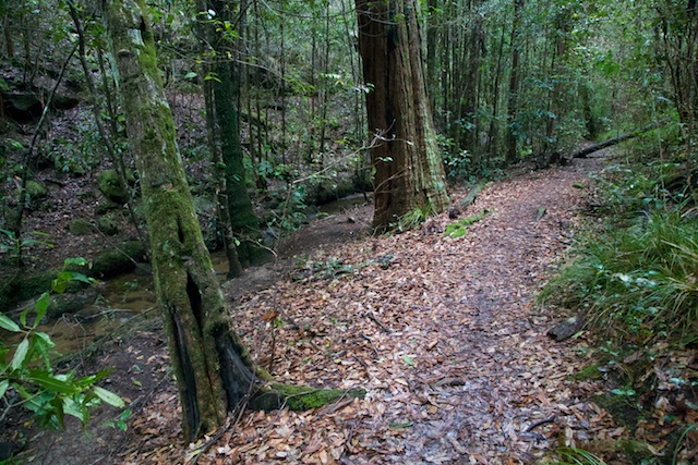
This time, I set off from Faulconbridge with a camera and tripod. The Victory Track starts near the railway level crossing. It soon leaves the houses and enters a world of ferns and tall trees. The creek picks up pace and soon tumbles over Clarinda Falls.
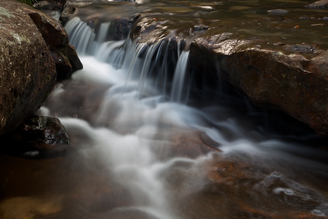
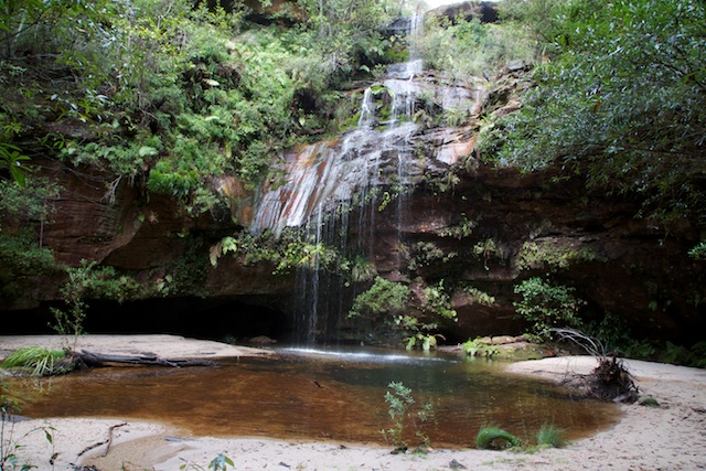
Clarinda Falls
These falls were challenging to photograph. It had been raining and the local council weather site showed about 18mm of rain had fallen the day before. I was hoping for more rain and cloudy conditions. Instead I had sun and no rain, and little more than a trickle going over the falls.
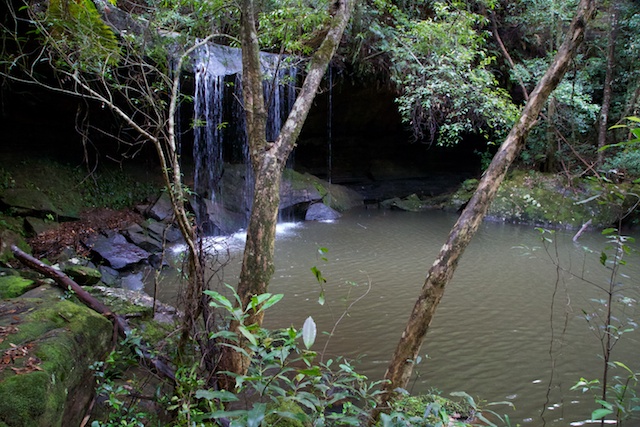
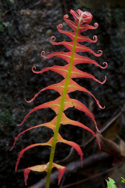
I then continued down the track through delightful rainforest. At Numantia Creek junction, I detoured on a rough and not marked, but easy to follow track up Numantia Creek to Numantia Falls. These falls are in a nice grotto – but I found them even harder to photograph.
Numantia Falls
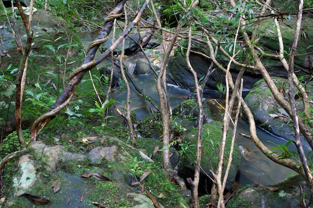
Back to the main track – and then down to the Glenbrook Creek junction. Here it is worth crossing Glenbrook Creek to check out the amazing rock formations in the streamed. An interesting place – and it would be a great place to camp and swim.
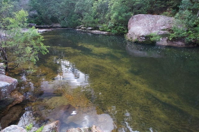
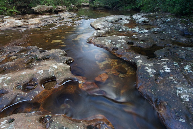
Next, down the gorge to Perch Ponds. Delightful walking along the way. Glenbrook Creek is fascinating and I could easily have spent many hours photographing.
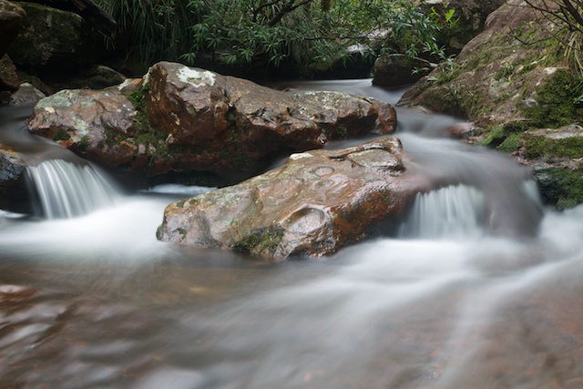
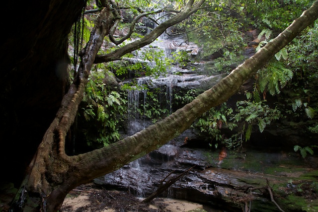
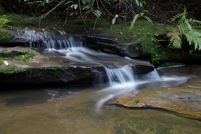
I stopped for a late lunch at the junction with Magdala Creek. More photos and then up the Magdala Creek track. Its not far to Martins Falls. Again – these are in a dark amphitheatre and its a hard place to photograph. Even harder is Magdala Falls, not far upstream. From the track, its too steep to climb down to the falls and the view through trees is very limited. Next time, it may be worth exploring upward from creek level.
Martins Falls
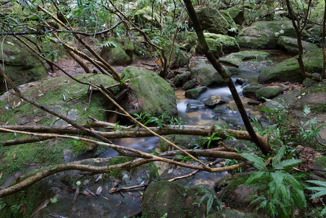
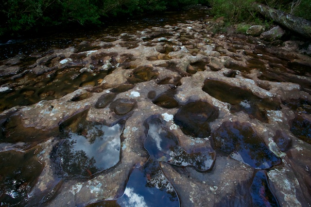
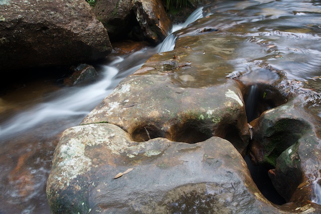
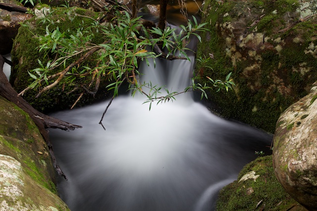
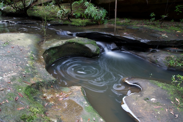
Above the falls, the creek is delightful.

The streambed is a series of open rock slabs. There are interesting cascades and small holes and arches that capture the flow in many places. It was easy walking right up the creek to Ferny Dell near Springwood and then a short walk to the station.
More photos are on my website here.

Nice photos David,
I personally have never walked more than about 45minutes down the Sassafras Gully track from Springwood. After rain is usually the best time for photography but then the leeches come out. How far did you walk to get these photos?
Bushfires make it dangerous to go bushwalking in the summer months.
Has anyone made videos of sassafras bushwalking ?
Kind regards
Richard
I find the best time to do this walk is after rain, and in the cooler months, leeches don’t really come out in cooler weather so much 🙂 wear sensible footwear and thick socks of course.
Thank you, David, this is such a beautiful way to indulge my nostalgia for the Sassafras walk. My grandparents, ( Britten ), owned ” My Bush “and we took this trail many times. My grandmother was ninety years old when i last saw her on the track.