
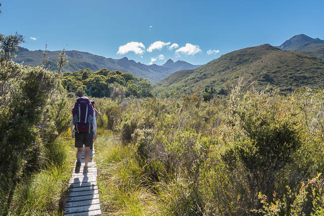
After a short rest at Mt Field National Park – we headed out to the start of the track up Mt Anne at Condominium Creek.
Its then a big 900 m climb up to the Eliza Plateau. We stopped just above the Memorial Hut for lunch. The hut seemed a bit run down – with the door having fallen or being ripped off.
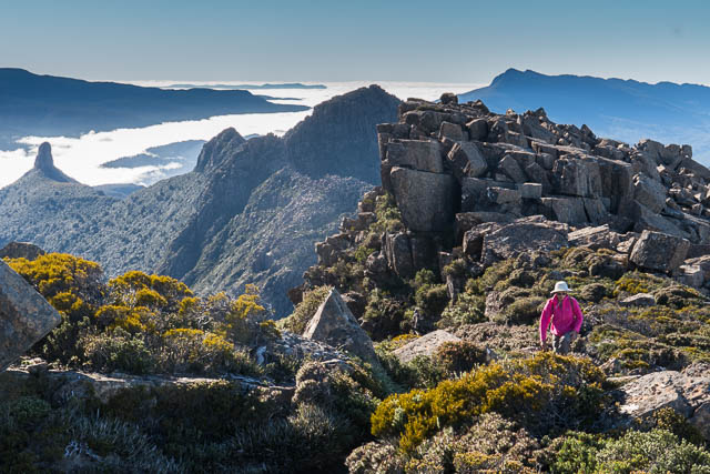
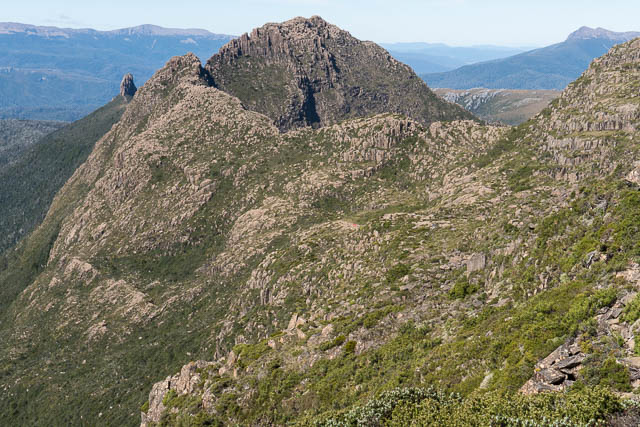
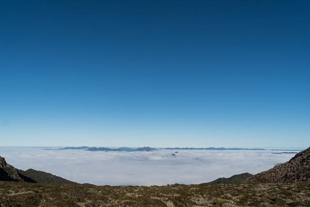
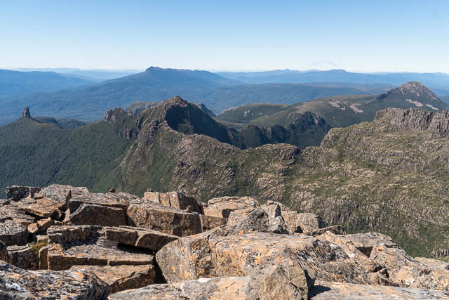
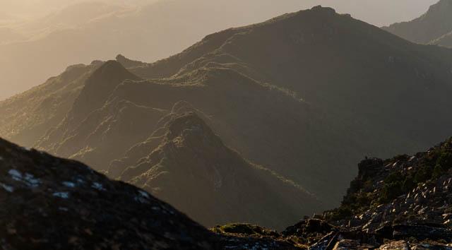
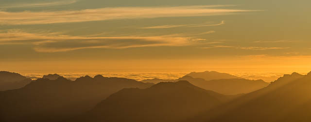
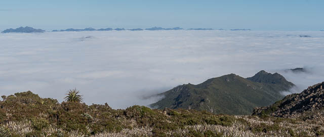
On the plateau, we enjoyed fine views of many of the peaks in the South West. Prominent are Precipitous Bluff and Federation Peak. But also you can see Mt Weld, Mt Picton, the Western Arthurs, the Franklands etc.
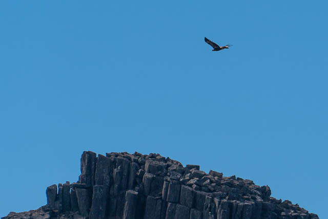
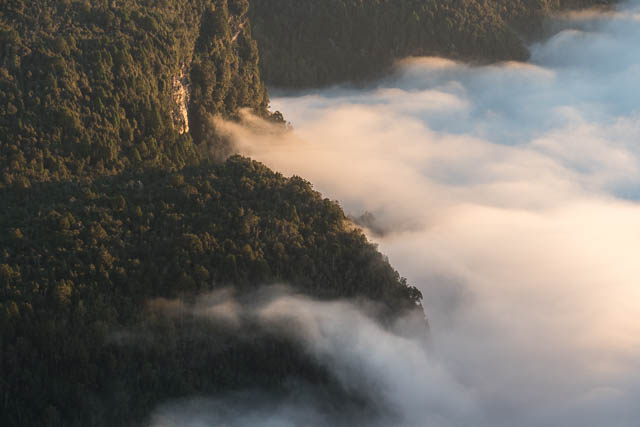
Later, we we could see to the north west – we could see Mt Wedge, The entire Prince of Wales Range and a distant Frenchmans Cap. The only thing marring the view was something rather large – the two ugly impoundments. One of these destroyed Lake Peddar. Sad! This is the bad thing about Mt Anne (and also the Wilmot and Franklin Range) – the views you are forced to have of the impoundments. But our attention was turned to a soaring Wedge Tailed Eagle flying over Mt Anne.
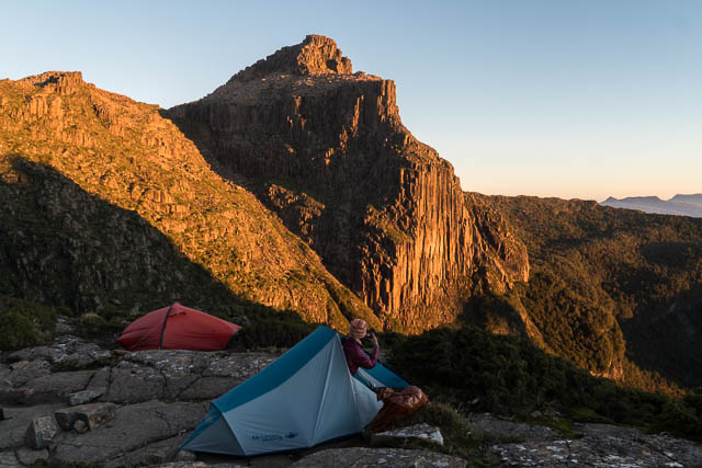
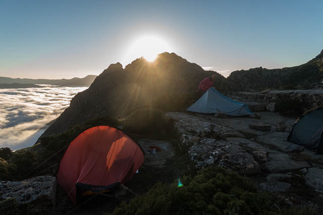
We proceeded along the plateau and then not far before Mt Anne turned off and descended to the Shelf Camp. This was to be our campsite for two nights. On our way there we could see three tents set up – and on arrival found they belonged to anther apart of three people that were attempting the Mt Anne Circuit. They had attempted Mt Anne earlier that day and been rebuffed. So had another solo walker we had seen out on a day trip from the carpark. We planned our attempt the next morning.
Later that afternoon, another party of two arrived. They too were attempting the circuit.
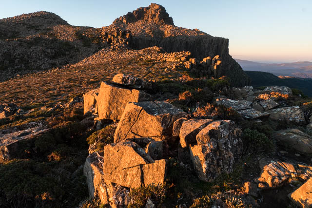
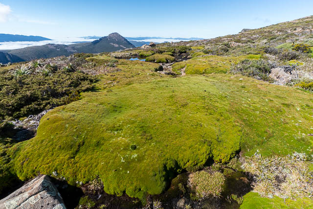
The shelf camp is a rather delicate place – a small alpine environment. There is not much room for tents, and probably the main issue is toilet waste. You have to pitch your tent on one of the rock shelves and so this makes it almost impossible to dig holes. There are no facilities here and I would strongly advise people to dig their toilet holes well away from the campsite – preferably walk 15 minutes away back to the main ridge leading to Mt Anne and then find a spot well downhill on the far side of that ridge.
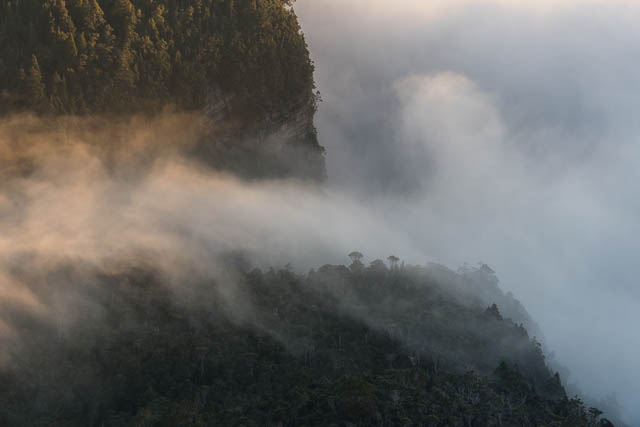
Next morning, we awoke to another fine day. After breakfast, we headed back to the main ridge, and then started off on the track to Mt Anne. Also attempting the climb were the two walkers we had seen that had turned up late. We were lucky this time – the views of the impoundments were shrouded by a large mass of valley mist.
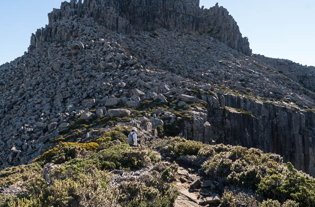
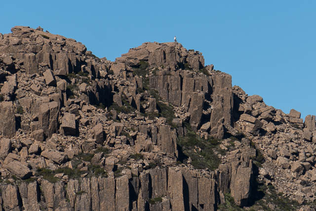
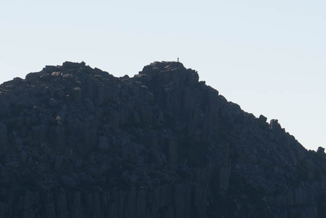
Near the peak, the two walkers in the other party were following the cairns towards a steep section. That was not the way I recalled I had been to the summit before (back in 1976 and 1979). So we traversed to the right on the boulders before the steep section. This was easy going. The we looked for a way up. We tried a few spots without any success. By this time, the other party had turned back – they said that the cairned route looked very dangerous.
After a while we gave up looking in one section. This was where I thought we had climbed up back in those old trips. I could only remember a short tricky section. Most of the way was straightforward. Further around to the right looked possible. There seemed to be a ramp going up a fair way. So we descended and traversed on the boulders a bit more. Wendy was first and she had climbed up a long way quite easily. But when I reached her I could see that there was a tricky bit ahead – too tricky perhaps? Steph had also climbed up, but a bit further to the left (east) and she found a way that involved some exposed scrambling. Meanwhile Wendy and myself had scrambled up a bit to the left too – quite easy scrambling and not exposed, up to where we could see some cairns. From there we could join Steph and it was not far to the summit.
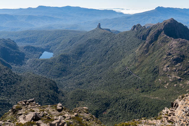
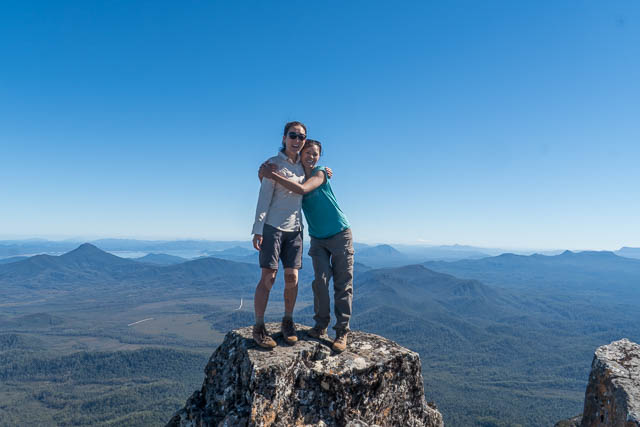
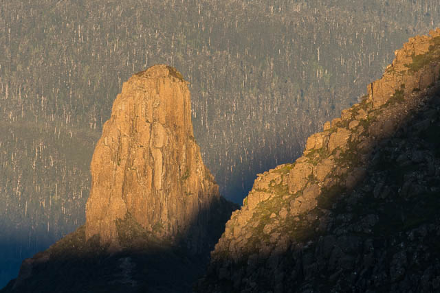
On top we could enjoy some great views – but again married by the large impoundments.
We then descended and returned to the campsite for lunch. Wendy and myself enjoyed lazy afternoon, but Steph was full of energy – so she spent the afternoon wandering out to Mt Lot and back.
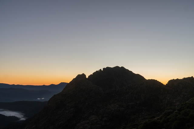
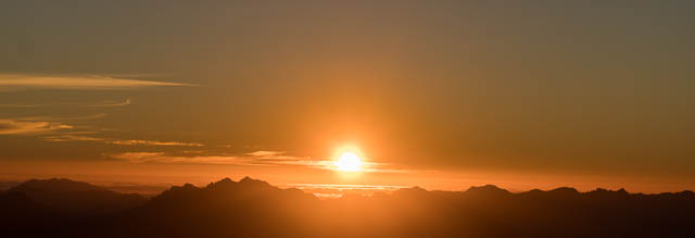
In the late afternoon, I went up to the Mt Eliza – Mt Anne for the sunset. It was difficult to get photos without them being spoilt by the impoundment.
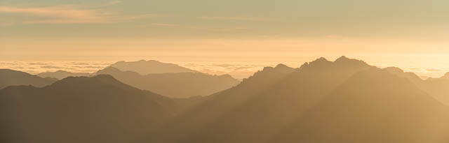
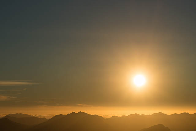
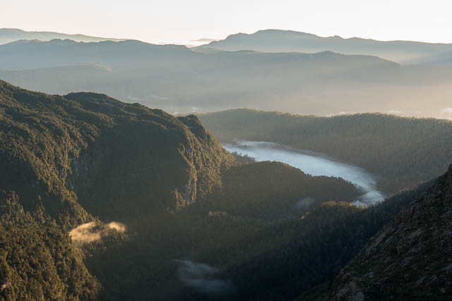
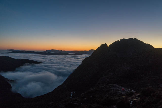
The next morning was even better than the one before. The weather was very settled and still and there was a larger amount of mist in the valley.
This was going to be our last day at Mt Anne. Wendy was inspired by the trip Steph had done to Mt Lot the afternoon before and she was keen to do the same. So she set off early to do the same thing.
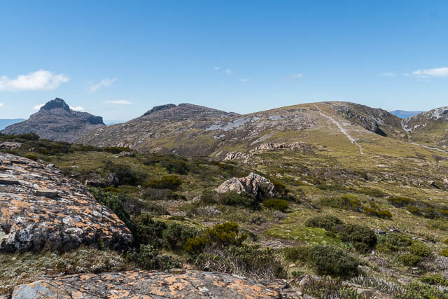
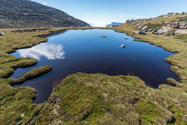
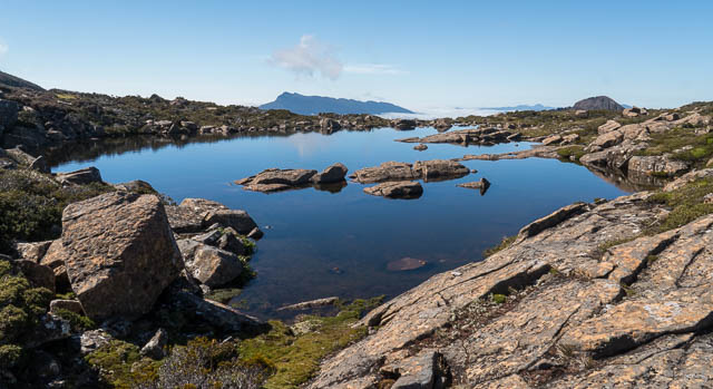
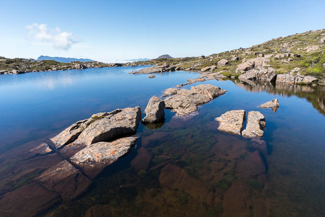
Steph and myself had a more relaxed start, and after packing up headed back up to the Mt Eliza – Mt Anne ridge and found nice spots to wait for Wendy. I spent the tie trying to photograph the alpine gardens and tarns.
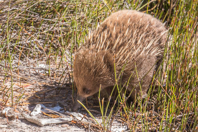
We could see Wendy had reached the summit of Mt Lot and it did not take her long to return. Then we walked to Mt Eliza and descended back down to the car. The highlight of the descent was seeing a baby Echidna close to the track.
More photos are online here on my website.
I remember having climbed “the cairned route” to Mt Anne around 2005.
It was very straightforward up to the face and after gaining a ledge on it, traverse to the right. I don’t remember the terrain details because the weather was not good: misty drizzle with visibility less than 100m. But the fact I was able to do it in such conditions, indicates the route is not hard contrary to what other party has told you. There was only one spot with ~3m vertical scramble (moderate exposure, I felt confident even in the wet) to the ledge, rest was just walking. I’d give it definitely easier grade (3) than Federation Peak (graded 5):
https://www.thecrag.com/climbing/australia/federation-peak/route/80227533
I think “the cairned route” did not change much since then? Or maybe it did and my route was in fact your route? But if your route involved significant amount of traversing to the right with some altitude loss, then it’s incompatible with my recollection. In the end the truth might be the other party exaggerated the “danger” of the route I took, due to lack of scrambling skills.