
The traverse of the Western Arthur Range is one of my favourite walks. It features great views in what is undoubtedly the best glacial landforms in Australia and has some very enjoyable scrambling. However the range is subject to bad weather and is quite strenuous.
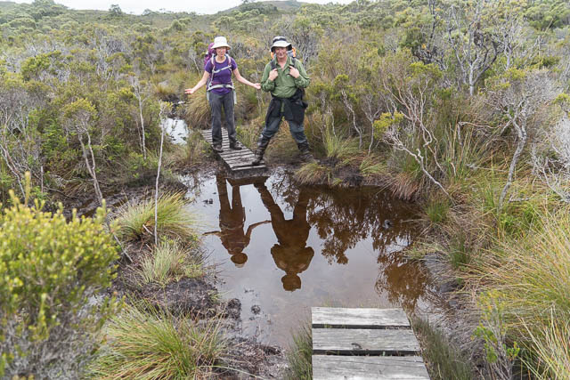
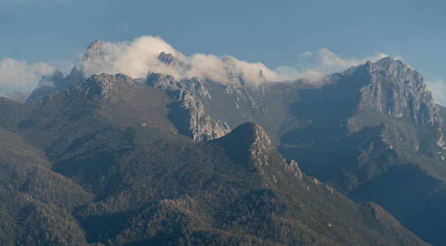
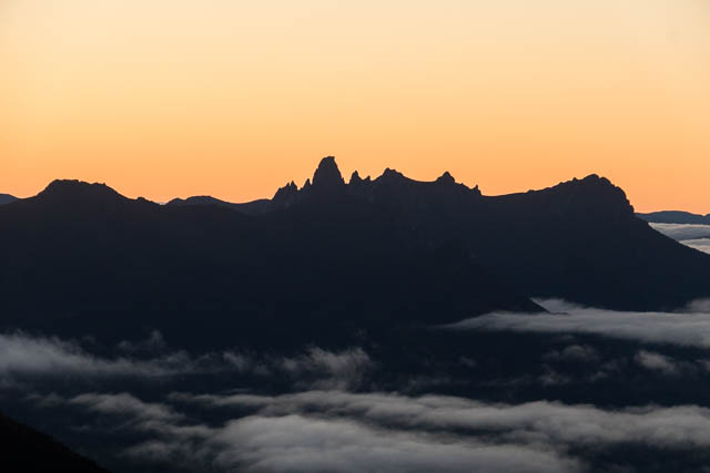
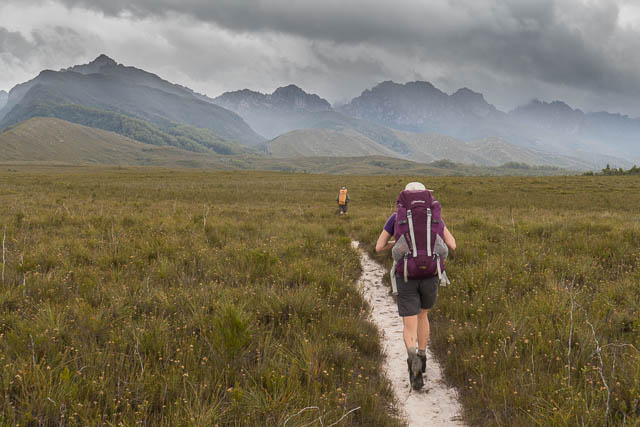
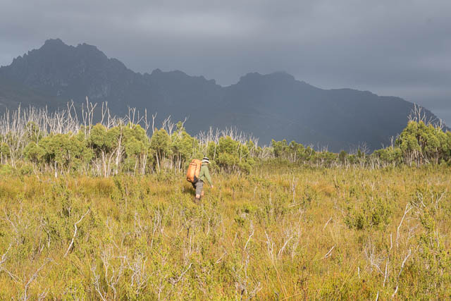
Our party – Wendy, Steph, Colin and myself set off from Huon Camp at Scotts Peak Dam and walked to Junction Creek via the Port Davey Track. This track invariably seems to be very boggy and muddy and is tiresome walking. On our way, we could see the Western Arthurs becoming closer, but the tops were obscured by clouds. The forecast was for the weather to improve – so we hoped the tops would clear by the time we reached them.
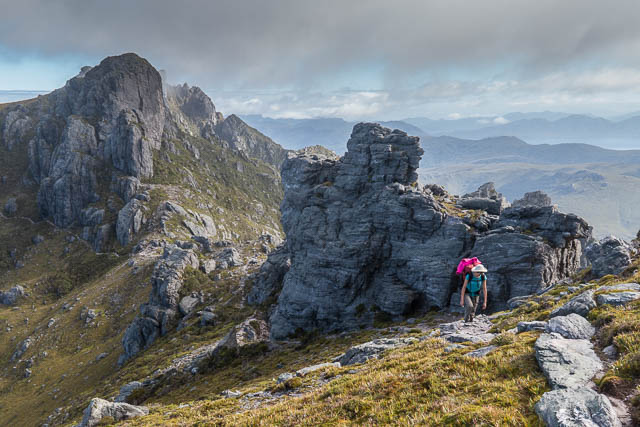
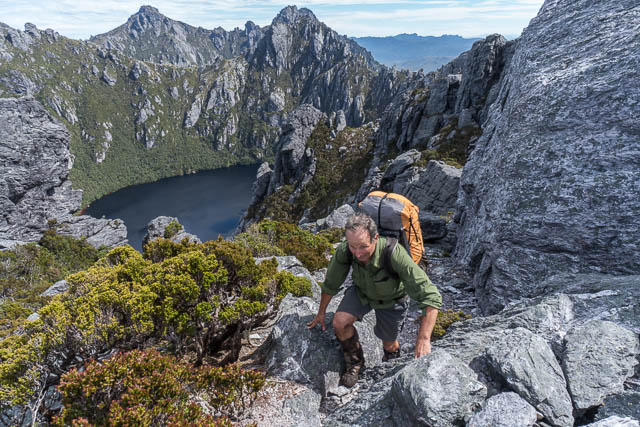
At Junction Creek, we stopped for lunch, and then walked the short distance to the base of Moraine A. Then began the big climb. This was the only big climb of the walk – around 800 m of ascending, and its always a struggle to do it on the first day when packs are heaviest.
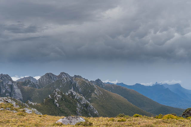
We arrived on the top and could then marvel at the views of the South West Wilderness. Peaks in all directions! But more climbing awaited us. The track climbs up on a broad rising plateau, an old airdrop zone, and this is recorded in one of the verses of an old bushwalking song –
There was an airdrop, a lonely airdrop
That scattered far and wide, across the mountainside
Its tin cans various, neath scrub scoparious
On the far slopes of Peak 4
Peak 4 was the old bushwalkers name for what is now called Mt Hesperus. In the early days of bushwalking in the Western Arthurs, most of the peaks were referred to by numbers and the morainal ridges on the northern side by letters. The peaks were later given formal names – from stars in the zodiac and the lakes in the range were largely named after planets and moons. More recently, some of the ridges were renamed from Roman letters to Greek letters. The trouble with this is that the Greek alphabet is not isomorphic with the Roman alphabet. So the 9th moraine – Moraine K is is now called Moraine Kappa, but Kappa is the 8th letter of the Greek alphabet! So a moraine seems to have gone missing. So I still use the old names for these.
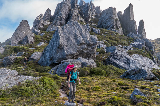
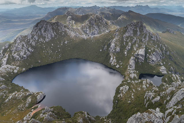
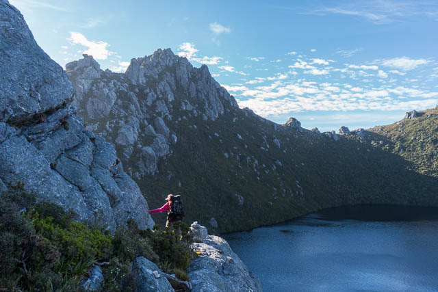
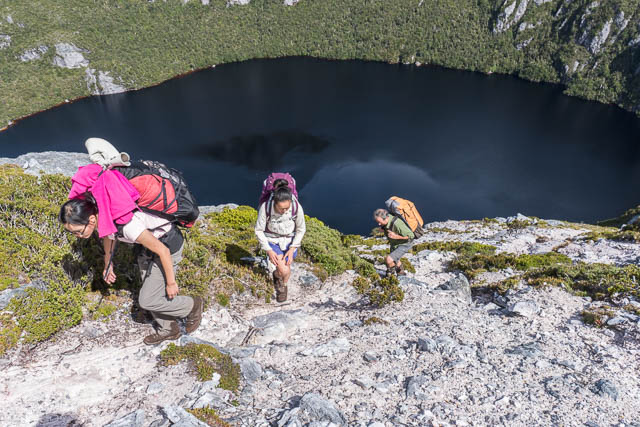
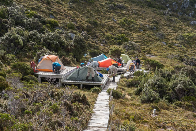
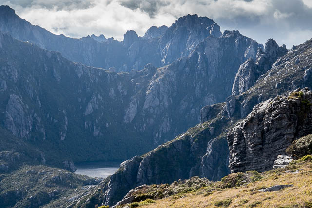
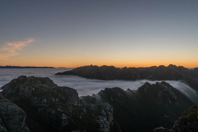
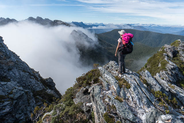
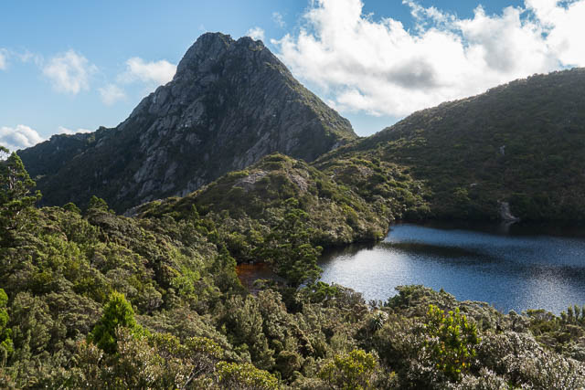
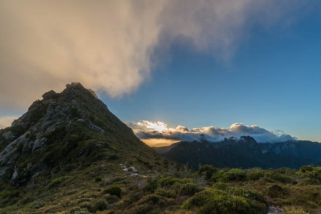
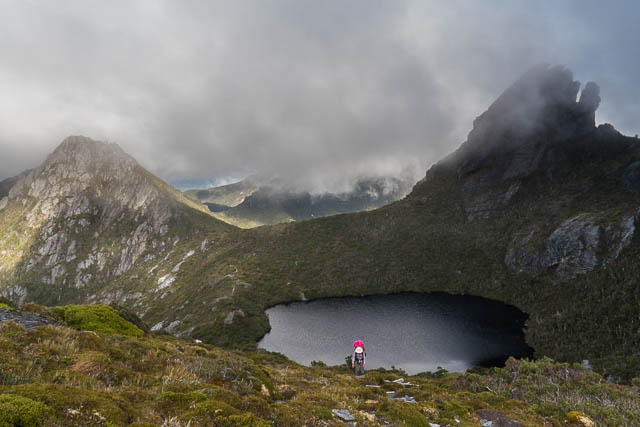
We climbed up towards Mt Hesperus and then descended to a saddle overlooking Lake Fortuna. Another short climb to the Capella Crags brought us to the ridge above Lake Cygnus – our intended campsite. Below we could see the tents of another party pitched on the platforms near the lake.
We descended to the lake and the campsites and were glad to stop after a tiring day. The weather had gradually improved during the day and we had a good forecast for the next few days.
Our neighbours at the campsite were four walkers from the VMTC. Next morning, one of them showed off his pack – a large hole had been gnawed right into it by a native rat after food. Our packs were all OK.
The Melbourne party packed up early and set off. We eventually followed them – we knew we had a short day, so were more relaxed. The weather was fine but cloudy.
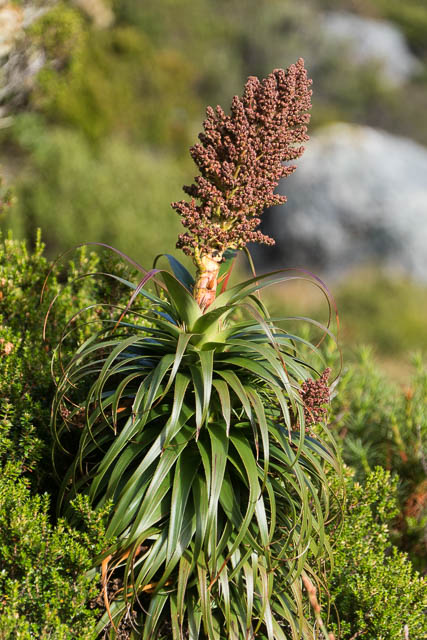
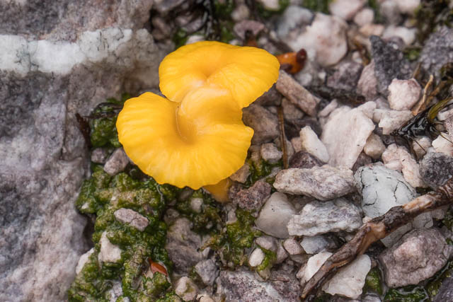
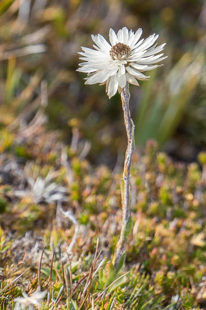
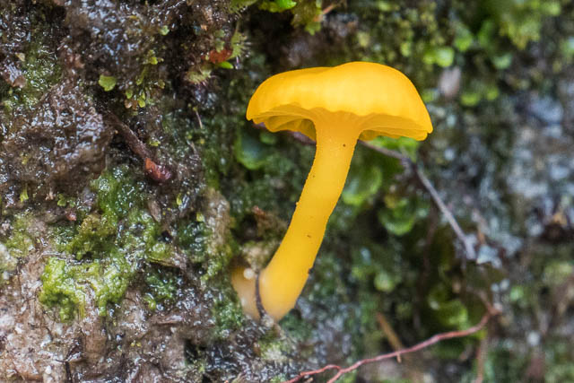
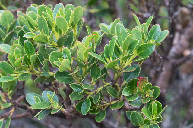
Richea alpina
It is interesting and easy walking following the track as it climbs above Lake Cynus, then past some low peaks to climb up onto the side of Mt Hayes (one of the few peaks to have an old name). On the side of the peak, we passed the Melbourne party, they had climbed it. We didn’t bother as it was a bit misty on top.
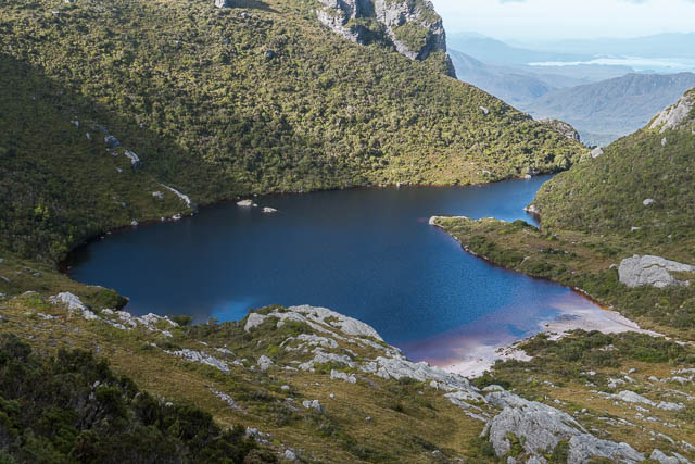
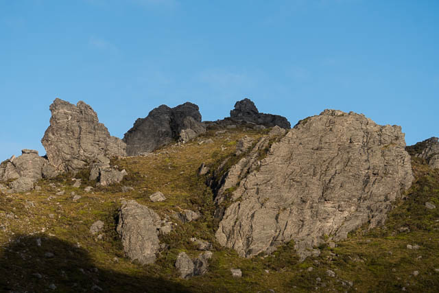
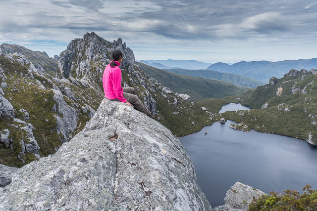
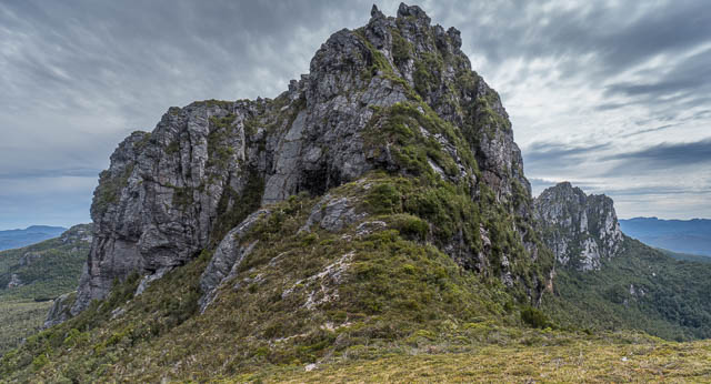
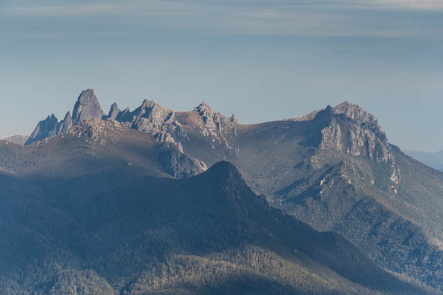
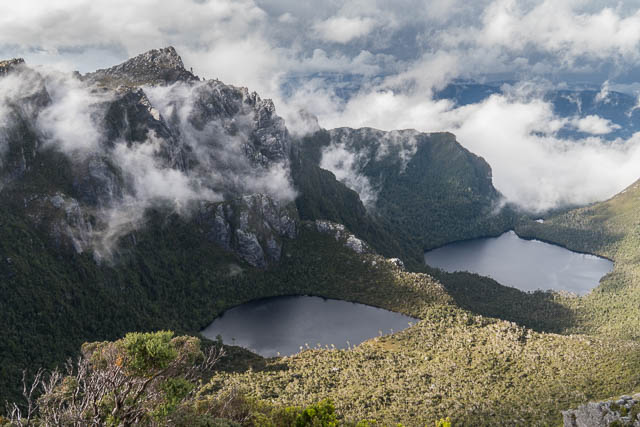
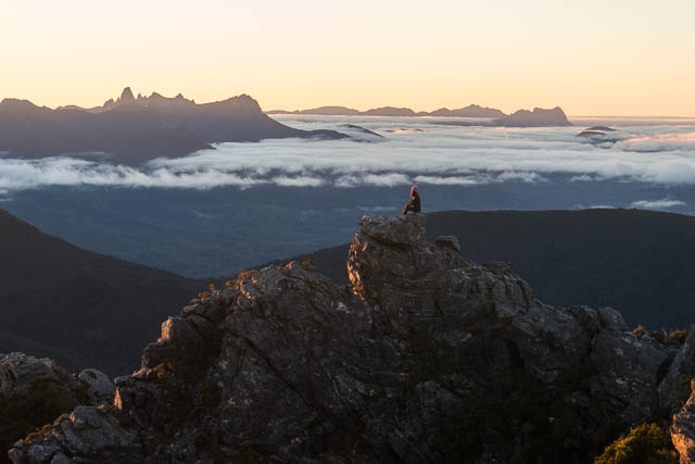
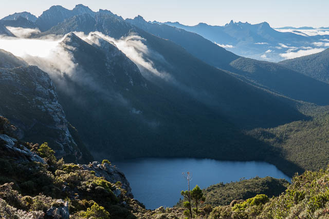
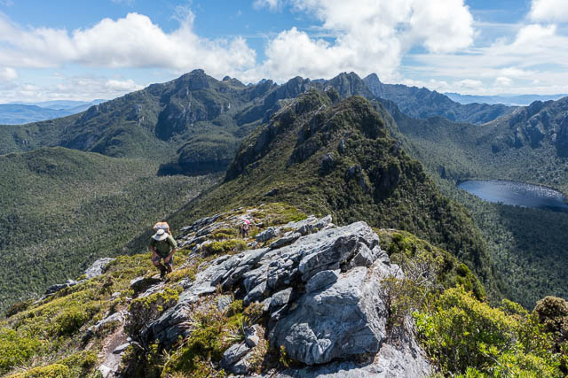
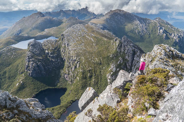
Our next goal was Square Lake (one of only two lakes not named after a planet or moon – the other being Lake Rosanne, which is named after Christian Wilson’s mum). At Square Lake, we collected some water as we wanted to have lunch on the ridge above. This is a splendid section of the range. The lake is nestled between two Peaks – Mt Procyon and Mt Orion, and the latter peak is connected to the very high Mt Sirius which features some of the finest views in the range.
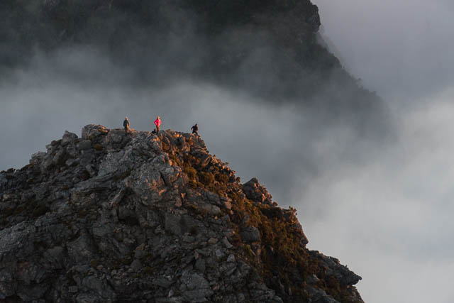
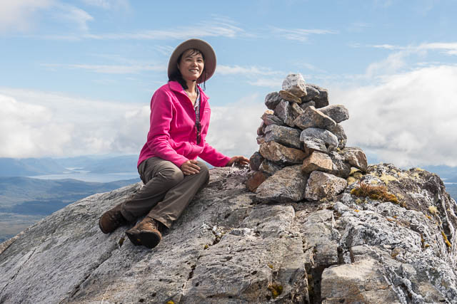
After a short but steep climb we reached the crest of the ridge and stopped for lunch. We then left our packs and wandered out to Mt Sirius. The views were great. Its a mountain that I have been lucky to be on during sunrise a few times – then it is a really special place.
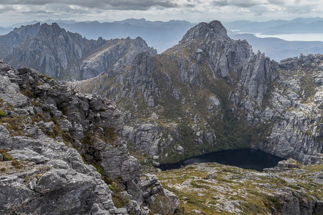
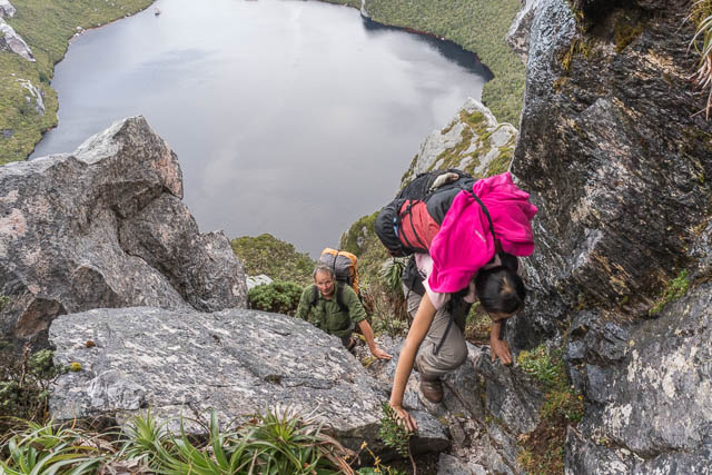
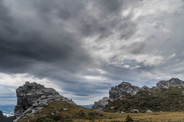
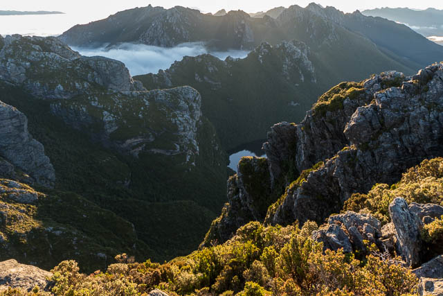
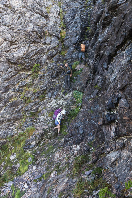
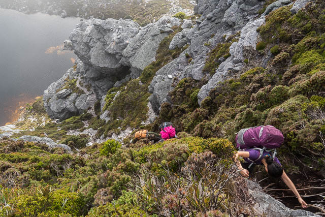
The Melbourne party joined us on the summit. We then returned to our packs and started the steep descent to Lake Oberon. One section of this descent is more technical and needs care. It is a good test for party members – if anyone has trouble here, then they should go no further than Lake Oberon, as it gives a good taste of the scrambling ahead.
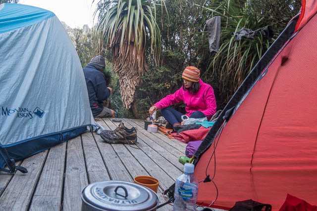
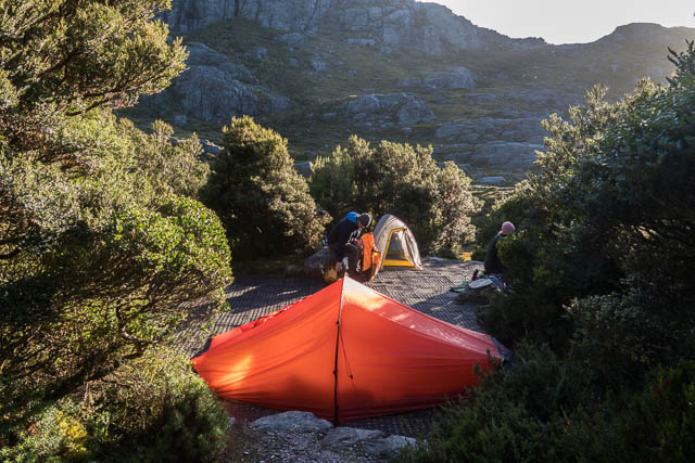
We had a pleasant evening at Lake Oberon, camped on the tent platforms, except for Steph who wanted a waterfront campsite. Next morning was fine and cool.

As before, the Melbourne party experienced ingress into their packs by a rat and they also set off before us. We soon caught them up on the slopes of The Pegasus.
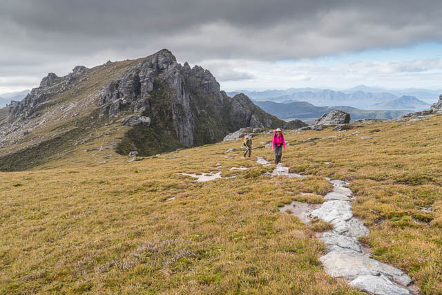
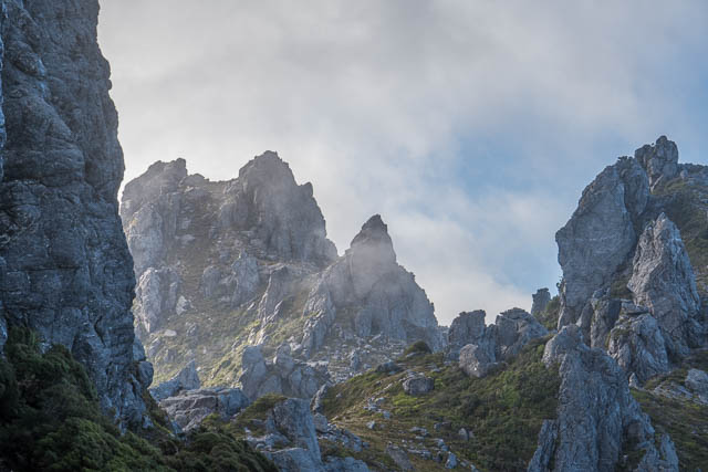
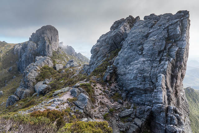
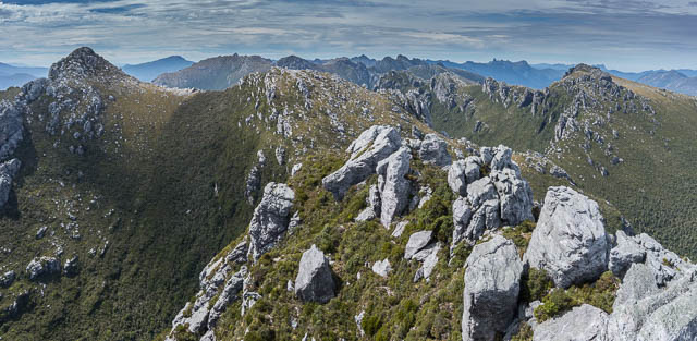
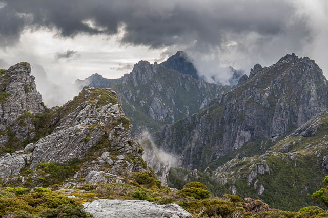
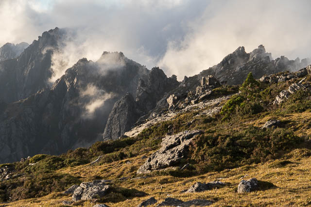
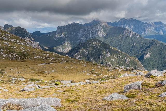
Then followed great section where the route follows a tortuous path, steeply down, then along a balcony posted above Lake Uranus, then up past some pinnacles to the other side of the range, then another steep descent and a traverse to reach the saddle before Mt Capricorn. An amazing route! If you don’t like scrambling then it is not for you.
The climb up Mt Capricorn is easy, and the summit is a nice place for lunch. More great views. The descent from Mt Capricorn is another matter. My old Hobart Walking Club route guide notes for the range that I used on traverses in the 1970’s say to “descend the amazingly steep but fern covered slope”. This is still alarmingly steep and exposed but the passage of many walkers have gouged out large steps.
We were soon at the bottom. Then followed a short climb and traverse around the ridge leading to Dorado Peak. Some pools provided a good source of water and we had a rest stop. Looking back we could see the other party descending Mt Capricorn.
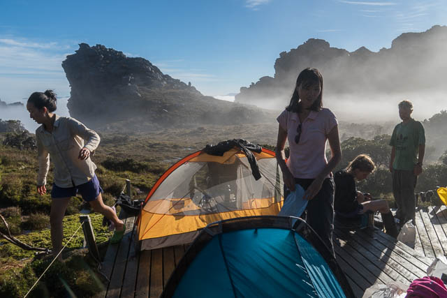
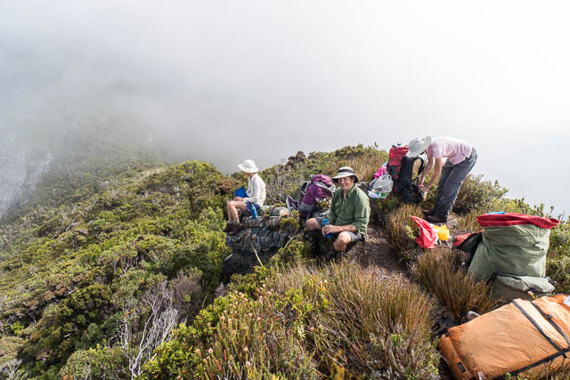
The last part of the day, was the slow climb up to Mt Columba and the High Moor. Its not far, but it always seem to take a long time and its a relief to break out of the scrub onto the open slopes of the moor. We quickly designed down to the lower moor and set up our tents on the platforms. We were soon joined by the Melbourne party.
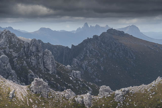
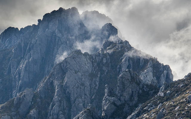
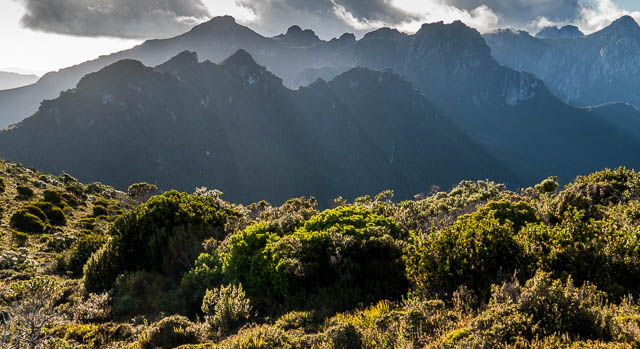
We knew the forecast for the next day was not good, so we expected to be stormbound at High Moor for at least a day. It turned out we spent two days there. The first day was quite wet, but the visibility was good and there was little wind. The rain came in about three squalls during the morning and early afternoon.
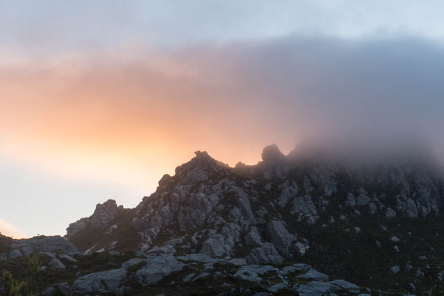
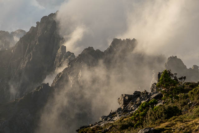
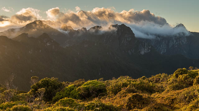
Late afternoon was reasonable and provided some interesting atmospheric conditions for photography.
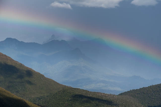
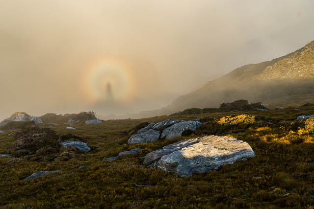
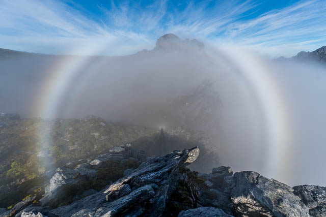
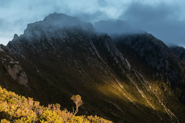
In the late afternoon, another party arrived from Lake Oberon. Four walkers – three of them from the Netherlands. They squeezed their tents onto the platforms. It was nice to climb up to the higher moor during the early evening for photography. There was even a Brocken Spectre.
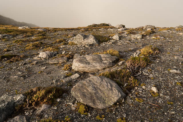
Next morning, the weather was cold, windy and wet. Thick mist was blowing around outside and was not nice to leave the tent. All three parties spent the day in the shelter of their tents. From the upper part of the High Moor, we were able to get phone reception and this means being able to get weather forecasts. The next day was supposed to be better.
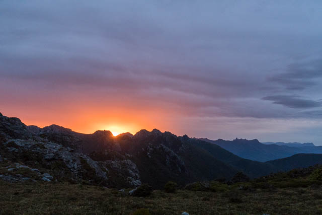
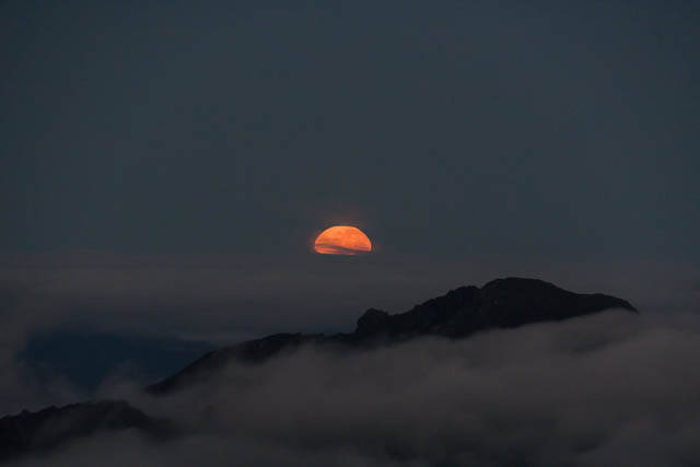
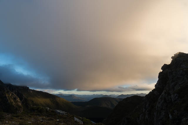
It was, we woke up early, and a few of us climbed up to nearby summits for the sunrise. But before the sun could rise, equally spectacular was the setting moon over the ocean, far to the west.
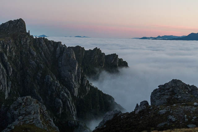
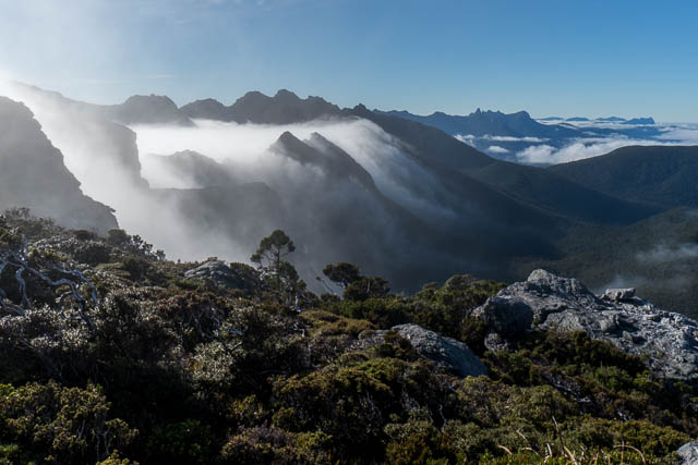
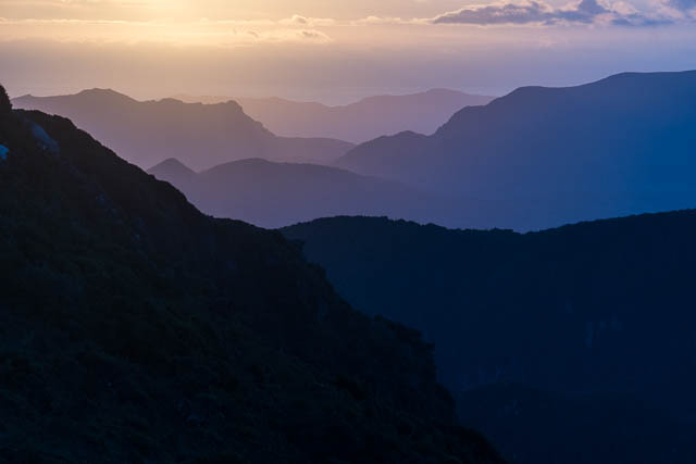
There had been a nice inversion – the valleys were filed with mist. Nice conditions. Steph and myself and climbed one of the summits of Mt Columba – a great place to watch the sun rise.
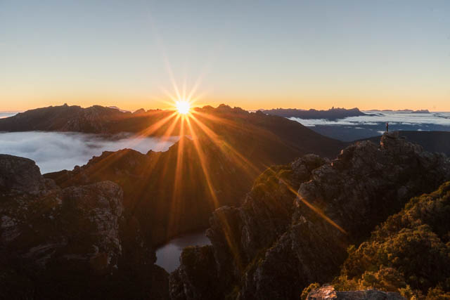
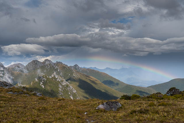
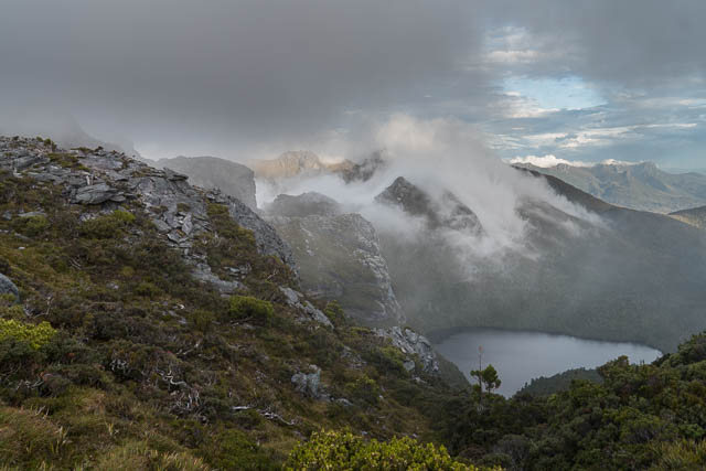
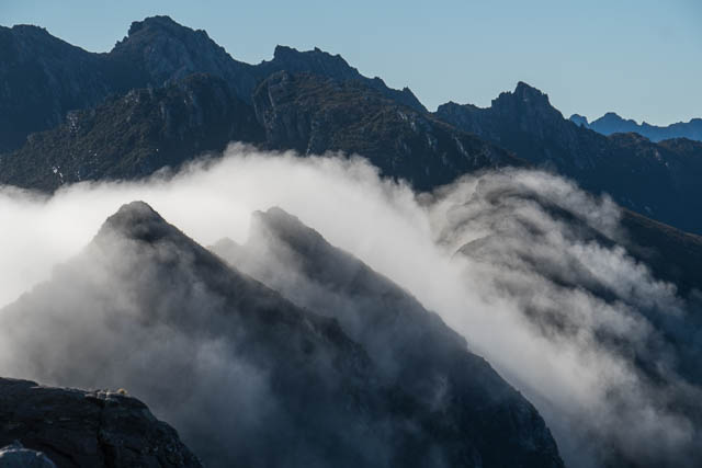
This was a magical morning. A stunning sunrise and then later, after breakfast, the Sun had warmed up the mist in the Arthur Plains valley and it started rising and pouring over the range. We were indeed lucky to experience the most amazing series of fogbows, glories and Brocken Spectres.
As usual, the Melbourne party left first and missed all the fogbows and Brocken Spectres. They also seemed to suffer more rat damage to their packs and food stocks. We packed up and left the campsite an hour or so later.
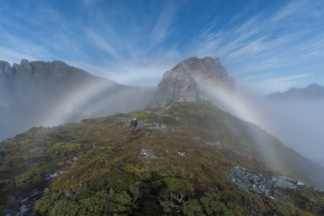

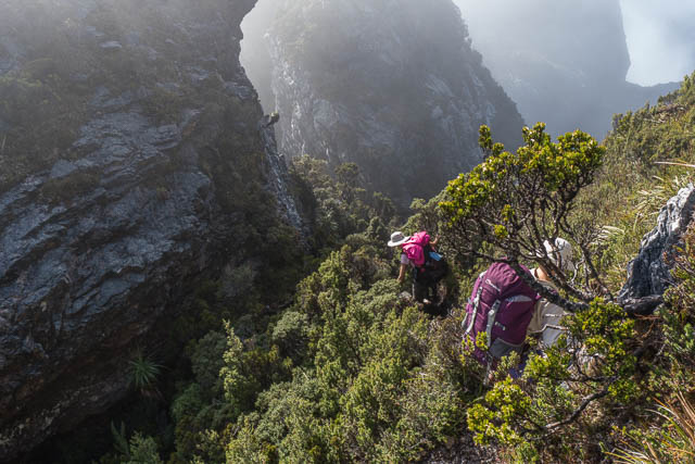
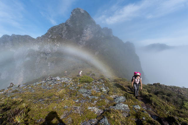
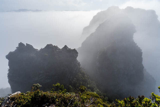
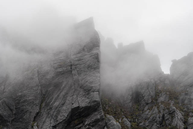
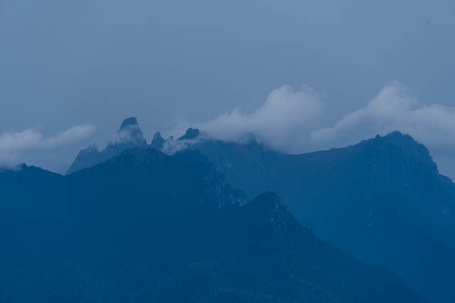
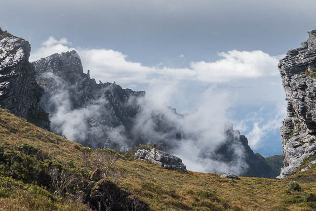
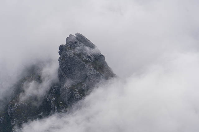
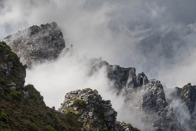
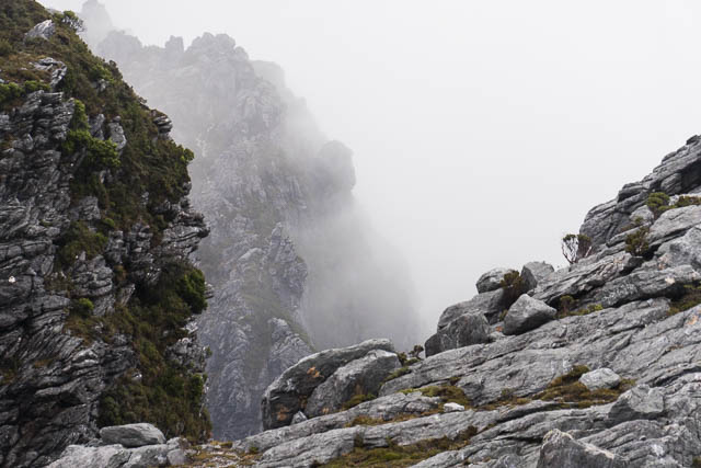
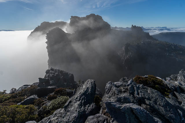
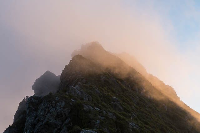
It was very special to walk through the Beggary Bumps during the atmospheric conditions. Another tortuous route – down steep chasms, along precarious parapets and belvedere ledges, over boulderfields – and all shrouded in mist with its amazing optical effects.
We then reached Lovers Leap, and started traversing the Little Beggaries. It was still misty, but be the time we had lunch in the saddle before Mt Taurus it had all cleared.
The climb up Mt Taurus is not so steep, and it is good to look back at the country we had just walked through. The passage by bushwalkers looks impossible!
After a steep descent from Mt Taurus, we reached the stunningly beautiful and serene Haven Lake. After setting up our tents, we all went to the lake for a swim.
Our camp at Haven Lake was to be our last camp high in the range. I took advantage of the high camp by walking to the saddle near Mt Taurus for the sunset. The girls viewed it from a peak near Mt Alderbaran.
The next morning was a bit cloudy and misty. We packed up and climbed up the ridge behind the lake and then traversed around to the next saddle.
Then it was across a broad ridge to the steep descent down to Lake Cirona.
After a short break to pick up some water, we continued on and climbed Mt Scorpio – our last peak. The rest of the range looked superb and very enticing, but we were starting to run out of food and fuel.
After some photos at Mt Scorpio, we descended down Moraine K to the Arthur Plains. There is a shortcut route available that cuts off some of the walking, but we chose to be more conservative and follow the lower track to Seven Mile Creek.
We then continued on McKays Track – along the Arthur Plains. Above us, it looked quite stormy on the tops, but weather was no longer a concern.
Our last night, we camped at Wullyawa Creek, and on the last day walked to Junction Creek and then along the Port Davey Track back to Huon Camp.
This was a great walk with great company. Thanks to Wendy for the organisation and the invitation to join her. More photos from the trip are online on my website – start from this page.