
I was up at Springwood visiting a friend and I decided to use the remainder of the afternoon to do the short walk from Faulconbridge to Springwood via the Victory Track and Sassafras Gully Track. During most of the walk it was raining. This was one of my motivations.
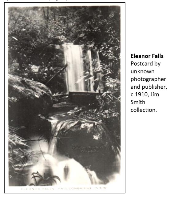
On a trip the week before down the Victory Track I had been on the lookout for Eleanor Falls. These falls are not marked on any map I have seen. This includes topographic maps and old parish maps that are available online. The only mention of them that I have seen is in an article by Jim Smith in “Hut News” published by the Blue Mountains Conservation Society. Jim includes a postcard photo of the falls (published around 1910) –
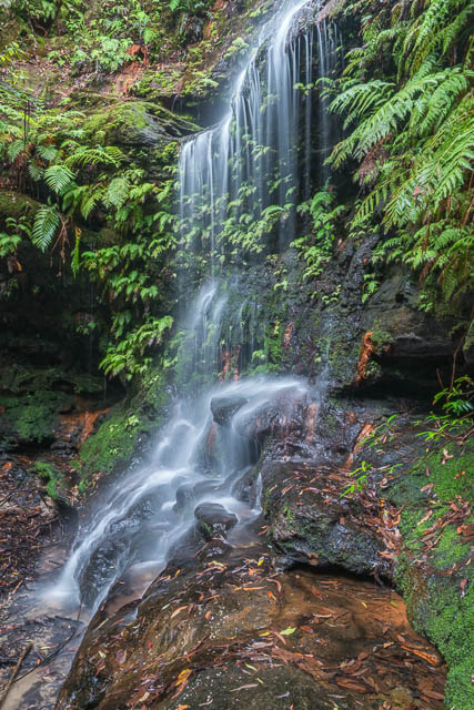
On the previous walk, I had seen a possible location, but it was then quite dry and the creek had no flow. On this trip, there was heavy rain.
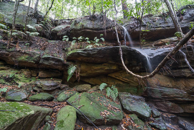
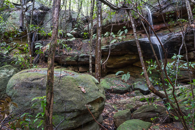
I walked down the Victory Track from Faulconbridge. It soon crosses the creek, and then re-crosses back to the true left and descends steeply at one place. The track then goes through a long sandstone overhang and later recrosses to the true right. The possible Eleanor Falls location is at the steep section, before the track goes through the cave.
Possibly Eleanor Falls. The waterfall may have been a bit to the left 100 years ago.
There was certainly some flow in the creek this visit, but not very much. Certainly nothing like what is shown in the postcard. But this cliff seems about the right height and it has a horizontal break about half way down like in the postcard. And there is a boulder at the base. But the flow seems different. Perhaps when the postcard photo was taken over 100 years ago, the water flowed from a point about 2 m to the left of where it flows now?
So, I think could be a likely location for the falls. It certainly seems to be the only possible location in the branch of the gully that the track follows. There is another branch, that joins this one before Clarinda Falls. It starts near the Grose Road turnoff. So it is possible that the falls lies in that branch. This creek is upper Sassafras Gully, but was earlier known as Parkes Gully. Sir Henry Parkes, a Prime Minister, was a major landholder at the top of that gully.
Jim Smith speculates that the waterfall could have been named after Eleanor, a daughter of one of the local landholders, Sir James Martin, who was known to Sir Henry Parkes. She dies young from consumption (TB). This is possible, but I think another alternative could be more plausible. Sir Henry could have named the falls after his mistress, Eleanor Dixon, who became his second wife in 1889. The other waterfall in the creek, Clarinda Falls are named after his first wife.
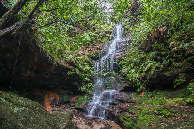
Clarinda Falls
After photographing the possible location of Eleanor Falls, I continued down to Clarinda Falls and took a few more photos. And then walked down to Numantia Creek and then walked up to Springwood via the track from Sassafras Gully Road. By this stage I was quite wet and had quite a few leeches to remove.
Clarinda Falls
More photos are online on my website here.