
It was time to get away from the heat and humidity of Sydney. After the hottest night on record and a forecast temperature of 44°C in the western suburbs I was glad to board a plane to Launceston. It was also a good chance to catch up with one of my sisters and her husband who had recently moved to Tasmania. They picked me up at the airport and I spent the first night at their very nice house on the coast near Penguin.
The next afternoon, they joined me for the first part of my walk. We drove out to Mole Creek and then along Westrope Road to Higgs Track. From the carpark, it was a little over an hour, walking up the hill to the top of the tier, and 100 m away lay Lady Lake Hut – our destination for the night. We steeled into the hut, but when a family group arrived a little later, we set up tents outside. Another two walkers would later join us.
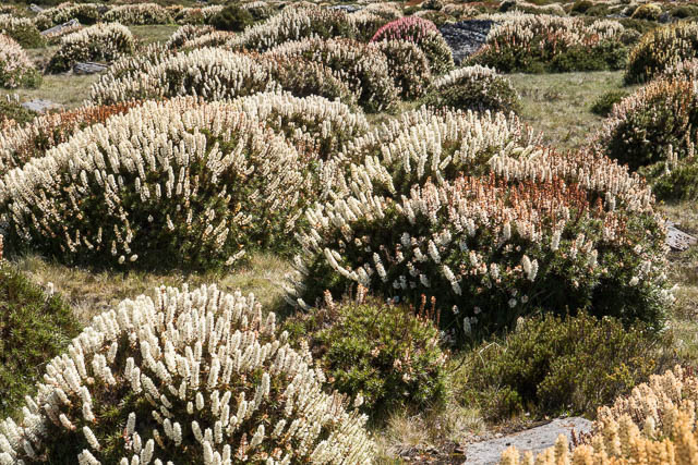
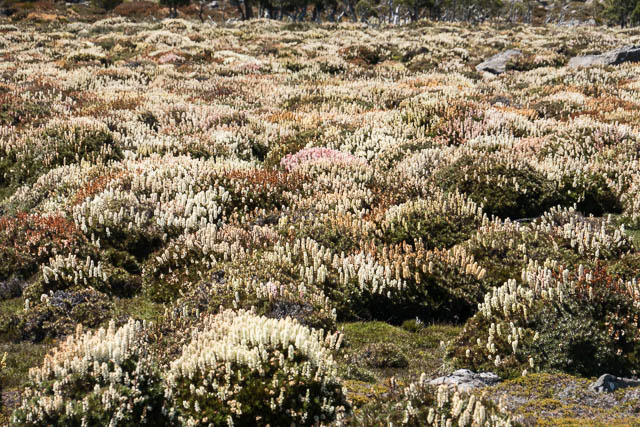
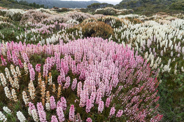
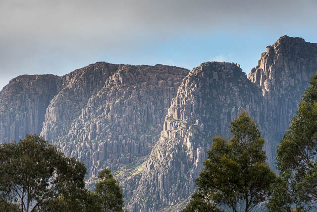
I had not done too much planning for my walk. I just wanted to get away from Sydney for a while to a cooler environment. Recently bushwalker and photographer Dan Broun had posted some amazing pictures of scoparia in flower and suggested to people to get out an see it – it was the best season he could recall. So that was good motivation to return to the central Plateau – an area I know well. From Higgs Track I would take about ten days to walk to Cynthia Bay at Lake St Clair, where I could catch a bus to Hobart. Another motivation for my choice of walk, was that the usual access to the Walls of Jerusalem had been cut off by slips during spring rain and the road had not been fixed yet, so this delightful area should be a bit quieter.
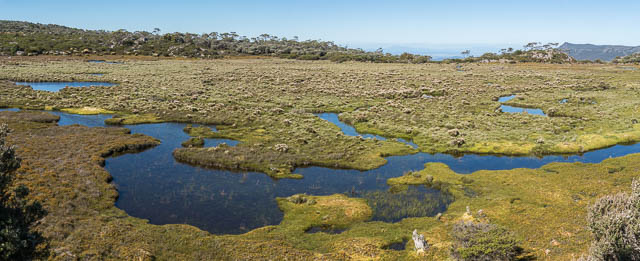
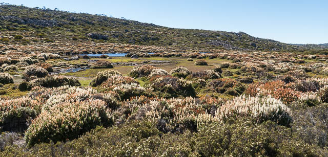
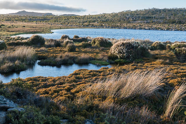
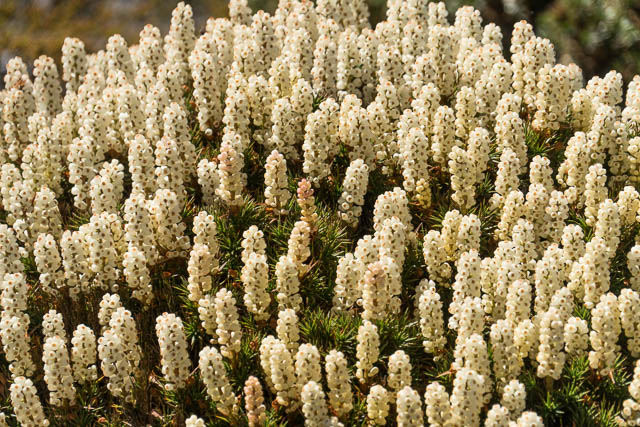
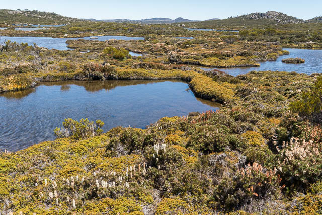
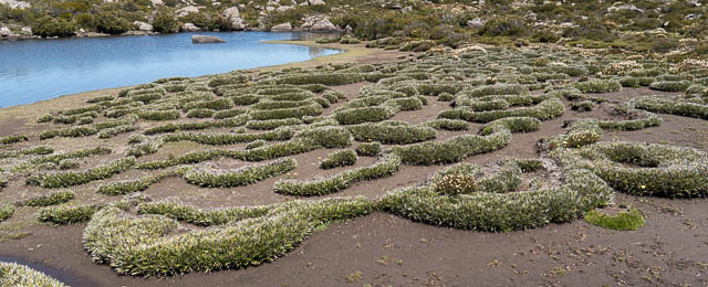
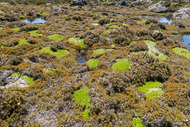
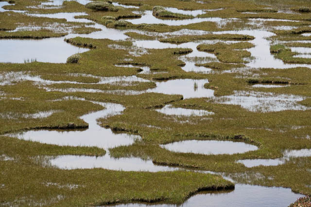
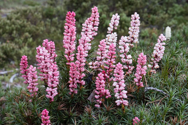
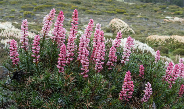
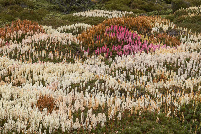
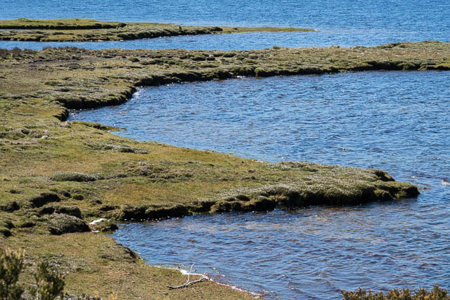
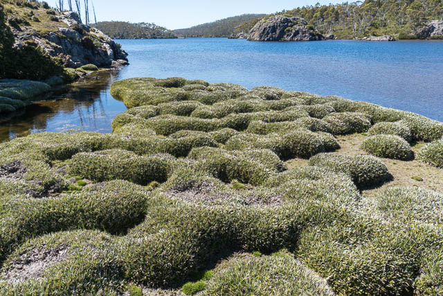
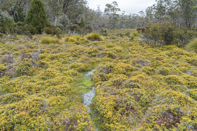
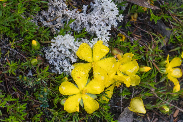
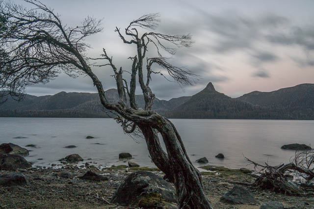
The area near Lady Lake and its hut is certainly very nice. Just outside the hut are a number of small lakes. They make up what is called a “patterned peat bog (or fen)” and the lakes recalled “flarks” and the lad between them called “strings” (or “strangs”). There are a number of these features on the plateau. Also, near Lady Lake is a nice patch of Richea scoparia – and it was indeed in flower. This was a good sign, I knew more patches lay along my route, particularly in the central area of the Walls of Jerusalem. My last visit to Tasmania, in April/May 2016 had been a “fungi and fagus trip”, this one would become a “scoparia in flower trip”.
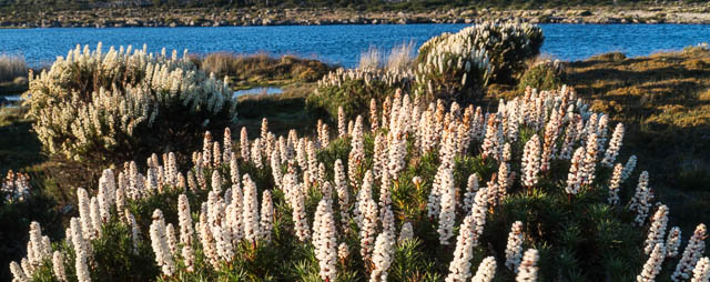
Next morning, in fine weather, I set off for Lake Nameless and beyond. My sister and her husband joined me for the first section to Lake Nameless. Along the way, we passed more delightful gardens of scoparia in full flower. Very nice!
I called into Lake Nameless Hut – no one was around, so after a snack I continued on my way – around there lake and then through a broad saddle to the untracked country of the Plateau. In this area, there is an old route still marked with lichen encrusted cairns – but trying to follow this way does not offer any advantage. Its easier to make your own way across the generally open country. You do need to watch the map and compass (or GPS) to make sure you don’t get stuck on some lake headland that does not connect up. Having the 1:25,000 maps is useful here since they show good detail of the lakes.
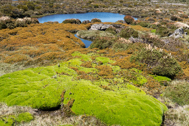
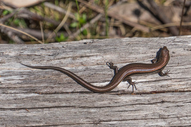
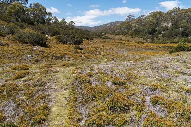
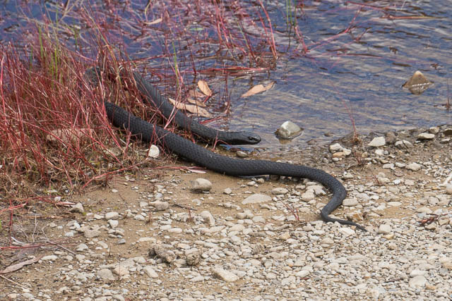
I made my way through generally delightful country – past beautiful tarns, cushion plants and scoparia gardens. There is too much to see to walk fas through here – its better to take your time and have good look around. I saw a lot of small lizards (skinks) and a few whip snakes. It was quite a warm sunny day.
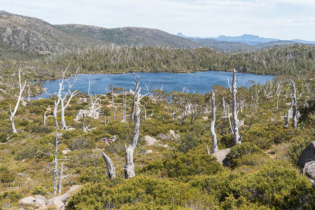
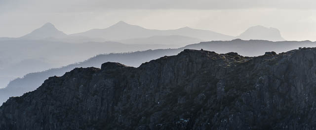
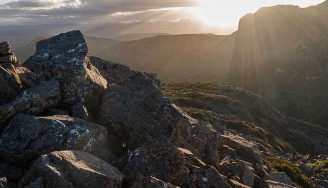
I have made quite a few trips across these parts over the years, and each time I try and vary at least part of the route. This time I climbed up onto a saddle and then down towards Lake Lexie, but then dropped down to a familiar and very nice campsite at Lake Gwendy. It was quiet sheltered from the wind and had an excellent outlook. A nice place to spend the night.
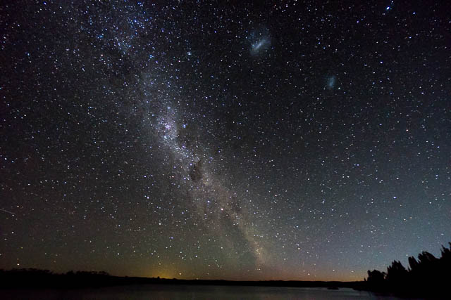
I was on the lookout for an aurora, and this lake provided a good viewpoint of the southern horizon. But the moon would rise around 11 pm wrecking the night sky. I took a few photos shortly before moonrise, but they didn’t seem to show an aurora – perhaps some slight airglow.
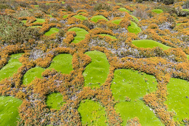
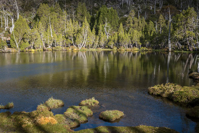
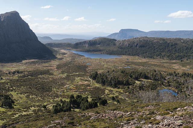
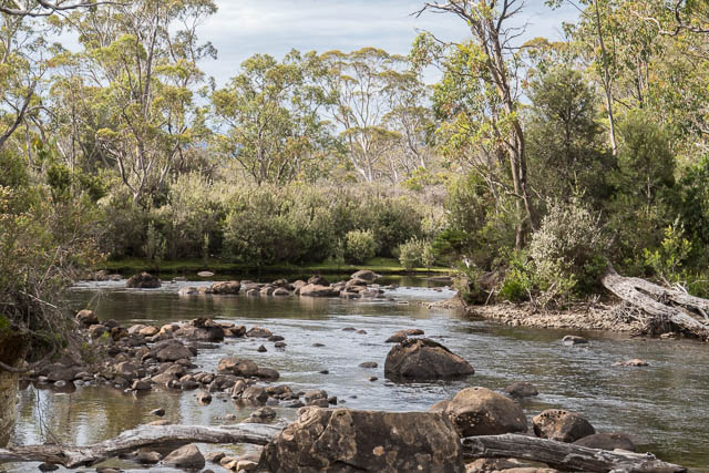
Next day, I continued on, making my way towards the Walls of Jerusalem. I walked past the pretty Pencil Pine Tarn and then cross country to the south end of the Long Tarns and then through attractive country to Lake Tyre. From there it is easy going to the lower vales of the Walls of Jerusalem. In this area are more flarks and strings and some amazing cushion plants. A good time to stop for some photos.
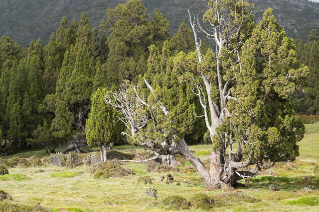
I walked up the vale looking for a shady spot for lunch. There was only one small stand of trees – some pencil pines. I headed there for for my refuge from the Sun.
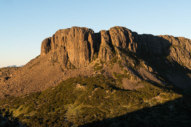
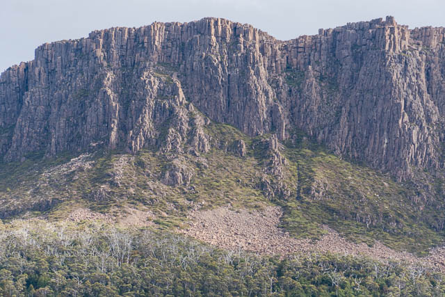
Then it was not far to the Jaffa Gate and the duckboard of the track from Dixons Kingdom to Mt Jerusalem. I was surprised to see quite a number of other walkers at Dixons Kingdom. Perhaps a dozen or so. I don’t think they noticed me as I walked past. I continued on to the Damascus Gate and then a little past it to camp.
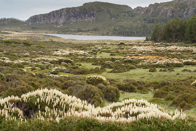
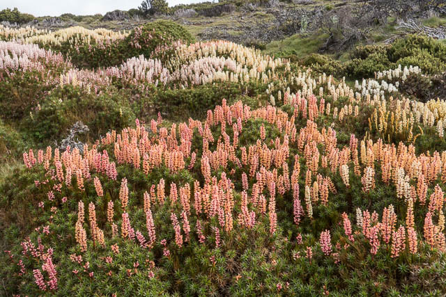
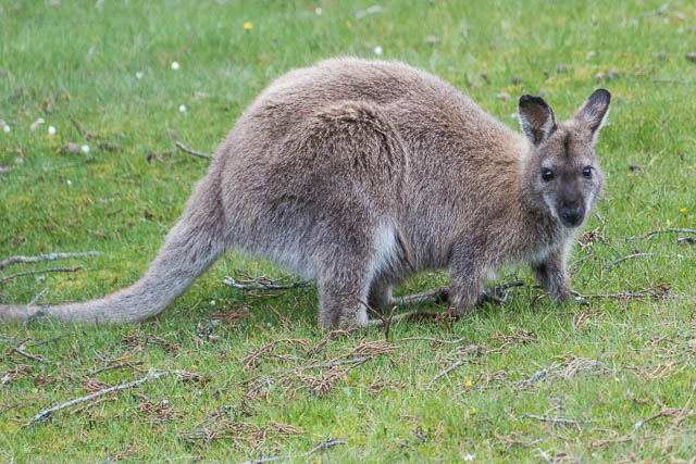
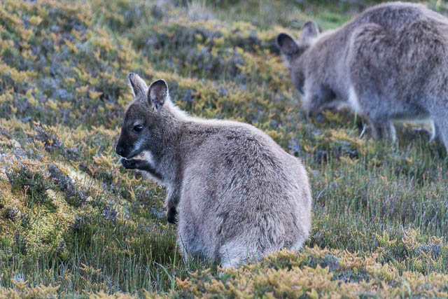
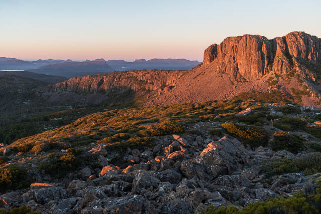
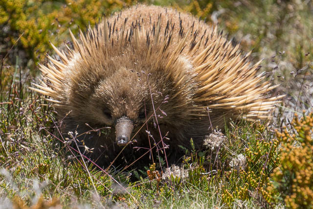
I spent the remainder of the afternoon wandering around the central area of the Walls of Jerusalem. The scoparia was certainly very good. The Walls are also a good place to see Bennetts Wallabies.
You cannot help noticing a lot of small skinks sunning themselves on the duckboards. They seem to play a role in the pollination of the Richea scoparia. This is one species that has fused petals keeping their reproductive organs secure in a closed capsule during the frequent spells of bad weather in their alpine habitat. However this makes it hard for insects to pollinate the flowers and for their seeds to emerge. It seems this is where the skinks help out – they normally eat insects, but during summer, they feed off the scoparia nectar. They bite open the capsules – opening the flowers to pollinating insects. See here for more information.

It rained, as forecast, during the night and was quite wet the next morning. But it was still quite nice to venture out of the tent for short periods with the camera.
Later in the afternoon, I walked down to Lake Salome and then to the Pool of Siloam. Both exquisitely beautiful places. Back at the Pool of Bethesda I met another group of walkers (looking in the logbook at Dixons Kingdom later showed they were well known local walkers Rick and Maria Rolls and their friend Charles). They had walked in via Lake Fanny. It seems many of the other walkers at the Walls had come in that way.

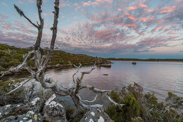
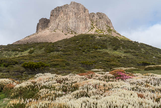
During the day, the weather improved, and it was worth climbing up onto the Temple for sunset.
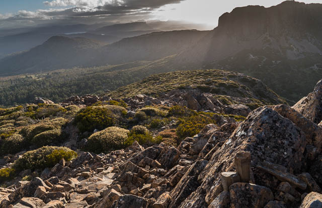
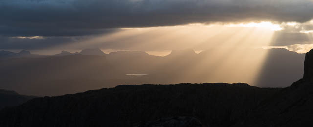
The night was clear and cold. Next morning it was 0°C – and a bit frosty. I got up early and climbed back to the Temple for sunrise. Unfortunately there was not very much valley mist.
Then back to the tent for breakfast and to pack up. The forecast for the next day was for rain, so I thought that it may be worth making a bit of progress today. I walked to Dixons Kingdom and then down to Lake Ball and along the lakeside track to pick up the Lake Adelaide Track.
It was another warn sunny day. I stopped at the south end of Lake Adelaide for lunch in a shy spot and then continued down to the north end of Lake Meston to camp. An early stop provided a good opportunity to have a wash in the lake and wash my clothes.
It was indeed wet the next morning. I stayed in the tent until after lunch. It seemed to be improving in the afternoon, and I ended up packing up and setting off at 3pm. Its not far down to Junction Lake – a little over two hours walk to a very nice campsite about 200 m below the Junction Lake Hut. It was still raining – but only lightly. On the way, I had stopped at the Lake Meston Hut and was fortunate to find some discarded batteries. Early on my trip, my small radio, that I carry for weather forecasts had tuned on in my pack and flattened the battery. The ones I found in the hut fitted and had enough charge remaining to work. On a solo trip like this one – I either listen to the radio during the evening and on storm bounds days or read books on my kindle. I think I read about 4 books on this trip.
On this trip I planned to follow the route many walkers take – the Never Never route along the Mersey River down to Hartnett Falls and there Overland Track. I had been this way twice before back in 1993 and 2006. My memory of that section of those trips had faded a bit over the years. I have often been to Junction Lake – and invariably choose to walk to the Overland Track via the much more scenic Traveller Range. This takes longer, I usually camp on the Traveller Range – a very spectacular high camp with amazing views. I think the only time I have walked from Junction Lake all the way to Windy Ridge on the Overland Track was on an April trip in 2000 when it was too snowy to stop. The other route from Junction Lake to the Overland Track that I have used three times is to go via Cathedral Mountain. There is a track from the Lake to Cloister Lagoon and from there it is possible to climb onto the Cathedral Plateau. Once on top, it is an easy fast descent to the Overland Track near Fergusson Falls. The Never Never is the fastest route of the three, but not necessarily the easiest and certainly not the most worthwhile and enjoyable.
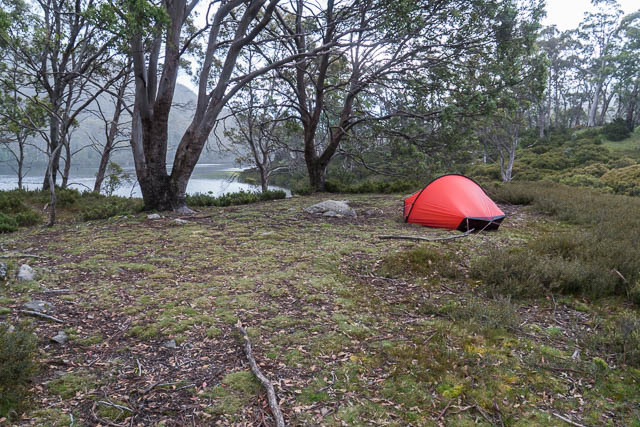
Camp at Junction Lake
Anyway, for this trip, I had better weather for the Never Never than for high level walking – light drizzle on and off. Not to bad to walk down a valley. Most of the way down the valley – there is a track, if you can find it and stay on it. Its not hard walking, but you do need to be prepared to back track a bit when you loose the best way, otherwise you may find yourselves pushing through a bit of scrub. On the way you pass two sets of waterfalls – Clarke Falls, just below Junction Lake, and then further down the valley – McCoy Falls. Along this section it seems best to stay on the true right bank, and cross the river not too far below McCoy Falls. You can wade across or find a log crossing. In the end, I took about 3 hours from the Lake to reach Hartnett Falls. This included a few photography stops.
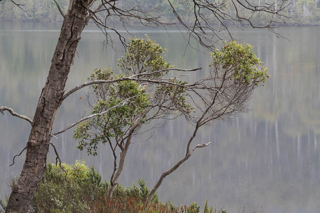
Junction Lake
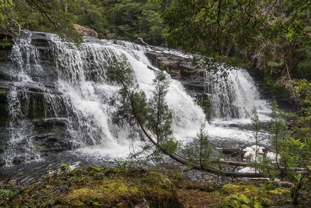
Clarke Falls
The Never Never
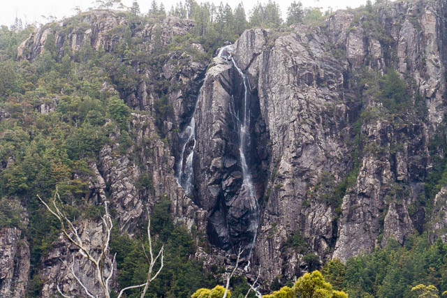
Feather Falls
McCoy Falls
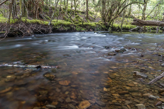
Mersey River
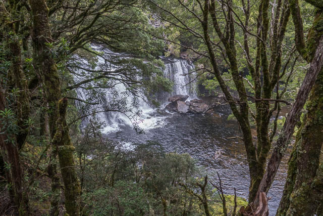
Hartnett Falls are always impressive given a reasonable flow in the Mersey River.
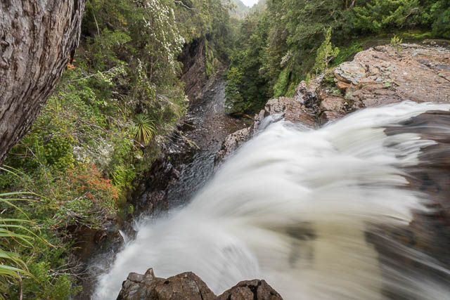
Hartnett Falls
Once on the Overland Track I stopped for lunch and then made my way to Du Cane Gap and down to the Bert Nicholls Hut at Windy Ridge.


For many walkers on the Overland Track, the day from Windy Ridge is their last one. Its about 3 hours down to Narcissus where they then catch a boat along Lake St Clair to Cynthia Bay. I still had 4 days left. On the trip, one of my shoes had been rubbing on my ankle – and I had covered the area with a bandaid – but it was still a bit sore, so I was not too keen on something too strenuous. I walked from Windy Ridge to Pine Valley -arriving at the hut for lunch.
I met quite a few other walkers there. One was a keen and fit looking girl that had jus come down from the Acropolis. She was next keen to climb the north peak of The Geryon. I was able to give her some advice before she headed up to the Labyrinth to camp.

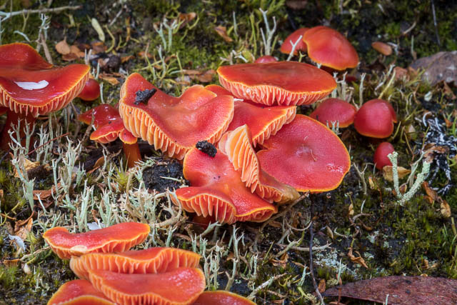
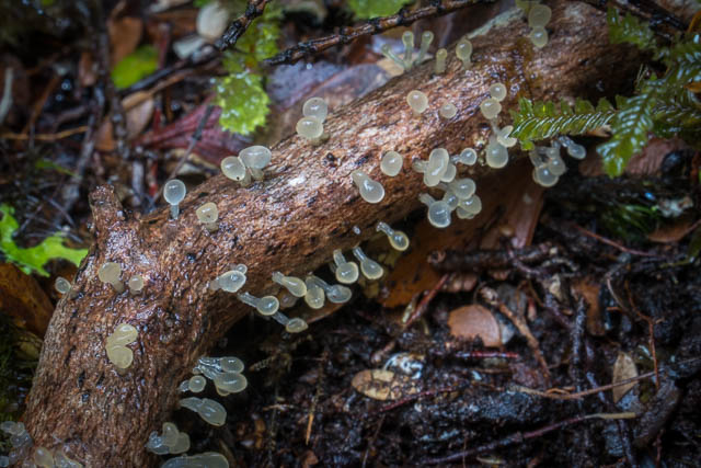
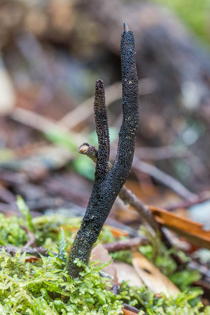
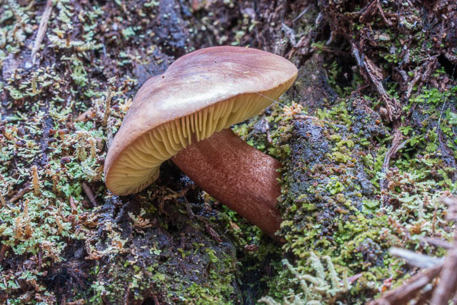
I spent the afternoon wandering up Pine Valley looking for fungi. I spotted a few nice things but there was not too much out (especially when compared to the previous April).
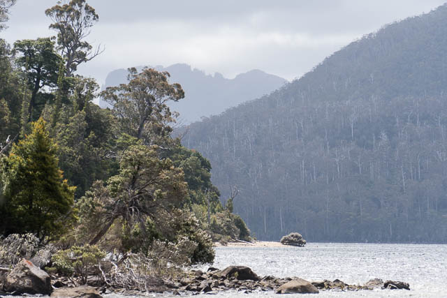
The next day, I did the short walk down to Narcissus and spent the afternoon photographing – a nice easy day. Despite a lot of looking I did not manage to spot a platypus in the lake or river. Later that evening a storm hit – and it was very windy and wet. I was staying in the Narcissus Hut with two other groups of walkers, and we were awoken around 11:30 pm by a helicopter flying lower over the hut. It hovered around the year for about ten minutes. Enquiries later revealed there were no rescues in the area. Strange? Perhaps a training flight?
It was still raining the next day. I had plenty of time – my walk was only to Echo Point – about two hours away. This game me plenty of time for photography along the way. I found quite a but of fungi out and also some slime moulds.
At Echo Point, I camped outside the hut and enjoyed a nice afternoon of photography. It was still cold and a bit wet.
On the last day of my walk, I continued on the Overland Track to Cynthia Bay – arrive for lunch at the cafe. I stayed overnight in one of the bunk rooms at the Lake St Clair Lodge, and then caught the bus to Hobart the next day.
More photos from the walk are online – go to this Menu Page
Desperately trying to grow Richeas, here in the UK. Can’t wait until I will be able to come to Tasmania to see them on mass like in your beautiful photos.
Loved this report Dave, and the photos were great. Yours is the only picture of Feather Falls I could find in the whole web. I would love to see isolated ones like this.