
I waited only a few days before completing part 2 of this walk – the northern section between Minnamurra and Kiama. It is a shorter section – but one that demands a bit of time to see what is on offer. The weather was forecast to be wet to start and then improving. I think any rain had fallen before I had arrived – but at least there were some nice clouds that made photography more atmospheric.
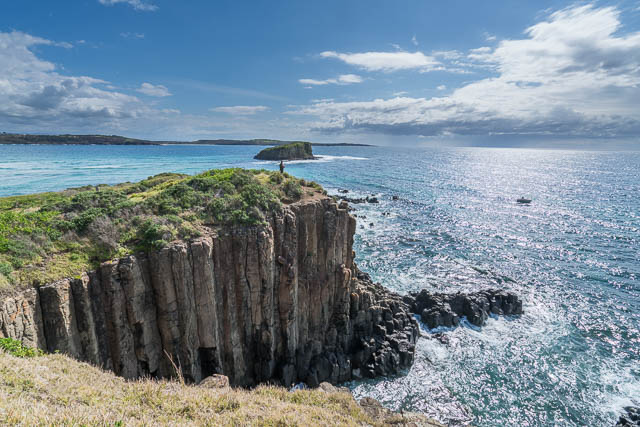
Minnamurra Head and Stack Island
I arrived at Minnamurra Station about 9:30 am and walked a short way along roads to a park near the Minnamurra River and the start of the walk. Like the southern section, this is signposted – but perhaps not as well.
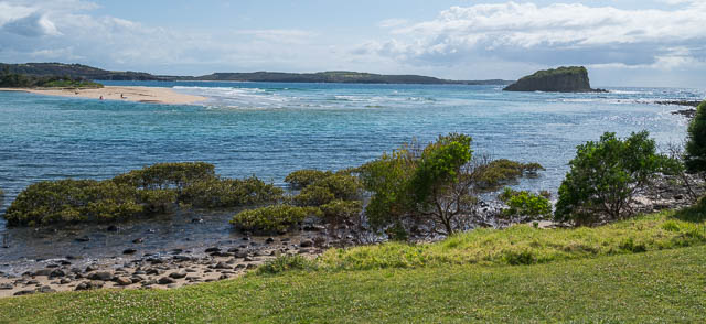
Minnamurra River
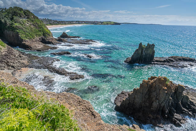
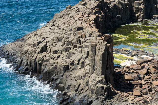
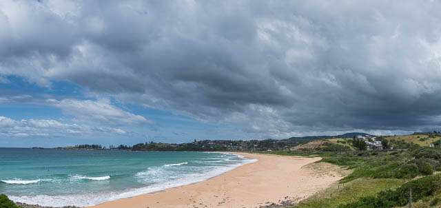
The first part is truly spectacular – up onto Minnamurra Headland with views of the Minnamurra River, the flat Rangoon Island and the more rugged Stack Island – which looks like it was once attached to the headland.
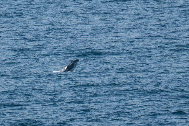
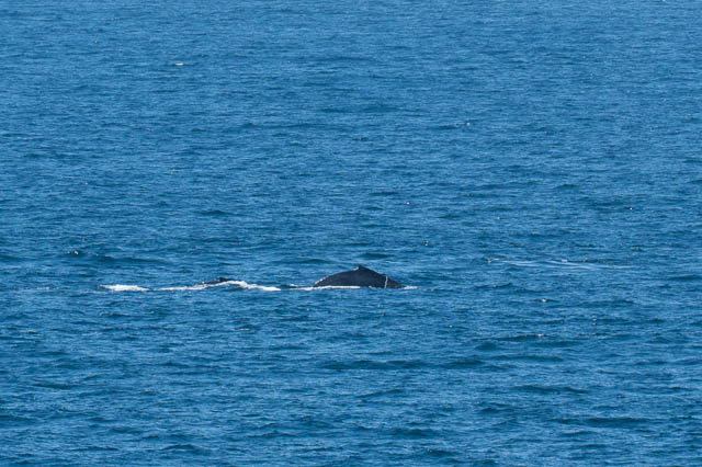
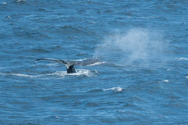
Also, I was fortunate to see some whales frolicking about. I had plenty of time on this walk to look for whales and I saw them all along the way.
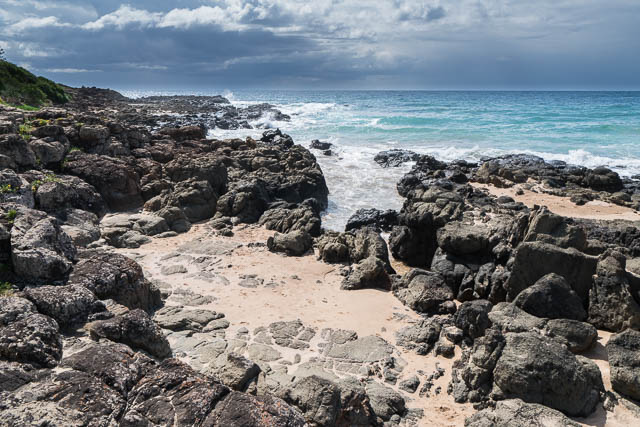
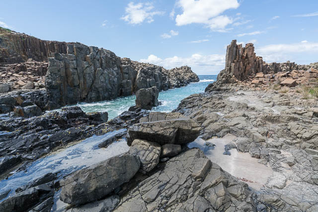
The track then descends down to Jones Beach. Another long walk in the sand along the beach. But at the far end – some more sea stacks. These are Cathedral Rocks – well known to photographers – particularly at dawn. I could not get to the base of the rocks because the tide was rather high. The start of the track around the tops was not marked but the route was obvious – you have to follow the road for a bit past some houses. Just past these was an opportunity to walk out through public land to a point overlooking the rocks for some nice views. There was also a track heading down to the rock platforms – but they were underwater.
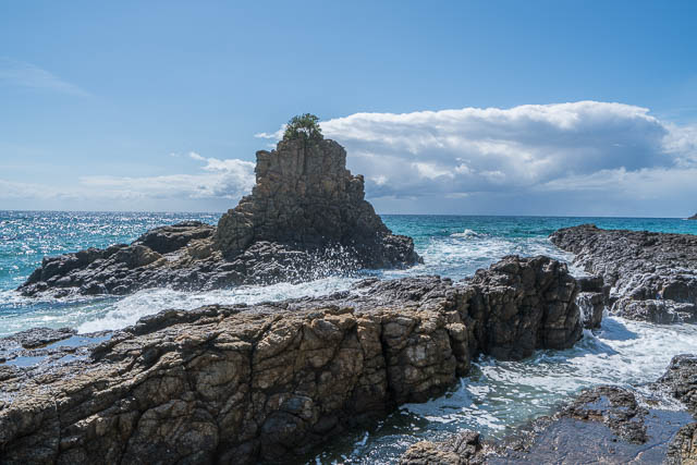
Cathedral Rocks
Cathedral Rocks
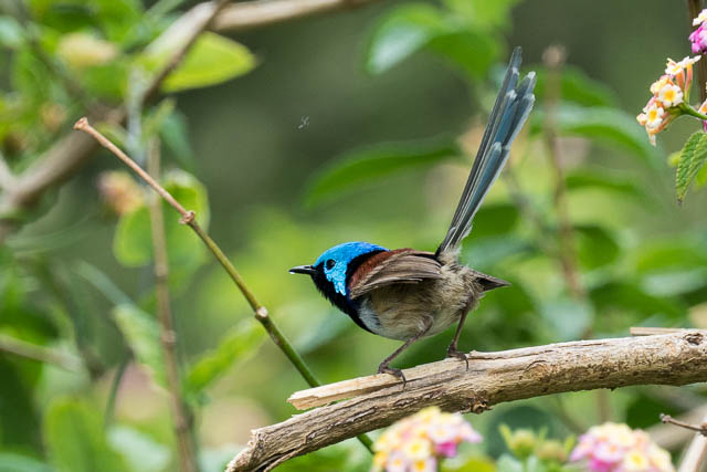
I continued along the road to where it ends and the track continue past Bombo Quarry. Having plenty of time I took some side tracks that descended down to a small stoney beach and then out to the far end of the headland. This was through quite dense bush – some partly regenerated, but a lot of lantana was also around. At least the bird life was abundant – lots of small wrens.
At the point – there is a large outcrop of volcanic rock (latite – a type of basalt). I sat down, had morning tea and took photographs of the Bombo Quarry and looked for whales. Quite a few, most of them with calves were cruising past.
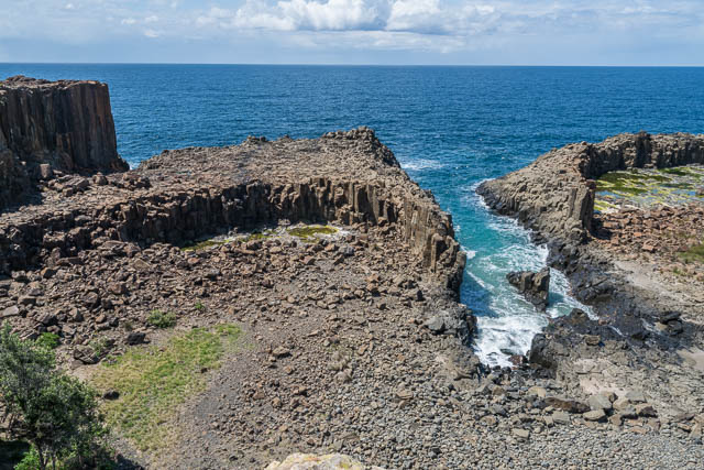
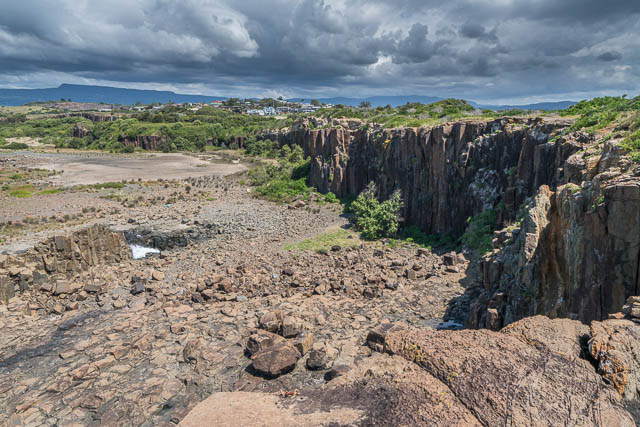
I then walked back to the main Coast Track – but not far along I found it fenced off. A sign said that some tree lopping was going on – and the dates indicated the track would be closed till late in the month. I consulted my map – it looked like it would be a long walk back to get across the railway line before being able to proceed. Before doing this, I headed back through towards the quarry to see if there was a way down the cliffs to the open bottom or though the thick lantana. Indeed there was! I found am old cut track that led through the thicket to a steep section right above the quarry. It was possible to scramble down. This was ideal – and it saved a lot of distance and time – as I intended to visit the quarry anyway.
The quarry is a very interesting place from a geological point of view. There are many examples of columnar jointing and it is criss crossed with dykes. in the right light, it would be a great photographic place.
I left the quarry and continued on its access road back to the main track above Bombo Beach. Just before the beach was a park where I stopped for lunch. Then another long beach trudge….
At the far end of the beach, it was not obvious which way to go. The map was quite vague and the notes were too. I tried to follow the rock platform around – this was easy at first, but with the tide still quite high – it looked like I would soon get quite wet, so I went back to a path that left the beach near a stream. I followed this and it led to a road around the point above the rock platforms. More signposts were reassuring. I followed the roads and signs till they led down to the park at the north side of Kiama Harbour. The walk was almost finished.
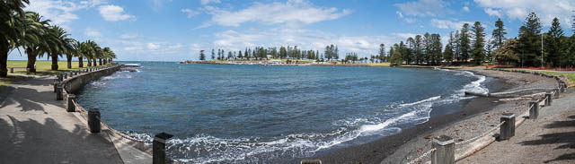
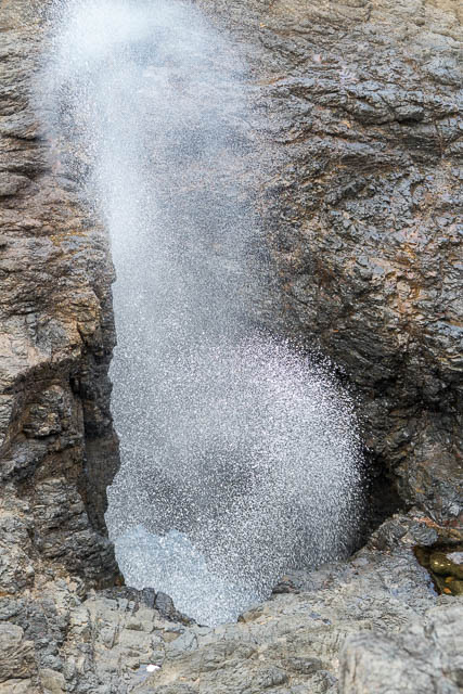
I followed the foreshore path to the Blowhole. This time the tide was hit enough that it was working – occasionally. Also, the lookout just beyond the platform was a great place to watch for whales. Since I had time to wait for my train – it was a good place to spend some time.
Meow photos from this walk are online on my website here.
Hi David, it is great to see that the track has been extended. We walked from Kiama to Gerringong a few years ago, this section would be good to do soon. Thanks for sharing