
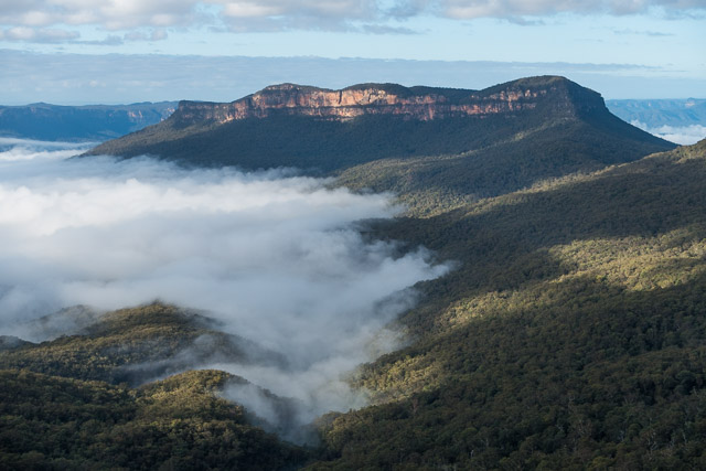
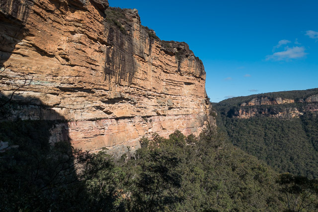
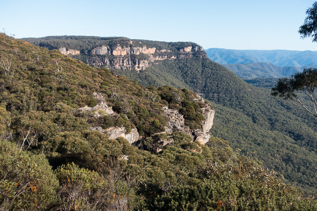
Narrow Neck is the peninsula of sandstone that juts out from Katoomba and separates the Jamison Valley and Megalong. It has long been a popular place for bushwalking. For a long time a track along the Neck was used as a access route to the Greater Southern Blue Mountains. In the early 1060’s a fire road was bulldozed all the way along the plateau to its end. This somewhat lessened its appeal as a bushwalking destination in its own right. A pleasant track walk had become a road bash. Despite this, the great views remained. It was still a gateway to a great area for walking.
Bushwalkers on weekend trips, would catch a train to Katoomba and then walk out Narrow Neck on a Friday night and camp in a cave at the end. This would give them a good start for walks in the Wild Dog Mountains or beyond. Perhaps the “Neckbash” became a lot less popular when a road to Mellow Gap was opened up, but that road was later closed to bushwalkers, and so Narrow Neck regained its use. Perhaps in more recent times, many walkers approach the Wild Dog Mountains via the Dunphy Campground at Carlons Farm in Megalong.
Another appeal of Narrow Neck has been to seek out and traverse the many passes to the valleys below. Indeed, several books have been written that describe these passes. Also, many bushwalkers have set out to find new passes. Here is a list of some of the better known passes and routes used by bushwalkers –
- Dog Face Gully
- Golden Stairs
- Castle Head (Not really a “pass” – an abseiling descent, rock climbing ascent)
- Walls Pass
- Duncan’s Pass (and Tarros Ladders)
- Dunphys Pass
- Glenraphael Head
- Harmil Ledge (an easier variant that ascends Glenraphael Head – but avoids the tricky, exposed scramble of the former route)
- Carlons Chains
- Black Billy Head
- Mitchells Creek
- Rock Pile Pass
- Redledge Pass
- Diamond Head Pass
- Waterboard Ladders
Many of these passes seem to have a history that predates bushwalkers. Some such as Red Ledge Pass and Black Billy Head were used by miners. Mitchells Creek pass uses a coachwood tree with spikes hammered into it – probably placed many years ago by miners?
Bob and myself set out from the barrier on Narrow Neck with the intention of visiting Rock Pile Pass.
Neither Bob nor myself had visited Rock Pile Pass on Narrow Neck. But where was it? It seems that many walkers had heard of the pass and set out to visit it with a rough idea of its location, but it seems they had visited the wrong place. See for example this site. The wrong place involved an abseil descent or a rock climb to ascend. This is more than a bushwalkers pass usually requires.
Rock Pile Pass was found by Graeme Holbeach and Don Rice of Sutherland Bushwalking Club back in 25 November 1988. The rock pile of the pass seems to have been a pile of rocks they placed in order to climb up the topmost of three tricky bits on the pass. The “wrong” Rock Pile Pass is on a headland, not that far away. Bob had visited that area a few times and says there are signs of miners (e.g. cut steps) and there is an old pile of stones at the top (cairn). He thinks, that perhaps miners used long gone ladders to negotiate that particular route.
A bit of googling revealed the general location of the correct Rock Pile Pass. Part of the pass – the half way ledge is now used as a sports climbing area – The Farside. An online guide provides access notes. Also – it seems other bushwalking parties have visited the pass on a trip where they descended Mitchells Pass and then ascended Rock Pile Pass. That is what Bob and myself set out to do.
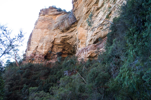
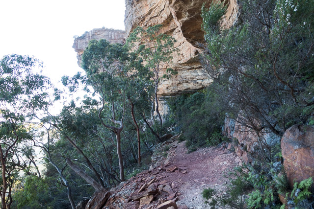
We soon arrived at Coral Swamp and noted a few plants that had wire cages around them and signs saying that they were endangered. We continued on and crossed the Second Neck and out to above Mitchells Creek. We walked along a short ridge and descended down to Mitchells Creek. Once at the creek – it is slow going downstream through a lot of ferns, but we soon arrived at where the creek drops down a series of waterfalls. The key to the pass is to traverse on ledges on the true left for 100 m or so, then descend a bit on ledges, trending back slightly upstream to reach the top of a coachwood tree. This is the tree with spikes embedded in it. Bob and myself had been this way many years before on another Narrow Neck passes trip, and we had no trouble finding the way.
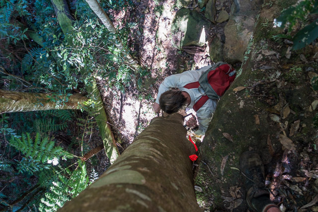
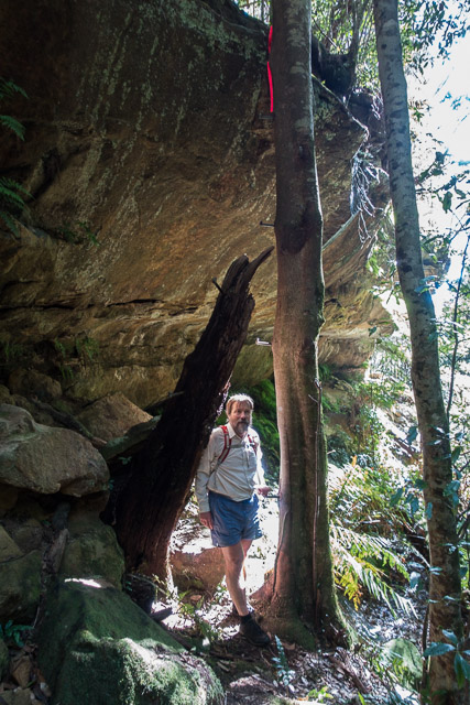
Soon, we were down the tree. We then descended a little to the creek, crossed it and then traversed under the cliffs heading north. It was not hard going, but in one or two places it was hard to work out which level to be on. A few keys parts are where you squeeze behind a large fallen bit of cliff and another place where you cross a landslide. Here we found bits from a stolen car that had been pushed off the Second Neck many years ago.
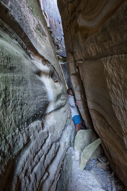
We thought we were now getting close to the pass, but no way up seemed likely. We then came across a bit of tape tied to a tree. This looked promising. We climbed up at that spot but further progress upwards seemed very tricky. This did not seem the way. We kept on traversing. Around a point revealed a view of the area where the wrong pass was, so we backtracked a little, back around the point to a corner. What had looked most unlikely now looked much more promising and scuffle showed it was the way others had gone before.
We climbed up and around, and soon were at the bottom of two more technical sections. Both had lengths of rope placed on them. You did not need to use the rope to climb up, but they did protect the vegetation that we would have had to use instead as handholds.
Above us were lots of ring bolts. We had arrived at the climbing area. We followed the ledge to the north and found a nice sunny spot for lunch.
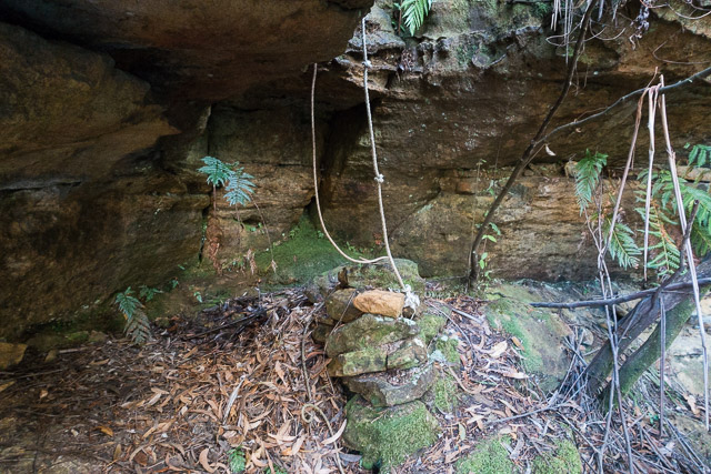
Further along, in another damp corner, we found the original rock pile and more rope hanging down. We ascended this to arrive at the top and more great views. But….. above all the technical difficulties, this is where things went wrong. The climbers had placed cairns all over the place and we did not know which ones to follow for the track out, and went up through low heath. Easy low heath…. that led to very thick high heath. What should have been an easy walk back to the road became a major scrub bash – at least for a short while. We eventually found ourselves on the climbers track and soon back at Corral Swamp and the firetrail back to Bob’s car.
More photos are online on my website here.
Hi David
Could we go down castle head and up walls pass?
Would it be hard to find the up path to the cliff line?
Regards Tim
I don’t know why you’re asking it here, as the route described in this post has nothing to do with castle head or walls pass.
But answering it anyway, yes you could if you are good enough at navigation and scramblng so as to reverse the route described here:
http://bushwalkingnsw.com/walk.php?nid=805
from ruined castle back.
There are no “paths” between ruined castle and cedar head. If you expect one, then you’re not fit to go there, do not attempt it.
Going up the final ridge to reach cedar head may involve tricky scramble if you don’t find the gully described while walking in reverse. Climbing up the chains of walls pass can be dangerous, it’s a bit trickier than e.g. carlons chains.
And above all, you will be seriously burdened by carrying your abseiling ropes through that terrain, so what’s the point? Unless you find a rope boy (or the weakest in your party) to carry out ropes the easy standard way via golden stairs.
A note for anyone reading: as of the 2020 bushfires it is now sensible to do this trip from Rock Pile to Mitchell’s Creek (in reverse), because the fixed ropes were burnt out.
We dropped down to Rock Pile pass with a 25m tape sling wrapped over a tree high above the rock pile. A climber could manage without. We also set a tape sling twice more where the old ropes used to be. If it was bone dry again a climber might not bother.
Went back a couple of days ago. While it’s easy enough to get down or up the rock pile without a tape sling if that’s your inclination, we found that you can simply carry on following the same ledge North for 250m and exit an easy ramp on the right (instead of dealing with the rock pile). Apparently climbers have fixed ropes up the waterfall opposite the rock pile but I didn’t try them.
NB: I would still bring a tape for the two down-climbs off the Far Side ledge. The terrain is a bit too sketchy and slippery to rely on in my opinion, and the old ropes burned away.