
This was a midweek walk with Bob. We both had the traverse along the side of Mt Banks on our short lists for a while.
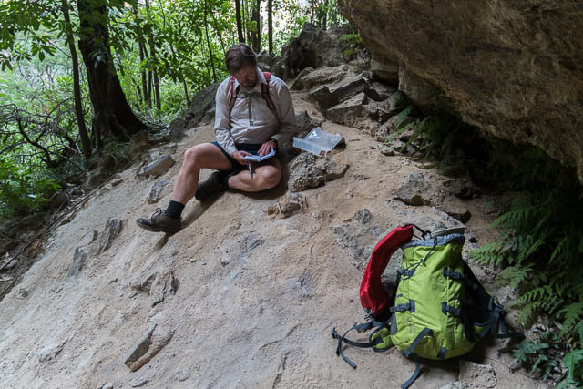
I am not sure who first completed this traverse as a bushwalking trip. It links up old routes used by climbers on the side of Mt Banks. These routes would have been in use since the early 1960’s. Springwood Bushwalker Phil Foster calls the route the “Traverse of the Gods” and has named a large gulch which needs to be crossed the “Devils Throat”. He has also placed a log book in a cave along the way. In the book he records that he found the route when looking for stone “hut” used by climbers for bivouacking. However that shelter lies on a lower level.
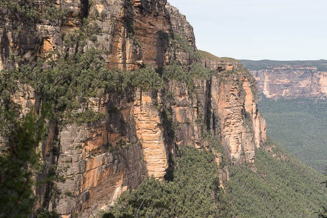
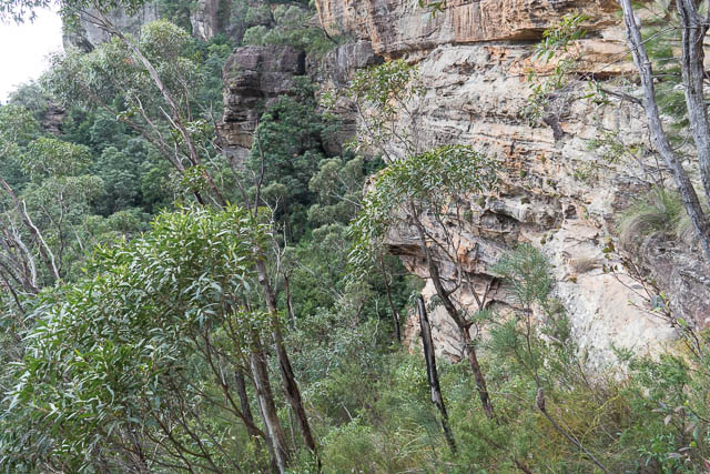
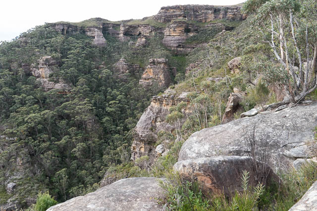
The route makes use of a large ledge which has formed along a rock layer called “The Wentworth Falls Claystone”. The main cliffs that make up the massive walls of the Blue Mountains such as in the Jamison Valley or here in the Grose Valley are made up out of Narrabeen sandstone. There are normally two layers of this sandstone – the lower Burra-Moko Head Layer and the higher Banks Wall layer. These layers are split by a thin layer of softer rock – the Mt York Claystone. Some bushwalks lie along this mid layer – the best example being National Pass at Wentworth Falls. At Mt Banks, the upper Banks Wall is also split into two and these layers are separated by the Wentworth Falls Claystone. And at Mt Banks there are also upper layers of rock – Hawkesbury Sandstone and then a layer of the volcanic rock basalt (see the graphic on page 16 of this link)
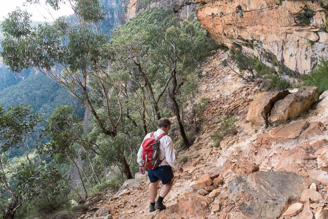
On our trip, we approached the ledge on the eastern side by walking around Mt Banks via the fire trail. From the lookout at the eastern side it was a short descent (10 m) along a climbers track to the ledge. Then the traversing began.
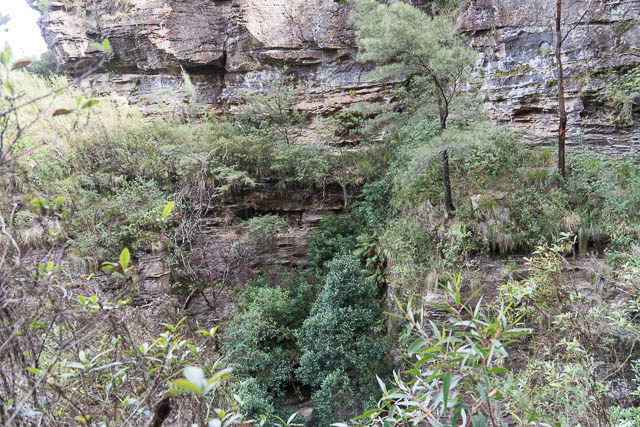
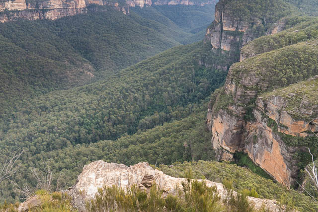
It started very easy going often through caves. Other parts were a bit scrubby following a faint pad. I expected views to be better given the situation – but they were mostly obscured by trees. We made good progress and soon arrived at the western end of the ledge. Here things became interesting. First we crossed a large gulch – possibly a dyke formed when larva flowed to cap Mt Banks. This was a nice place with a small pool of very clear water. Then around a corner to a larger gulch. This is a rainforest area -and we were not sure which level to continue on. We started off too low as it turned out.
We soon found our way blocked by another gulch. This one seemed to split the ledge. We would have thought it unlikely that you could get past except that we had heard that it was possible. We retraced our steps and tried a higher route. No good, then back further and an even higher route. This took us to the head of the gulch (The Devils Throat) and then a short climb and an easy scramble to a higher ledge looked like it led on to easy ground. It did. Finding a logbook in a plastic container gave us some re-assurance that the route went.
We continued around the corner and then we could see that it is possible to climb up on some easy slabs. We were around the ledge. It was time for lunch and time to enjoy some fine views. From there it was a short and easy walk back up to the Mt Banks summit track where it crosses a section of heath.
This was an interesting walk in a great situation. Not as hard in terms of scrambling or exposure as I had thought it would be, and not as good for continuous views perhaps also. But some of the route finding was more challenging.
More photos are online on my website here.
More information – According to Bryden Allen there are two climbers bivvys on the ledges of Mt Banks. Also – it is possible to traverse the half way ledge – see this post on the Fat Canyoners Blog