
As I write, bush fires are continuing to burn in some of the beautiful alpine areas of Tasmania. So far there have been two fires that have burnt alpine areas near Lake Bill and near Lake Mackenzie. Both of these areas are on the Central Plateau and within the World Heritage Area.
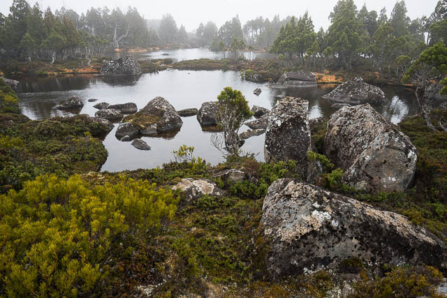
The incredibly beautiful Central Plateau of Tasmania – alpine tarns surrounded by Pencil Pines
My first walk across the central Plateau was in 1980, and on that walk, I can remember walking into a zone of destruction between the Long Tarns and Lake Tyre (near the Walls of Jerusalem). It was as though an atomic bomb had been detonated in the area a few years before – all that remained were the skeletons of trees, a few scattered bushes and mainly bare earth and boulders. We guessed the destruction was due to a bushfire.
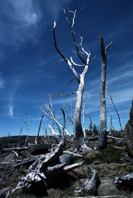
1980 photo – twenty years after a bushfire
It was. In the summer of 1960/61, a fire had burnt that area and a lot more. I think it was deliberately lit by cattle graziers to encourage regrowth. The fire lasted for three months and burnt out about 30,000 hectares and changed the landscape for ever. As well as burning out a lot of pencil pines and other unique alpine plants, the fire slowly burnt out the peat which accumulates in many of the alpine areas of Tasmania over thousands of years.
I can remember being told by a person who lived in Tasmania during the early 1960’s that the fire had another unintended outcome. The newly commissioned Great Lakes Power Scheme used a lot of the burnt out area as catchment, and the fire changed the catchment forever. With no peat or spongy sphagnum swamps, when it did rain, the water drained straight off into the reservoir and then could not be utilised efficiently. The scheme was designed for a gradual runoff that was no longer available. So hydro engineers pressed ahead to the next scheme which destroyed Lake Pedder.
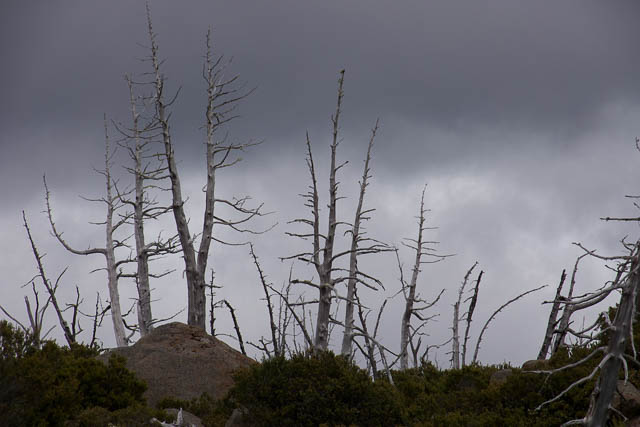
That burnt out area of the Central Plateau. Twenty years later in 1980 – and still a scene of desolation!
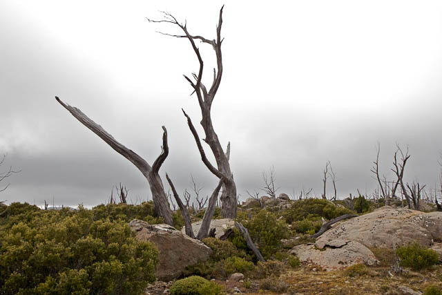
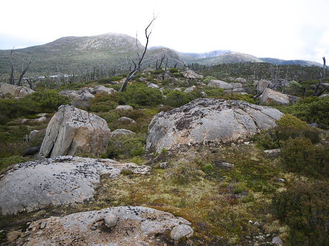
Now jump to 50 years after the fire, and what is it like? Not very good. Here are photos taken on a walk in the same area during April 2011 –
So how bad are the current fires? From photos taken by Dan Broun and Rob Blakers the burnt areas look really bad. Dead pencil pines and burnt out cushion plants……. Simon Cubit in his blog has a report on the fires, written mainly from the perspective of loss of historic huts, but he estimates that the fire has destroyed 4% of the remaining pencil pines in Tasmania. That is, one tree out of every 25 on the planet have been destroyed!
Another unfortunate consequence of bush fires is that they kill the native deciduous beech trees, known as “Fagus”. If you walk south of the Walls of Jerusalem, along the Chinamans Plains, you cannot help noticing that the fagus seems to be confined to growing on the islands in the lakes until you get the Ling Roth Lakes. It seem that those islands were their refuge from fire.
a really good piece Dave. It’s tragic. It helps to see the photos, to see ‘then and now’. Tassie tends to not be on our radar here in “the premier state”. I’ve just read “The Rise and Fall of Gunns Ltd.”, feel I have a better understanding of how the place is governed / run / run into the ground. He uses the phrase ‘crony capitalism’ to describe the system that runs “Develop or Die”. By Quentin Beresford.
Diana