
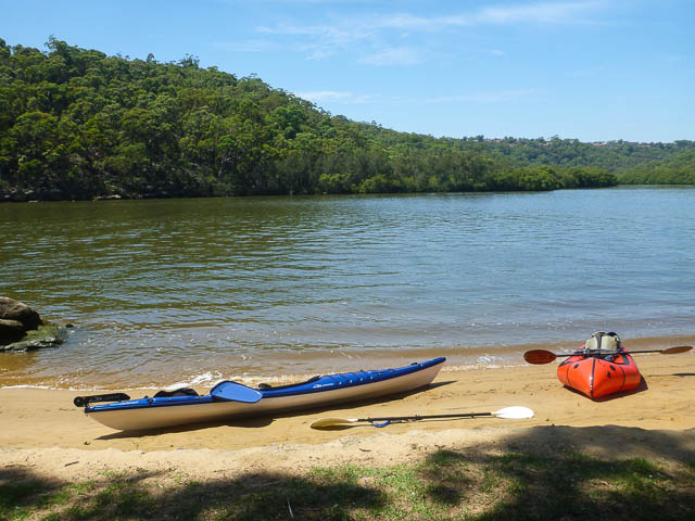
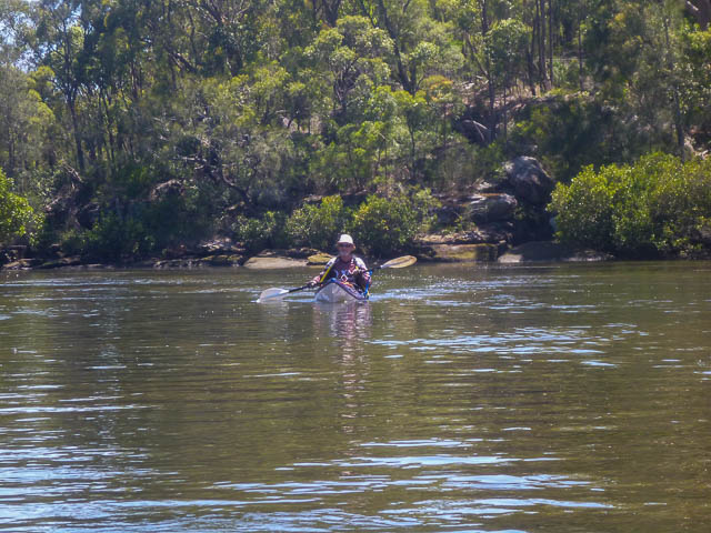
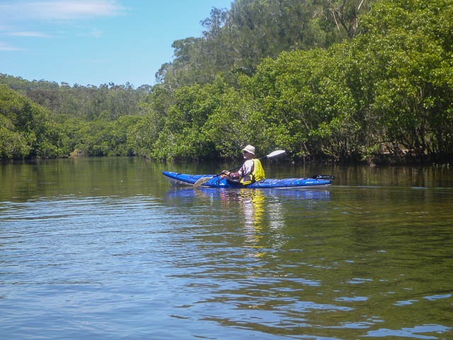
I spent an enjoyable day with Digi Dave paddling around parts of the Georges River. Digi Dave had his sea kayak and I was in my packraft. Our main objective was to see how far we could paddle up Mill Creek.
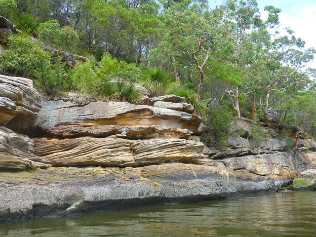
We set off from a Georges River National Park picnic area just opposite Mill Creek. On the far side of the river I was pleased to spot a kingfisher sitting on a branch.
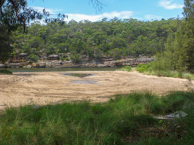
The lower part of Mill Creek is lined with mangroves. The creek is also quite shallow and we had to watch the tide. Low tide was coming and we didn’t want to be marooned on sand higher up the creek.
We paddled upstream quite easily, and made a distance of 3 km or so upstream from the junction. We then paddled downstream back to the Georges River for lunch. It was a bit noisy now with jet skies and motor boats screaming past.
After lunch, we paddled upstream to Parkesvale and old “pleasure ground” on a headland further up the Georges River. Parkesvale was named after the statesman, Sir Henry Parkes and was very popular with day visitors from Sydney back from 1899 until WW1. Visitors could catch a train to Como and then travel by boat up the river. One such boat was the SS Telephone, that could carry 400 people. Parkesvale was fitted out with a pier, dancehall, a pavilion complete with a grand piano, summer houses and shelter sheds. One attraction was that it was a sufficient distance from Sydney that visitors could purchase liquor there on a Sunday.
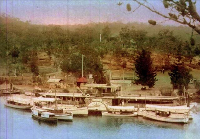
S S Telephone at Parkesvale
Not much remains now. There are some stunted bits of timber sticking out of the water which may have once been part of the pier. Trail bikes and 4WD’s have had a field day around the point.
Digi Dave did search in the sand near the pier and unearth some relics including square shaped nails.
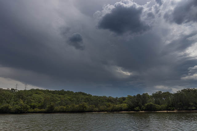
It then looked like a forecast storm was approaching, so we headed back down the river to where Digi Dave had parked his car.
As it was a very hot day, we finished with a cool drink at the East Hills Hotel.
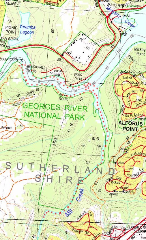
Here is a map of our paddling –
More photos are online here. Thanks to Digi Dave for organising the day.
Deadmans and Williams Creeks are nice short paddles too. On the high tide you can run up Deadmans above Heathcote Road bridge, leave the canoe and explore upstream on foot.
Been doing a bit of mountain biking / walking in that area recently.
If you’d got another 250m up Mill Ck you’d get to the spot where SIX Maps shows a road crossing the creek and eventually through to Heathcote Rd – it’s only about a km in a straight line. The road actually makes it down on the eastern side and there a number of very old large diameter concrete pipes stored up on the bank, obviously for a culvert. Unfortunately it appears they got this far without checking the terrain on the western side of the river. It’s almost vertical.
May have had morning tea at ‘Parksvale’ on another trip. Is it the headland opposite Yeramda Lagoon? Difficult to imagine it had ever been pleasure grounds.
Yes – directly opposite Yeramda Lagoon.
On a historical note: the original cart road from Liverpool across to Woronora, before there ever was a bridge over Deadmans Creek, crossed that creek a couple of miles above where the Heathcote Road bridge is, then went across Mill Creek to link up with what is now New Illawarra Road. It’s still there, and the section through Mill Creek valley might be the one Graeme refers to.
Colin,
Can’t find any info on the cart road so I’m guessing the alignment is basically that of the only road one shown in the air photos crossing Deadmans Ck in the position you describe. If so, it would have been logical for the road to have followed the high ground (ie. Little Forest Rd) to emerge on New Illawarra Rd opposite ANSTO. ‘My’ road is about 6 km to the north and appears to have never been completed.
Dave; Sorry about hijacking your blog.