
I have just returned from a very good 23 day walk in Slovenia. I had long wanted to visit the Alps in Slovenia. The mountains there sounded very rugged and spectacular and a bit less crowded than other parts of Europe.
Several years ago, I had purchased a Cicerone Guidebook “Trekking in Slovenia” by Justi Carey and Roy Clark. This describes a long high level walk called the Slovene High Level Route or in Slovenian – the Slovenska Planinska Pot or Transverzala. This walk, or a section of it sounded like a worthwhile thing to do. Also, friends Ashley and Kendy Burke had visited Slovenia in 2010 and walked a long section of the Transvezala and brought back many inspiring photos and stories.
On my walk, I flew into Vienna. There I had a hiccup – my luggage (pack) did not turn up, and I was delayed there two days till it arrived. Next, a train trip to Maribor, the second largest city in Slovenia, where my walk would start. Maribor is a delightful city – lots of friendly helpful people, lots of bars and cafes. A nice place. My stay was all too short. Keen to make up for my early delays in Vienna, I set off for my walk the morning after I arrived. All I needed to buy was a bit of lunch food (mainly bread and cheese) and a map for the first section of the walk.
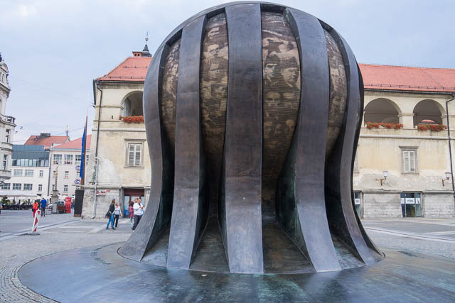
Maribor
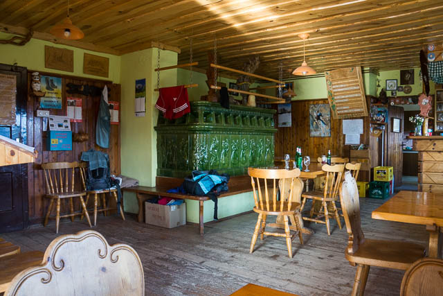
On the walk, I intended to follow the usual Slovene way of doing things – and stay in the many comfortable mountain huts. These huts, called koča or dom, are scattered all along the route, and provide accommodation, drinks and meals.
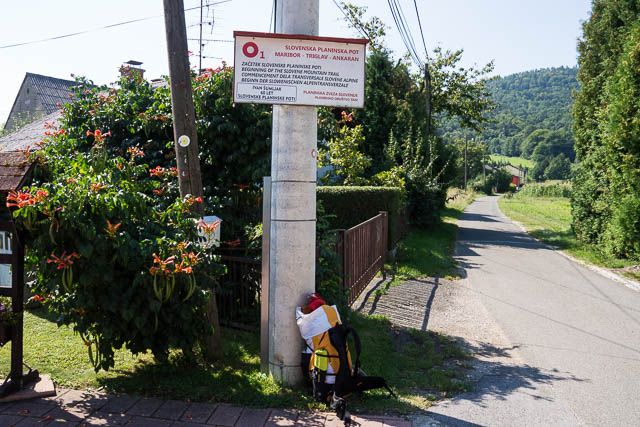
Official start of the Transverzala
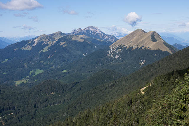
Pohorje
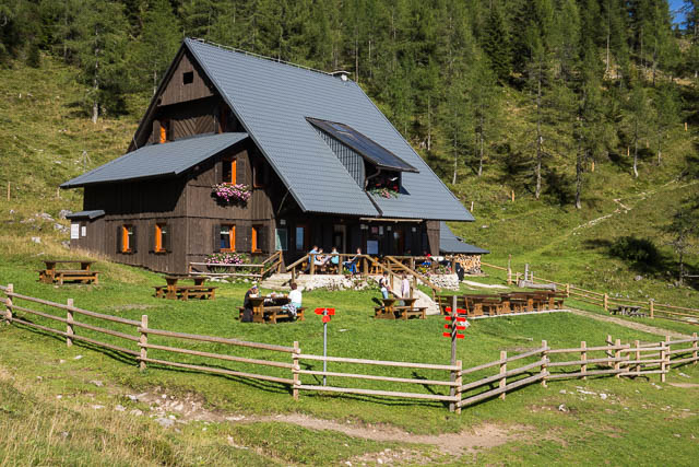
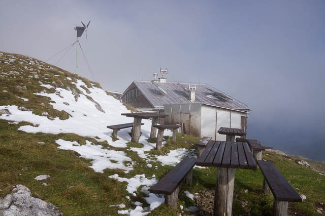
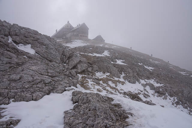
A bus took me across the city to the official start of the Transverzala – a monument in a back street, and then it was up a big climb onto the Pohorje Plateau. The route is marked by waymarks – but as there were also numerous mountain bike tracks I think I lost it a few times. It didn’t matter. All you had to do was go up till you reached some ski tows. Then the first hut described in the guidebook was not too far off. I soon arrive at the hut, but found it was going to no be open that evening. It seemed to be a one off thing – perhaps a staff shortage? Anyway – it was still quite early and another hut was not too far off. So I continued along through beech and pine forest and soon arrived at the Ruška koča. When I arrived I realised my inadequacy – language difficulties. I was talking to a staff member, and he didn’t speak any English but did speak a bit of German. I don’t speak German, but I think he eventually worked out that I wanted to stay the night. This didn’t seem to be a problem. As it turned out – this was the only hut where I encountered communication problems. Most of the hut keepers spoke some English.
There was no communication problem when I asked for pivo (beer), and I enjoyed a nice Laško – a very nice beer produced near Maribor. It was pleasant to sit outside on the terrace with other hikers. Many of these other hikers were only on day trips, but there also were quite a few staying the night, and a big group turned up later in the evening. Dinner was goulash with a big bowl of bread. This was a very typical meal in the huts.
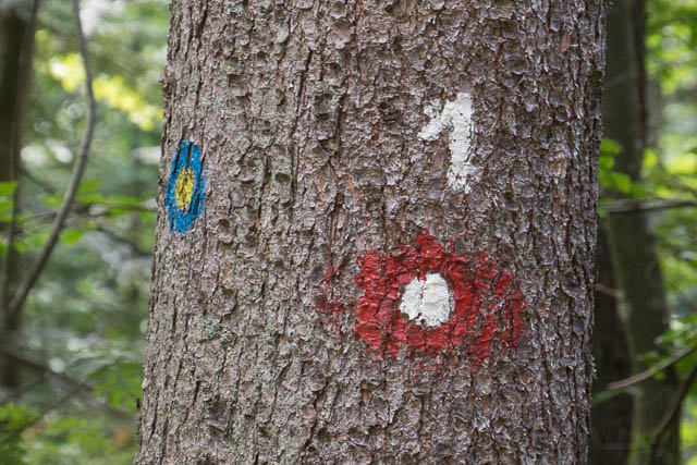
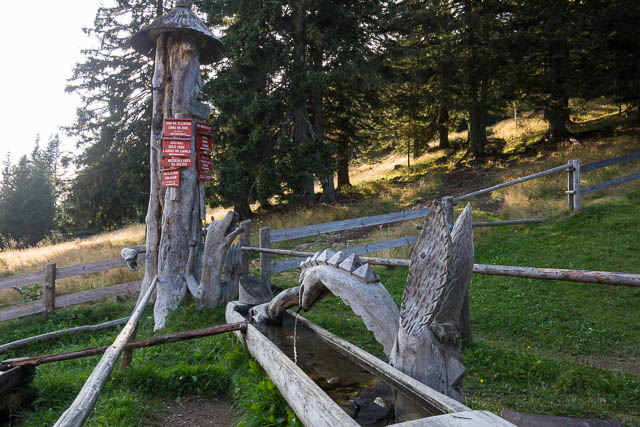
Waymark
More good walking weather the next day. Fine and cool. I set off rather late – just before 9 am. Breakfast in the hut had been served at 8 am. I found later that it was common for breakfast to be on at 6:30 or 7 am, and most days I was away by 8 am or earlier. A late start ddi not matter as I and walked an extra hour the day before, or so I thought. Some of the walking was a bit confusing at first – trying to work out what was the official mark route. There were a lot of roads in the forest and a lot of markers in some places and few in others. I had lunch at a picnic area near a nice small river. Then up a hill to the second hut in the guidebook – the Koča na Klopnem vrhu. I was tired after the last uphill walk – and keen to sit down for a pivo. But! – the hut was full. No accommodation available. It was probably some party group staying there? This was communicated to me by a family group that had also walked there from Ruška koča that I had seen the day before. They spoke good English and told me that there was another hut about 2 hours on. They were going that way too, so we walked together for the first bit. They were Matthew (probably Matevž), Sabina and two bright kids, the youngest only 4 1/2 and they were from the capital – Ljubljana. I enjoyed their company at the hut – the large and very comfortable Koča na Pesku.
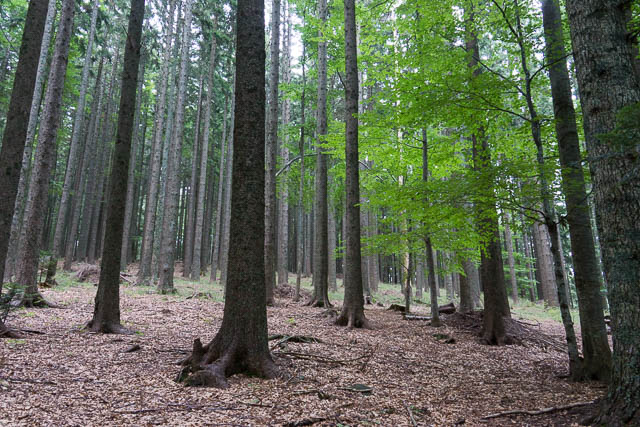
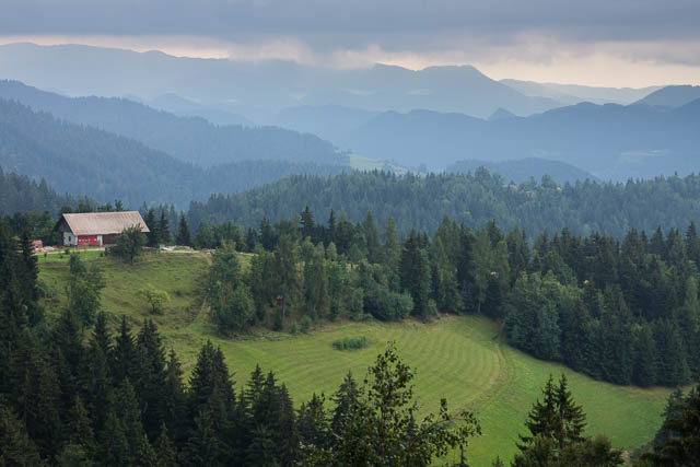
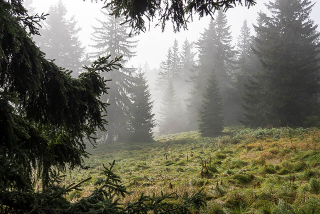
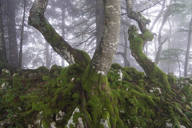
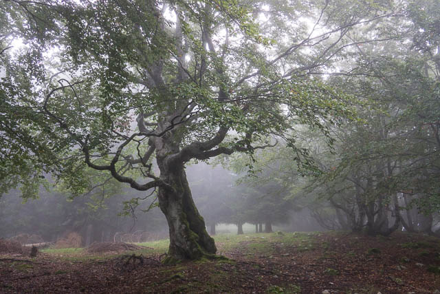
All of this first bit of walking was on the Pohorje Plateau. This is a high area covered in pine forests and ski fields. In summer it is popular with walkers and mountain bikers. There are farms in places and small scale sustainable logging of the forests. Most of the walking is an an altitude of around 1300 metres.

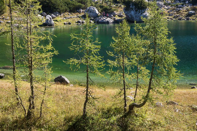
Lovrenška jezera
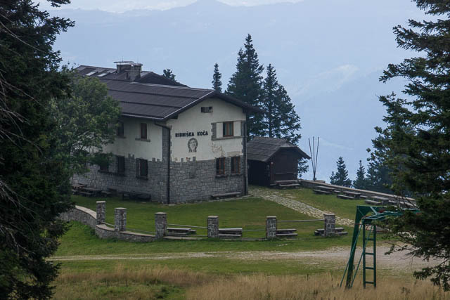
The next day, I was able to enjoy one of the highlights of the plateau – an area of bog lakes known as Lovrenška jezera. The lakes are surrounded by dwarf pines. A beautiful place. I had plenty of time to linger as the next hut listed in the guidebook was only 3 1/2 hours from the previous one. When I arrived – at lunchtime, it was just starting to rain outside. A good time to be indoors! This hut was the Ribniški koča. It turned out that I was the only person staying overnight besides the hut keeper.
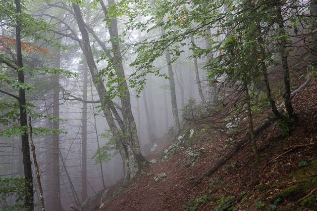
The next morning, I started out at 8 am in rain , but it did not last long. It was quite misty at times, and generally very pleasant walking through forests along a ridge line. I passed a nice saddle – Kasivško Sedlo then to a small summit – Kremzarjev vrh and then a descent to the town of Slovenj Gradec.
More photos from the first part of the walk are online here.
Uršlja Gora to Raduha
I arrived at Slovenj Gradec in the early afternoon. I went to the tourist office in the main street to ask about accommodation. The staff there were very helpful. They suggested the local youth hostel, but after a phone call they found it was fully booked out by a sporting group. So they suggested the big hotel, just up the road. But it too turned out to be booked out by more of the sporting group. So I considered walking to the first hut of the next stage (only 2 hours or so away) – and the staff at the tourist office called them and found they had plenty of room, and the lady I had spoken to – also suggested that if I waited till she finished work then I could get a lift to it as she lived close to it. As it was starting to rain this seemed a very good idea and I accepted her kind offer. I had time to have lunch and then buy some maps which I needed of the rest of the walk.
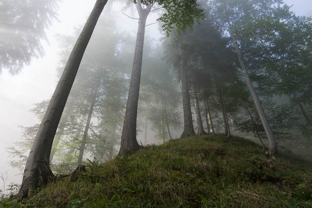
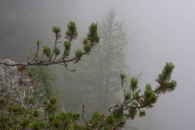
I got dropped off at Above – Poštarski Dom – a very nice hut. I was the only one staying there that evening. In the early morning I had a big climb through the forest up Uršlja Gora. It was misty, but I thought I would soon climb out of it as the sun was peeking through. But I think the mist was forming and building up quite fast and the mist got thicker as I climbed. One difficulty in the climb was due to a severe winter a few years back, when black ice built up on some of the pine trees and the trees fell over – right over the track. It was hard clambering over big logs and trying to find where the track went in one section! Near the summit was another hut. I didn’t climb the last bit – there was no point in the thick mist. Instead I back-tracked a short way to the next section of the track.
It was a descent to Križan and then a short climb to Dom na Slemnu. It was too early to stop so I continued on to Dom na Smrekovcu. This was an interesting place with a lot of wood sculptures of animals outside and inside on top of the big ceramic heater were some dinosaur eggs and other fossils. I was the only guest in the hut that night.
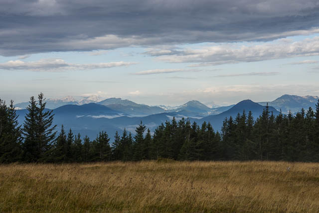
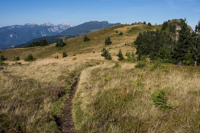
Another 8 am start the next morning for what turned out to be an easy delightful day of walking. It was very beautiful waking through forest along the crest of the ridge with open patches (planina) which offered great views. On the way, I turned off on a short side trip to the summit of Komen – where there were very good views of the country ahead. Lots of locals were around – foraging for berries amongst the heather. I ended the day at the very nice Koča na Loki. This is just below Raduha – the highest point of this part of the range.
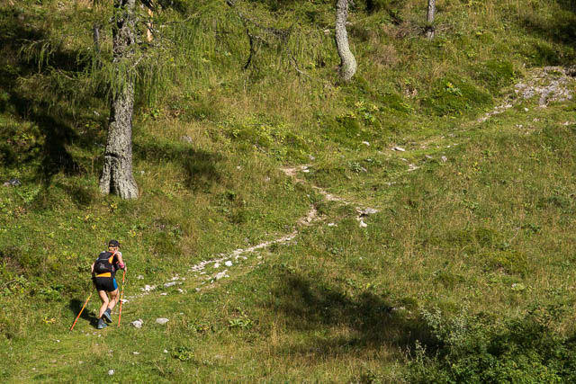
While I was having a cool drink, sitting at one of the tables in the shade of the hut, I met a local mountain runner, Aleksandra, from Maribor. She was resting after having run 30 kms over two 2000 m peaks, and had another 12 km to still run to get back to her car. She had time however to show me some nice photos on her phone of some of the mountains that I would see later on my trip.
That evening, again I was the only guest staying in the hut. All the other visitors were day trippers. For dinner I had soup, goulash and polenta, followed by štrudelj (strudel). With my dinner I enjoyed some excellent local red wine.
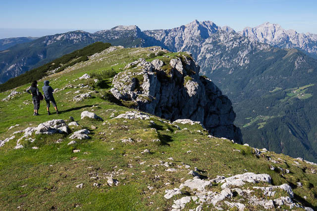
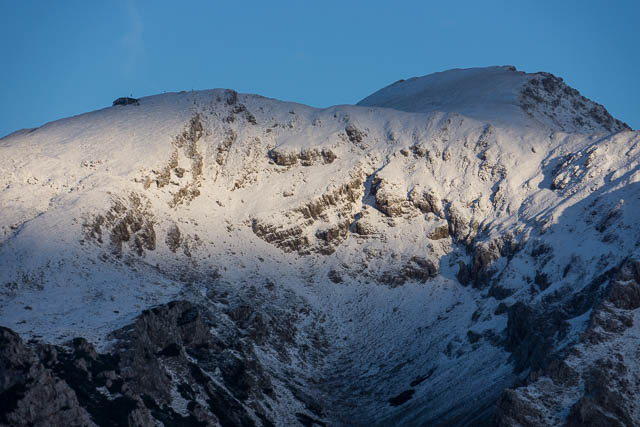
View from Raduha
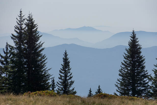
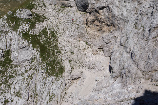
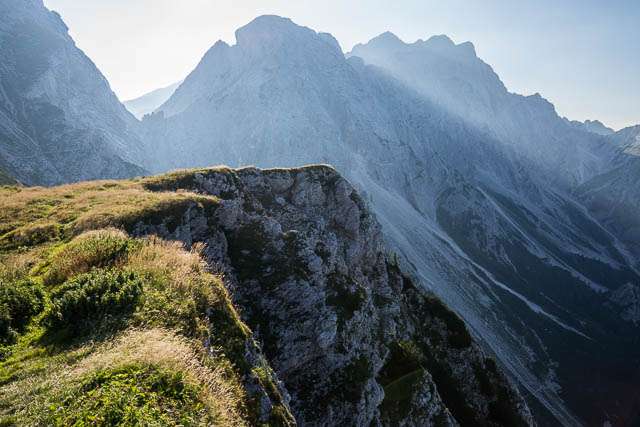
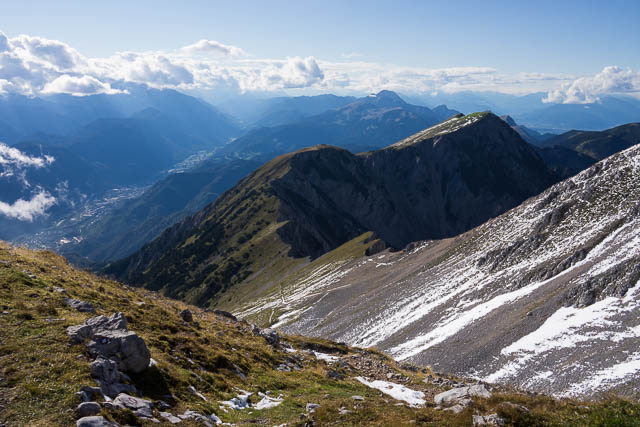
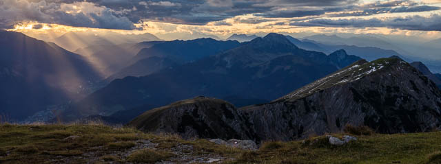
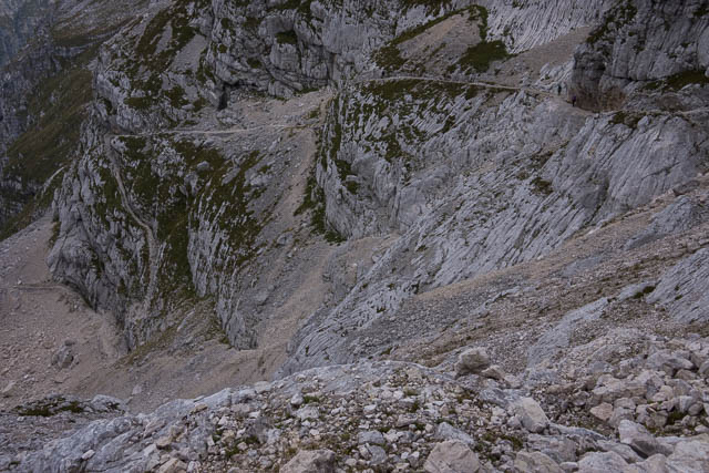
The climb up Raduha (2062 m) the next morning was quite pleasant, through flower filled meadows and then stunted pines, on a cool fine day. On top – great views, looking back to Pohorje and looking forward to the amazing looking Kamniško-Savinjske Alpe – the next part of my trip. After the summit, I walked back to where I had left my pack and then began the descent to Solčava. My guide said there would be a section with steel cables, but a new track seems to avoid this, and there was a long section of switchbacks and then a traverse under cliffs to a planina. Then more descending. The last part of the descend was quite difficult – the official track was very hard to find and when found – it was quite overgrown. I later had to remove lots of burrs from my socks.
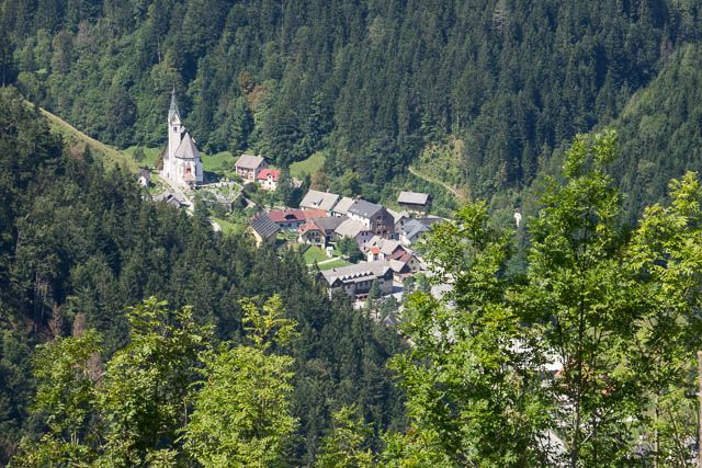
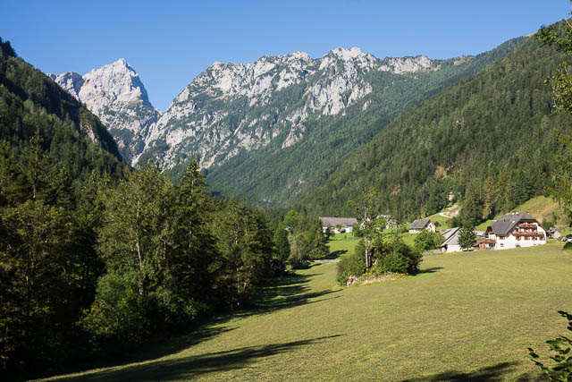
Solčava
At Solčava I headed to the tourist office and they directed my to a local bed and breakfast place called “Stiftar” which turned out to be excellent. And later I had a nice dinner at a local pub. Solčava is a beautiful small town nestled amongst the mountains.
More photos from the second part of the walk are online here
Raduha from Solčava
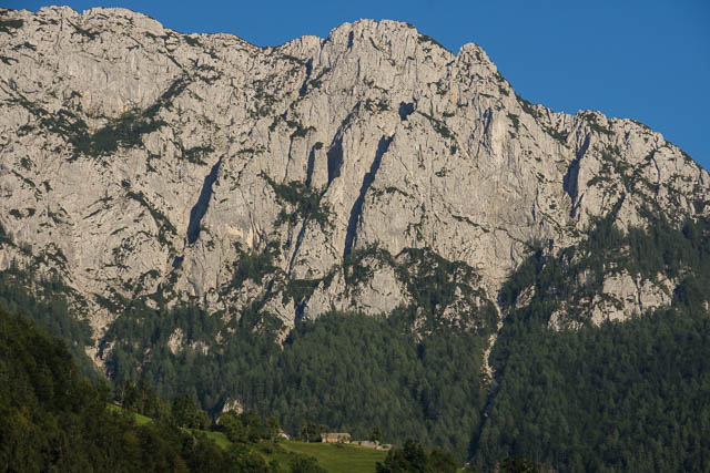
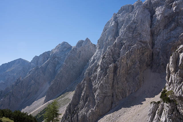
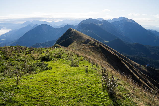
The Kamniško-Savinjske Alpe
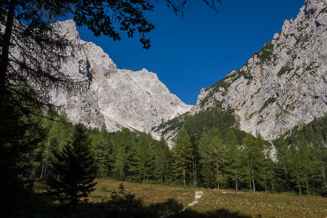
After a very nice breakfast, I set off for the the next day’s walk. First I had to walk about two and a half kilometres down the valley via the main road, to the Robanov Kot – a very beautiful side valley. I walked up this valley on farm roads and tracks – passing through forest and meadows to reach the upper valley where the route suddenly goes vertical. Very vertical. It climbs up the side of the U shaped valley using cables and steel pegs at the steeper or more exposed sections – and this was just about the while way. Eventually I emerged at a nice planina.
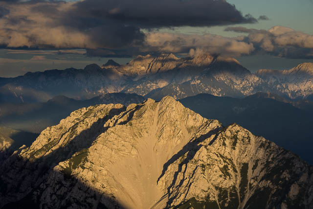
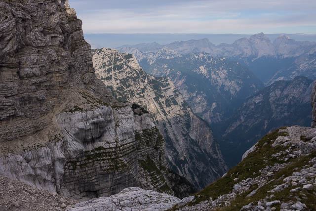
I was in the Kamniško-Savinjske Alpe (or Kamnik-Savinja Alps) one of the most rugged and spectacular parts of the entire walk.
Robanov Kot
From here the going was much easier and reasonably level. It did not take long to arrive at Kocbekov Dom at the far end of a large planina.

It was an extremely hot day and being so high up – there was also a lot of solar radiation. It was good to shelter in the shade of the hut and have a couple of cool drinks. That night was spent in a crowded dorm in the hut.
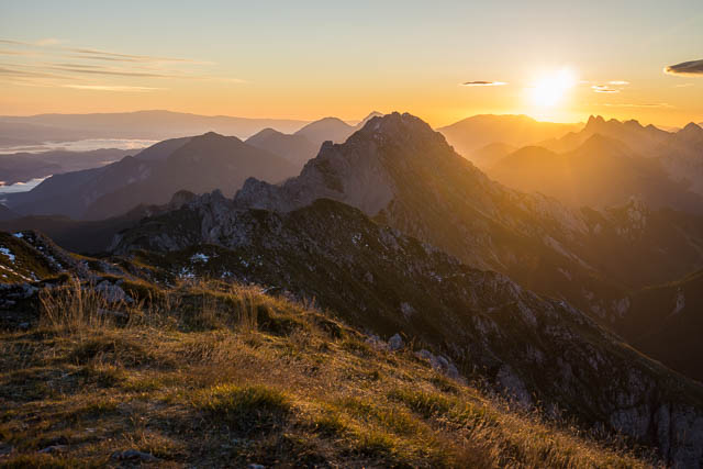
The next day was very scenic. I started walking at 7 am to avoid the heat. It did not take long to climb up the slopes of Ojstrica, to a place where I could dump my pack and then proceed up the final part. All quite easy going. The summit of Ojstrica (2350 m) provided outstanding views in the clear early morning air.
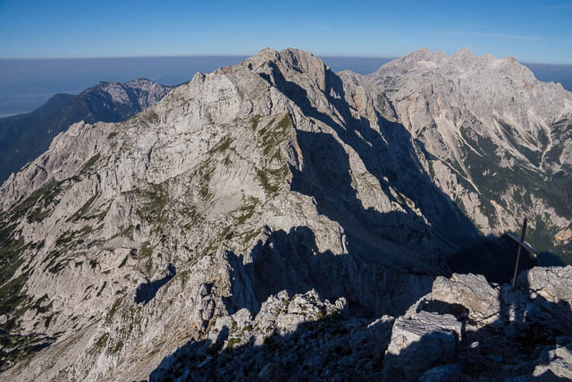
View from Ojstrica
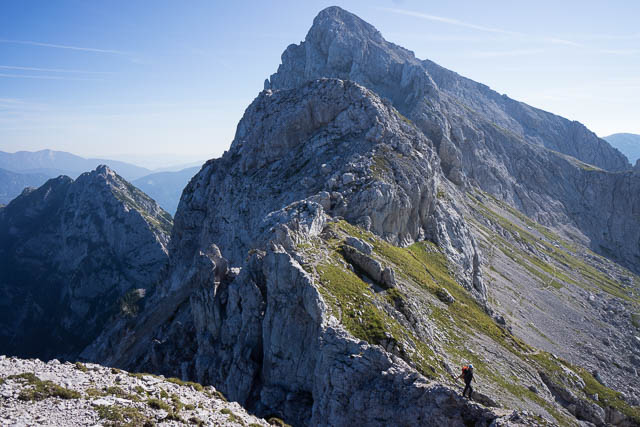
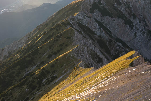
Steep traverse around Mali Planjava. You can just make out a pair of walkers on the narrow track.
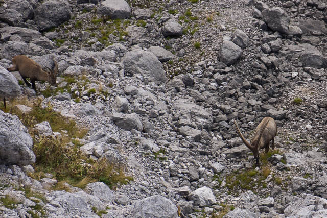
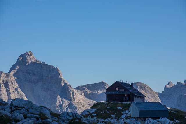
Then the descent back to my pack and off again on the route to the next hut. Near my pack were a group of Ibex (or Capricorns as the locals called them). The route was extremely scenic – following close to the very rugged ridge crest – up and down, around obstacles – using cables and pegs in places. The last part of the walk was around the side of another peak called Mali Planjava – and was certainly quite exposed. That took me to a saddle which was the location of the next hut – Kamniška koča na Kamniškem sedlu. This was a very nice hut with an amazing location. It was a hot day – but a cool breeze was passing through he saddle.

Kamniška koča na Kamniškem sedlu with Mali Planjava behind
The saddle just above the hut (Kamniškem sedlu) was a good place for late afternoon and early morning photography. During the evening in the hut I got talking to some of the other guests – Peter and Emily, climbers from England, and the first native English speakers I had met since setting out.
The next day to was my tenth day out. I got up early to photograph the dawn from the saddle. it was very nice. Then breakfast at the hut and another early start. It was going to be a hot day again! Very pleasant walking at first with great views on a traversing track and then a very steep descent (more cables and spikes) to the valet below. Even though there are cables for aid, you really have to be very careful on these sections. It would be easy to trip or mis-step leading to fatal consequences. The drops are enormous! Once at the bottom, it was easy going, walking up another valley – quite a gentle climb up to a col. But this was another place with no shade and the being in the floor of the valley was like being in the focus of a radar dish. I was glad to have a rest behind a boulder with a small strip of shade.

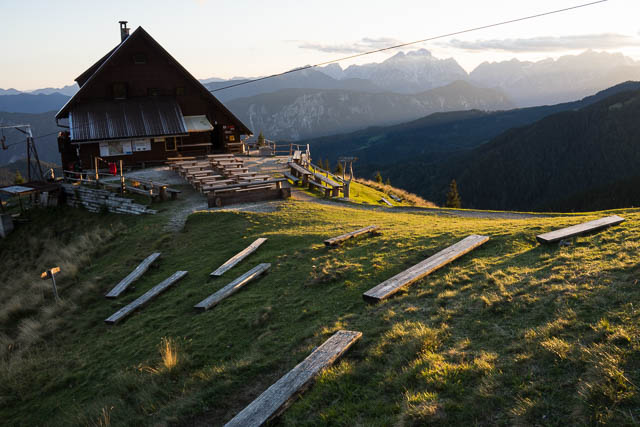
The going remained technically easy up to the saddle at the head of the valley – Savinjsko sedlo. Here I was on the border with Austria for a while. I followed a track, traversing across screes to another saddle then it was an easy descent to the next hut – Kranjska koča na Ledinah. And more shade and a nice terrace to sit and enjoy cool drinks and take in the fine view. This hut was another good place for sunset and dawn photography.

The official Transverzala route stays in the Kamniško-Savinjske Alpe for two more days – criss crossing the high tops. I was not keen on another very hot and exposed day on the open tops. And the forecast for the day after was rain – not the weather to negotiate steep cables and spikes. So I decided to descend to the valley – and arrived at the nice town of Zgornje Jesersko in time for lunch. I stayed at the large Hotel Planinka.
View from my hotel window
More photos of this section are online here and here.
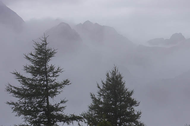
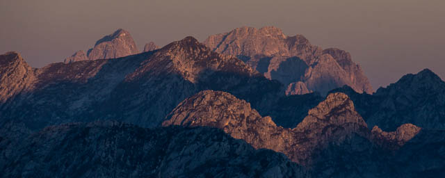
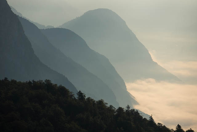
Storžič
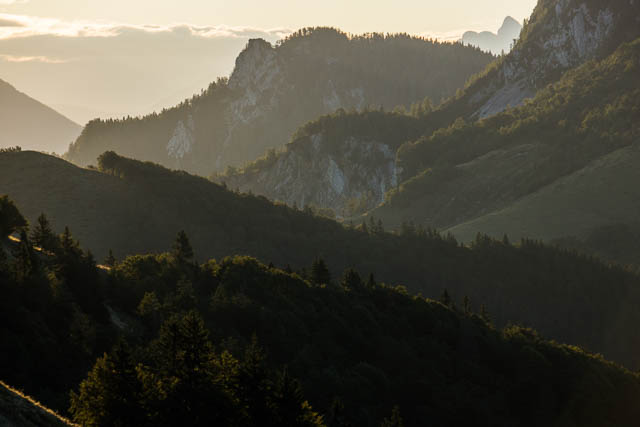
So far, on my walk, I had been experiencing fairly fine weather. Good walking weather at first and then a spell of hot weather the past few days. Now I was going to experience a spell of quite bad weather. Rain start as I was climbing up to the next hut – the Planinski Dom na Kolisšču. I reached the hut at 1 pm and found it shrouded in thick mist. I was glad to get inside out of the rain. With the bad weather it was a quiet hut. For most of the time there was only me and the hut keeper. In the afternoon, the rain eased a bit, but theist remained till late afternoon. Then it started to clear. It looked like the next day may be fine, despite a poor forecast.

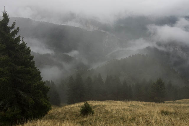
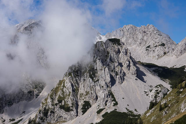
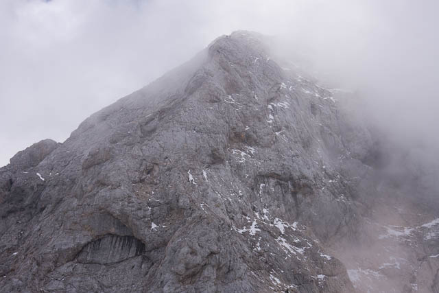
Storžic
On day 13, I wake to more mist and rain, so I settled in for a rest day at the hut. Unfortunately the forecast for the next few days was also poor. I had just enjoyed a nice lunch of pasta cooked up by the hut keeper washed down with a beer, when it appears the weather was clearing once more. You could actually see most of Storžič, the large peak nearby that the route traversed. So I decided to make the most of it and pack up and set off. With the weather it looked wise to avoid the peak by following a track around the side of it which is what I did – all easy walking, then I arrived at a saddle and had a steep climb up to Tolsti vrh.
Back in the mist again. No views! But easy walking to the next hut Koča na Kriški Gori. Again – this was a good refuge from the rain. There were a few other hikers at the hut – and they seemed to be enjoying the very fine local schnapps. I was the only guest staying overnight and later in the evening I also partook some of the schnapps – trying several quite different varieties.
Next morning, after a lot of rain overnight, it was only misty. It took less than 2 hours to descend down to Trzžič the next town.
You can see more photos of this section online here.
The Karavanke Alps
I had arrived at Trzžič at 10 am, and the weather seemed to beholding a bit. So I decided to keep walking. It was not too far to the next hut – Koča na Dobrči. However, as I climbed the nearly 1000 m to the hut, it started raining again – and quite heavy rain. Near the hut, I got a bit lost in an open planina in thick mist. I walked across to a farm building – and used the side of a barn as a temporary refuge – so I could get out my map and try and work out where I was. I could see no more waymarks in the mist and things were a bit confusing. Eventually I woke out where I thought I was and walked to a gate and soon picked up a sign pointing to the hut.
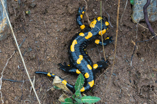
At the hut, I was glad to get out of my wet weather gear and go inside. I asked about accommodation, but found the hut was book out that night – by a big group celebrating a birthday. This was a shock – after being the only guest in many huts on the previous sections. I had a nice cup of tea and thought what to do. The next hut, according to my guidebook was 4 1/2 hours away, and in bad weather….. I was not too keen to move. The hut keepers – a young girl and her grandmother told me about another hut – at Preval, only two hours away. This didn’t sound too far, and it was only half past two. So – I put on my parka again and set off. As I walked he rain got heavier and heavier! After I had walked for nearly an hour, I though it would be wise to turn back. As well as the rain – in the forrest it was quite dark, and the track was very slippery as well. But I pressed on regardless. At one point I had to climb up quite a steep slope using tree roots – hmmm interesting. A bit further I spotted a black and yellow salamander. it was one creature that could enjoy the weather! It was far too wet to get out a camera and try and photograph it. Eventually I arrived at the planina of Preval, and did find the hut. It was a large shepherds hut. I knocked on the door and was made welcome. As well as the couple that owned it, there were some other farmers inside enjoying the fire and a drink. They did have beds and could give me dinner and breakfast. At Preval I enjoyed some very nice hospitality. I think all the food I had, except for the beer was made on the premises.
View from Preval
More bad weather the next day – day 15. So I only did a short walk – to the next hut – Roblekov dom. Breakfast at Preval was early – 6 am as the farmers wife had to look after animals, and I was away by 7 am. On the way I saw another three of the black and yellow salamanders – and this time managed to get some photos. I was also interested to read some information boards about how the local mines provided manganese, which was added to steel for the first time in then world, at local steelworks in 1870. This made the steel more elastic.
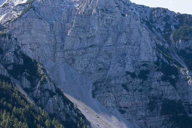
Old mine
I arrived at Roblekov dom at 9 am, and found things fairly quiet. Bad weather was keeping people away. I could see that if the weather cleared this hut would have an amazing view – and I found that was indeed the case the next morning. I had a lazy day at the hut – mainly reading my kindle. Overnight it snowed, and I awoke to a cold clear morning. it was going to be a fantastic day!
Roblekov dom

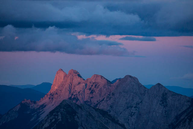
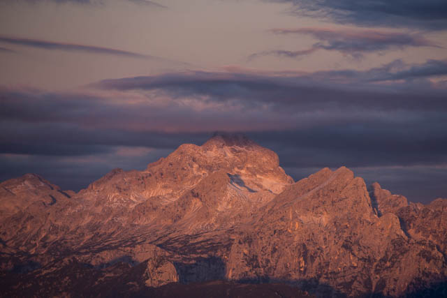
Triglav
Stol and the next hut (on the left) after fresh overnight snow
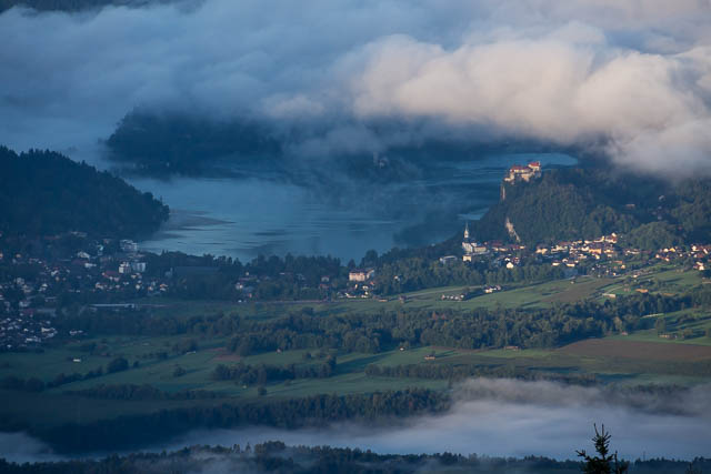
Lake Bled
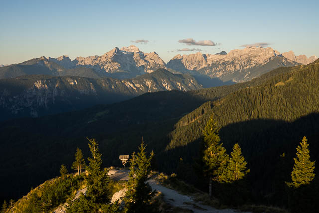
it was nice to watch the sun hit Triglav- the highest point in Slovenia, and in the heart of the Julian Alps. After morning photos, I made my way along the next section of track. It looked easy on the map – but it did traverse steep country – so that meant more cables and spikes. That took me to a nice green valley and then a nice uphill walk up another valley and then steeper up to near the summit of Stol. It was only the last part of the climb that was tricky – the snow was a bit icy.


Stol (2236 m) is high enough to generate its own weather – and it was quite misty while I was on the top and at the hut.

Me on the summit of Stol
The hut – the Prešernova koča is on a high shoulder of the peak and only ten minutes from the summit. The hut offers outstanding views and I was hoping the mist would clear by evening. It did! And the next morning too was clear.


Day 17 was a really nice day of walking. Just about all the walking was slightly downhill – and along the crest of the Karavanke Alps. So fantastic views all day.
The hut that night was the Koča na Golici. Again it is well situated high on the side of a hill. At the hut I met a nice German couple who were on a seven day hike.
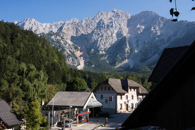
The last day of this section of the walk, was along more of the Karavanke Alps and then an easy descent down to the town of Dovje and then across the river to the slightly larger town of Mojstrana. I again use the very helpful tourist office to get some accommodation – at a nearby hostel, which happened to be next to the very interesting Alpine Museum.
More photos of this section can be viewed here and here
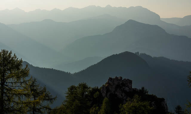
The Julian Alps
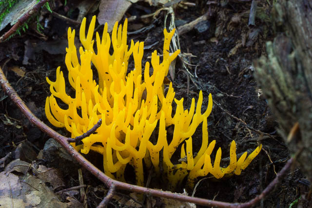
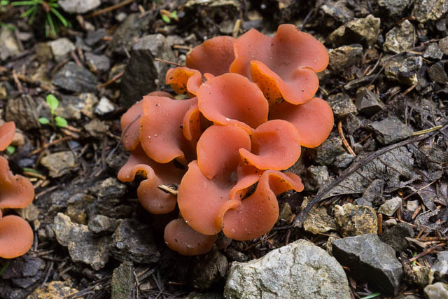
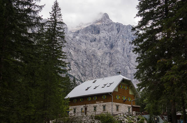
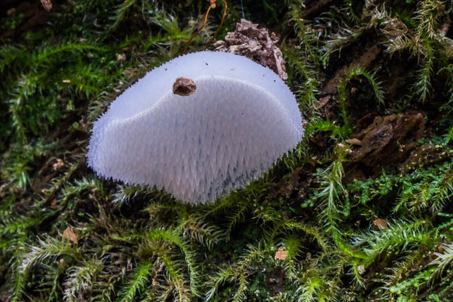
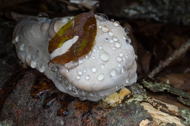
The first day of this section, my 19th day out, was a short walk up the Vrata River Valley to the large Aljažem dom. This was a pleasant walk, mainly along tracks close to the river. The spectacular waterfall – Slap Peričnik was well worth seeing. Also interesting were the sections of galerija – or galleries – limestone cliffs that he track passed under. I arrived at the dom for lunch and then spent the afternoon wandering around the valley taking photos – mainly of the interesting fungi that was out. The setting is very impressive being within the steep walls of a deep U shaped valley.
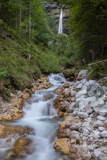
Slap Peričnik
The next morning, I was away by 7:30 and heading up the valley.
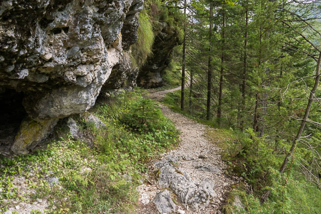
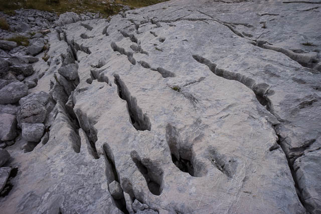
I started out on the very steep Praga Route – which climbs up the side of the valley using many cables and spikes. It was also the home to many ibex. As I climbed, it became very misty. The steep part continued for a long way and then brought you into gentler terrain. But this was a karst landscape – and not simple to walk through. You had to look out for markers and then carefully make your way towards them being careful not to fall down a sinkhole.
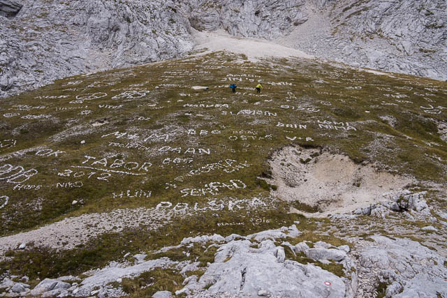
I soon arrived at the huge and crowded Triglavski dom. The way to the summit of Triglav (an hour away) was very misty – and when the mist cleared a bit – there were hoards of people queued up waiting to use the cables. I didn’t see any point. So after a cup of tea I continued to the Dom Planiki – another crowded hut. This time I had coffee and continued on my way. I had lunch further along just above a huge flat area – full of stone arrangements – mainly people’s names spelt out with rocks.
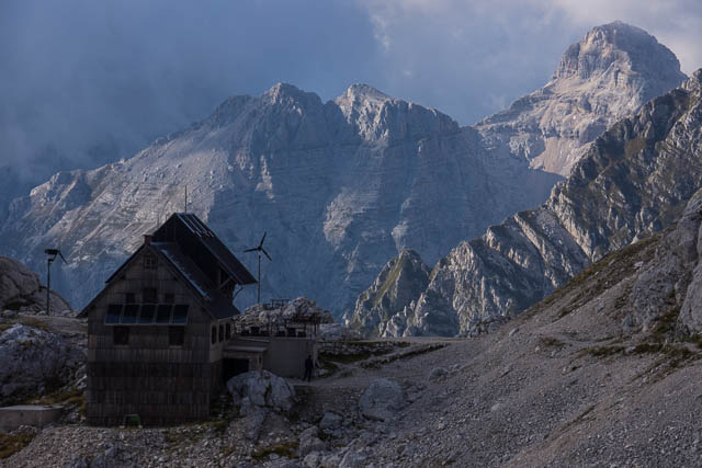
From there it was not far to the Tržaška koča na Dolič. It was not too crowded when I arrived – but I was lucky to get a bed as a lot of people had booked accommodation there. This was another hut with an incredible location – built on a saddle, high up between the peaks.
From Dolič, I headed off the next morning along an old WWI army road carved into the side of the hill. Very impressive! Lower down it made a very long series of switchbacks to reach the valley floor. I was now not too far from the town of Trenta. I stead of continuing down, I climbed another valley and then up another old WWI road to the Zasavska koča na Prehodavcih.
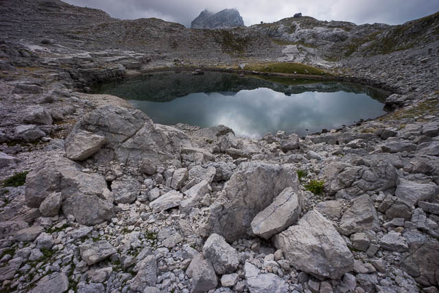
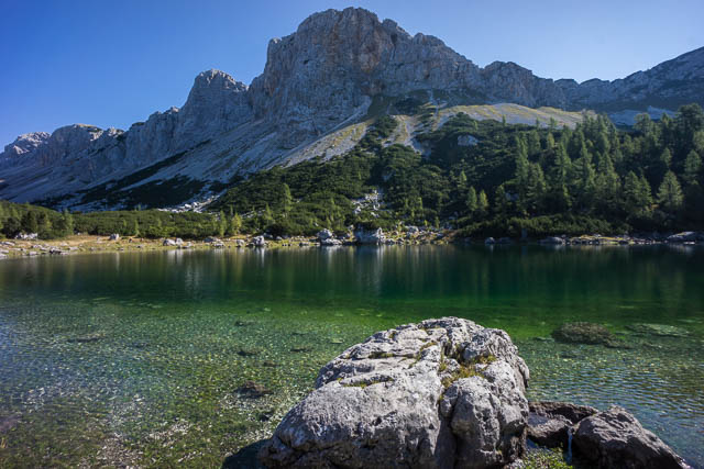
Near the hut was the first of the Triglav Lakes. These lakes are interesting being in limestone country – they have no obvious outlets. The water vanishes underground somewhere. Grazing nearby were some ibex. The landscape is very marked by karst features.


The Zasavska koča na Prehodavcih is built on the shoulder of the mountain and offers amazing views – at least when the weather clears – which it did on dusk. At the hut I also met again, Wim and Janita, two walkers from Holland that I had talked to at the Aljažem dom a few days earlier. We had another pleasant chat.
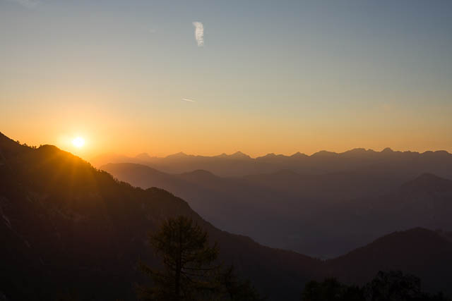
 By the next morning, all the mist had gone – it was a beautiful dawn.
Day 22 was a very pleasant walking day – great weather, easy walking – the path led gently downhill just about all day and interesting scenery. I started by walking down past the rest of the Triglav Lakes, which nestle is a really beautiful valley, and then over interesting kasrt country full of dolines to arrive at the Dom na Kolmi.


The hut was huge, which is not surprising as it is a short walk from Bohinjsko Jezero – a very popular lake. The hut also had wifi! But more importantly it had great views of the surrounding peaks and lakes. It was possible to see Triglav from the terrace, and telephoto photos showed the summit area pack with about 100 people! But at least this time it was a fine day and they would have had a great view.


The hut was quite crowded that night – with a big parties of young girls and their mothers arriving. I talked to two hikers from Oregon – Frank and Julie, an interesting couple.
The next morning, I set of on my last day of walking – day 23. I headed down an easy track to Bohinjsko Jezero and then caught a boat across the lake to a small town. On the boat I and met a couple from London, and we shared a taxi to the nearest big town – Bohinjska Bistrica. There, I stayed overnight at a hotel and was happy to be out of the mountains. It rain a lot overnight and the forecast was not good for the next few days. The next morning, I headed back to Marribor by train, for a short rest before travelling to Germany for the next part of my trip.
You can see more photos of the Julian Alps here and here.
Hello,
Thank you for the detailed description of the Transverzala. I’m interested in doing it as well.
I’m curious if you needed to use mountaineering equipment (helmet/self-belaying device) or if you just hike the whole way?
I’m also wondering if there are often alternate routes if I don’t want to climb peaks?
Thank you!
The routes involving the use of Via Ferrata gear are all avoidable I would think – but then you may miss out on some of the best sections. I did carry a harness and the other stuff but didn’t end up using it. All the “assisted” sections I traversed I was happy to do unprotected (and carrying my backpack). The maps show a lot of alternate routes and show the more difficult sections. And the guidebook I used was helpful.
Hello and thank you for this description. It sounds amazing and the photographs are stunning. We’re off to Slovenia next week walking the route for 3 weeks. I have one question regarding the need for helmets. Are they necessary? Did you carry one with you? In any case, thank you for your blog which was very helpful.!
I cannot recall exactly – but I think I didn’t take a helmet. A bit bulky?
Hi Thijs, it is absolutely recommended to use a helmet in the rocky parts of the Julian Alps and Kamnik Alps. Summer is peak hiking season and there’s a lot of people on the trails which causes rocks to crumble and fall and you certainly don’t want to get hit in your head. I’d say a helmet is perhaps more important than the harness.
Did you reserve each one of the mountain huts you stayed in ahead of time. Planning on hiking it in middle of August and am not sure if I should book ahead. Thanks
I didn’t book – and most of the time I had no trouble getting a bed. Many times I was the only person staying overnight (this was midweek, on the quieter parts of my walk). But some huts were full – and I had to walk to the next hut. This occurred when huts were booked for special occasions like a birthday party. The huts in the Julian Alps were often quite full.
Hi Dave,
My husband and I want to hike the Julian Alps next September. Can you recommend a way for me to find out which huts I should stay at and how to make a reservation with them?
Thanks,
Cara
Do you have a guidebook? They can be useful for huts. You can use the Slovenian Alpine Club’s site to get information on the huts.
Hi Dave. So glad to have come across your blog – very helpful indeed! I was hoping to ask your advice. I am thinking of solo-hiking the trail this summer and wondered what level of experience you think someone needs to do the trail (including the more difficult bits). I have done a fair few self-supported hiking trips, but never done any climbing/via ferrata. Planning on having a practice/training weekend here in the UK before I go. Do you think that would constitute sufficient experience?
Thanks
Fred
Hard to say, but you can always walk down to a village if thing get too hard.
Hi Dave
There is an update to the Cicerone guide ( by the same authors). “The Slovene Mountain Trail: Slovenska planinska pot”, released March 2019.
I have it on kindle for a 2 week walk this autumn. Trying to decide the best section to do but I expect we will just start at the beginning with view to returning in another year to continue.
Chris
Its all good (the sections I did), but the high mountain section were probably the best parts. But the lower mountains and plateaus were nice and certainly interesting.