
It is interesting, and disturbing, that in the discussions that have come up regarding the recent pollution spill from the Clarence Colliery into the Wollangambe River, there have been questions asked about whether one of the iconic features of that area – Goochs Crater is within Blue Mountains National Park (and the Greater Blue Mountains World Heritage Area).
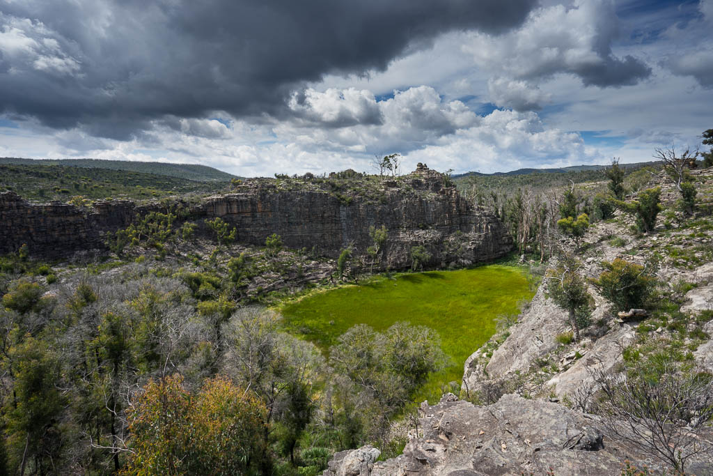
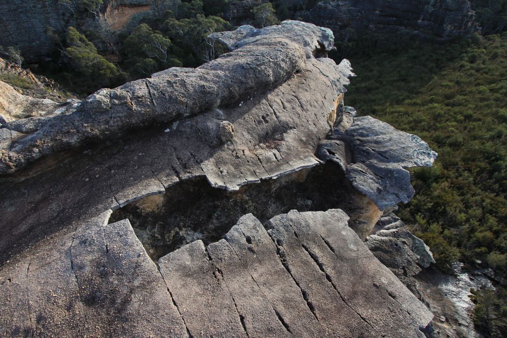
Goochs Crater
The Gardens of Stone were originally proposed for national park back in 1986 (as extensions to Wollemi National Park), and that original proposal included features that were at that time unprotected like Rocky Creek Canyon and Goochs Crater. When the Gardens of Stone National Park was declared neither of these features were included in the park, but Rocky Creek Canyon had been added as an addition to Wollemi National Park.
I had assumed that Goochs Crater was unprotected and still part of Newnes State Forest (and part of the Clarence Coal Mining Lease). But when the nearby part of Blue Mountains National Park was closed just after the October 2013 bushfire, I checked on the map to ascertain whether the Crater was in the park, and found that it was. This was a pleasant surprise. I thought that it must have been added at some stage.
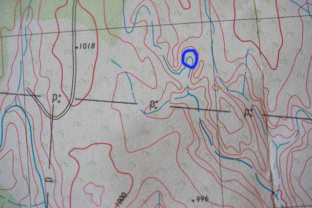
First edition Wollangambe 1:25,000 map. Goochs Crater marked in blue. The P line marks the park boundary – below the line is within the park.
But is the map accurate? The map I was using for this was the latest topographic map – the third edition map Wollangambe 1:25,000 map. This map shows Goochs Crater is clearly within Blue Mountains National Park. But the first edition of that map shows it is not in the park. So which map is correct?
Some cartographers have recently been using digital data to plot the actual national park boundary. According to them, the (added my me) red line on the map below shows the park boundary, it is not along the green line shown on the map.
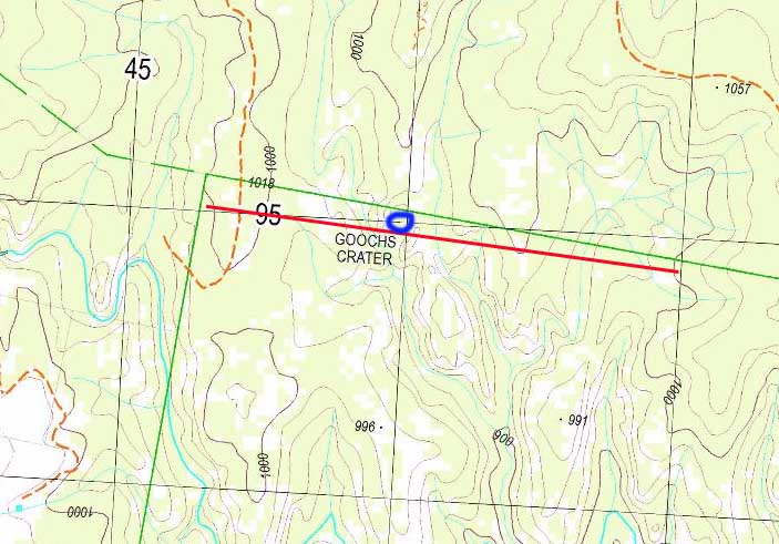
Third edition 1:25,000 Wollangambe Map. The added red line is closer to the actual national park boundary, not the green line that is on the map.
So, it looks like this very special and important feature – Goochs Crater is not protected in Blue Mountains National Park, nor is it in the Greater Blue Mountains World Heritage Area. This is something that must be remedied.

Pagodas near Goochs Crater
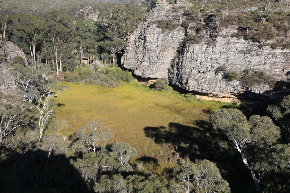
Around Goochs Crater is a complex of pagodas. Most of these would not be protected. There is an aboriginal art site in a cave just to the southeast of the crater. It probably lies within the park. I think a nearby canyon – Billabong Canyon is too close to call.
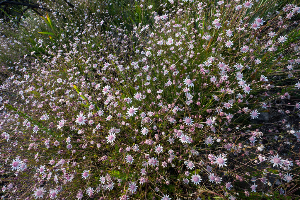
Pink Flannel Flowers at Goochs Crater
Delicate rock formations at Goochs Crater
Goochs Crater
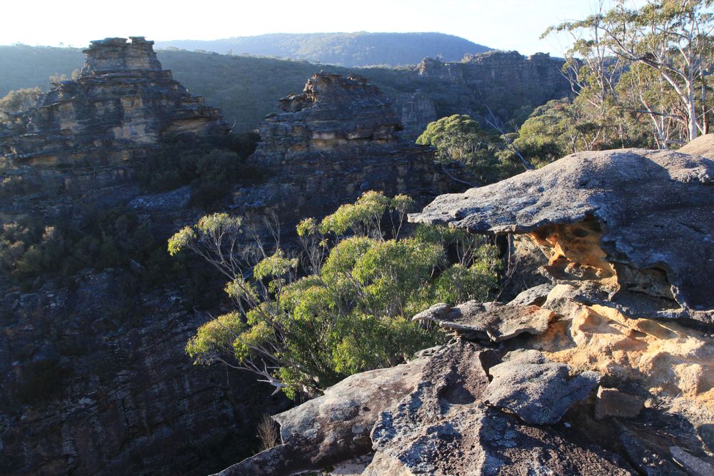
Pagodas near Goochs Crater
Hi David
Goochs Crater is within the Blue Mountains National Park
I had a small part in helping the Springwood Bushwalking Club have the name officially gazetted by the NSW Geographical Names Board (I have all the correspondance) one part of the naming process is to have the land on which the feature resides give their input and permission for the name. In this case it was sent to the NPWS, (2004).
The Wollangambe Topo map 2nd edition (2006) shows the boundary of the park and the Newnes State Forest aligned as it should ie NPWS northern boundary and SF southern boundary. With Goochs Crater within the BMNP. Yes early editions can have different boundary lines. One part of the cartographic process was to check and change where necessary any statutory changes made to Administrative boundary’s.
Regards
Brian
Hopefully the LPI which looks after the information defining legally defined boundaries can manage to combine it with their terrain information. Did the boundary of the park change between the two map versions or did they make an error with the first?