
I headed up the mountains with Bob to Medlow Bath. Bob was keen to check out some of the old walking tracks behind the Hydro Majestic Hotel. I had been on those tracks once before and I too was keen to visit some of the places that we missed on that earlier trip – in particular the Colleseum (this is the spelling on the topo map), a large cave below the lower cliff line near the Hotel.
Marks Tomb
It was also forecast to be a wet day, and this walk offered a number of overhangs in which we could shelter from the rain from time to time. It turned out to be a good choice – there was a fair bit of rain on the day.
We started from Belgravia Road, and set off along the Wonderland Track and first visited Marks Tomb, which lies down a side track a short way from the Wonderland Track. Leading Sydney retailer Mark Foy, who owned the Hydro Majestic Hotel is reported to have wanted to be buried in this cave. He wasn’t buried there, but the cave still carries his name.
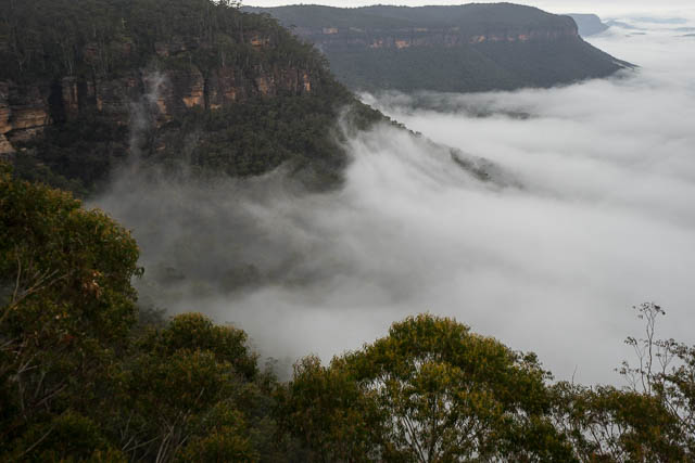

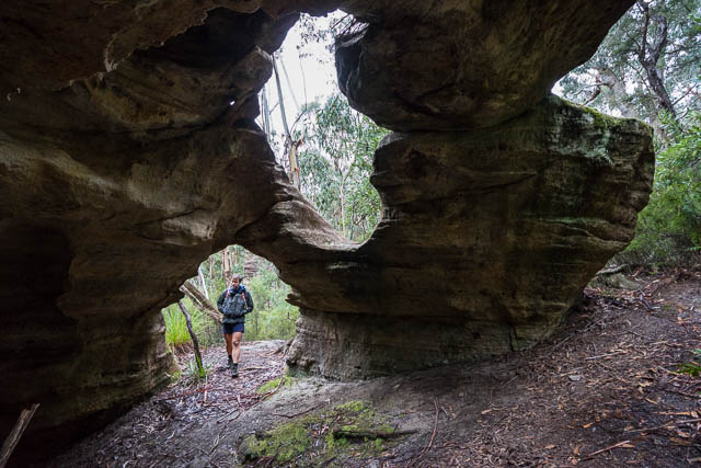
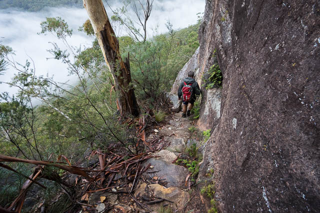
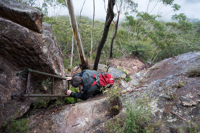
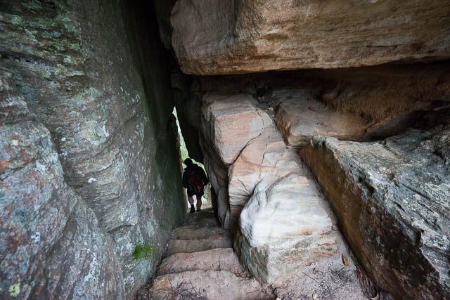
We then backtracked a bit to near the Sunbath and went out to Tuckers Lookout. Despite rain and mist we had some quite good views overlooking Megalong. To get to the Colleseum, you need to climb down to below the bottom cliffline. I knew the way to the half way ledge – I and been down there on some climbing trips. The track continues past the climbing area and descends very steeply down Sentinel Pass. From above it looks like you are approaching a huge abyss and there appears to be no way down. But the track cunningly descends via a few tunnels and connecting ledges and utilises a steel ladder at one point – and seen reaches the bottom of the cliff. A very nice pass. We would later go back up the same way.
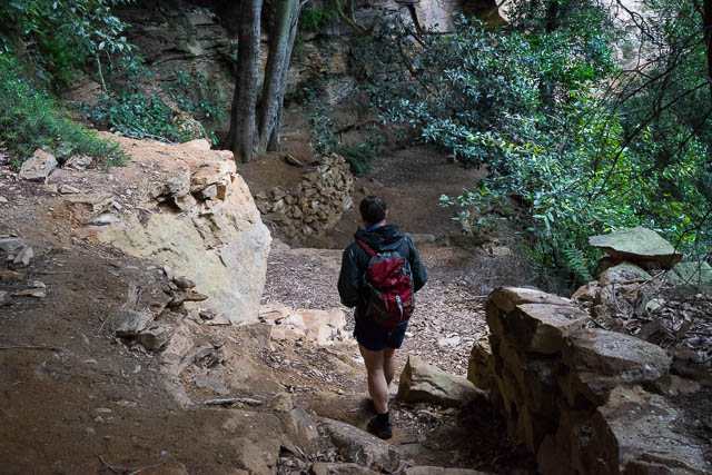
We continued under the cliff, and above the talus slope to soon arrive at the Colleseum. This is a huge overhang. In the cave is some very old looking dry stonewalling and an old rock table. The track, now called Murphys Track continues past the cave, descending on old stone steps near the creek, then crosses the creek and follows a benched path around the forest and heads towards the open farmlands of Megalong. We followed the track and took a branch that led back to the base of Sentinel Pass.
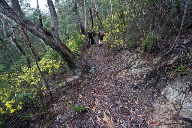
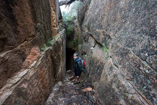
Next, we then climbed up Sentinel Pass and at the top, took the turnoff to the Sunbath – and old, but now dry,swimming pool. Nearby was an interesting Bower Bird bower with a huge array of blue objects. The track continues along the tops of the cliff line, passing more climbing areas. It was now raining a lot heavier, and we were reluctant to pull out the map to check where were going so we missed the runoff to the Underworld, another climbing area well protected by a cave – which we thought would be a dry place for lunch. Instead, we kept going and found ourselves below the Hydro Majestic Hotel. From there we could reached the Underworld via another track that descends a narrow slot at one point.
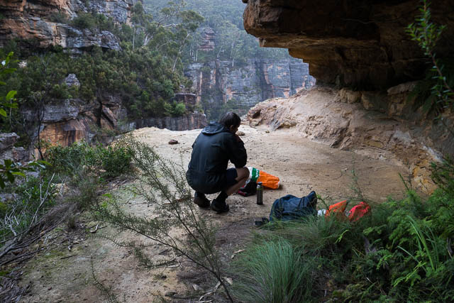
The underworld was a good lunch spot. We found a nice dry overhang well protected from the wind and rain and had a quick lunch stop.
Next, we walked back up towards the Hydro and then around to the top of the old Flying Fox. Again, in the rain and mist we missed the more spectacular Glen Rosa Track which passes Maxines Bower – another interesting large cave.
Our last point of interest was the Three Brothers – a rock formation a bit like the better known Three Sisters (but not as spectacular). From there, it was not far to walk back to Bob’s car via the highway.
Bob’s GPS trace –
[map style=”width: auto; height:400px; margin:20px 0px 20px 0px; border: 1px solid black;” gpx=”http://www.david-noble.net/blog/wp-content/uploads/2015-06-16-Walk.gpx”]
More photos from the walk are online here. For more information about the walking tracks see Allan Wells site and Tom Brennans site here and here.
Hi Tom
A wonderful site of detailed information. At present along with my brother John and Mike Keats I am doing a total revision of my book of the place names in the Blue Mountains. There are so many new names I have found in relation to the back of the Hydro, unfortunately most in name only. One name Tuckers Lookout in which I had placed on the Katoomba Topo Map, I have now realised I had placed in the wrong position, that location was called Pulpit Rock, Tuckers Lookout was top of the cliff line in what is now the Mazda dealership. Well done on the map you have produced of this area. I have an old mud map in which John Webb had drawn which showed Tuckers Lookout which is where I wrongly assumed the position, but correct position helped by Trove and a former long time resident of Belgravia St, Medlow Bath, John King (who constructed the Kings Link track at Springwood)
Cheers
Brian
Hello Dave,
Have you been here recently?
FYI, there’s been a landslide since the above was written, so the track to the Colleseum isn’t as easily found as mentioned above. However you can carefully transverse the landslide.
No – have not been there recently, but I have head that you can get past it – with some effort.
Yes I went past it, and still an interesting walk. I just didn’t expect to come across it but I should have kept in mind you visited 6 years ago!