
The walk down the Grose River in one of the classic bushwalks in the Blue Mountains. This is one walk that I have never done, and one that I had saved up from my early bushwalking days, and thus keeping it available as one that I could do some time in the distant future. My philosophy was that there would still be some walks that I had not done in the Blue Mountains. Another walk in the same category, that I have deliberately avoided doing, is the Jenolan River downstream from Jenolan Caves.
Keith Muir, the Director of the Colong Foundation for Wilderness had organised a walk down the Grose River over the Easter period and he invited me to join him. Perhaps it was the right time to finally do this walk? Two others were also keen to come along – Alex and Wendy. Perhaps though, we should have looked at the weather forecast a bit more carefully. As it turned out we had a lot of rain, and had to abandon our original goal to go down the river as far as Faulconbridge Point. But we still had an excellent walk in great country.
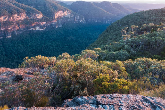
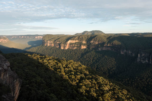
The Grose Wilderness Area can be thought of as a “pocket” wilderness (like the idea of a pocket battleship) – it is a relatively small area, but it still has a great feeling of ruggedness and remoteness. I had visited the Grose River below Blue Gum Forest on a few occasions – the first bit, a lot on early Mt Hay Canyon trips. The original exit was to go down the creek all the way to the Grose River, and then walk upstream to Blue Gum and climb out of the valley via Lockleys Pylon. I had also visited the river at the junction of Hungerfords Creek on a bush walk back in the 1970’s. Another trip I remember was a walk from Leura, to Mt Hay and then along the ridge to Mt Whitton, then descending to the river at the Wentworth Creek Junction, a short walk downstream and then climbing out at Faulconbridge Point. Further downstream I had visited on a number of trips.
So most of the walk should be new country for me. I was looking forward to it.
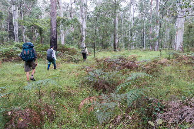
We set of after meeting up at Blackheath and getting a lift to Perrys Lookdown, thanks to Wyn Jones. Then down the steep steps to Blue Gum Forest, and then off along the first bit of the Lockleys Pylong Track to Govetts Creek. Once across, we could start off down the river. Keith had been down the river at least twice before on earlier trips and he told us we could stay all the way on the true right bank.
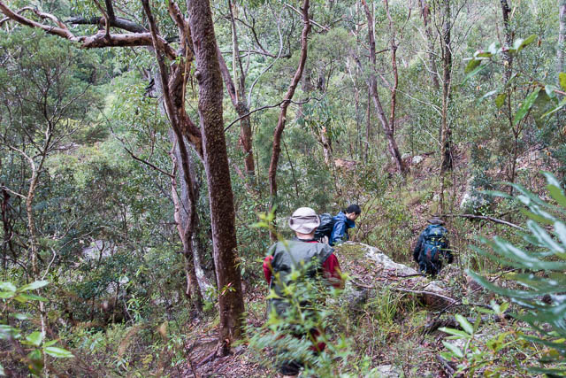
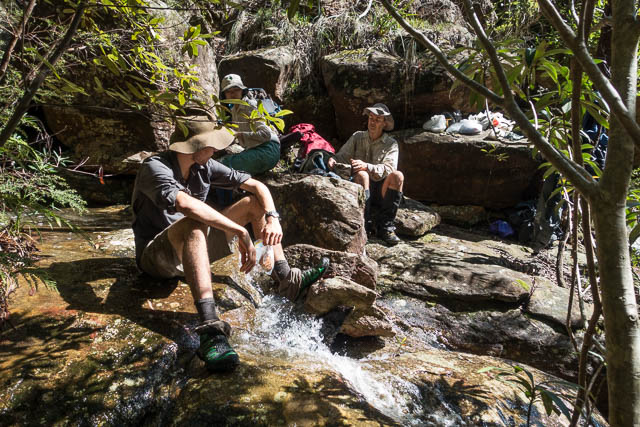
At first the going was reasonable. There was no track, but the country was fairly open. We had gaiters on, and most of us wore leather gardening gloves. Both provided good protection from the odd patch of Lawyer Vine. Most of the way we walked in light rain.
At the bottom of Walfords Gully, there were some large open flats. Many Blue Gums were growing. A nice place that would have been an excellent campsite. We kept on our way. At Rocky Points Ravine (the creek that flows through Mt Hay Canyon) we stopped for lunch. We drank water from the side creeks rather than the main river, to avoid pollution.
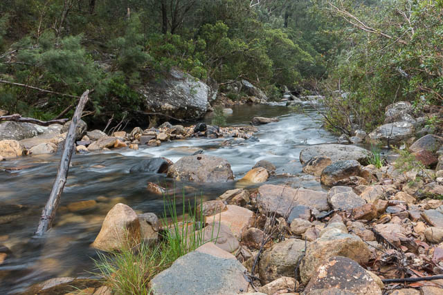
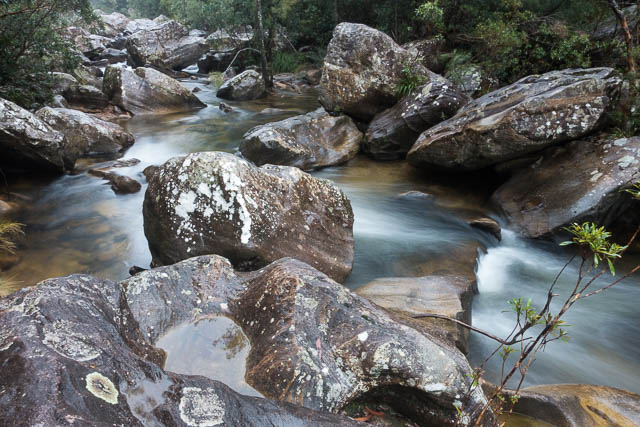
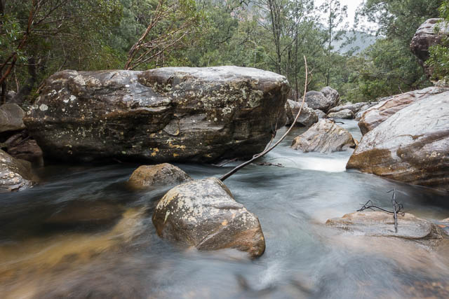
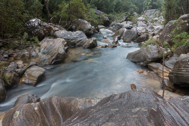
Further downstream, the going was a lot harder and slower. In a few places we could find short sections of the Engineers Track, but it was largely either completely overgrown or had been washed away. The riverbed was quite slow – with large boulders that were very slippery due to the rain. So our walking was a mixture of the riverbed or along the steep scrubby sides.
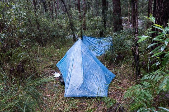
Campsites were very scarce. We seemed to find a reasonable one every hour or so. A little after 4 pm, tired of walking in the rain, we stopped on a nice terrace and decided to camp. There was just enough room for our tents and another spot were we could light a fire. There was no side creek to provide good water, but there were some large rock pools on a large boulder in the river. As we set up camp, the rain stopped and it held off till later in the evening, after we had cooked dinner.
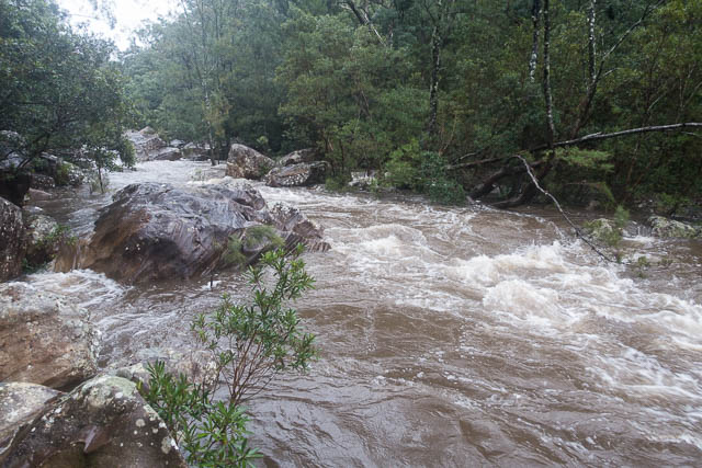
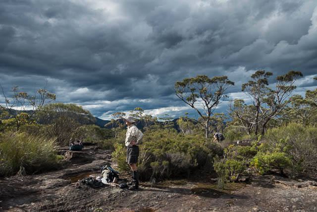
Overnight it start raining again. And there was a lot of rain. It kept on raining, continuously, right through to the morning. When we awoke, we found the river very high and some of our gear wet. The rain seemed to show no sign of slowing – so we decided it was wise to abandon our original goal. We could escape from the gorge via the nearby Shaws Gully if we needed to. So we stayed put.
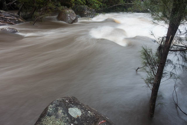
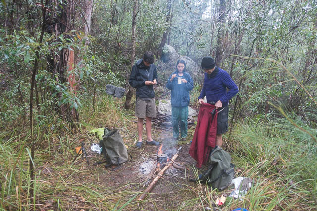
I spent most of the day in my tarp. Relatively dry. Cramped but comfortable. Keith, with a wet sleeping bag, was keen to get the fire going and eventually succeeded in very trying conditions. The Grose River was very spectacular. It looked ideal for packrafting. But no doubt would be very dangerous with so many large boulders and logs in the riverbed. Also spectacular were a series of large waterfalls coming down off the cliffs on the north side of the river.
Late in the afternoon, the rain eased a lot and towards dusk eventually stopped. Next morning we awoke to clear blue skies.
With our revised plans, we didn’t have to hurry too much and enjoyed a slow walk down the rough section to the bottom of Shaw Gully. This was only about 1.5 kms downstream from our campsite, but took about one and a half hours to walk. The first half hour was very rough going. Perhaps the slowest section of the river?
Then it was easy going, climbing up Shaw Gully. The creek was flowing a lot so we couldn’t walk up the creekbed, but it was easy to climb next to it (on the western side). Then is was more easy going up a short steep section at the cliffline – the section known as Byles Pass, after being pioneered by early bushwalkers Marie Byles and Margery Shaw. An alternative name for this creek/pass that was used by the Kameruka Bushwalkers back in the 1960’s was “Y Creek”. This is due to the shape of the creek on the map. We climbed right up the creek to the Y and then up the ridge between the two branches. It was easy going all the way – and not too scrubby.
Checking up on the history of this pass. According to Andy Macqueen, in his book “Back From The Brink”, it seems that Frank Walford knew about the pass. He wrote about it in 1928. But Macqueen thinks that he probably did not discover the pass. A baker by the name of Morris used the pass well before 1930 several times to access the river for fishing trips. He referred to the creek as “Y Creek”. The Byles/Shaw party ascended the pass in 1935. At that time no one seems to have known the exact location of the pass, and they first tried to find it from the top without success. On a later trip – a long daywalk from Leura, they walked all the way out to Lockleys Pylon, down to Blue Gum Forest, then down the river till they spotted a likely gully, which they climbed and reached the tops. Then they walked back to Leura along the Leura to Mt Hay track.
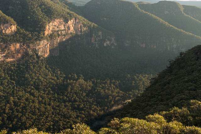
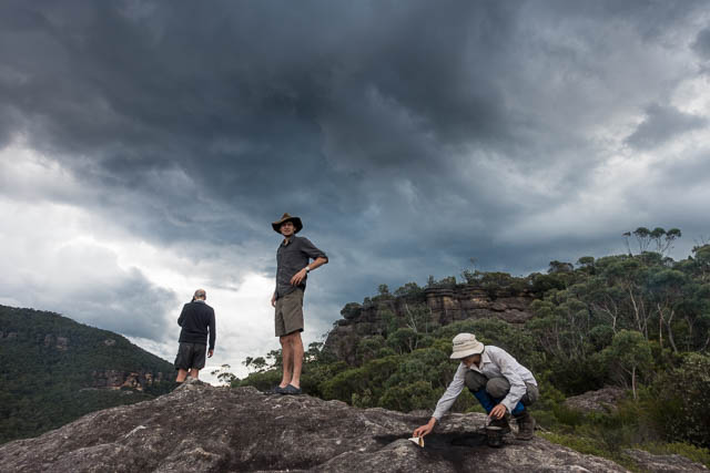
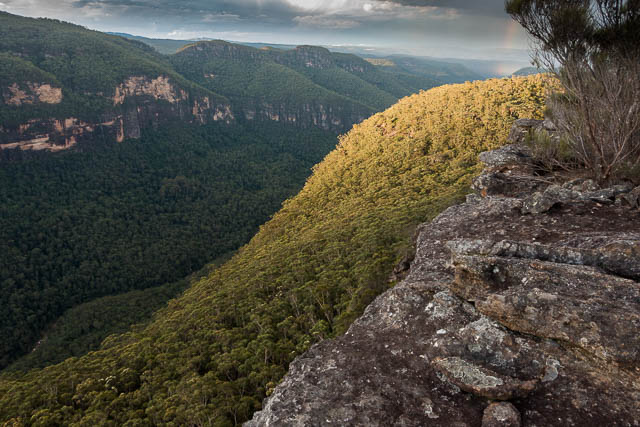
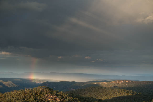
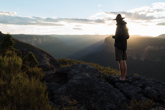
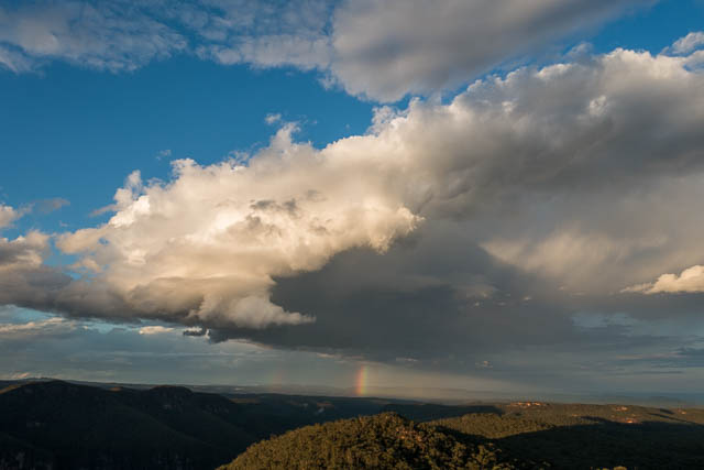
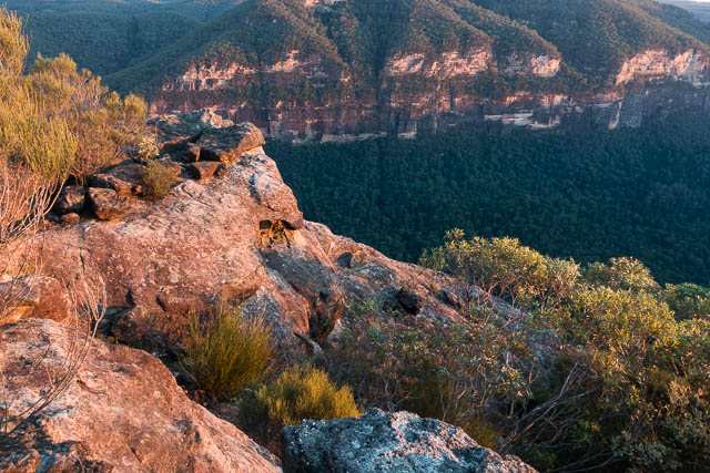
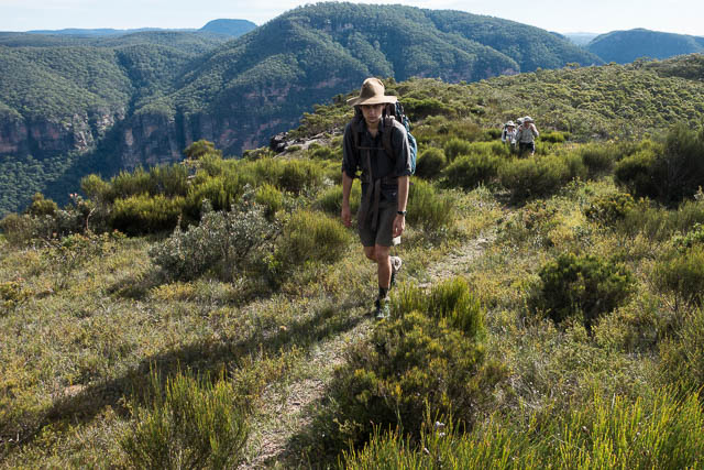
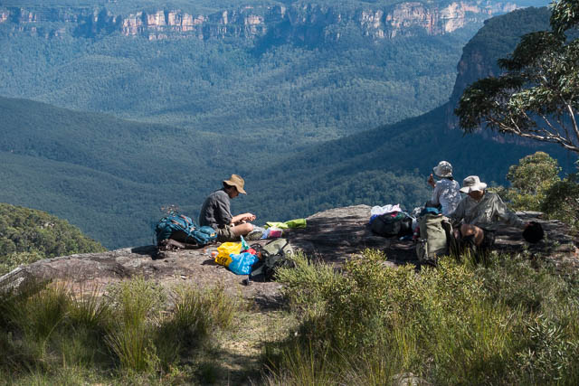
Next was some ridge walking, heading to Mt Hay. Part way, we stopped at a very nice campsite right on top of the Boorong Crags. We could obtain good water from the many rockpools on the platforms around about. We also had great views in all directions. We could look east and see the distant buildings of Sydney. To the north was the Grose Valley – very impressive in its deep gorge. Overhead a storm was passing by. It seemed to miss us.
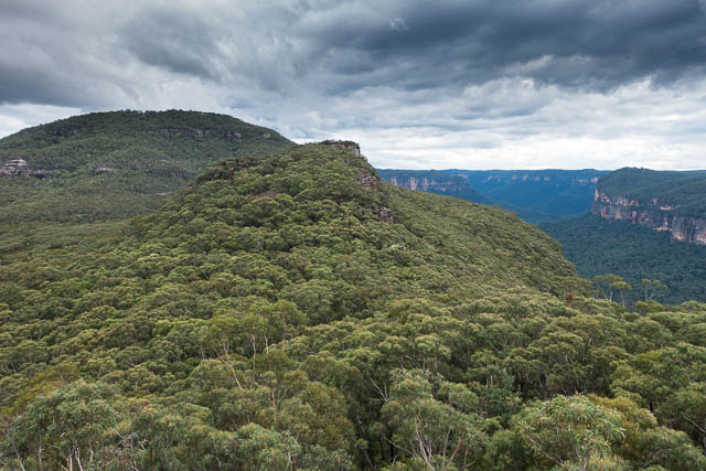
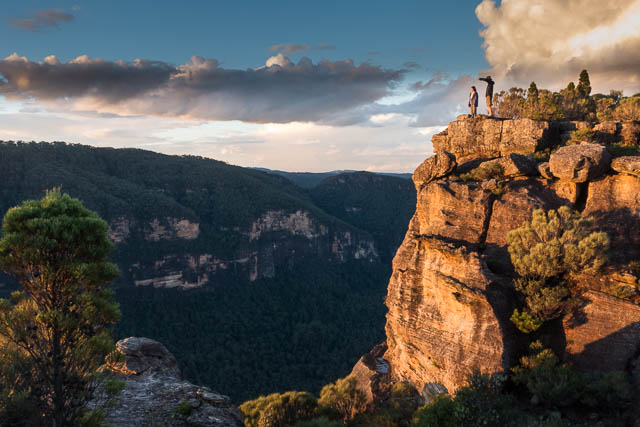
Boorong Crags and Mt Hay
The storm passed over and the sky cleared. We had a very pleasant sunset, and next morning a nice sunrise.
At our highpoint, Keith had managed to make phone contact with Wyn, and he was going to drive out and pick us up from the end of the Mt Hay Road. So our walk that morning would only be short. We packed up and soon found ourselves on the way to Mt Hay. We could now follow a faint track and so the going was faster.
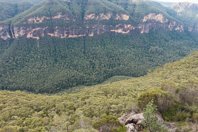
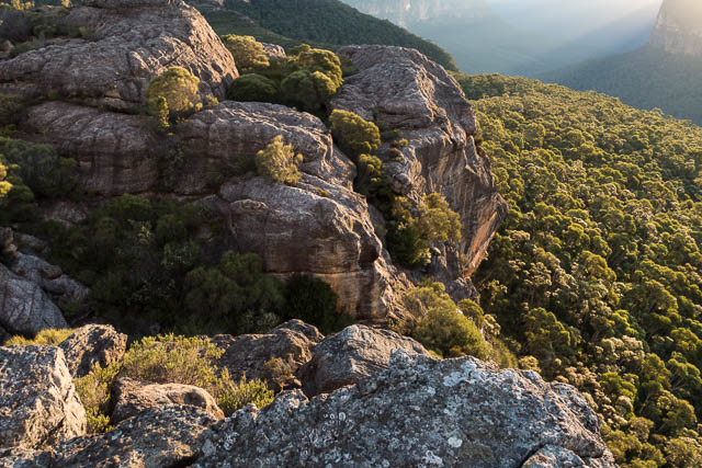
On the way we passed a large gully, and we speculated if it could be used as a pass. We though that if it could, then it would have surely become well known. When I got home I checked on this. Looking up some old notes, I found that it was explored by the Kameruka Bushwalkers back in 1963. Jeff Boyd had led a party down the creek, and they had to asbeil a few times. They called it Shedju-Struya Canyon. It must have been more effort than it was worth as the trip was never repeated by that club as far as I can tell. Andy Macqueen, in his book on the area – “Back From the Brink” mentions that Frank Bendeich also visited the creek somewhat later with members of the Catholic Bushwalkers.
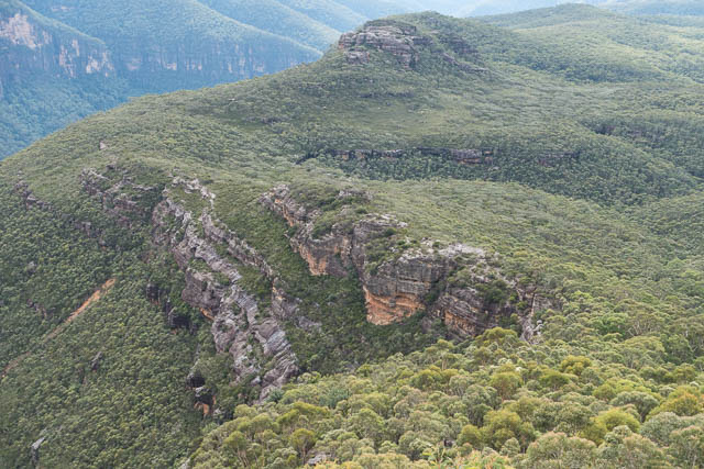
Shedju-Struya Canyon with Boorong Crags behind
We were soon over Mt Hay, and stopped for short break on a nice platform on the western side. Then it was not far to the carpark and finding Wyn there waiting for us.
Many thanks to Keith for organising the walk, and to Wyn for helping out with the transport. We did not achieve our original goal but we still enjoyed and excellent walk.
More photos are online on my website here.
Thanks for the excellent narrative and breathtaking pics. I live in winmalee and have ridden my bike around Bluegum Creek and Faulconbridge Pt. and although the landscape below has always enticed me, I have yet to walk it. Thanks for sharing – truly inspiring.