
It was good to head out to the Baal Bone – Blue Rocks area for the June Long Weekend once more. This is a great area for high camps during cool weather – and it is nice to go for at least three days.
This is beautiful country and it should not be rushed through. There is a lot to see, a lot to explore and for me a lot to photograph.
Wendy had organised this walk, and she was joined by Martin and myself.
On Saturday morning we drove out along the road up pas the swamps that are the headwaters of the Coxs River to the tops above the Wolgan Valley. We parked just before the road drops extremely steeply down towards Baal Bone Gap. Time to get out and walk.
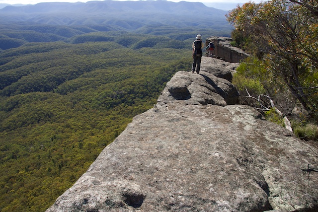
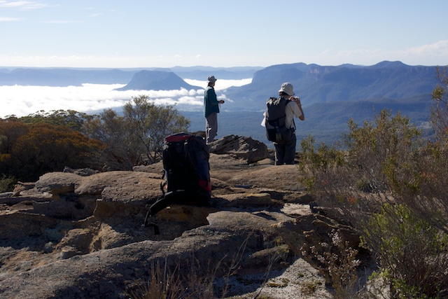
At Baal Bone Point, we filled up our water containers from the pressure reducing station, and left the roads for some off track walking out to Baal Bone Point.
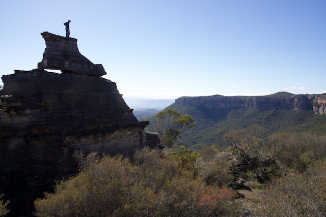
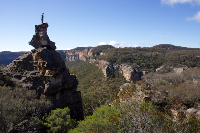
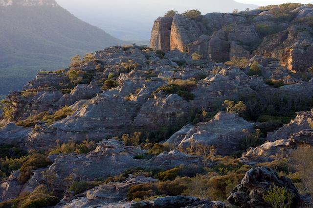
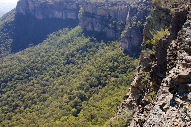
Its an easy climb up through cliffs to the heath above, then a short scrubby section to arrive at the boot shaped pagoda, time for a few photos, then open easy going all the way to Baal Bone Point for lunch.

It was disappointing on the way to pass some broken glass and a few discarded stubbies at a campsite part way out. A real shame! We were going the wrong way to volunteer to carry out this rubbish.
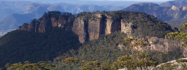
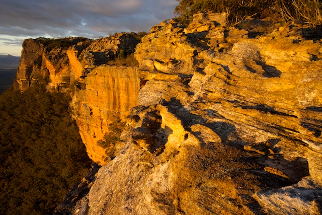
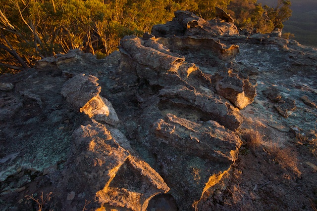
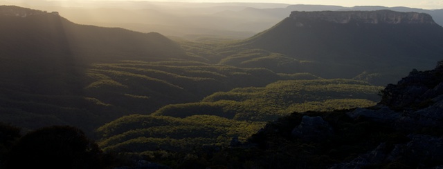
It only took us an hour to cross from Baal Bone Point to the top of Pantoneys Crown and that left plenty of time to set up camp and for me to take photos during the golden hour. It was a nice sunset. Meanwhile – another party of bushwalkers had arrived – two fellows who seemed to be in the army. They camped at a separate campsite not too far away.
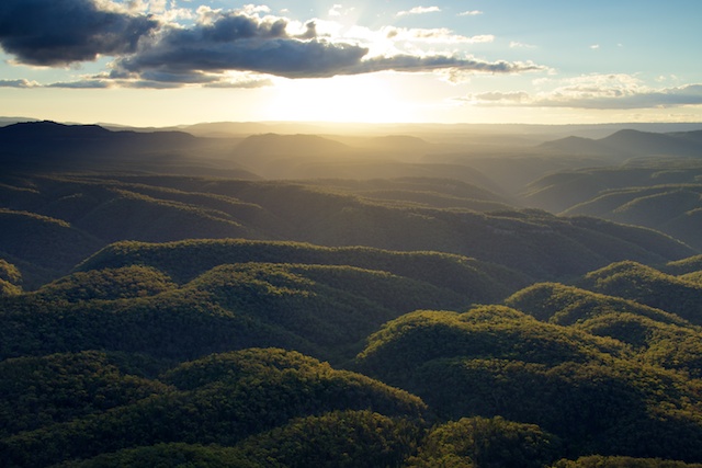
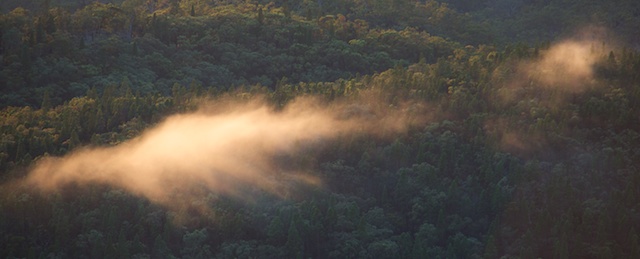
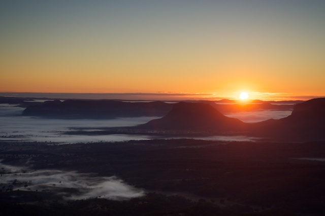
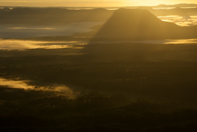
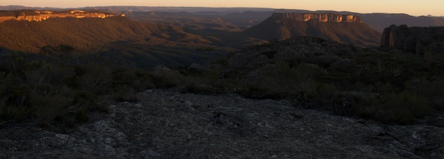
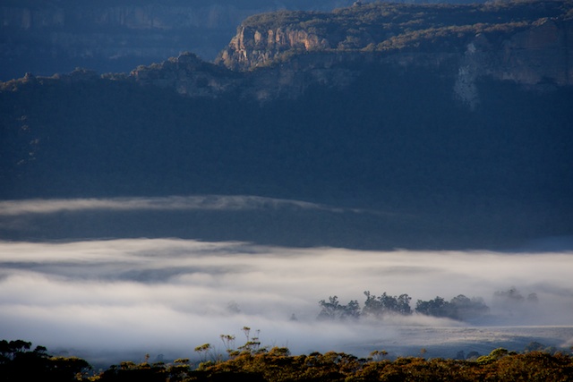
Sunday morning. I got up early and wandered along the plateau a bit to a good observation point to wait for sunrise. There was a tiny bit of mist in the Capertee Valley. More photos….


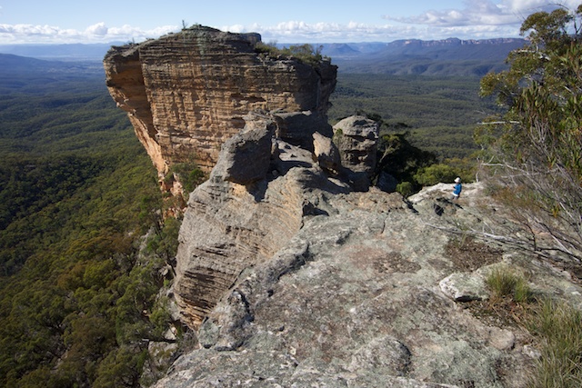
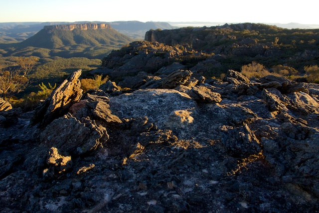
Then back to camp to rouse the others and have breakfast. We then packed and set off along the top of Pantoneys Mountain. This is easy to do – following close to the eastern rim. At the summit cairn, we signed the logbook, took more photos and then climbed down to the northern point of the mountain. A short way bad on the eastern side is the start of the descent pass. It goes through a bit of a tunnel to reach a ledge which you follow around to the north and little to the western side and then steeply down small cliffs and back slightly to the nose and more steep scrambling to reaching the talus slopes.
We then had to do some careful navigation to pick up the start of a long ridge that leads to Crown Creek. This ridge is covered in an ironbark forest, and many of the trees have red coloured bark due to some lichen or fungi. In places the ground is covered with coral lichen. Strange for a ridge that otherwise appears quite dry.

The ridge ends abruptly with a steep and rock descent down to the creek. Here you need to watch your footing. We had chosen a spur that took us to an upstream part of the creek, a bit above the Blue Rocks limestone outcrop (and caves). We thought there would be a better chance of finding water away from the limestone. Sure enough the creek was flowing nicely and we could refill our water containers. It was also a good place for a relaxing lunch.
Then, time to head up to Point Cameron. The ridge up is easy and very open for most of the way. The last section is quite steep and loose – more careful footwork to climb up to the cliff line. The we headed a short way around to the left to a steep but easy pass to the top.

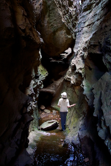
On previous trips, I have camped at Point Cameron, and it is a nice place to camp, but this time, with a smaller party, we had arrived too early to we pushed on over “The Domes” area – high rounded rock formations and then dropped into a large swampy area known as the Pondage. Nearby we explored a small canyon,
We then headed up to the Wolgan/Capertee Divide to camp.


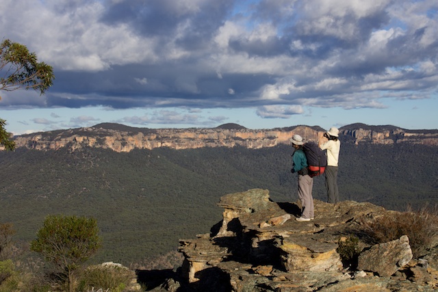
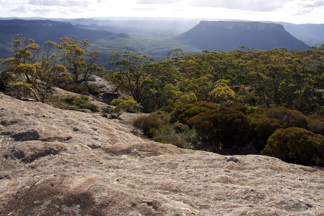
This was the same campsite we had used a few times last year – and is close to an interesting feature known as “The Exploded Pagoda”, a rocky area strewn with strange contorted rocks. It also has outstanding views, mainly of the Capertee Valley from Baal Bone Point to Pantoneys Crown and beyond. A good place for sunset and sunrise photography.
Monday brought us more fine weather and only a short walk back along the divide past McLeans Pass back to the car.
A very scenic and pleasant walk with good friends.
More photographs can be viewed on my website here.