
A few days before Easter a few trips were suggested in the Northern Blue Mountains, and just before we headed out one was settle on. Dave Williams had contacted the farm managers involved and we would be able to drive close to where we wanted to start walking. Also on the trip were Wendy, Martin and Michael.
So, on Good Friday, we drove into the Capertee Valley and later turned off onto a farm road, and after chatting with the farmers we parked at the base of the Red Rock Trail. This led into Gardens of Stone National Park. Not far along, we left the trail and climbed up the spur leading to Mt Harvey. This was straightforward but not always easy walking – some parts were scrubby, other parts were bouldery and we had to scramble up and around obstacles.

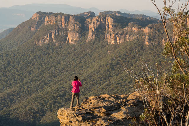
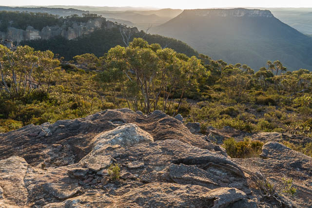
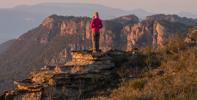
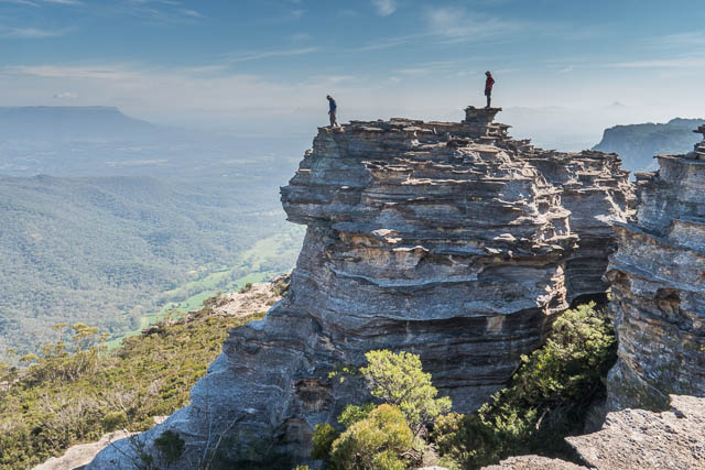
The last part of the climb to Mt Harvey was along an interesting ridge – almost a knife edge. The mountain intent was soon climbed and then we had a little more scrambling to get up the final bit up the summit rock. We had to be careful on top – there were quite a few bullants, and these ones had wings. Queen bullants? But the views made all the climbing worthwhile.
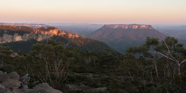
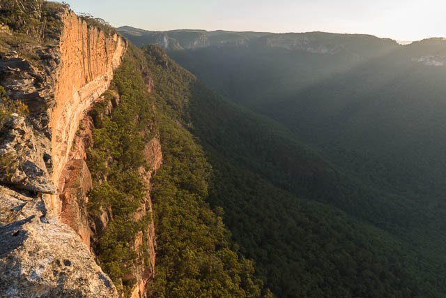
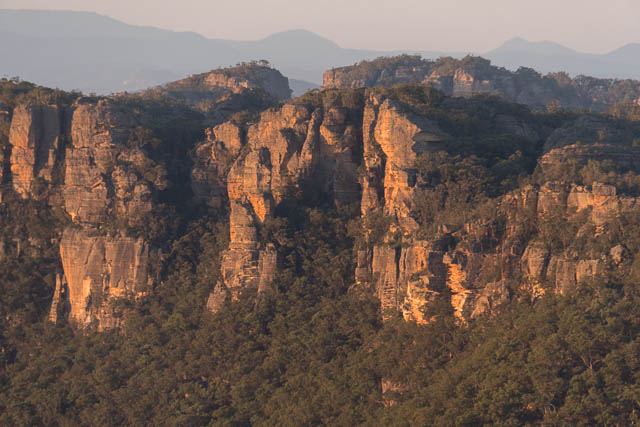
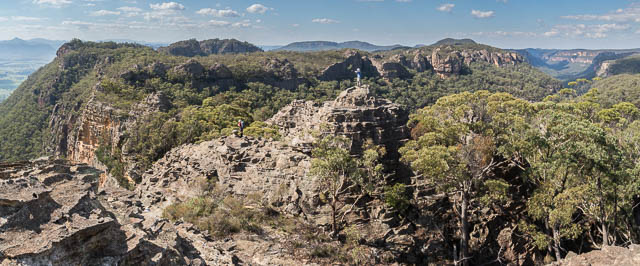
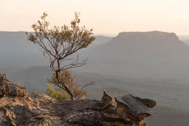
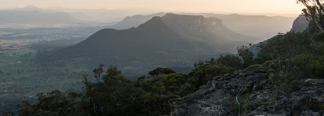
We then continued ascending along the ridge, and up to a mountain we had called Peak Harvey on an earlier trip. From there we climbed up onto the plateau on the Wolgan-Capertee Divide that is separated by Hughes Defile to the west and Woolpack Gap to the east. This starts with an area of heath which offers good views towards the Red Rocks and then some pagodas. It was near these pagodas that we planned to camp and look for water.
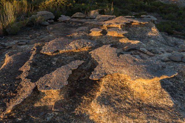
With fading daylight we first searched for water. We found a small rock pool in the pagodas and more pools in a nearby creek. I then headed off to photograph the sunset while Martin looked for a suitable campsite. Just past the pagodas, he found a campsite – it was not great, but it was getting dark and it would have to do.


Our day had been quite strenuous and we were all suffering from dehydration to some extent. we hoped to find more water early on the next day.
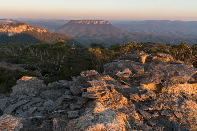
I got up early for sunrise back on the pagodas. Then after breakfast, we packed up and headed towards Woolpack Gap.
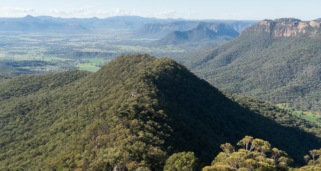
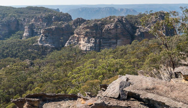
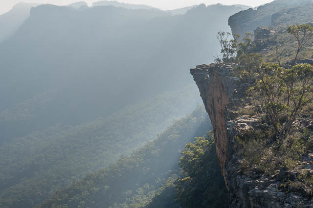
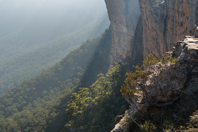
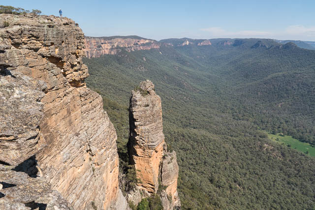
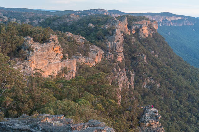
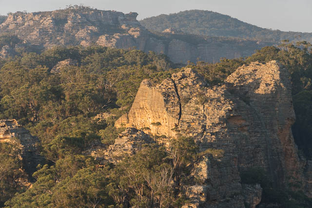
On the way, we passed some impressive cliffs jutting out into the Wolgan Valley. We though a rock peninsula we saw well worth of a return visit. Near Woolpack Gap, we explored down some small canyons and some pagodas that Martin and myself had visited back on a trip in 2013. We then descended into the gap and climbed around Woolpack Rock and down an open spur to the north, past a few campsites, and then dropped into a creek to the east. Straight away we found some nice large pools of water and drank our fill and replenished our containers. It was too early for lunch, so we continued around the base of a bluff and then up an easy pass to the tops again.
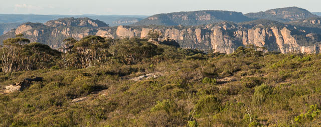
Our next obstacle would be Collett Gap – and that is easy. In the gap we stop for lunch and then climbed up the east side. The next it of the Wolgan-Capertee Divide is a bit scrubby at first until you drop down to a large wall of rock. We passed this on the north side and then crossed a few saddles and back onto a scrubby top. Just past this were the heath covered tops between Point March and Mt Dawson. We set up camp in an open glade just above the heath. It was not too far to walk to the cliffs for photos at dusk and dawn.

So far on the trip, we had camped under the stars on the walk – the weather was so fine and the forecast good. The next morning was a bit dewy however. The next area past Mt Dawson was shrouded in low cloud that gradually burnt off once the Sun got higher.
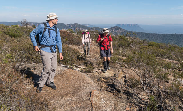
It was interesting going along the open tops to Mt Dawson. Easy walking with amazing views. We soon reached Mt Dawson and climbed to its summit for more photos.
Just past Mt Dawson, is another well known camping area – known as The Defile. We stopped here for a snack and also to collect some more water from rock pools in the headwaters of Little Capertee Creek.

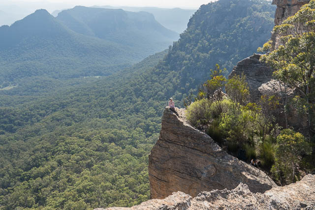
From there, it was more easy walking along the Red Rocks to Point Nicholson. This was country that we are very familiar with and knowing the route we could go fast. We stopped on the way for lunch, but still reached our ext campsite at 2:30 pm. It was near Point Nicholson, at a very scenic spot. A great place for a lazy afternoon.

Our last sunset was nice as we sat on a rock balcony overlooking the valley.
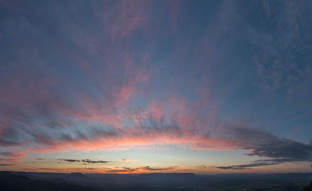
And a few photos from dawn –
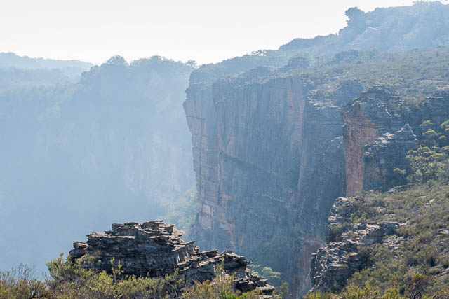
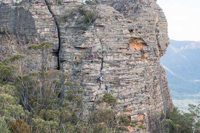
On the last day of the walk, we continued on from Point Nicholson to Point Anderson. This part of the Red Rocks Traverse is usually done by bushwalkers by traversing around the base of three large blocks. It is possible to traverse the skyline of the first of these – but that involves a tricky and dangerous scramble to get off. The next block can be scrambled up, but not down from the far end. The third black is also inaccessible from the south-western end. On this trip, we followed the low route. Past the third block, you pass a large camp cave. It was one we used a lot on Red Rocks trips back in the mid 1970’s and 1980’s. On one trip, I can remember a nasty incident. We were camped in the cave, when our fire exploded. Quite a few in the party were badly burnt. I only found out many years later that the explosion was due to one of the party members throwing a paper bag of gunpowder into the fire as a joke……

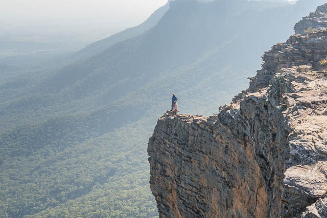
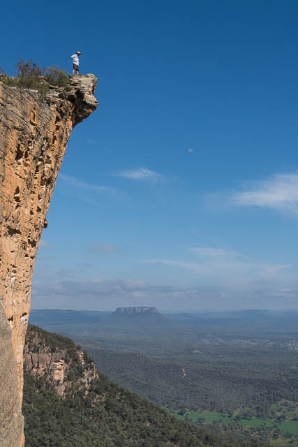
Past the third block, you regain the skyline, but it is worth looking back up onto the third block – at a very impressive overhang. It is easy to climb up on top of this for photos poses.
Then more interesting and easy route finding and scrambling to reach Point Anderson.

At the point, we were getting thirsty and most of our water was now gone. Below us, at Canobla Gap is a pressure reducing station on the Oberon – Glen Davis water pipeline. That was a good incentive to descend quickly. But there were a few more bluffs to negotiate and then open steep country to the gap.
At the pressure reducing station, we were able to drink plenty of water. We also had lunch there before walking back into the farming country and to Dave’s car.

This was a classic walk in great country. Not easy going, but very rewarding and very scenic. More photos are online on my website here.

thanks a lot for this blog. I love to visit it. i live in Poland, and visited Australia some 20 years ago. was staying in Sydney at my friend and hiking a lot in Blue Mountains and Royal National Park, to the point, that i started to knew the paths there, as i know the paths in the mountains here. many beautiful camps under the stars, or in the tent. and your photos keep my memory of that land alive. the land, where i was not afraid to go alone on a 3-day hike soon after landing in Sydney 😉
You don’t talk David about the access logistics but walking thought that farming country might not be straightforward without owner’s permit.
I guess the start from the car to Mt Harvey ridge is simple if you can drive all the way where Half Way Hollow Trail becomes Red Rock Trail – that’s within NP.
But completing the loop from Canola Gap back to that car is a long walk through private farming land. At least 6km in straight line. Which is more or less possible if you can gain access through a farm marked Goolooinboin at 288366. But if you cannot gain access, you need to make even a longer circuit.
You say you did talk to the local farmers during your walk. Do they allow walkers to pass their farms if needed? And can you share with us the details of your deproach here on this trip?
Looks at the first paragraph – you can read that one of the party did contact the farm managers and obtained permission to drive and park on the property involved. I was not involved in this, but I believe he found contact details online. Also, alternative access to much of this country can be made from the Wolgan Valley.
David, you said you had permission from Goolooinboin to cross “there land” but then you went through other people’s property to get to the pressure reducing station. Did you get there permission??
From the Red Rocks to the Pressure Reducing Station is national park (Wollemi NP), then we followed the fire road – farm road back to the car. I am not sure if Goolooinboin starts at the gap with the Pressure Reducing Station or if there are some other properties first – but we seemed to be walking along a fenced off road all the way back.