
This was a pleasant walk down the upper part of the Grose River from Mt Victoria to Blackheath. On the way we visited Blue Gum Forest.
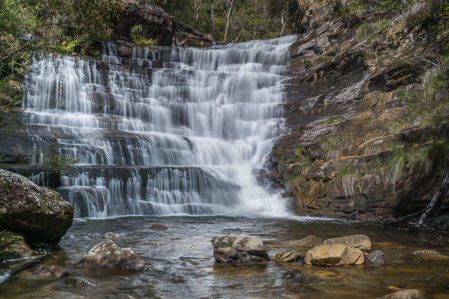
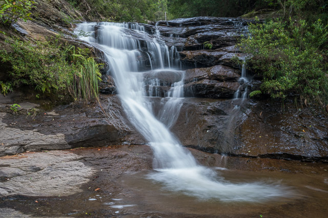
The Silver Cascades
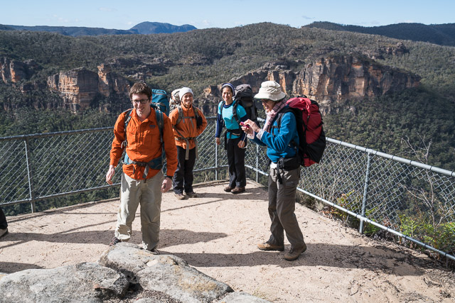
The weather forecast was for fine but cold and windy weather. So a walk along a sheltered valley seemed a good idea. But it was still quite windy in the valley. In the party were Su Li, Brent, Wendy, Enmoore and myself.
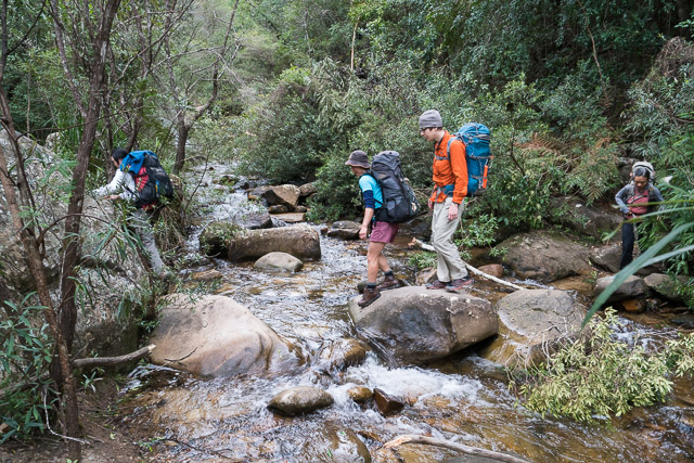
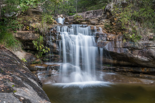
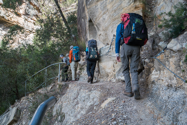
After leaving Wendy’s car at Evans Lookout, we started off from the lookout above Victoria Falls at Mt Victoria. To escape the bast of cold wind, we quickly descended to the valley down to Victoria Falls. Here things were somewhat calmer. Victoria Falls had a fair flow of water going over it, as did the Silver Cascade above. This did make crossing the creek a bit tricky though.
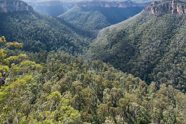
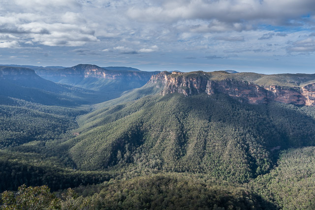
The Grose Valley from Victoria Falls Lookout
Victoria Falls
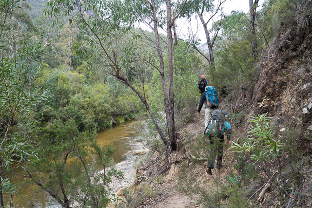
We continued down to Burra Korain Flat and the Grose River. Walking along the broader Grose Valley brought us into the wind again however. Suggested lunch places were dismissed as being to exposed to the wind when we arrive at them, so we carried on to near the Pierces Pass track junction before taking a break.
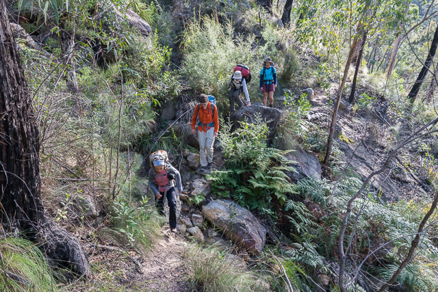
Lower down the valley there was more bush and we were more sheltered from the wind. We soon passed through Little Blue Gum Forest and then down to Blue Gum Forest itself. Always an impressive place to venture into. We continued on to the campground at Acacia Flat.
But, the campsite was no haven from the wind. We found some more sheltered campsites right at the back and set up our tents and tarps. Being a no fire area, it was quite cold siting around our stoves that evening.
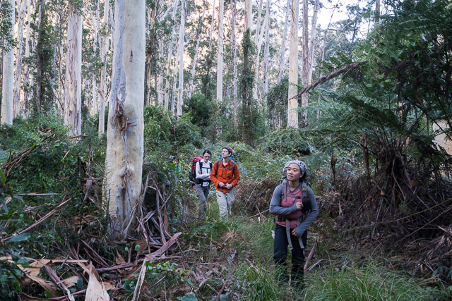
Next morning, I got up early and walked back to Blue Gum Forest for some photos. Thankfully, overnight, the wind had stopped.
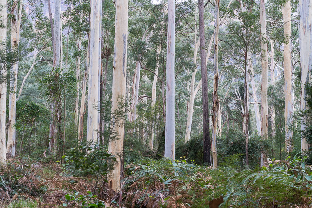
Blue Gum Forest
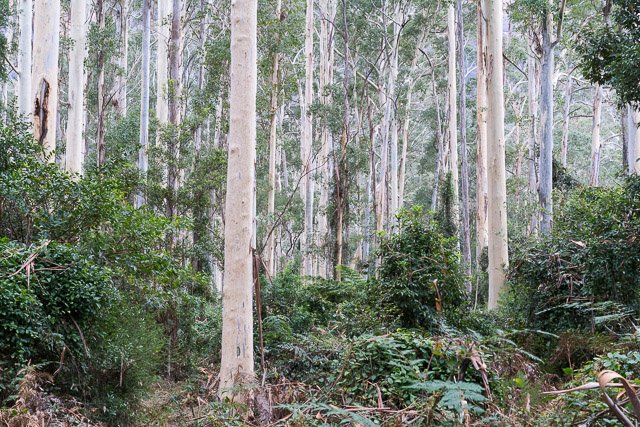
Blue Gum Forest
After a leisurely breakfast we packed up and started walking along the track up Govetts Creek to Junction Rock and then to Syncarpia.
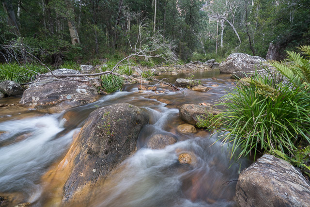
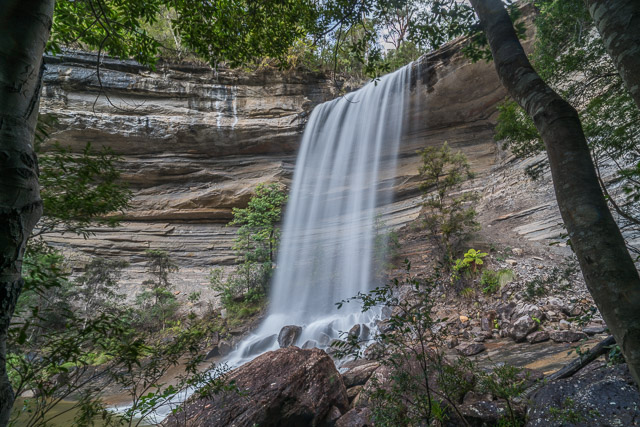
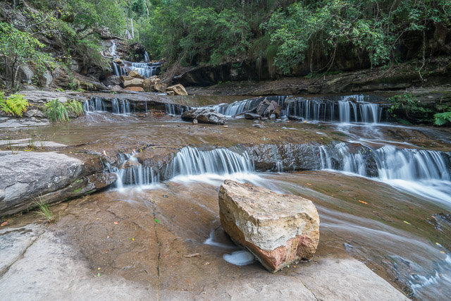
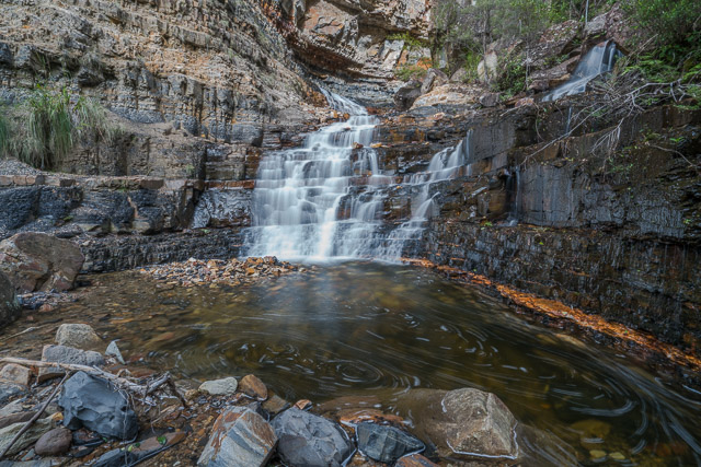
I was keen to photograph the lower waterfalls in Greaves Creek between the Govetts Creek junction and Beauchamp Falls. Along this section of Greaves Creek lie a series of waterfalls. Most were named after the original sponsors of the track from Govetts Leap to Evans Lookout via the valley. Some of the waterfalls are un-named. Perhaps there are more waterfalls than there were sponsors? Several sources list the names of these waterfalls, but their order does not seem to be clear, and which waterfall corresponds to which name. None of the names appear on modern maps except for Beauchamp Falls at the top of the series. Looking at old maps such as Isaac Barrow’s map of 1908 and early parish maps that are online show some of the names but not all of them. Some photos of the waterfalls are online – and these photos provide good reference points.
Lower un-named falls
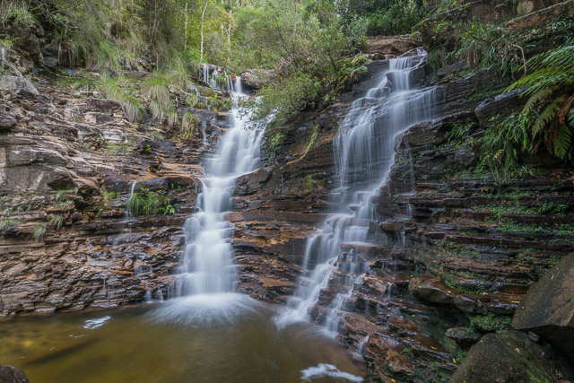
According to Brian Fox, the order of waterfalls is Beauchamp Falls, Popes Falls, Foy Falls, John Harris Falls, Bettington Falls and then Campbell Falls. Links to old reference photos – Popes Falls – here and here, Bettington Falls here, and Campbell Falls here. Looking at these old photos, it is easy to see that Campbell Falls is where the track crosses Greaves Creek.
Campbell Falls (lower part)
Campbell Falls (middle part)
Campbell Falls (upper part)
As we walked along the track. There are several waterfalls below this crossing point. One is quite a major waterfall and appears to have no name. Above that, is what I assume is a lower waterfall that makes up Campbell Falls. Above the upper cascades of this fall lies Bettington Falls – hidden away in some boulders and behind trees. Higher up is a very pretty waterfall – this is presumably John Harris Falls. Foy Falls is higher up and also must be be in a boulder zone of the creek. Popes Falls is also a very attractive waterfall flowing down beautiful exposed rock bands. Above that is the well known Beauchamp Falls.
John Harris Falls
Popes Falls
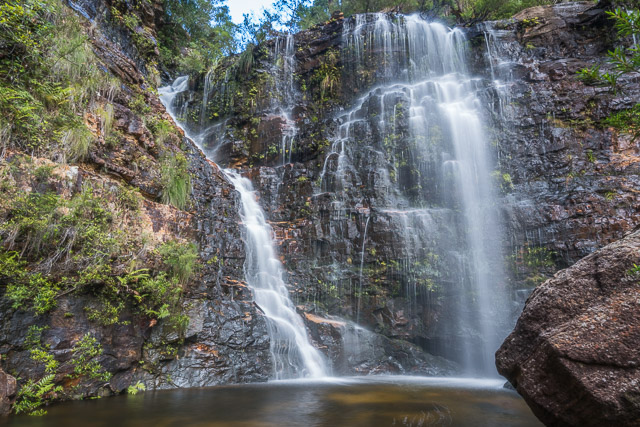
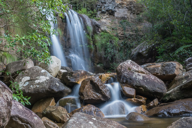
Beauchamp Falls
On our walk, we stopped for lunch in the middle of the waterfalls on a nice sunny rock. From there it was only a short walk up to join the Grand Canyon Track and then not far up to Evans Lookout.
At Evans Lookout – more great views of the Grose Valley.
More photos from the walk are online on my website here.
Hi Dave
You have a great blog.
Is it OK if I can use some of your photos of the Blue Gum Forest – with acknowledgement – at my upcoming WEA course?
It would be much appreciated.
best wishes
Janine
0428 860 623
The Battle of the Blue Gums
Saturday 10th June, 2017, 10am-12noon WEA, Sydney course $35
During the 1930s, two forests were under threat – the Blue Gum Forest in the Blue Mountains and the Blue Gum High Forest in suburban Sydney. Discover how pioneer conservationists like Myles Dunphy and Annie Wyatt successfully rallied to protect these forests. How did these forest battles contribute to the modern Australian conservation movement? How are these forests faring today – at a time of burgeoning population increase, habitat loss and climate change?
Tutor: Janine Kitson. Bookings essential. Contact WEA, SYDNEY Ph: (02) 9264 2781 E: [email protected] http://www.weasydney.com.au
Yes Janine, that is fine.
Great post. Thanks for sharing!