
It was nice to take part on a walk with Wendy to the Red Rocks on the June long weekend. We had cold, but generally good weather on the trip, and this meant that we could experience many outstanding views.
We headed to Newnes, noting that the last part of the road – the unsealed section past the One and Only Resort turnoff is now very badly corrugated.
The first part of the walk was following a road and then a faint track up Little Capertee Creek. On the way we could help noticing some nice fungi that was out. Further up the creek, we turned off up a side branch and soon found ourselves on the Wolgan Capertee Divide. It was quite cold and windy, but not too bad in the saddle where we were, so we stopped for lunch. While we were eating a party of Sydney Bushwalkers turned up. It turned out they had climbed up onto the divide a bit earlier than we had and were spending the kong weekend walking to Cape Horne to the west.
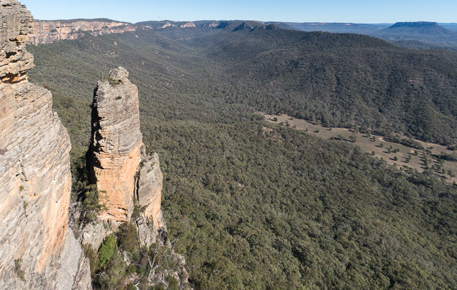
After lunch, we walked the short distance to our intended campsite at Point Nicholson. This was a very sheltered spot, well put of the cold wind, but still very close to excellent views.
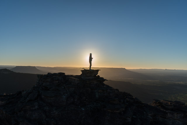
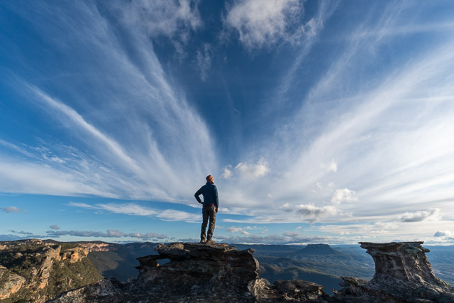
It was nice to spend the late afternoon photographing.
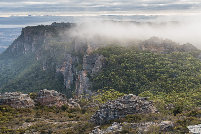
We awoke on Sunday to a very nice day. The wind had moderated greatly and it was cool and sunny. After some dawn photography, we packed up and started our walk south along the Red Rocks. This was another fairly short day to Mt Dawson.
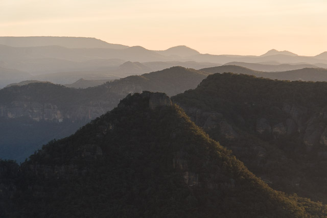
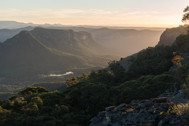
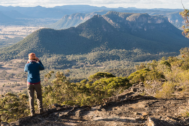
As well as constantly fine views, we were disrupted by two aerial visitors. One was a scenic flights helicopter flying low overhead. The other were many large flocks of honeyeaters (probably Yellow Faced Honeyeaters) – flying north along to tops and heading to the Capertee Valley. We probably saw at least ten flocks of anywhere between 20 to 50 birds.
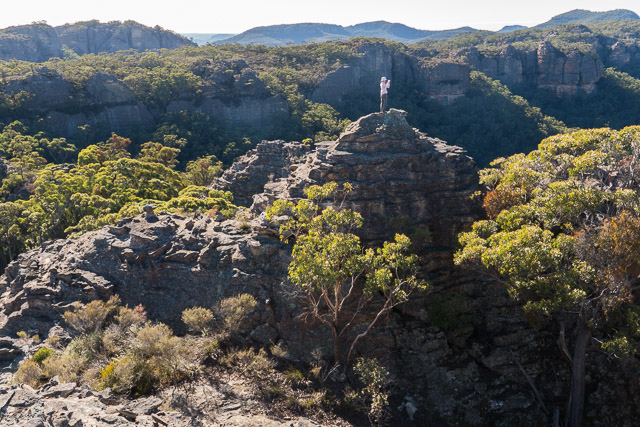
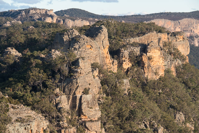
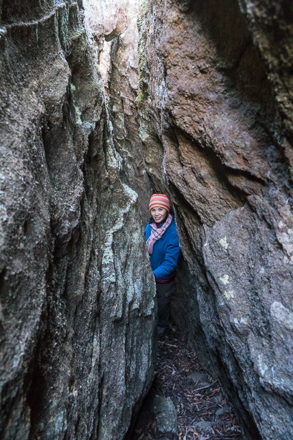
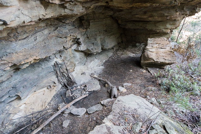
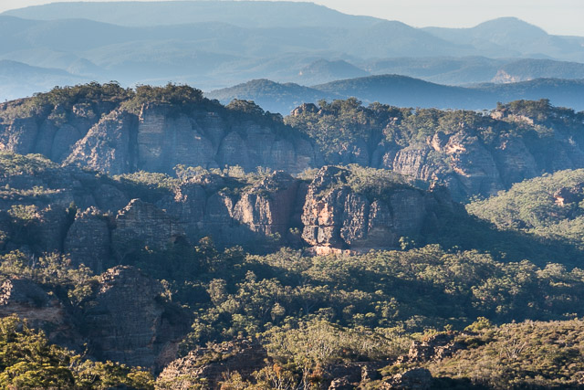
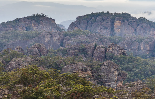
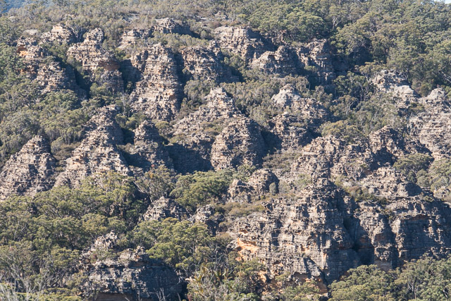
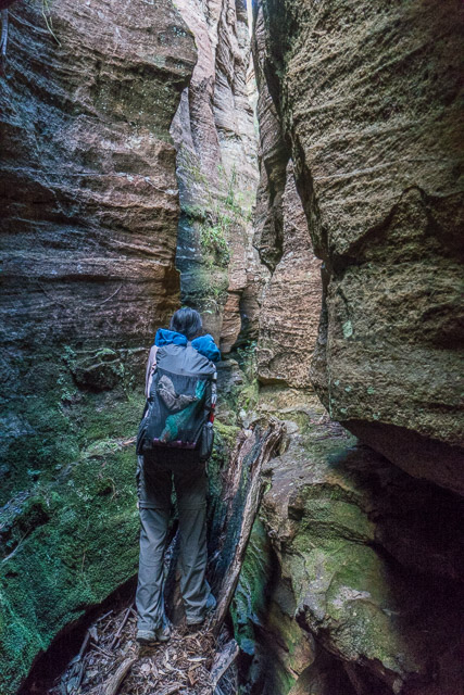
The walking along the Red Rocks is very interesting. You need to route find and do some easy scrambling. Enjoyable bushwalking. It was annoying to find a few orange plastic tapes tied on trees. Like cairns, these have no place here. Part of its appeal to walkers is the challenge of route finding. Its not a hard area to find your way through. Further we came across a camp cave that had a constructed fireplace complete with huge rocks placed as seats around it. Again – walkers should leave the area looking natural when they leave a spot.
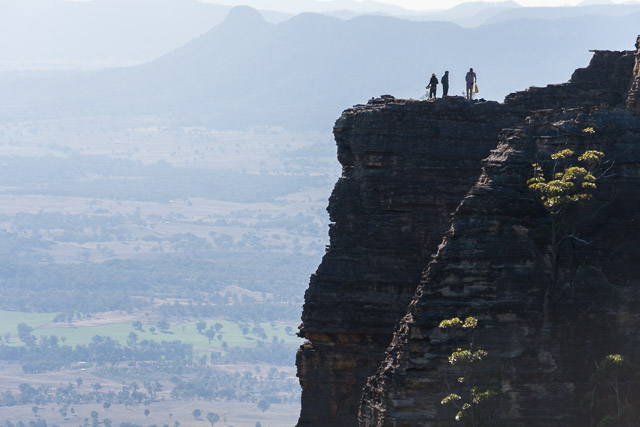
Close to Mt Dawson, we passed the Defile – another good place to camp. Koalas have been observed around here, but we couldn’t see any despite a fair but of looking up into the trees as we passed by. We did spot however, another party of bushwalkers enjoying the fine views.
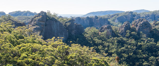
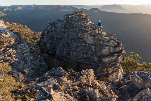
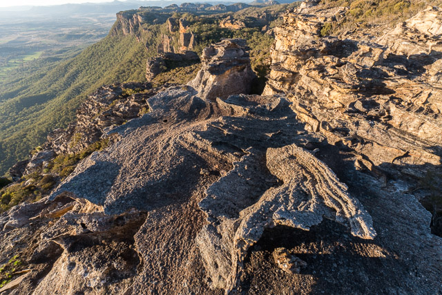
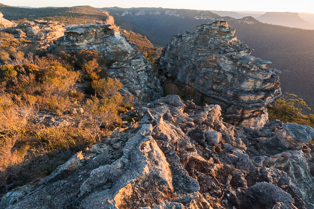
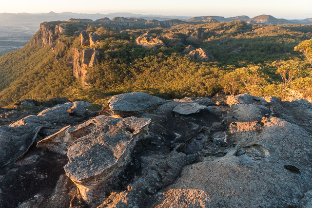
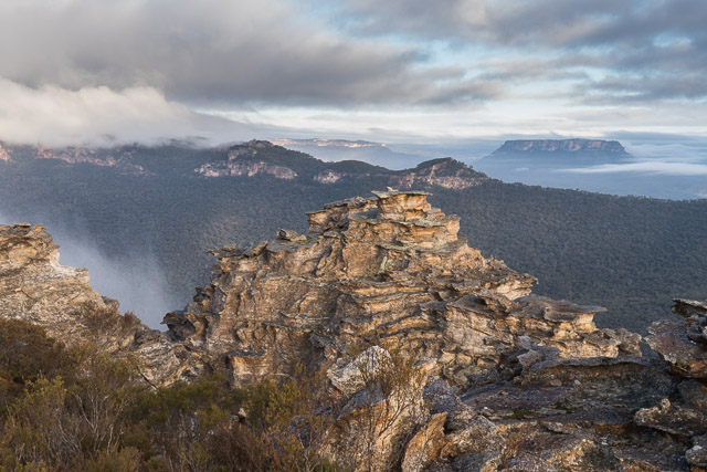
We continued on to Mt Dawson and set up camp on top. Campsites are very limited and exposed to the weather. You need to have good conditions. We did. We had a very pleasant golden hour – and it was nice to photograph the intricate rock formations and pagodas found on Mt Dawson. This is a great place for views.
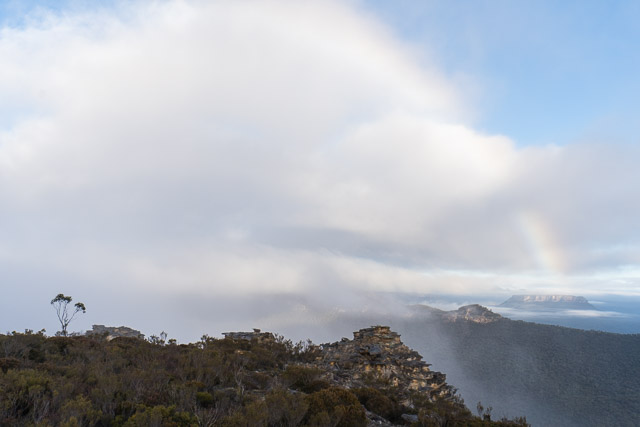
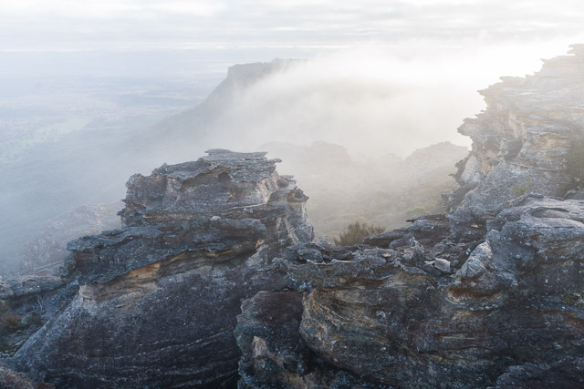
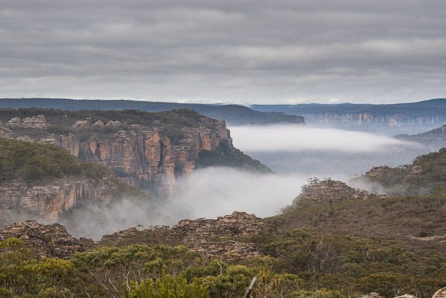
It was unexpectedly cloudy and misty the next morning. The mist slowly cleared and we experienced a partial fogbow.
Then we set off for our longest day of the walk, along a scrubby ridge to the south overlooking Capertee Creek. This took us out to a complex of pagodas, and we descended back to the Wolgan Valley via a nice dry canyon.

More photos from the walk are online on my website here.
Hi, I’m trying to trace your route on a map. You say you went south from Point Nicholson to Red Rocks. I see that Red Rocks is North of Point Nicholson, South of Point Anderson. Was the camp site on Point Nicholson or Point Anderson?
The Red Rocks is really all the way from Mt Dawson to Point Nicholson and then to Point Anderson as far as bushwalkers are concerned. This is known as “The Red Rocks Traverse”. So on this trip we did a partial traverse. We camped one night at Point Nicholson and then the next night at Mt Dawson.