
All photos © David Noble 2004. No photos can be used for any purpose without permission.
Return to Menu page
The night before this hike I stayed at Bishop enjoying the hospitality of Lizzy's uncle John and aunt Carolyn. They had helped with the transport connections of the second hike - eg driving us to the trailhead and leaving cars at the end trailhead. I was also very grateful to Carolyn for letting me consult her guidebooks and organising a lift for me up to the North Lake Trailhead so I could start the third section of my walk.
I had come up to North Lake with some other hikers who were heading up Piute Canyon. This was convenient for me as it allowed me to cross over Lamark Col and descend towards the John Muir Trail at the scenic Evolution Valley. It was big climb up to Lamarck Col (12,960') on a hot day and with a big pack - but by this stage I was well acclimatised to altitude. The descent from the pass was quite easy.
Above - Darwin Canyon from Lamarck Col
I camped just before the route I was on joined the John Muir Trail at the end of the Darwin Bench. It was a most beautiful place with many lakes and waterfalls.
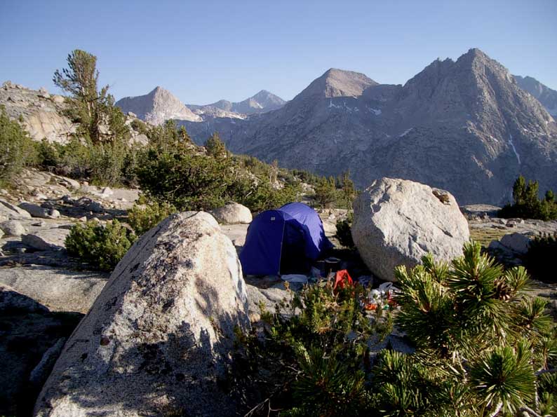
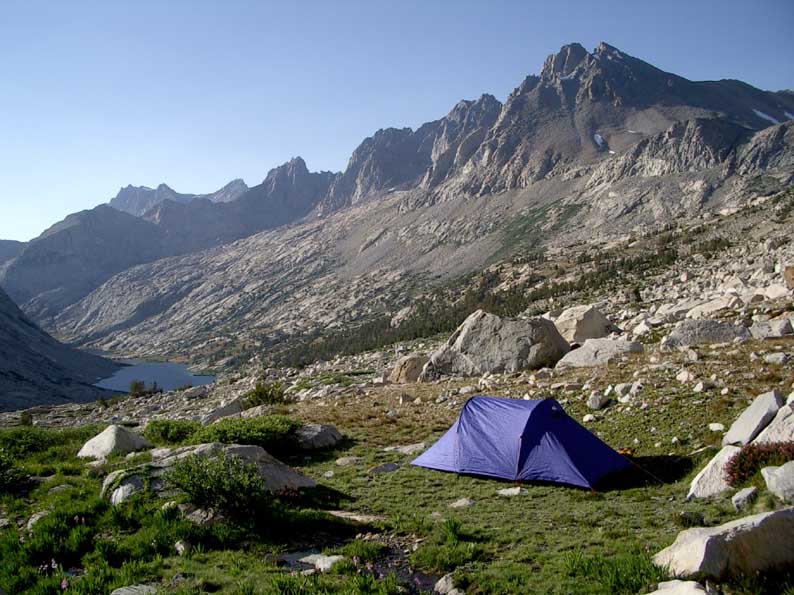
Above - My campsite on the Darwin Bench
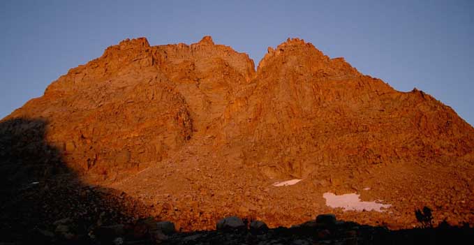
Above - Alpenglow on a peak above my campsite
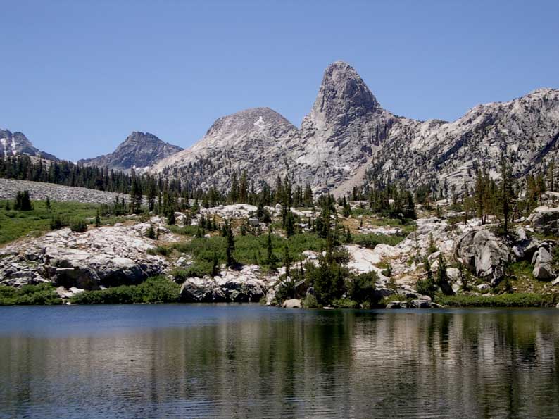
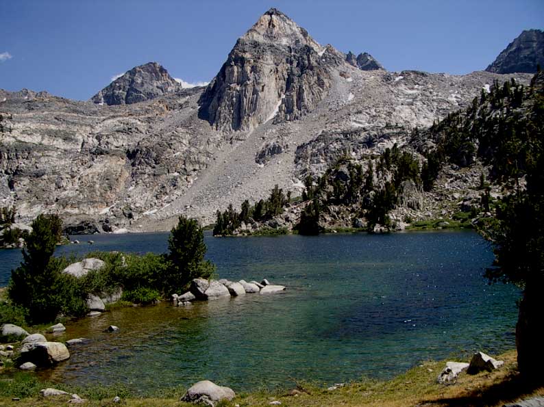
I dropped down a short distance to join up with the John Muir Trail - which I would follow for the rest of the hike. It was slight climb up into the Evolution Valley. This was an amazing place with peaks such as Mt Darwin, Mt Haeckel, Mt Spencer, Mt Wallace and Mt Mendel towering above beautiful lakes.
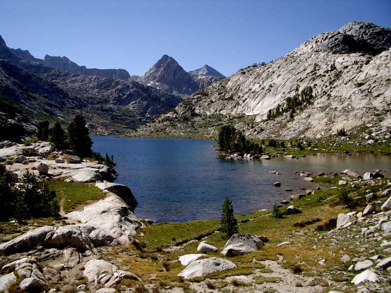
Above - Evolution Lake
Above - Evolution Lake
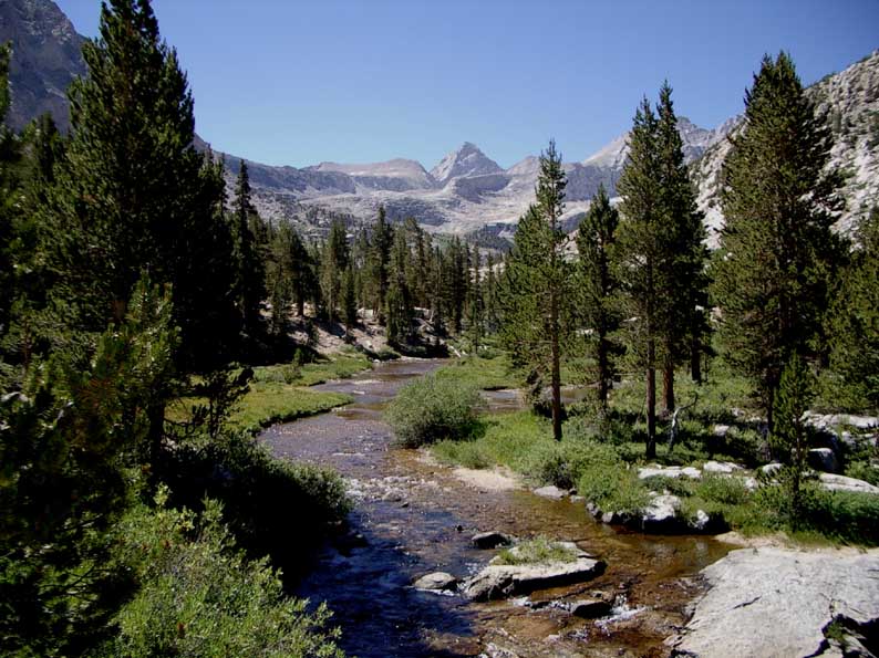
I followed the Evolution Valley up to John Muir Pass (11,995') which was gentle climb. The descent was quite scenic with lots of lakes, waterfalls and small gorges. I camped at Big Pete Meadow.
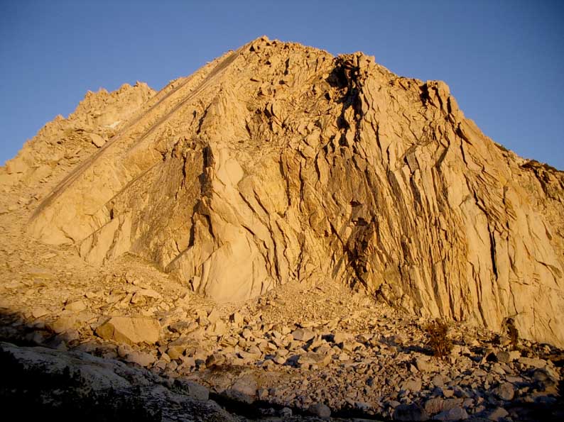
I wandered down Le Conte Canyon. Above me towered the bulk of The Citidel - an impresive white granite peak.
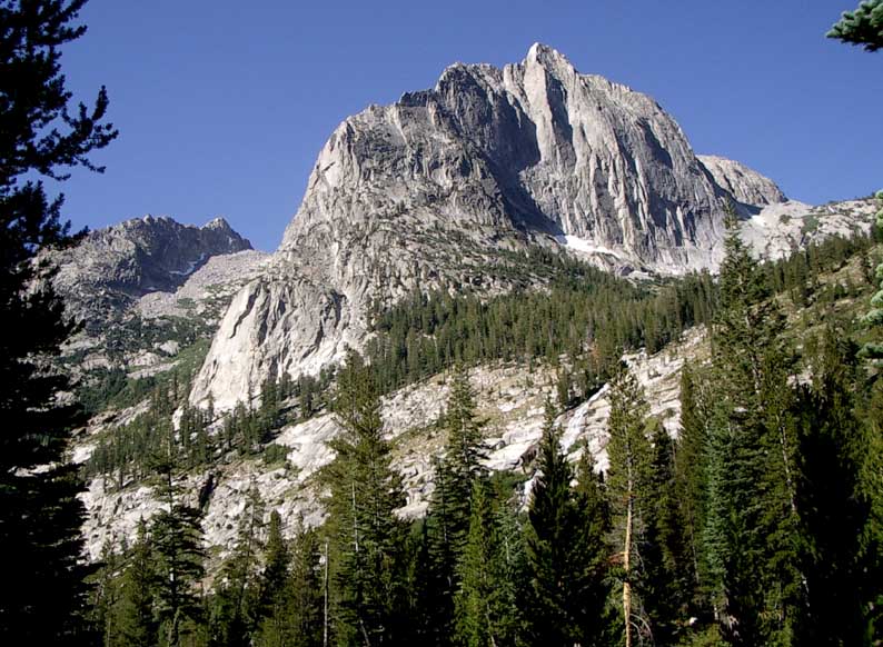
Above - The Citidel towers above Le Conte Canyon
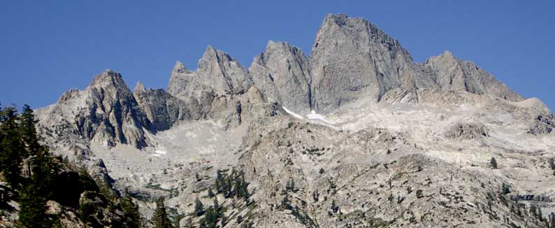
Above - The Devils Crags
Under the Devils Crags, the track leaves Le Conte Canon and goes up Palisade Creek. the walking was fast and easy except for s steep and tiring ascent up to Palisade Lakes. It was a very hot day and there was not much shade to be found. I camped early at a nice place on a small shelf a little above the trail about a mile before Mather Pass. I had excellent views of the magnificently rugged Palisades.
Above - My campsite near Mather Pass - looking towards the Palasades
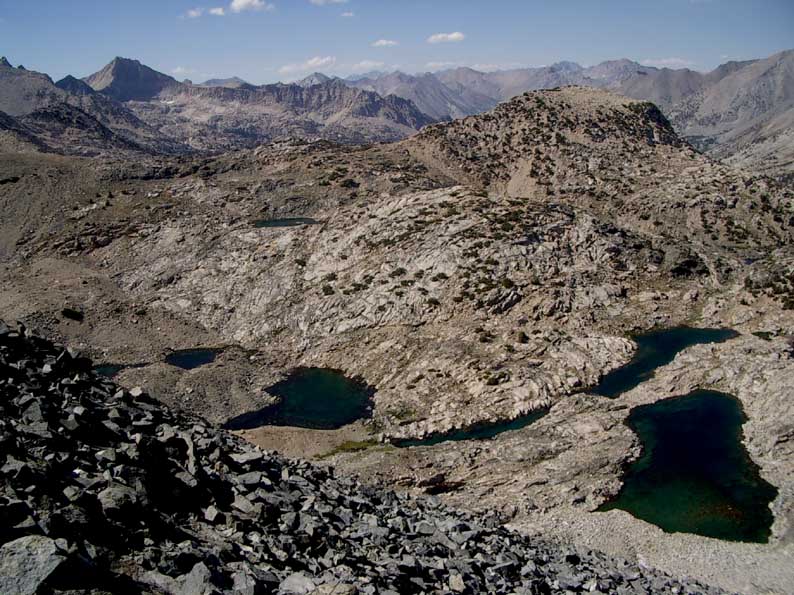
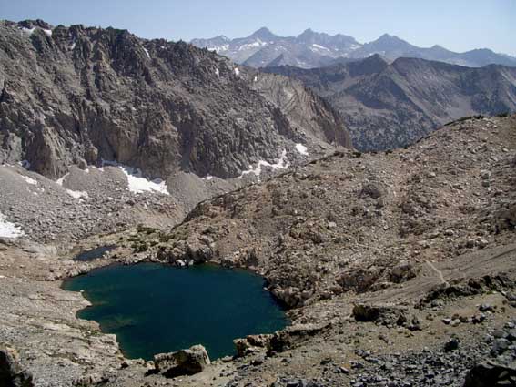
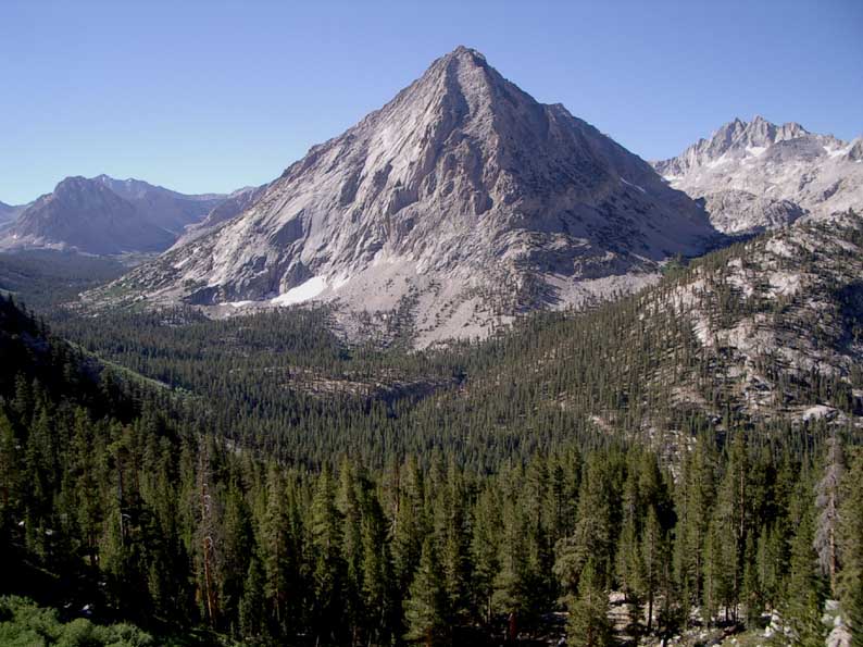
I quickly climbed Mather Pass (12,100') and dropped int othe next valley and follwoed the trail down the South Fork of the Kings River. Then the trail climbed up to Lake Marjorie and Pinchot Pass (12,130'). I crossed the pass and descended, passing an incredibly beautiful lake shelf about a mile off the track. Further down I camped near a beautiful (and warm) tarn. I had great views of Mt Clarence King and the nearby Mt Perkins.
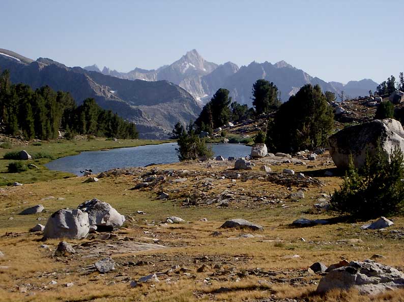
Above - I camped near this beautiful tarn south of Pinchot Pass. Looking towards Mt Clarence King
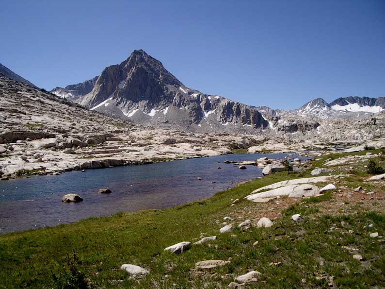
The train continued down Woods Creek and then up to the beautiful Rae Lakes
Above - Fin Dome from Dollar Lake
Above - The Painted Lady from Rae lakes
From Rae Lakes, it was big climb up to Glen Pass (11,978')
Above - Looking down towards the north from near Glen Pass
Above - Looking down towards the south from near Glen Pass
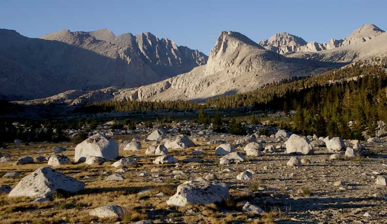
Not far around the corner from the small lake, I camped near some tarns. My camspite was shady and sheltered and it was not far to walk onto a shelf that provided great views.
Above - Alpenglow on a peak above my campsite near Glen Pass
The track sidled above Charlotte Lake and then dropped down to the beautiful Vidette Meadow
Above - East Vidette Peak
Above - Vidette Meadows and Bubbs Creek
It was then another big climb up to Forester pass (13,180'). The top set of switchbacks on the descent were really quite amazing. I then continued past Tyndall Creek and Bighorn Plateau and camped at Wright Creek.
Above - Mountains northeast of Wright Ck
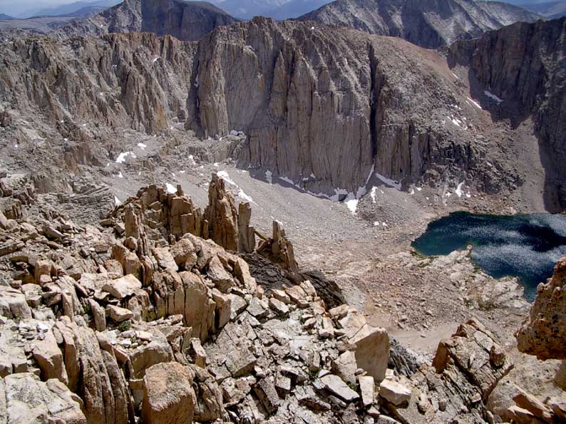
I walked to Crabtree and climbed up to Guitar Lake which is traditially the last campsite on the taril before Mt Whitney. I arrived there before noon - so kept walking. Storm clouds were gathering and some other hikers descending down from the summit told me the forecast was for afternoon thnderstorms. So I decided to have lunch and later decide whether to keep climbing or to head back and camp at the lake. After lunch the weather seemed to be improving - so I kept going. It was the usual long series of switchbacks to the junction of the track down to Whitney Portal. Here I was able to leave my pack and I quickly climbed to the summit of Mt Whitney (14,494')
Above - Hitchcock Lake from the track up Mt Whitney

Above - Pinnacles tower above the track on the way up Mt Whitney
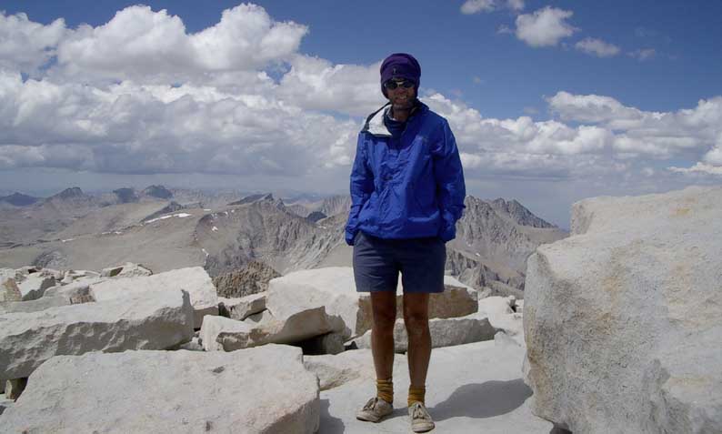
Above - Me on the summit of Mt Whitney
On the summit - I was at first the only person, despite passing many people travelling in both directions on the trail. Soon a girl from San Diego arrived - and we were able to take photos of each other. Then some rock climbers arrived on top as well. The summit was the end of the John Muir Trail.
I descended to my pack, and then dropped down to the highest of the campsites on the trail to Whitney Portal. This was a rocky area - with many people camping close together - but in the morning I had some great lighting on Mt Whitney.
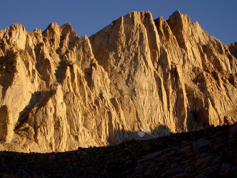
Above - Alpenglow on Mt Whitney. Dawn - from Trail Camp
it was then a straightforward descent down to Whitney Portal - the trailhead. I easily hitched down to Lone Pine - the nearest town where I had lunch. On the Inyo Transport bus to Bishop and Mammoth I met some other hikers who had also completed the John Muir Trail. One, named Randy I had met a few weeks earlier at Shadow Lake, and two others - David and Yuki, with whom I shared a campsite with at Mammoth. Next day we all caught the Yarts Bus to Yosemite, and a later bus to Merced and the Amtrak back to Richmond and the Bart back to Doug and Lizzy's place.
Return to Menu page