
(This article was originally published in VS&M, 1992. This text
has been modified in 2005. Note - This information assumes those who
are reading it are experienced and competent at off track bushwalking)
All text and images © David Noble. No images can be used for
any purpose without permission.
Tasmania's Cradle Mountain - Lake St Clair National Park or "The
Reserve" as it is more commonly called by bushwalkers is one of
Australia's truly great bushwalking regions. Each year thousands of
walkers sample the joys of this fabulous park. However, for the vast
majority of these walkers, a stroll along the Overland Track with a
few side trips is all they do. For the connoisseur bushwalker the
park has much to offer. There are many summits to be climbed, many
passes to pass and many seldom visited lakes to swim in.
Cradle Mountain and the Barn Bluff dominate the northern end of the Park. Both are well worth climbing. Cradle has a lower peak, Little Horn, that the author has not yet climbed but it looks inviting. It may be possible and fulfilling to scramble from Little Horn to the main summit with daypacks. The main summit offers good views of Barn Bluff and Dove Lake. A few interesting dolerite tors on the summit plateau offer interesting climbs and photos.
Barn Bluff, higher than Cradle, is also a must. It lies further from the main track but the summit is soon reached after negotiating a large boulderfield. Although the author hasn't tried it yet, it is supposed to be possible to traverse south from the summit and descend to Lake Will.
There are many other interesting places to visit in this section
of the park. For the peak bagger, the best way to approach Cradle from
the north is along the track to the east of Lake Dove. Mt Campbell
and Hansons Peak lie a short distance from this track. The Twisted
Lakes and the Artists Pool are photogenic.
One last place well worth visiting, that I have not been must be Suttons Tarn if the number of times it appears in wilderness calendars is any indication of scenic value. Mt Emmet also looks worthwhile.
All in all, at least a week could be spent profitably exploring the northern section - or at least seeing a different part on each trip to the Park.
The Windemere Plains used to be a windswept buttongrass bog. Now I
with many years of trackwork it is a wild, beautiful place. There are
many interesting things along the way - small pools, pretty creeks and
some great views. Lake Windemere is a nice gentle place to stay
and needs to be experienced in both good and bad weather for a full
appreciation of its beauty. Many small groves of trees line the
foreshore - it is well worth going for a stroll away from the track.

The Pelion Valley lies roughly in the middle of the park and is
surrounded by a spectacular series of peaks. The Pelion Range circles
most of the valley and stretches from Mt Pelion West to Mt Pelion
East via Mts Achilles, Thetis, Paddys Nut and Ossa.
The Pelion and
also the Du Cane Range are the highlights of a visit to the Park. A
traverse of either of these should be considered in a similar fashion
to a traverse of the Frankland or Arthur Ranges or the Mount Anne
Circuit in the South West. One feature of the Overland Track is that
once you go a few metres from it, you wouldn't know the track was
there and you probably won't see any other parties. Some walkers who
visit
the Park more than once just regard the Overland Track only as an
access route rather than a walk in its own right. The high traverses
are much more challenging than walking along the lower tracks. There
are little of no marked routes, difficult obstacles to be negotiated
and the ever present possibility of being caught in bad weather.
However, the scenery is simply outstanding.
Tracks go up onto the range in a number of places. The best is the
track up Mt Ossa from Pelion gap. There is also a poorly marked track
to the saddle between Mt Ossa and Mt Thetis. This leaves the Overland
Track near the turnoff to Old Pelion Hut. The turnoff is no longer
signposted and it is quite hard to find. Likewise, the old track to
Pelion West is no longer signposted or maintained and can be quite hard
to find. Old maps which mark these tracks can be useful. Once on the
Pelion West track, it is easy going up through forest and then alpine
moors till a large boulderfield is reached. Then it is tough going over
giant dolerite boulders to reach the highest point - a slender, angled
needle.


With early starts it is possible to complete most or all of the
Pelion Traverse as a long daytrip. From the spectacular summit
pinnacle of Pelion West there is no difficult obstacle along the
ridge that extends to Mt Achilles and walking is easy and fast.
It is quite easy to descend off Pelion West from the far side and the
descent is close to the summit. Achilles itself is easy to climb. Two
sidetrips, untried by the
author are possible - the first, the ascent of a nearby minor but
very spectacular northern summit of Achilles, known as Achilles Heel
- the second, a trip out to the summit of the mighty Perrins Bluff.
This side peak looks very impressive when seen for the Labyrinth.
Below it is a lake shelf that could offer nice camping. Just past
Achilles, on the way to Thetis, lies Leonards Tarn which
offers attractive, "bomb proof " campsites. Then it is a steep climb up
through boulders to Mt Thetis.
Mt Thetis is a massive boulder garden and Paddys Nut lies close by and is easy to traverse. From just to the east lies an escape route off the range back down to the Pelion Valley. The track for this route starts near a small tarn that offers attractive camping. There is another campsite closer to Paddys Nut in a thicket of pencil pines. The ascent of Mt Ossa from the northwest is very spectacular involving scrambling up giant dolerite boulders if following the skyline and it is perhaps easier to traverse on the south a little below the crest. One highlight of the skyline route is the single dolerite pinnacle that forms a minor summit - this pinnacle is climbable. Ossa's main summit offers stunning views of the Du Cane Range to the south and a near infinity of peaks stretching far into the Southwest Wilderness. Indeed, on a clear day, Federation Peak is just visible. In fine stable weather, a camp on the summit can be very rewarding. Water is available in a small tarn. However, this should not be considered lightly given the fickle nature of the weather in Tasmania.
To complete the traverse, Mt Pelion East must be climbed - this is easy and well worth doing. Several interesting pinnacles are to found on the way up.
The Pelion Valley makes a good base in which to visit all these
peaks. As well, two other peaks should be considered. Mt Oakleigh has
a sensational, photogenic pinnacle ridge leading up to summit. This
can be seen from the Pelion Valley or from the summit - looked down
upon. The other peak in the area is Mt Pillinger, which can be
climbed as part of a long daywalk. The only views seen by the author
whilst on top were of the inside of clouds but more could be expected
in clement weather.


On the way south, the spectacular Cathedral Mountain should be considered. Its summit lies at the top of an imposing series of ramparts. Most parties probably reach it from tracks to the east near Cloister Lagoon. However it can be climbed just as easily from the Overland Track. A natural rock bridge spans the Mersey near D'Alton Falls and open rainforest leads to the summit plateau. Here perfect sheltered campsites can be found metres from the rim with commanding views to the west.
From Du Cane Gap it is easy to climb up to the open tops of the
Traveler Range. The area near the Orion Lakes is a paradise. It has
a wild beauty reminiscent of the Labyrinth and views to match.


The Du Cane Range itself is the most spectacular range in the park and is probably the finest dolerite range in the state. Its scenery is on par with the finest of that in the South West Wilderness. Although individual peaks are not as high as those of the Pelion Range it has a higher average elevation, larger cliffs and finer alpine gardens. The best way to see the range is to complete a high level skyline traverse. This should only be attempted by fit and experienced parties in fine weather. It is possible to climb from Pine Valley hut to the Labyrinth and traverse onto the plateau north of the Geryon and continue all the way to Falling Mountain, drop off to Du cane gap and walk via the track to Pine Valley in one long day however, it is much more rewarding to camp high on the range and enjoy fully what it has to offer. Many superb campsites exist in the Labyrinth, my favorite being near Lake Elysia although other prefer The Pool of Memories. Camping is also possible at Lake Helios, on the plateau south of Big Gun Pass (limited shelter), on the summit of Mt Massif (in a depression) or in a few places along the ridge to Falling Mountain. This part of the traverse is very worthwhile with many giant dolerite boulders to be negotiated sometimes necessitating routefinding.
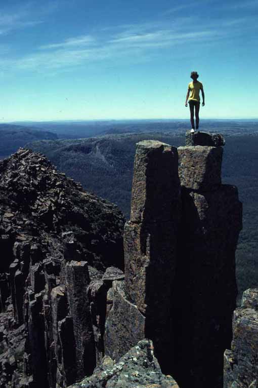
The north peak of the Geryon is one of the most rewarding summits
in Tasmania. It can be reached with a little scrambling by a well
cairned route from the north. Be sure to climb both the highest part
and also the lower summit slightly to the south to enjoy better views
of the incredible, breathtaking middle summit - the foresight. The
Geryon's neighbor, the Acropolis is often attempted by Overland
treckers. It is a spectacular peak, well worth climbing although its
summit is a little tricky to reach. The true summit is the first of
many pinnacles that form a precipitous ridge leading up to the summit
from the west. From the summit plateau it is worth scrambling to
reach the final summit - it is exposed, but easier than it looks!

The Labyrinth is a good base for many trips. North lie the easy peak of Mt Eros and the not so easy but well worth climbing Mt Hyperion. Both can be climbed with a detour from the route the leaves for the Geryon from the Labyrinth, the last few metres of Hyperion requires a little easy scrambling.
To the west lies Walled Mountain - easily reached via a track that starts on the western side of the labyrinth between two small lakes. Further west, Macs Mountain can be visited and further still lies the seldom frequented Mt Nereus - although views are reported to be limited from this peak (this is one peak that I have not climbed).
South of the Labyrinth lies the rest of the Du Cane Range. From
the track it is easy to follow a vague track over the Minotaur to the
boulderfield leading to Mt Gould. This peak can be then directly
climbed. A detour can be made to the summit of the Guardians which
lies near the far end of an interesting and easy plateau. It is
also possible to traverse off Mt Gould and pick up a track that drops
down
to near Narcissus hut.

Near Narcissus lies the three summits of Manfred, Cuvier and Byron. It is possible to link these summits with a traverse (possible as a long day walk?). Byron can be climbed from Byron Gap and broad saddles lie beyond towards Cuvier. Mt Manfred can be climbed from the Lake Marion track. (The author attempted to do this on a solo trip but instead of being repulsed by the peak's quadruple clifflines was repulsed by Huey's quintuple storm - this was a long time ago and I still haven't climbed Manfred or Cuvier).
Mt Olympus can be climbed from a little south of Lake Petrarch although it can be traversed from Byron Gap or via the lakes above Echo Point. On the other side of Lake St Clair lies Mt Ida. This peak looks particularly impressive from the lake and also looks spectacular from the Mountains of Jupiter. It can be climbed from the Lake via the steep Ida Buttress or from the west as a side trip on a longer walk.
From Cynthia Bay it is possible to do an easy walk up Mt Rufus - although this peak is only moderately spectacular. Mt Hugel is more impressive - I haven't yet visited this peak nor Mt Gell and the Cheyne Range - rumored to be the place to see the best flowering scoparia in the early summer.
It is well worthwhile to visit the Park during autumn to see the
fagus
(native deciduous beech) turning orange. The best time is said to
be near Anzac day.
Snow is much more likely at this time. During winter, the weather is
often atrocious and a metre of snow or more can cover parts of the
Overland track. In the right conditions a ski tour through the park
would be fantastic - although conditions are such that this is rarely
possible. Even better would be a ski traverse of the Pelion or Du
Cane ranges.

Return to my Bushwalking
Web Page
Return to david-noble.net